Filters: Tags: Malheur Lake (X)
4 results (11ms)|
Filters
Date Range
Types Contacts
Categories Tag Types Tag Schemes |
Malheur Lake is a shallow, freshwater lake in southeastern Oregon. This data release includes phytoplankton data from three sites located in Malheur Lake collected from 8/8/2018 to 8/11/2020. For each sample collected, the phytoplankton were reported to the lowest taxonomic unit. Phytoplankton biovolume, algal cell concentration, and algal biomass concentration are included. All phytoplankton data were generated by PhycoTech, Inc. The dataset includes two comma-separated values (.csv) files and metadata. The first CSV file includes all of the taxonomic, biovolume, and density information. The second CSV file includes the 111 unique taxa identified.
The USGS measured photosynthetically active radiation (PAR, wavelength between 400 and 700 nanometers) at Malheur Lake, Oregon, as vertical profiles and as continuous measurements at a fixed depth, in 2017 and 2018. Malheur Lake is a large, shallow, turbid lake located in southeastern Oregon that fluctuates widely in surface area in response to yearly precipitation and climatic cycles. High suspended-sediment concentrations likely are negatively affecting the survival of aquatic plants. The PAR measurements in this data release were collected to assess PAR attenuation in the lake, and to quantify attenuation as a function of water quality (primarily turbidity). The continuous PAR measurements were collected at 10-minute...
Categories: Data;
Tags: Malheur Lake,
Oregon,
USGS Science Data Catalog (SDC),
Water Quality,
environment,
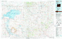
USGS Historical Quadrangle in GeoPDF.
A three-dimensional groundwater flow model, MODFLOW 6, was developed to provide a better understanding of the hydrogeology of the Harney Basin, southeastern Oregon. The model was used to investigate the historical groundwater-level decline and storage loss associated with anthropogenic groundwater demands. The model was calibrated to 1930 through 2018 conditions. This USGS data release contains all of the input and output files for the simulation described in the associated model documentation report (https://doi.org/10.3133/sir20241518)
Types: Map Service,
OGC WFS Layer,
OGC WMS Layer,
OGC WMS Service;
Tags: Burns,
Groundwater Model,
Harney Basin,
Harney County,
Harney Lake,
|

|
