Filters: Tags: Manitoba (X)
170 results (14ms)|
Filters
Date Range
Extensions Types
Contacts
Categories Tag Types
|
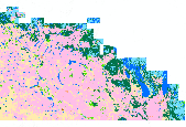
This dataset contains generalized landcover data for the Prairie Farm Rehabilitation Administration (PFRA) determined agricultural extent of Manitoba and Saskatchewan. This dataset was subset into two shapefiles. The other half of this dataset covers PFRA agricultural areas of Alberta and British Columbia. The Landcover Generalization process was undertaken to solve rendering problems of the original vectorized landcover data due to its unwieldy/overwhelming size. LANDSAT 7 imagery used in the process was collected during the WGTPP. This landcover imagery has a 30 meter resolution and is stored in over 1,100 vectorized 1:50,000 map sheet tiles. The data requires over seven gigabytes of disc space. If the user wishes...

A nationally compiled dataset containing provincial Forest Tenures/Forest Management Areas and other administrative areas where rights to establish, grow, harvest or remove timber from a particular area of land has been granted. Each province has different boundary definitions and/or harvesting practices which prevents this dataset from having a standard defined tenure unit for all of Canada (See data sources in metadata). British Columbia was the only province where tenure boundaries had to be complied from several different sources in order to have a definable tenure unit comparable to other provinces (see NOTES in metadata).
These data represent simulated soil temperature and moisture conditions for current climate, and for future climate represented by all available climate models at two time periods during the 21st century. These data were used to: 1) quantify the direction and magnitude of expected changes in several measures of soil temperature and soil moisture, including the key variables used to distinguish the regimes used in the R and R categories; 2) assess how these changes will impact the geographic distribution of soil temperature and moisture regimes; and 3) explore the implications for using R and R categories for estimating future ecosystem resilience and resistance.
I. .\GrantDevine_Comb.csv: This file contains the total inflow volume to Grant Devine Reservoir for the 30 days with the largest streamflow volume between March and May and the mean of the 3- and 12-month SPEI values for each November 1st. Spring streamflow volume for a given calendar year is paired with SPEI from the previous November 1st value. Column A is an unnamed index number, column B is a year in a stochastic simulation, column C is named “simnum” and is the stochastic simulation number, column D is named “mnspei” and is the mean of the 3- and 12-month SPEI for November 1 of each year in a stochastic simulation, and column E is named “SprintgThirtyTot” and is the total inflow volume for the 30 days with...
Categories: Data;
Types: Map Service,
OGC WFS Layer,
OGC WMS Layer,
OGC WMS Service;
Tags: Manitoba,
North Dakota,
Saskatchewan,
Souris River,
meteorology,
Geographic distribution data were collected based on county level occurrences (or converted from point occurrences to county level occurrences) within the five focal states (Minnesota, North Dakota, South Dakota, Nebraska & Iowa) and each U.S. state or Canadian province bordering those focal states (Wisconsin, Illinois, Missouri, Kansas, Wyoming, & Montana in the USA and Saskatchewan, Ontario & Manitoba in Canada).
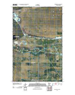
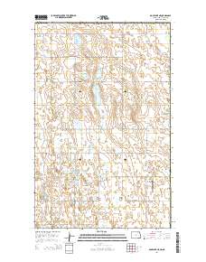
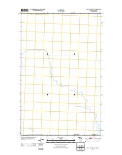
Layered GeoPDF 7.5 Minute Quadrangle Map. Layers of geospatial data include orthoimagery, roads, grids, geographic names, elevation contours, hydrography, and other selected map features.
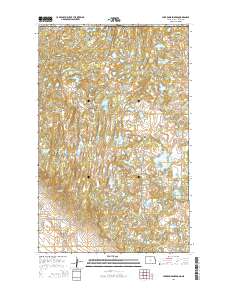
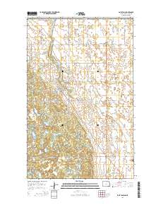
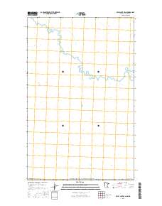
Layered GeoPDF 7.5 Minute Quadrangle Map. Layers of geospatial data include orthoimagery, roads, grids, geographic names, elevation contours, hydrography, and other selected map features.
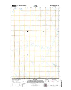
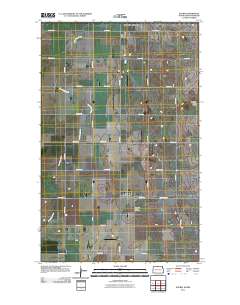
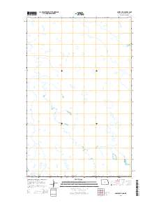
Layered GeoPDF 7.5 Minute Quadrangle Map. Layers of geospatial data include orthoimagery, roads, grids, geographic names, elevation contours, hydrography, and other selected map features.

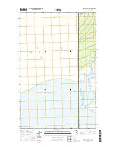
Layered GeoPDF 7.5 Minute Quadrangle Map. Layers of geospatial data include orthoimagery, roads, grids, geographic names, elevation contours, hydrography, and other selected map features.
Layered GeoPDF 7.5 Minute Quadrangle Map. Layers of geospatial data include orthoimagery, roads, grids, geographic names, elevation contours, hydrography, and other selected map features.
Layered GeoPDF 7.5 Minute Quadrangle Map. Layers of geospatial data include orthoimagery, roads, grids, geographic names, elevation contours, hydrography, and other selected map features.
Layered GeoPDF 7.5 Minute Quadrangle Map. Layers of geospatial data include orthoimagery, roads, grids, geographic names, elevation contours, hydrography, and other selected map features.
Layered GeoPDF 7.5 Minute Quadrangle Map. Layers of geospatial data include orthoimagery, roads, grids, geographic names, elevation contours, hydrography, and other selected map features.
Layered GeoPDF 7.5 Minute Quadrangle Map. Layers of geospatial data include orthoimagery, roads, grids, geographic names, elevation contours, hydrography, and other selected map features.
Layered GeoPDF 7.5 Minute Quadrangle Map. Layers of geospatial data include orthoimagery, roads, grids, geographic names, elevation contours, hydrography, and other selected map features.
Types: Citation;
Tags: 7.5 x 7.5 minute,
Downloadable Data,
EarthCover,
GeoPDF,
Imagery and Base Maps,
Wildlife species face threats from climate and land use change, which may exacerbate how extreme climatic events influence population persistence and biodiversity. Migratory waterbirds are especially vulnerable to hydrological drought via reduced availability of surface water habitats. We assessed how whooping cranes, an endangered species in the U.S. and Canada, modified habitat use and migration strategies during drought to understand this species’ resilience to changing conditions and adaptive capacity. The data included 8,555 night-roost sites used by 145 cranes, 2010–2022, under non-drought conditions, moderate drought, and extreme drought conditions.
These data were compiled using a new multivariate matching algorithm that transfers simulated soil moisture conditions (Bradford et al. 2020) from an original 10-km resolution to a 30-arcsec spatial resolution. Also, these data are a supplement to a previously published journal article (Bradford et al., 2020) and USGS data release (Bradford and Schlaepfer, 2020). The objectives of our study were to (1) characterize geographic patterns in ecological drought under historical climate, (2) quantify the direction and magnitude of projected responses in ecological drought under climate change, (3) identify areas and drought metrics with projected changes that are robust across climate models for a representative set of...
This child page contains 34 csv files, site_qw_nuts, which contain observations of nitrate plus nitrite as nitrogen (npnN), total nitrogen (TN), total phosphorus (TP) for each site . Each file includes date of observation, measured value of water-quality constituent, remark code for the measured value, and site name. Availability of observations of water-quality constituents depended upon collecting agency and varied by site and constituent. Not all sites had observations for all constituents. The format of the csv file (date format and column headings) is designed to meet the specific requirements of file format for R-QWTREND. If csv files are opened directly in excel, the format of the data can change. To ensure...
This data shows select streamgage locations throughout the Red River of the North Basin upstream of Emerson, Manitoba, and basin outlines for eight subbasins..
Categories: Data;
Types: Citation,
Downloadable,
Map Service,
OGC WFS Layer,
OGC WMS Layer,
Shapefile;
Tags: Crookston,
Emerson,
Fargo,
Halstad,
Kindred,
Layered GeoPDF 7.5 Minute Quadrangle Map. Layers of geospatial data include orthoimagery, roads, grids, geographic names, elevation contours, hydrography, and other selected map features.
|

|
