Filters: Tags: Map (X) > partyWithName: U.S. Geological Survey (X)
443,457 results (480ms)|
Filters
Date Range
Extensions Types
Contacts
Categories Tag Types
|
These feature data are part of a larger dataset containing shapefiles and associated metadata for lava flows erupted at Kilauea volcano from ca. 1790 through 1982. The complete dataset includes all known subaerial eruptions in the volcano's Southwest Rift Zone and East Rift Zone, and selected flows erupted within the summit caldera, during this time period. Two attributed shapefiles are associated with each eruption: a polyline shapefile for the lava flow contacts and eruptive fissures, and a polygon shapefile showing the full extent of the lava flow after emplacement. In total, this dataset contains 100 shapefiles, each with an associated metadata .txt file, representing 50 separate eruptions. The lava flow contacts...
Categories: Data;
Types: Downloadable,
Map Service,
OGC WFS Layer,
OGC WMS Layer,
Shapefile;
Tags: Hawai`i,
Hawai`i,
Hawaii,
Hawaii,
Kilauea,
The 2018 lower East Rift Zone eruption of Kilauea Volcano began in the late afternoon of 3 May, with fissure 1 opening and erupting lava onto Mohala Street in the Leilani Estates subdivision, part of the lower Puna District of the Island of Hawai'i. For the first week of the eruption, relatively viscous lava flowed only within a kilometer (0.6 miles) of the fissures within Leilani Estates, before activity shifted downrift (east-northeast) and out of the subdivision during mid-May. Around 18 May, activity along the lower East Rift Zone intensified, and fluid lava erupting at higher effusion rates from the downrift fissures reached the ocean within two days. Near the end of May, this more vigorous activity shifted...
Categories: Data;
Types: Downloadable,
Map Service,
OGC WFS Layer,
OGC WMS Layer,
Shapefile;
Tags: East Rift Zone,
FissureLines,
Green Lake,
Hawai'i,
Hawaii,
The 2018 lower East Rift Zone eruption of Kilauea Volcano began in the late afternoon of 3 May, with fissure 1 opening and erupting lava onto Mohala Street in the Leilani Estates subdivision, part of the lower Puna District of the Island of Hawai'i. For the first week of the eruption, relatively viscous lava flowed only within a kilometer (0.6 miles) of the fissures within Leilani Estates, before activity shifted downrift (east-northeast) and out of the subdivision during mid-May. Around 18 May, activity along the lower East Rift Zone intensified, and fluid lava erupting at higher effusion rates from the downrift fissures reached the ocean within two days. Near the end of May, this more vigorous activity shifted...
Categories: Data;
Types: Downloadable,
Map Service,
OGC WFS Layer,
OGC WMS Layer,
Shapefile;
Tags: East Rift Zone,
FlowsOverlap,
Green Lake,
Hawai'i,
Hawaii,
The 2018 lower East Rift Zone eruption of Kilauea Volcano began in the late afternoon of 3 May, with fissure 1 opening and erupting lava onto Mohala Street in the Leilani Estates subdivision, part of the lower Puna District of the Island of Hawai'i. For the first week of the eruption, relatively viscous lava flowed only within a kilometer (0.6 miles) of the fissures within Leilani Estates, before activity shifted downrift (east-northeast) and out of the subdivision during mid-May. Around 18 May, activity along the lower East Rift Zone intensified, and fluid lava erupting at higher effusion rates from the downrift fissures reached the ocean within two days. Near the end of May, this more vigorous activity shifted...
Categories: Data;
Types: Downloadable,
Map Service,
OGC WFS Layer,
OGC WMS Layer,
Shapefile;
Tags: East Rift Zone,
Fissure03Flow,
Green Lake,
Hawai'i,
Hawaii,
The 2018 lower East Rift Zone eruption of Kilauea Volcano began in the late afternoon of 3 May, with fissure 1 opening and erupting lava onto Mohala Street in the Leilani Estates subdivision, part of the lower Puna District of the Island of Hawai'i. For the first week of the eruption, relatively viscous lava flowed only within a kilometer (0.6 miles) of the fissures within Leilani Estates, before activity shifted downrift (east-northeast) and out of the subdivision during mid-May. Around 18 May, activity along the lower East Rift Zone intensified, and fluid lava erupting at higher effusion rates from the downrift fissures reached the ocean within two days. Near the end of May, this more vigorous activity shifted...
Categories: Data;
Types: Downloadable,
Map Service,
OGC WFS Layer,
OGC WMS Layer,
Shapefile;
Tags: East Rift Zone,
Fissure14Flow,
Green Lake,
Hawai'i,
Hawaii,
The 2018 lower East Rift Zone eruption of Kilauea Volcano began in the late afternoon of 3 May, with fissure 1 opening and erupting lava onto Mohala Street in the Leilani Estates subdivision, part of the lower Puna District of the Island of Hawai'i. For the first week of the eruption, relatively viscous lava flowed only within a kilometer (0.6 miles) of the fissures within Leilani Estates, before activity shifted downrift (east-northeast) and out of the subdivision during mid-May. Around 18 May, activity along the lower East Rift Zone intensified, and fluid lava erupting at higher effusion rates from the downrift fissures reached the ocean within two days. Near the end of May, this more vigorous activity shifted...
Categories: Data;
Types: Downloadable,
Map Service,
OGC WFS Layer,
OGC WMS Layer,
Shapefile;
Tags: East Rift Zone,
Fissure18Flow,
Green Lake,
Hawai'i,
Hawaii,
The 2018 lower East Rift Zone eruption of Kilauea Volcano began in the late afternoon of 3 May, with fissure 1 opening and erupting lava onto Mohala Street in the Leilani Estates subdivision, part of the lower Puna District of the Island of Hawai'i. For the first week of the eruption, relatively viscous lava flowed only within a kilometer (0.6 miles) of the fissures within Leilani Estates, before activity shifted downrift (east-northeast) and out of the subdivision during mid-May. Around 18 May, activity along the lower East Rift Zone intensified, and fluid lava erupting at higher effusion rates from the downrift fissures reached the ocean within two days. Near the end of May, this more vigorous activity shifted...
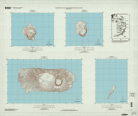
USGS 1:25000-scale Quadrangle for Commonwealth of the Northern Mariana Islands Sheet 3 of 3, MP 2006
USGS Historical Quadrangle in PDF. This scanned map is different from most USGS scanned map products. The published paper map from which it is derived contained multiple independent geographic extents - multiple islands separated from one another by white space. For this reason, this digital version is a non-georeferenced PDF file instead of the GeoPDF that is standard for most of the Historical Topographic Map Collection. This also means that there are multiple GNIS Cells associated with this product.
These feature data are part of a larger dataset containing shapefiles and associated metadata for lava flows erupted at Kilauea volcano from ca. 1790 through 1982. The complete dataset includes all known subaerial eruptions in the volcano's Southwest Rift Zone and East Rift Zone, and selected flows erupted within the summit caldera, during this time period. Two attributed shapefiles are associated with each eruption: a polyline shapefile for the lava flow contacts and eruptive fissures, and a polygon shapefile showing the full extent of the lava flow after emplacement. In total, this dataset contains 100 shapefiles, each with an associated metadata .txt file, representing 50 separate eruptions. The lava flow contacts...
Categories: Data;
Types: Downloadable,
Map Service,
OGC WFS Layer,
OGC WMS Layer,
Shapefile;
Tags: Hawai`i,
Hawai`i,
Hawaii,
Hawaii,
Kilauea,
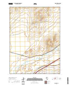
Layered geospatial PDF 7.5 Minute Quadrangle Map. Layers of geospatial data include orthoimagery, roads, grids, geographic names, elevation contours, hydrography, and other selected map features. This map is derived from GIS (geospatial information system) data. It represents a repackaging of GIS data in traditional map form, not creation of new information. The geospatial data in this map are from selected National Map data holdings and other government sources.
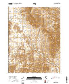
Layered geospatial PDF 7.5 Minute Quadrangle Map. Layers of geospatial data include orthoimagery, roads, grids, geographic names, elevation contours, hydrography, and other selected map features. This map is derived from GIS (geospatial information system) data. It represents a repackaging of GIS data in traditional map form, not creation of new information. The geospatial data in this map are from selected National Map data holdings and other government sources.
|

|
