Filters: Tags: Mariana Islands (X)
23 results (120ms)|
Filters
Date Range
Extensions (Less) Types (Less) Contacts (Less)
Categories (Less) Tag Types
|
album Caption: Fabiana saipanensis, Pellatispira, and Asterocyclina. Foraminifera of Saipan Island. Mariana Islands. n.d. Published in U.S.Geological Survey Professional paper 253, Plate 15. 1953.
Lepidocyclina, spiroclypeus and miogypsinoides. Foraminifera of Saipan Island. Mariana Islands. n.d. Published in U.S.Geological Survey Professional paper 253, Plate 8. 1953.
Album Caption: Operculina, Streblus, Spiroclypeus, and Ccclociypues. Foraminifera of Saipan Island. Mariana Islands. n.d. Published in U.S.Geological Survey Professional paper 253, Plate 5. 1953.
Reducing coral reef vulnerability to climate change requires that managers understand and support the natural resilience of coral reefs. We define coral reef resilience as: the capacity of a reef to resist and/or recover from disturbance given its probable exposure regime, and maintain provision of ecosystem goods and services. Spatial variation in exposure to disturbance and the resilience of reefs in the face of those disturbances will determine the fate of coral reefs within management jurisdictions. This project sought to: (1) undertake ecological resilience assessments in the Commonwealth of the Northern Mariana Islands (CNMI), which is in the west Pacific near Guam, and (2) collaboratively develop a decision-support...
Categories: Publication;
Types: Citation;
Tags: Climate Change,
Coral Reef,
Coral Reefs,
Mariana Islands,
Pacific Islands CASC,
Album Caption: Lepidocyclina (Eulepidina) formosa. Foraminifera of Saipan Island. Mariana Islands. n.d. Published in U.S.Geological Survey Professional paper 253, Plate 10. 1953.
This data release provides flooding extent polygons and flood depth rasters (geotiffs) based on sea-level rise and wave-driven total water levels for the coast of the most populated Hawaiian, Mariana, and American Samoan Islands. Oceanographic, coastal engineering, ecologic, and geospatial data and tools were combined to evaluate the increased risks of storm-induced coastal flooding due to climate change and sea-level rise. We followed risk-based valuation approaches to map flooding due to waves and storm surge at 10 square meter resolution along these islands’ coastlines for annual (1-year), 20-year, and 100-year return-interval storm events and +0.25 m, +0.50 m, +1.00 m, +1.50 m, +2.00 m, and +3.00 m sea-level...
Categories: Data;
Tags: CMHRP,
Climate Change,
Climatology,
Coastal Processes,
Coastal and Marine Hazards and Resources Program,
Album Caption: Spiroclypeus tidoenganensis: Formaminifera of Saipan Island. Mariana Islands. n.d. Published in U.S.Geological Survey Professional paper 253, Plate 3. 1953.
Album Caption: Lepidocyclina and spiroclypeus. Foraminifera of Saipan Island. Mariana Islands. n.d. Published in U.S.Geological Survey Professional paper 253, Plate 7. 1953.
Exogenous and endogenous factors influence invasive reptile movement at multiple scales, 2018 - 2019
These data reflect movement values for brown treesnakes from Guam that were translocated (moved by humans) to new locations or were resident (left in place) on Guam. The data are related to the specimen's treatment group, individual values, locations and other details affiliated with radio telemetry based acquisition and positional changes by the individual snakes across tracking events. The data were collected to help inform early detection and rapid response efforts for brown treesnakes in the Mariana Islands.
Categories: Data;
Tags: Ecology,
Guam,
Mariana Islands,
USGS Science Data Catalog (SDC),
Wildlife Biology,
This data release provides flood depth GeoTIFFs based on sea-level rise and wave-driven total water levels for the coast of the most populated Mariana Islands of Guam and Saipan. Oceanographic, coastal engineering, ecologic, and geospatial data and tools were combined to evaluate the increased risks of storm-induced coastal flooding in the populated Mariana Islands due to climate change and sea-level rise. We followed risk-based valuation approaches to map flooding due to waves and storm surge at 10-m2 resolution along the coastlines for annual (1-year), 20-year, and 100-year return-interval storm events and +0.25 m, +0.50 m, +1.00 m, +1.50 m, +2.00 m, and +3.00 m sea-level rise scenarios.
Categories: Data;
Tags: CMHRP,
Climate Change,
Coastal Processes,
Coastal and Marine Hazards and Resources Program,
Earth sciences,
Album Caption: Lepidocyclina (Nephrolepidina) rutteni: Larger forminifera of the Palau Islands. Caroline Islands. n.d. Published in U.S. Geological Survey Professional paper 221-B, Plate 6. 1950.
Sorites, Lepidocyclina, Victoriella, Cycloclypeus, Spiroclypeus, Miogypsinoides, Miogypsina, and Austrotrillina. Foraminifera ofSaipan Island. Mariana Islands. n.d. Published in U.S.Geological Survey Professional paper 253, Plate 14. 1953.
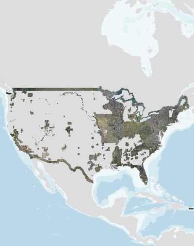
USGS high resolution orthorectified images from The National Map combine the image characteristics of an aerial photograph with the geometric qualities of a map. An orthoimage is a uniform-scale image where corrections have been made for feature displacement such as building tilt and for scale variations caused by terrain relief, sensor geometry, and camera tilt. A mathematical equation based on ground control points, sensor calibration information, and a digital elevation model is applied to each pixel to rectify the image to obtain the geometric qualities of a map. A digital orthoimage may be created from several photographs mosaicked to form the final image. The source imagery may be black-and-white, natural...
Album Caption: Spiroclypeus higginsi: Operculina, and Heterostegina. Foraminifera of Saipan Island. Mariana Islands. n.d. Published in U.S.Geological Survey Professional paper 253, Plate 4. 1953.
Album Caption: Heterostegina borneensis and Camerina saipanensis: Foraminifera of Saipan Island. Mariana Islands. n.d. Published in U.S.Geological Survey Professional paper 253, Plate 2. 1953.
Album Caption: Miogypsinoides formosensis, Miogygpsina and Borelis. Foraminifera of Saipan Island, Mariana Islands. n.d. Published in U.S.Geological Survey Professional paper 253, Plate 13. 1953.
Album Caption: Asterocyclina, Discocylcina, Lepidocyclina, Sorities and Borelis. Foraminifera of Saipan Island. Mariana Islands. n.d. Published in U.S.Geological Survey Professional paper 253, Plate 12. 1953.
Album Caption: Pellatispira and Biplanispira. Foraminifera of Saipan Island. Mariana Islands. n.d. Published in U.S.Geological Survey Professional paper 253, Plate 6. 1953.
Lepidocyclina (Nephrolepidina) parva: Foraminifera of Saipan Island. Mariana Islands. n.d. Published in U.S.Geological Survey Professional paper 253, Plate 11. 1953.
Nest success and predation data for Mariana swiftlets (Aerodramus bartschi), Hawai'i, USA, 2006-2010
This study examined the reproductive biology of the Mariana Swiftlet over five annual cycles on the island of O‘ahu in the Hawaiian Islands. This introduced population used a human-made tunnel for roosting and nesting, and was studied as a surrogate to negate interference with the endangered populations in the Mariana Islands. Active nests (N = 478) were observed in every month of the year. Data recorded included: nest visit dates, date nests were identified, number of visits to each nest; nest stage, nest fate, nest failure status, number of rat traps present, number of rats captures, daily rainfall, and nest ages.
|

|
