Filters: Tags: Marmaton (X)
18 results (51ms)|
Filters
Date Range
Types Contacts
Categories Tag Types Tag Schemes |
This data set contains imagery from the National Agriculture Imagery Program (NAIP). The NAIP program is administered by USDA FSA and has been established to support two main FSA strategic goals centered on agricultural production. These are, increase stewardship of America's natural resources while enhancing the environment, and to ensure commodities are procured and distributed effectively and efficiently to increase food security. The NAIP program supports these goals by acquiring and providing ortho imagery that has been collected during the agricultural growing season in the U.S. The NAIP ortho imagery is tailored to meet FSA requirements and is a fundamental tool used to support FSA farm and conservation programs....
Core Research Center, cutting HH01823, from well operated by LARIO OIL AND GASRaw Properties from download, web scrape, MapServer, and Macrostrat API{"Lib Num": "HH01823", "API Num": "0512111068", "Operator": "LARIO OIL AND GAS", "Well Name": "WAKANDA 3-42", "Field": "WILDCAT", "State": "CO", "County": "WASHINGTON", "Thin Sec": "F", "Analysis": "T", "Latitude": "39.73818", "Longitude": "-102.956", "coordinates_geohash": "9xnf14jexmdj", "Source": "FROM STATE RECORDS", "Min": "3500", "Max": "7300", "Security Flag": "NO SPECIAL RESTRICTIONS", "crc_collection_name": "cutting", "sb_parent_id": "4f4e49d8e4b07f02db5df2d2", "intervals": [{"Formation": "UNKNOWN", "Age": null, "Min Depth": "7214", "Max Depth": "7300"}, {"Formation":...
This data set contains imagery from the National Agriculture Imagery Program (NAIP). The NAIP program is administered by USDA FSA and has been established to support two main FSA strategic goals centered on agricultural production. These are, increase stewardship of America's natural resources while enhancing the environment, and to ensure commodities are procured and distributed effectively and efficiently to increase food security. The NAIP program supports these goals by acquiring and providing ortho imagery that has been collected during the agricultural growing season in the U.S. The NAIP ortho imagery is tailored to meet FSA requirements and is a fundamental tool used to support FSA farm and conservation programs....
Core Research Center, cutting HH01822, from well operated by LARIO OIL AND GASRaw Properties from download, web scrape, MapServer, and Macrostrat API{"Lib Num": "HH01822", "API Num": "0512111064", "Operator": "LARIO OIL AND GAS", "Well Name": "FRIEND TRUST 18-22", "Field": "WILDCAT", "State": "CO", "County": "WASHINGTON", "Thin Sec": "F", "Analysis": "T", "Latitude": "39.70946", "Longitude": "-103.02187", "coordinates_geohash": "9xn9zsvu27vg", "Source": "FROM STATE RECORDS", "Min": "5107", "Max": "7375", "Security Flag": "NO SPECIAL RESTRICTIONS", "crc_collection_name": "cutting", "sb_parent_id": "4f4e49d8e4b07f02db5df2d2", "intervals": [{"Formation": "UNKNOWN", "Age": "MISSISSIPPIAN", "Min Depth": "7342", "Max...
Core Research Center, core S107, from well operated by ANADARKO PRODUCTIONRaw Properties from download, web scrape, MapServer, and Macrostrat API{"Lib Num": "S107", "API Num": "3500722129", "Operator": "ANADARKO PRODUCTION", "Well Name": "A-2 DORMAN", "Field": "E TURPIN", "State": "OK", "County": "BEAVER", "Type": "SLABBED", "Photos": "F", "Thin Sec": "F", "Analysis": "F", "Latitude": "36.890072", "Longitude": "-100.749408", "coordinates_geohash": "9y83g7ss0xu7", "Source": "FROM STATE RECORDS", "Security Flag": "NO SPECIAL RESTRICTIONS", "crc_collection_name": "core", "sb_parent_id": "4f4e49dae4b07f02db5e0486", "intervals": [{"Formation": "KANSAS CITY", "Age": "PENN", "Min Depth": "5233", "Max Depth": "5267"}, {"Formation":...
Core Research Center, core T338, from well operated by CHAMPLIN PETROLEUMRaw Properties from download, web scrape, MapServer, and Macrostrat API{"Lib Num": "T338", "API Num": "0507306113", "Operator": "CHAMPLIN PETROLEUM", "Well Name": "2 KOCH 22-7", "Field": "CLIFFORD", "State": "CO", "County": "LINCOLN", "Type": "THICK SLAB", "Photos": "T", "Thin Sec": "F", "Analysis": "T", "Latitude": "39.018139", "Longitude": "-103.267834", "coordinates_geohash": "9wytfp49jh3c", "Source": "FROM STATE RECORDS", "Security Flag": "NO SPECIAL RESTRICTIONS", "crc_collection_name": "core", "sb_parent_id": "4f4e49dae4b07f02db5e0486", "intervals": [{"Formation": "MARMATON", "Age": "PENN", "Min Depth": "6005", "Max Depth": "6034"}],...
Categories: Physical Item;
Tags: Late Cretaceous,
MARMATON,
PENN,
Pierre Shale,
Pierre Shale--Upper unit,
Core Research Center, core D956, from well operated by CHAMPLIN PETROLEUMRaw Properties from download, web scrape, MapServer, and Macrostrat API{"Lib Num": "D956", "API Num": "0507306160", "Operator": "CHAMPLIN PETROLEUM", "Well Name": "1 CLAY 24-35", "Field": "CLIFFORD", "State": "CO", "County": "LINCOLN", "Type": "SLABBED", "Photos": "T", "Thin Sec": "T", "Analysis": "T", "Latitude": "39.040119", "Longitude": "-103.305305", "coordinates_geohash": "9wyw15p35vtt", "Source": "FROM STATE RECORDS", "Security Flag": "NO SPECIAL RESTRICTIONS", "crc_collection_name": "core", "sb_parent_id": "4f4e49dae4b07f02db5e0486", "intervals": [{"Formation": "MARMATON", "Age": "PENN", "Min Depth": "6068", "Max Depth": "6105"}, {"Formation":...
Core Research Center, core A886, from well operated by KIRBY EXPL COMPANYRaw Properties from download, web scrape, MapServer, and Macrostrat API{"Lib Num": "A886", "API Num": "0506106228", "Operator": "KIRBY EXPL COMPANY", "Well Name": "2-31 FENTON", "Field": "UNNAMED", "State": "CO", "County": "KIOWA", "Type": "SLABBED", "Photos": "T", "Thin Sec": "T", "Analysis": "T", "Latitude": "38.270115", "Longitude": "-102.169585", "coordinates_geohash": "9wz3enf7s4e8", "Source": "FROM STATE RECORDS", "Security Flag": "NO SPECIAL RESTRICTIONS", "crc_collection_name": "core", "sb_parent_id": "4f4e49dae4b07f02db5e0486", "intervals": [{"Formation": "LANSING", "Age": "PENN", "Min Depth": "4275", "Max Depth": "4294"}, {"Formation":...
Categories: Physical Item;
Tags: LANSING,
MARMATON,
Miocene - Pliocene,
Ogallala Fm,
Ogallala Formation,
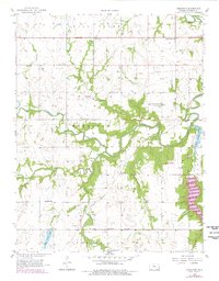
USGS Historical Quadrangle in GeoPDF.
Core Research Center, core T303, from well operated by SHELTER USRaw Properties from download, web scrape, MapServer, and Macrostrat API{"Lib Num": "T303", "API Num": "0507306109", "Operator": "SHELTER US", "Well Name": "1 DAUM", "Field": "WILDCAT", "State": "CO", "County": "LINCOLN", "Type": "THICK SLAB", "Photos": "T", "Thin Sec": "F", "Analysis": "T", "Latitude": "39.01455", "Longitude": "-103.253813", "coordinates_geohash": "9wytfqku5z0x", "Source": "FROM STATE RECORDS", "Security Flag": "NO SPECIAL RESTRICTIONS", "crc_collection_name": "core", "sb_parent_id": "4f4e49dae4b07f02db5e0486", "intervals": [{"Formation": "MARMATON", "Age": "PENN", "Min Depth": "5963", "Max Depth": "5991"}], "crcwc_url": "https://my.usgs.gov/crcwc/core/report/14090",...
Categories: Physical Item;
Tags: Late Cretaceous,
MARMATON,
PENN,
Pierre Shale,
Pierre Shale--Upper unit,
This data set contains imagery from the National Agriculture Imagery Program (NAIP). The NAIP program is administered by USDA FSA and has been established to support two main FSA strategic goals centered on agricultural production. These are, increase stewardship of America's natural resources while enhancing the environment, and to ensure commodities are procured and distributed effectively and efficiently to increase food security. The NAIP program supports these goals by acquiring and providing ortho imagery that has been collected during the agricultural growing season in the U.S. The NAIP ortho imagery is tailored to meet FSA requirements and is a fundamental tool used to support FSA farm and conservation programs....
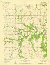
USGS Historical Quadrangle in GeoPDF.
Core Research Center, core T007, from well operated by MCELVAIN OIL & GASRaw Properties from download, web scrape, MapServer, and Macrostrat API{"Lib Num": "T007", "API Num": "1519522693", "Operator": "MCELVAIN OIL & GAS", "Well Name": "HEMMERT 24-9-1", "Field": "MONG", "State": "KS", "County": "TREGO", "Type": "THIN SLAB", "Photos": "T", "Thin Sec": "T", "Analysis": "T", "Latitude": "39.077622", "Longitude": "-99.817095", "coordinates_geohash": "9ycn29g7ther", "Source": "PROVIDED BY DONOR", "Security Flag": "NO SPECIAL RESTRICTIONS", "crc_collection_name": "core", "sb_parent_id": "4f4e49dae4b07f02db5e0486", "intervals": [{"Formation": "MARMATON", "Age": "PENNSYLVANIAN", "Min Depth": "3943", "Max Depth": "3998"}],...
Categories: Physical Item;
Tags: Late Cretaceous,
MARMATON,
Niobrara Chalk,
Niobrara Chalk,
PENNSYLVANIAN,
Core Research Center, core C977, from well operated by FIRST ENERGY CORPRaw Properties from download, web scrape, MapServer, and Macrostrat API{"Lib Num": "C977", "API Num": "1519320261", "Operator": "FIRST ENERGY CORP", "Well Name": "24-25 D BIXENMAN", "Field": "TRIANGLE", "State": "KS", "County": "THOMAS", "Type": "SLABBED", "Photos": "F", "Thin Sec": "F", "Analysis": "F", "Latitude": "39.156084", "Longitude": "-100.73643", "coordinates_geohash": "9ybqg8juxp1e", "Source": "FROM STATE RECORDS", "Security Flag": "NO SPECIAL RESTRICTIONS", "crc_collection_name": "core", "sb_parent_id": "4f4e49dae4b07f02db5e0486", "intervals": [{"Formation": "MARMATON", "Age": "PENN", "Min Depth": "4378", "Max Depth": "4398"}, {"Formation":...
Core Research Center, core S308, from well operated by RUNNING FOXES PETROLEUMRaw Properties from download, web scrape, MapServer, and Macrostrat API{"Lib Num": "S308", "API Num": "1501123086", "Operator": "RUNNING FOXES PETROLEUM", "Well Name": "BLYTHE 14-20", "Field": "WILDCAT", "State": "KS", "County": "BOURBON", "Type": "FULL", "Photos": "T", "Thin Sec": "F", "Analysis": "F", "Latitude": "37.8506642", "Longitude": "-95.0174642", "coordinates_geohash": "9ysrmfd2he5w", "Source": "FROM STATE RECORDS", "Security Flag": "NO SPECIAL RESTRICTIONS", "crc_collection_name": "core", "sb_parent_id": "4f4e49dae4b07f02db5e0486", "intervals": [{"Formation": "MARMATON", "Age": "PENNSYLVANIAN", "Min Depth": "270", "Max Depth":...
Core Research Center, core C944, from well operated by FIRST ENERGY CORPRaw Properties from download, web scrape, MapServer, and Macrostrat API{"Lib Num": "C944", "API Num": "1519320263", "Operator": "FIRST ENERGY CORP", "Well Name": "32-25 BIXENMAN", "Field": "TRIANGLE", "State": "KS", "County": "THOMAS", "Type": "SLABBED", "Photos": "F", "Thin Sec": "F", "Analysis": "T", "Latitude": "39.159648", "Longitude": "-100.733712", "coordinates_geohash": "9ybqg8zcqrkp", "Source": "FROM STATE RECORDS", "Security Flag": "NO SPECIAL RESTRICTIONS", "crc_collection_name": "core", "sb_parent_id": "4f4e49dae4b07f02db5e0486", "intervals": [{"Formation": "PAWNEE", "Age": "PENN", "Min Depth": "4374", "Max Depth": "4394"}, {"Formation":...
Core Research Center, core S398, from well operated by HUNT OIL COMPANYRaw Properties from download, web scrape, MapServer, and Macrostrat API{"Lib Num": "S398", "API Num": "0509906233", "Operator": "HUNT OIL COMPANY", "Well Name": "1-35 HECKMAN", "Field": "WILDCAT", "State": "CO", "County": "PROWERS", "Type": "FULL", "Photos": "T", "Thin Sec": "F", "Analysis": "T", "Latitude": "38.185256", "Longitude": "-102.433032", "coordinates_geohash": "9wz1jp6t1rek", "Source": "FROM STATE RECORDS", "Security Flag": "NO SPECIAL RESTRICTIONS", "crc_collection_name": "core", "sb_parent_id": "4f4e49dae4b07f02db5e0486", "intervals": [{"Formation": "MARMATON", "Age": "PENN", "Min Depth": "3850", "Max Depth": "3885"}, {"Formation":...
Categories: Physical Item;
Tags: Calabrian - Middle Pleistocene,
MARMATON,
MARMATON,
Older gravels and alluviums,
PENN,
This data set contains imagery from the National Agriculture Imagery Program (NAIP). The NAIP program is administered by USDA FSA and has been established to support two main FSA strategic goals centered on agricultural production. These are, increase stewardship of America's natural resources while enhancing the environment, and to ensure commodities are procured and distributed effectively and efficiently to increase food security. The NAIP program supports these goals by acquiring and providing ortho imagery that has been collected during the agricultural growing season in the U.S. The NAIP ortho imagery is tailored to meet FSA requirements and is a fundamental tool used to support FSA farm and conservation programs....
|

|
