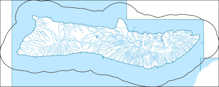
Filters: Tags: Maui (X)
177 results (112ms)|
Filters
Date Range
Extensions
Types Contacts
Categories Tag Types
|
Geospatial data is comprised of government boundaries.
Types: Citation;
Tags: Boundaries,
County or Equivalent,
Downloadable Data,
Esri File GeoDatabase 10,
FileGDB,
This data release provides flooding extent polygons and flood depth rasters (geotiffs) based on sea-level rise and wave-driven total water levels for the coast of the most populated Hawaiian, Mariana, and American Samoan Islands. Oceanographic, coastal engineering, ecologic, and geospatial data and tools were combined to evaluate the increased risks of storm-induced coastal flooding due to climate change and sea-level rise. We followed risk-based valuation approaches to map flooding due to waves and storm surge at 10 square meter resolution along these islands’ coastlines for annual (1-year), 20-year, and 100-year return-interval storm events and +0.25 m, +0.50 m, +1.00 m, +1.50 m, +2.00 m, and +3.00 m sea-level...
Categories: Data;
Tags: CMHRP,
Climate Change,
Climatology,
Coastal Processes,
Coastal and Marine Hazards and Resources Program,
The National Hydrography Dataset (NHD) is a feature-based database that interconnects and uniquely identifies the stream segments or reaches that make up the nation's surface water drainage system. NHD data was originally developed at 1:100,000-scale and exists at that scale for the whole country. This high-resolution NHD, generally developed at 1:24,000/1:12,000 scale, adds detail to the original 1:100,000-scale NHD. (Data for Alaska, Puerto Rico and the Virgin Islands was developed at high-resolution, not 1:100,000 scale.) Local resolution NHD is being developed where partners and data exist. The NHD contains reach codes for networked features, flow direction, names, and centerline representations for areal water...
This data release provides flooding extent polygons (flood masks) and depth values (flood points) based on wave-driven total water levels for 22 locations within the States of Hawaii and Florida, the Territories of Guam, American Samoa, Puerto Rico, and the U.S. Virgin Islands, and the Commonwealth of the Northern Mariana Islands. For each of the 22 locations there are eight associated flood mask polygons and flood depth point files: one for each four nearshore wave energy return periods (rp; 10-, 50-, 100-, and 500-years) and both with (wrf) and without (worf) the presence of coral reefs. These flood masks can be combined with economic, ecological, and engineering tools to provide a rigorous financial valuation...

These data were released prior to the October 1, 2016 effective date for the USGS’s policy dictating the review, approval, and release of scientific data as referenced in USGS Survey Manual Chapter 502.8 Fundamental Science Practices: Review and Approval of Scientific Data for Release. This dataset is a map of land use and vegetation for the Island of Maui, Hawaii, circa 2010. This dataset is a modified version of the U.S. Geological Survey LANDFIRE Existing Vegetation Type map (LANDFIRE.HI_110EVT, Refresh 2008) for the Island of Maui, Hawaii. The LANDFIRE Existing Vegetation Type map was modified to create this map of land use and vegetation for use in a water-budget model. Modifications included converting the...
The National Hydrography Dataset (NHD) is a feature-based database that interconnects and uniquely identifies the stream segments or reaches that make up the nation's surface water drainage system. NHD data was originally developed at 1:100,000-scale and exists at that scale for the whole country. This high-resolution NHD, generally developed at 1:24,000/1:12,000 scale, adds detail to the original 1:100,000-scale NHD. (Data for Alaska, Puerto Rico and the Virgin Islands was developed at high-resolution, not 1:100,000 scale.) Local resolution NHD is being developed where partners and data exist. The NHD contains reach codes for networked features, flow direction, names, and centerline representations for areal water...
The National Hydrography Dataset (NHD) is a feature-based database that interconnects and uniquely identifies the stream segments or reaches that make up the nation's surface water drainage system. NHD data was originally developed at 1:100,000-scale and exists at that scale for the whole country. This high-resolution NHD, generally developed at 1:24,000/1:12,000 scale, adds detail to the original 1:100,000-scale NHD. (Data for Alaska, Puerto Rico and the Virgin Islands was developed at high-resolution, not 1:100,000 scale.) Local resolution NHD is being developed where partners and data exist. The NHD contains reach codes for networked features, flow direction, names, and centerline representations for areal water...
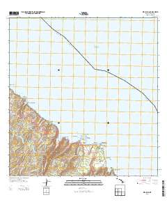
Layered GeoPDF 7.5 Minute Quadrangle Map. Layers of geospatial data include orthoimagery, roads, grids, geographic names, elevation contours, hydrography, and other selected map features.
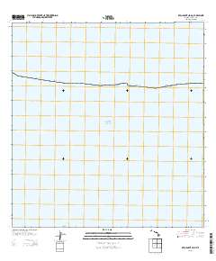
Layered GeoPDF 7.5 Minute Quadrangle Map. Layers of geospatial data include orthoimagery, roads, grids, geographic names, elevation contours, hydrography, and other selected map features.
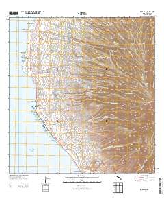
Layered GeoPDF 7.5 Minute Quadrangle Map. Layers of geospatial data include orthoimagery, roads, grids, geographic names, elevation contours, hydrography, and other selected map features.
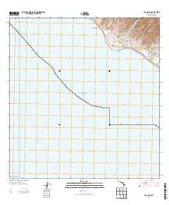
Layered GeoPDF 7.5 Minute Quadrangle Map. Layers of geospatial data include orthoimagery, roads, grids, geographic names, elevation contours, hydrography, and other selected map features.
This digital publication contains all the geologic map information used to publish U.S. Geological Survey Geologic Investigations Map Series SIM-3143 (Sherrod and others, 2021). This geologic map shows the distribution and stratigraphic relation of volcanic, intrusive, and sedimentary units emplaced in the past 8 million years across the eight principal islands of the Hawaiian archipelago, State of Hawaii, U.S.A. This geologic map database is accompanied by a report, which includes the formatted geologic map and explanatory pamphlet, available at https://doi.org/10.3133/sim3143. The authors ask that users of the geologic map database cite both the report and the database: Report: Sherrod, D.R., Sinton, J.M.,...
Categories: Data;
Types: ArcGIS Map Package,
ArcGIS REST Map Service,
ArcGIS Service Definition,
Downloadable,
Map Service;
Tags: Hana,
Hawaii,
Honolulu,
Kahoolawe,
Kauai County,
We tested the utility of a protocol using genetic markers that previously proved successful to identify the sex of Vespertilionid bats on tissues collected from live bats and carcasses of varying age from the Hawaiian hoary bat (Lasiurus semotus). This molecular method is based on genes unique to X and Y chromosomes in mammals and previously was used successfully on North American hoary bats (L. cinereus). Using genotyping, we determined the sex of 123 of 125 Hawaiian hoary bat tissue samples from carcasses. This dataset includes all 73 samples from the original data release, plus 58 additional samples. NOTE: While previous versions are available from the author, all the records in previous versions can be found...
Categories: Data,
Data Release - Revised;
Tags: Hawaii,
Hawaiian Islands,
Hawaiian hoary bat,
Maui,
Oahu,
As grazers, sea urchins are keystone species in tropical marine ecosystems, and their loss can have important ecological ramifications. Die-offs of urchins are frequently described but their causesare often unclear, in part because systematic examinations of animal tissues at gross and microscopic level are not done. In some areas, urchins are being employed to control invasive marine algae. Here we describe the pathology of a mortality event in Tripneustes gratilla in Hawaii where urchins were being translocated to control invasive algae. Although we did not determine the cause of the mortality event, our investigation suggests that animals died from inflammation of the test and epidermal ulceration followed by...
This data release contains a comma-delimited ascii file of three same-day, discrete discharge measurements made at sites along selected reaches of Lanikele Gulch, Maui, Hawai'i on October 20, 2021. These discrete discharge measurements form what is commonly referred to as a “seepage run.” The intent of the seepage run is to quantify the spatial distribution of streamflow along the reach during fair-weather, low-flow conditions, generally characterized by negligible direct runoff within the reach. The measurements can be used to characterize the net seepage of water into (water gain) or out of (water loss) the stream channel between measurement sites provided that the measurements were made during stable, nonchanging...
The National Hydrography Dataset (NHD) is a feature-based database that interconnects and uniquely identifies the stream segments or reaches that make up the nation's surface water drainage system. NHD data was originally developed at 1:100,000-scale and exists at that scale for the whole country. This high-resolution NHD, generally developed at 1:24,000/1:12,000 scale, adds detail to the original 1:100,000-scale NHD. (Data for Alaska, Puerto Rico and the Virgin Islands was developed at high-resolution, not 1:100,000 scale.) Local resolution NHD is being developed where partners and data exist. The NHD contains reach codes for networked features, flow direction, names, and centerline representations for areal water...
Eight-minute point-transect distance bird surveys were collected in and around Haleakala National Park from 1993-2008. This dataset contains the location, species, and distance to detected birds, as well as identifying initials to distinguish among observers.
Categories: Data;
Tags: Ecology,
Haleakala National Park,
Haleakala volcano,
Maui,
USGS Science Data Catalog (SDC),
The lack of geographic and thematic maps of coral reefs limits our understanding of reefs and our ability to assess change. The U.S. Geological Survey (USGS) has the capability to compile digital image mosaics that are useful for creating detailed map products. Image maps covering the shallow near-shore coastal waters have been produced for several of the main Hawaiian Islands, including Hawai‘i, Maui, Moloka‘i, and O‘ahu and are presented in JPEG2000 (.jp2) format. The digital-image mosaics were generated by first scanning historical aerial photographs. At the time, available satellite image resolutions were not acceptable and the aerial photographs used were the best option. The individually scanned digital...
Categories: Data;
Types: Map Service,
OGC WFS Layer,
OGC WMS Layer,
OGC WMS Service;
Tags: CMG,
CMGP,
Coastal and Marine Geology Program,
Hawai'i,
Maui,
Fine-sediment elemental chemistry and short-lived cosmogenic radionuclides (Beryllium-7, Cesium-137, and Lead-210) were quantified to describe land-based sediment sources and runoff to Olowalu Reef in February 2022. Charcoal counts, total organic carbon contents, and 76 urban- and wildfire-associated contaminants called polycyclic aromatic hydrocarbons (PAHs) were quantified to explore urban and wildfire effects in watersheds above Olowalu Reef and in reef sediment. Sampling occurred approximately two months after winter flooding and one month after tsunamigenic waves impinged on the Maui shore from the eruption of Hunga-Tonga volcano in the South Pacific. The USGS Coastal and Marine Hazards and Resources Program...
Categories: Data;
Tags: CMHRP,
Coastal and Marine Hazards and Resources Program,
Environmental Health,
Geochemistry,
Kealaloloa Ridge,
This layer depicts the status, or degree of disturbance, to plant communities on the main Hawaiian Islands. Several layers were uset to create this version (v 3.4). The original HabQual layer was developed by Jon Price and Jim Jacobi based on the mapped land cover units from the Hawaii GAP analysis program (Gon et al. 2006). This map was revised by combining data on land use and the “Bare” category from the NOAA C-CAP 2005 map (NOAA National Ocean Service Coastal Services Center 2012), and adding road corridors to the heavily disturbed category based on the Tiger Roads layer (United States Census Bureau 2014). Additionally, corrections were made to this version of the map by visually inspecting previously mapped...
Categories: Data;
Types: Citation,
Downloadable,
GeoTIFF,
Map Service,
Raster;
Tags: Hawaii Island,
Hawaiian Islands,
Kahoolawe,
Kauai,
Lanai,
|

|
