Filters: Tags: Meadows (X)
15 results (22ms)|
Filters
Date Range
Extensions Types Contacts
Categories Tag Types
|
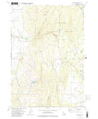
USGS Historical Quadrangle in GeoPDF.
FY2016This project will develop a strategic approach for conservation of wet meadows and riparian ecosystems and the species they support that focuses on threats caused by natural and anthropogenic disturbance. It uses information on (1) the factors that affect wet meadow and riparian ecosystem resilience to both natural and human-caused disturbances at the scale of the watershed and meadow or riparian ecosystem, and (2) the distributions and population abundances of at risk species to determine focal areas for management. Maps of the relative resilience of watersheds and wet meadows are overlaid with data on at risk species and the predominant threats to facilitate this process. Decision matrices are developed...
Categories: Data,
Project;
Types: Map Service,
OGC WFS Layer,
OGC WMS Layer,
OGC WMS Service;
Tags: Conservation Design,
Conservation Planning,
Datasets/Database,
Federal resource managers,
Great Basin,
This data set contains imagery from the National Agriculture Imagery Program (NAIP). The NAIP program is administered by USDA FSA and has been established to support two main FSA strategic goals centered on agricultural production. These are, increase stewardship of America's natural resources while enhancing the environment, and to ensure commodities are procured and distributed effectively and efficiently to increase food security. The NAIP program supports these goals by acquiring and providing ortho imagery that has been collected during the agricultural growing season in the U.S. The NAIP ortho imagery is tailored to meet FSA requirements and is a fundamental tool used to support FSA farm and conservation programs....
This data set contains imagery from the National Agriculture Imagery Program (NAIP). The NAIP program is administered by USDA FSA and has been established to support two main FSA strategic goals centered on agricultural production. These are, increase stewardship of America's natural resources while enhancing the environment, and to ensure commodities are procured and distributed effectively and efficiently to increase food security. The NAIP program supports these goals by acquiring and providing ortho imagery that has been collected during the agricultural growing season in the U.S. The NAIP ortho imagery is tailored to meet FSA requirements and is a fundamental tool used to support FSA farm and conservation programs....
This data set contains imagery from the National Agriculture Imagery Program (NAIP). The NAIP program is administered by USDA FSA and has been established to support two main FSA strategic goals centered on agricultural production. These are, increase stewardship of America's natural resources while enhancing the environment, and to ensure commodities are procured and distributed effectively and efficiently to increase food security. The NAIP program supports these goals by acquiring and providing ortho imagery that has been collected during the agricultural growing season in the U.S. The NAIP ortho imagery is tailored to meet FSA requirements and is a fundamental tool used to support FSA farm and conservation programs....
This publication presents data collected within meadows from samples used to assess meadow plant community responses to recreational pack stock as part of a USGS Natural Resources Preservation Project. High elevation meadows are a vital ecological component of mountain systems throughout western North America. They provide critical habitat for wildlife, supply key ecosystem services, and are favored destinations for people visiting the mountains. The biophysical characteristics of meadows are highly variable, especially related to hydrologic regimes and associated plant community types. In the semi-arid landscape of the Sierra, water availability operates at multiple scales strongly influencing meadow plant community...
Categories: Data;
Types: Citation;
Tags: Meadows,
Pack Stock,
Plant Communities,
Sequoia and Kings Canyon National Parks,
Sierra Nevada,

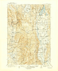
USGS Historical Quadrangle in GeoPDF.
This polygon vector dataset represents over 18,000 derived watersheds associated with meadows listed in the Sierra Nevada Meadows Compilation (version 2.0). The watershed polygons are attributed with geology, landform, and fire recurrence interval departure information thought to potentially influence the hydrology of meadows.
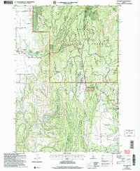
USGS Historical Quadrangle in GeoPDF.
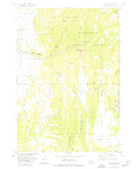
USGS Historical Quadrangle in GeoPDF.
This data set contains imagery from the National Agriculture Imagery Program (NAIP). The NAIP program is administered by USDA FSA and has been established to support two main FSA strategic goals centered on agricultural production. These are, increase stewardship of America's natural resources while enhancing the environment, and to ensure commodities are procured and distributed effectively and efficiently to increase food security. The NAIP program supports these goals by acquiring and providing ortho imagery that has been collected during the agricultural growing season in the U.S. The NAIP ortho imagery is tailored to meet FSA requirements and is a fundamental tool used to support FSA farm and conservation programs....
USGS Historical Quadrangle in GeoPDF.
FY2015Study the wildlife impacts of the Bruneau-Owyhee Sage-grouse Habitat (BOSH) project. (The removal of approximately 600,000 acres of western juniper across a landscape of ~1.5 million acres over the next generation in an attempt to reverse sage-grouse habitat loss caused by woodland encroachment.) Monitor the effects of the BOSH project on wildlife by understanding effects of habitat treatments conducted in support of greater sage-grouse on other wildlife critical to inform federal management plans. Collect and analyze data on wildlife and habitat responses at multiple control levels and in predetermined areas. Methods are described in the full proposal submitted and collection of data will occur for at least...
Categories: Data,
Project;
Types: Map Service,
OGC WFS Layer,
OGC WMS Layer,
OGC WMS Service;
Tags: Academics & scientific researchers,
Conservation Design,
Conservation Planning,
Datasets/Database,
Federal resource managers,

This dataset is a compiled meadows layer for the Sierra Nevada containing 17,039 meadow polygons (total area = 77,659 hectares, 191,900 acres).Brief Methods: UC Davis compiled the âbest availableâ meadow polygon layers into a single data layer. Data layers were collected from various agencies, individuals, and organizations. Data layer quality varied based on compilation methods and age; some layers were excluded due to poor data quality. A confidence rank (1 = low, 10 = high) was assigned to the remaining layers which were rasterized at a 10m resolution. The layers were combined and combined raster cells with a summed rank of 2 or less were excluded. Raster cells representing open water were also excluded....
Meadows within the Rogue Siskiyou National Forest. Illustrates merger of data for both ROR and SIS forests.
|

|
