Filters: Tags: Medina Lake (X)
10 results (8ms)|
Filters
Date Range
Types Contacts
Categories Tag Types Tag Schemes |
This data set contains imagery from the National Agriculture Imagery Program (NAIP). The NAIP program is administered by USDA FSA and has been established to support two main FSA strategic goals centered on agricultural production. These are increase stewardship of America's natural resources while enhancing the environment, and to ensure commodities are procured and distributed effectively and efficiently to increase food security. The NAIP program supports these goals by acquiring and providing ortho imagery that has been collected during the agricultural growing season in the U.S. The NAIP ortho imagery is tailored to meet FSA requirements and is a fundamental tool used to support FSA farm and conservation programs....
This data set contains imagery from the National Agriculture Imagery Program (NAIP). The NAIP program is administered by USDA FSA and has been established to support two main FSA strategic goals centered on agricultural production. These are increase stewardship of America's natural resources while enhancing the environment, and to ensure commodities are procured and distributed effectively and efficiently to increase food security. The NAIP program supports these goals by acquiring and providing ortho imagery that has been collected during the agricultural growing season in the U.S. The NAIP ortho imagery is tailored to meet FSA requirements and is a fundamental tool used to support FSA farm and conservation programs....
In 2004, a hydrologic water-budget analysis was conducted and the results published in the report, Water-Budget Analysis of Medina and Diversion Lakes and the Medina/Diversion Lake System, With Estimated Recharge to the Edwards Aquifer, San Antonio Area, Texas (SIR 2004-5209)(Slattery and Miller, 2004). This data release contains the hydrologic water-budget data used in a reanalysis of the data as well as the results of the reanalysis. The hydrologic water-budget data used was derived from selected columns of data found in table 5 of the report. The columns of selected data include the time period in which the data were collected, the number of days used to obtain the average groundwater outflow, the standard deviation...
Categories: Data;
Tags: Medina Lake,
USGS Science Data Catalog (SDC),
Water Resources,
groundwater,
recharge,
This data set contains imagery from the National Agriculture Imagery Program (NAIP). The NAIP program is administered by USDA FSA and has been established to support two main FSA strategic goals centered on agricultural production. These are increase stewardship of America's natural resources while enhancing the environment, and to ensure commodities are procured and distributed effectively and efficiently to increase food security. The NAIP program supports these goals by acquiring and providing ortho imagery that has been collected during the agricultural growing season in the U.S. The NAIP ortho imagery is tailored to meet FSA requirements and is a fundamental tool used to support FSA farm and conservation programs....
This data set contains imagery from the National Agriculture Imagery Program (NAIP). The NAIP program is administered by USDA FSA and has been established to support two main FSA strategic goals centered on agricultural production. These are increase stewardship of America's natural resources while enhancing the environment, and to ensure commodities are procured and distributed effectively and efficiently to increase food security. The NAIP program supports these goals by acquiring and providing ortho imagery that has been collected during the agricultural growing season in the U.S. The NAIP ortho imagery is tailored to meet FSA requirements and is a fundamental tool used to support FSA farm and conservation programs....

USGS Historical Quadrangle in GeoPDF.
The Edwards aquifer in south-central Texas is one of the most permeable and productive aquifers in the United States and is the major source of public water supply for Bexar, Comal, Hays, Medina, and Uvalde Counties. The Edwards aquifer also supplies large quantities of water for use in agriculture, business, and industry in the region. The major artesian springs of the Edwards aquifer provide water for recreational activities, businesses, and downstream users, and provide habitat for several threatened or endangered species. The areas pertinent to the recharge process are the catchment area and the recharge zone. The catchment area consists of the parts of river basins upstream from the recharge zone. Streams...
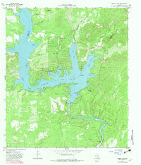
USGS Historical Quadrangle in GeoPDF.
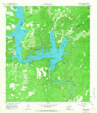
USGS Historical Quadrangle in GeoPDF.
This data release supports the U.S. Geological Survey Scientific Investigation Map (SIM) by Clark and others (2020) by documenting the data used to create the geologic maps and describes the geologic framework and hydrostratigraphy of the Edwards and Trinity aquifers for a 442 square-mile area in northern Medina County in south Texas. The karstic Edwards and Trinity aquifers that are the subject of the SIM by Clark and others (2020) are classified as major sources of water in south-central Texas by the Texas Water Development Board (George and others, 2011). The geologic framework and hydrostratigraphy of the Edwards and Trinity aquifers largely control groundwater flow paths and storage in northern Medina County...
|

|
