Filters: Tags: Meeteetse (X)
10 results (103ms)|
Filters
Date Range
Extensions Types Contacts
Categories Tag Types Tag Schemes |
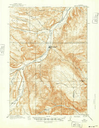
USGS Historical Quadrangle in GeoPDF.
Mule deer within the Red Desert population, part of the larger Sublette herd, make the longest ungulate migration ever recorded in the lower 48 states (fig. 33). Here, mule deer travel an average one-way distance of 150 mi (241 km) from the Red Desert in the south to the Gros Ventre Range and Teton Range in the north. This migration originates in the desert sagebrush basins of the Red Desert area of southwest Wyoming where deer winter. In spring, an estimated 500 deer travel 50 mi (84 km) north across the desert to the west side of the Wind River Range. From there they merge with 4,000 to 5,000 other deer that winter in the foothills of the Wind River Range and then travel a narrow corridor along the base of the...
Categories: Data;
Types: Downloadable,
Map Service,
OGC WFS Layer,
OGC WMS Layer,
Shapefile;
Tags: Meeteetse,
United States,
Wyoming,
animal behavior,
migration (organisms),
Core Research Center, core C234, from well operated by MICH WISC PIPELINERaw Properties from download, web scrape, MapServer, and Macrostrat API{"Lib Num": "C234", "API Num": "4901320712", "Operator": "MICH WISC PIPELINE", "Well Name": "1-12 LYSITE", "Field": "LYSITE", "State": "WY", "County": "FREMONT", "Type": "SLABBED", "Photos": "T", "Thin Sec": "T", "Analysis": "F", "Latitude": "43.27779", "Longitude": "-107.69877", "coordinates_geohash": "9xeqjq2pkub9", "Source": "FROM STATE RECORDS", "Security Flag": "NO SPECIAL RESTRICTIONS", "crc_collection_name": "core", "sb_parent_id": "4f4e49dae4b07f02db5e0486", "intervals": [{"Formation": "LANCE", "Age": "CRET", "Min Depth": "12801", "Max Depth": "12848"}, {"Formation":...
Core Research Center, core U946, from well operated by USGS-SPRaw Properties from download, web scrape, MapServer, and Macrostrat API{"Lib Num": "U946", "API Num": null, "Operator": "USGS-SP", "Well Name": "4 CBM - WELTON MINE", "Field": "WIND RIVER INDIAN RES", "State": "WY", "County": "FREMONT", "Type": "FULL", "Photos": "F", "Thin Sec": "F", "Analysis": "F", "Latitude": "43.46708", "Longitude": "-108.68482", "coordinates_geohash": "9xdxqbfnh5h2", "Source": "CENTER OF SECTION", "Security Flag": "PERMANENT HOLD NO VIEWING OR SAMPLING", "crc_collection_name": "core", "sb_parent_id": "4f4e49dae4b07f02db5e0486", "intervals": [{"Formation": "MEETEETSE", "Age": "CRET", "Min Depth": "691", "Max Depth": "701"}], "crcwc_url":...
Categories: Physical Item;
Tags: Alluvium and Colluvium,
CRET,
MEETEETSE,
Pleistocene - Holocene,
clay,
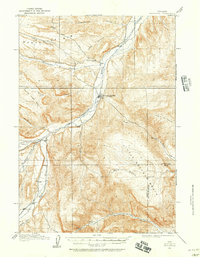
USGS Historical Quadrangle in GeoPDF.
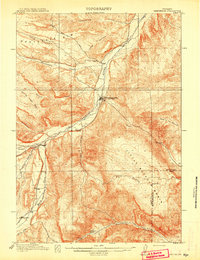
USGS Historical Quadrangle in GeoPDF.
The Mesa mule deer population is part of the larger Sublette herd that winters in the north-central portion of the Green River Basin, east of the Green River and west of U.S. Highway 191 (fig. 32). The Mesa wintering area supports 3,000 to 5,000 deer that migrate northwest to summer ranges in the Wyoming Range, Gros Ventre Range, and Salt River Range. The Mesa winter range, which has been fragmented by a large natural gas field, has experienced 30–40 percent declines in deer abundance since this development began. Mitigating winter range impacts continues to be a challenge for managers. These migratory deer have benefited from six underpasses and two overpasses constructed along U.S. Highway 191 in 2012; the project...
Categories: Data;
Types: Downloadable,
Map Service,
OGC WFS Layer,
OGC WMS Layer,
Shapefile;
Tags: Meeteetse,
United States,
Wyoming,
animal behavior,
migration (organisms),
Core Research Center, core D040, from well operated by MONSANTO OILRaw Properties from download, web scrape, MapServer, and Macrostrat API{"Lib Num": "D040", "API Num": "4901320722", "Operator": "MONSANTO OIL", "Well Name": "1-35 DOLLIS", "Field": "MADDEN", "State": "WY", "County": "FREMONT", "Type": "SLABBED", "Photos": "T", "Thin Sec": "F", "Analysis": "F", "Latitude": "43.30751", "Longitude": "-107.7236", "coordinates_geohash": "9xeqkeyhd0vz", "Source": "FROM STATE RECORDS", "Security Flag": "NO SPECIAL RESTRICTIONS", "crc_collection_name": "core", "sb_parent_id": "4f4e49dae4b07f02db5e0486", "intervals": [{"Formation": "LANCE", "Age": "CRET", "Min Depth": "12092", "Max Depth": "12134"}, {"Formation": "LANCE",...
Mule deer within the Owl Creek/Meeteetse herd make a number of medium- to long-distance migrations west into the Shoshone National Forest. These migrations originate on the sagebrush grasslands just southwest and west of Meeteetse, Wyoming, where this population winters. In spring, an estimated 4,100 deer leave these foothills and travel into the rugged Absaroka mountain range. These journeys, across challenging natural terrain, range an average of 27 miles and include navigating fast moving rivers, such as the Greybull River, and over high mountains passes like Bear Creek and East Fork Pass—the highest at 12,230 feet in elevation. The longest migration is 70 miles to the Dunoir Valley northwest of Dubois. Although...
Categories: Data;
Types: Downloadable,
Map Service,
OGC WFS Layer,
OGC WMS Layer,
Shapefile;
Tags: Meeteetse,
United States,
Wyoming,
animal behavior,
migration (organisms),
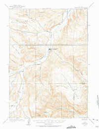
USGS Historical Quadrangle in GeoPDF.
|

|
