Filters: Tags: Meteor Crater (X)
15 results (67ms)|
Filters
Date Range
Types Contacts
Categories Tag Types Tag Schemes |
This data set contains imagery from the National Agriculture Imagery Program (NAIP). The NAIP program is administered by USDA FSA and has been established to support two main FSA strategic goals centered on agricultural production. These are, increase stewardship of America's natural resources while enhancing the environment, and to ensure commodities are procured and distributed effectively and efficiently to increase food security. The NAIP program supports these goals by acquiring and providing ortho imagery that has been collected during the agricultural growing season in the U.S. The NAIP ortho imagery is tailored to meet FSA requirements and is a fundamental tool used to support FSA farm and conservation programs....
The National Aeronautics and Space Administration, working with members of the scientific community, has determined that early manned lunar exploration will be oriented primarily to investigations in the geosciences. Exploration by man on the lunar surface will, therefore be geological, geophysical, geochemical, geochemical, and surveying in nature, and will be directed to the physical and chemical characteristics of the lunar crust, and to measurements that will furnish data pertinent to understanding the physics of the Moon. Scientific exploration of the Moon will provide information fundamental to understanding the origin and composition of the Solar System, and engineering data important to the design of specific...
This data set contains imagery from the National Agriculture Imagery Program (NAIP). The NAIP program is administered by USDA FSA and has been established to support two main FSA strategic goals centered on agricultural production. These are, increase stewardship of America's natural resources while enhancing the environment, and to ensure commodities are procured and distributed effectively and efficiently to increase food security. The NAIP program supports these goals by acquiring and providing ortho imagery that has been collected during the agricultural growing season in the U.S. The NAIP ortho imagery is tailored to meet FSA requirements and is a fundamental tool used to support FSA farm and conservation programs....
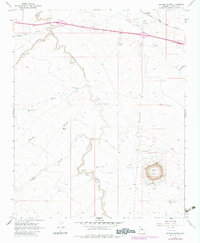
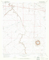
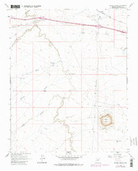
Meteor Crater, located in northern Arizona, is one of the best preserved and easily accessible impact sites on Earth. Scientific investigations of this crater have led to improvements in our understanding of impact mechanics, cratering dynamics, and ejecta distribution [e.g., 1-5]. In addition, this site has a rich history as a terrestrial analog that has been used for training astronauts, scientists, and engineers [e.g., 6-8]. In the 1970s Dr. David Roddy conducted a rotary drilling campaign at Meteor Crater, along the rim, flanks, and surrounding ejecta blanket [9]. This work resulted in 2,500 m of drill cuttings from 161 drill holes. The original samples were placed in sandwich-sized plastic bags with slips of...
Categories: Data;
Types: Map Service,
OGC WFS Layer,
OGC WMS Layer,
OGC WMS Service;
Tags: Arizona,
Flagstaff,
Meteor Crater,
USGS Science Data Catalog (SDC),
field sampling,
USGS Historical Quadrangle in GeoPDF.
USGS Historical Quadrangle in GeoPDF.
USGS Historical Quadrangle in GeoPDF.
This data set contains imagery from the National Agriculture Imagery Program (NAIP). The NAIP program is administered by USDA FSA and has been established to support two main FSA strategic goals centered on agricultural production. These are, increase stewardship of America's natural resources while enhancing the environment, and to ensure commodities are procured and distributed effectively and efficiently to increase food security. The NAIP program supports these goals by acquiring and providing ortho imagery that has been collected during the agricultural growing season in the U.S. The NAIP ortho imagery is tailored to meet FSA requirements and is a fundamental tool used to support FSA farm and conservation programs....
This data set contains imagery from the National Agriculture Imagery Program (NAIP). The NAIP program is administered by USDA FSA and has been established to support two main FSA strategic goals centered on agricultural production. These are, increase stewardship of America's natural resources while enhancing the environment, and to ensure commodities are procured and distributed effectively and efficiently to increase food security. The NAIP program supports these goals by acquiring and providing ortho imagery that has been collected during the agricultural growing season in the U.S. The NAIP ortho imagery is tailored to meet FSA requirements and is a fundamental tool used to support FSA farm and conservation programs....
This report includes the first substantive body of in situ density, bearing strength, shear strength, and moisture content data measured by Project personnel. Emphasis in this fiscal year's measurements was on low-density materials since available data suggest that the upper meter or so of the lunar surface consists of low-density material.
Geophysical surveys conducted at Zuni Salt Lake, Hopi Buttes, and Meteor Crater show anomalies that are representative of the varied geologic history of these test areas. This report presents only a qualitative representation of results obtained at the three major test sites: Zuni Salt Lake, Hopi Buttes, and Meteor Crater. Individual reports on each test site will examine and interpret geophysical anomalies in greater detail.
Current models do not sufficiently explain target rock-projectile mixing and ejecta blanket formation for small impact craters (i.e., <2km diameter). For example, due to the size of Meteor Crater and the low-velocity at which materials were excavated from the transient crater, the extent of target rock-projectile mixing is expected to be minor. However, based on drilling notes from Dr. David Roddy and preliminary work done at the USGS, we found lithologic mixing is much more prevalent throughout the ejecta blanket. We have used the USGS Meteor Crater sample collection to investigate the internal stratigraphy and spatial distribution of impact-generated materials in the ejecta blanket to better understand cratering...
Utilizing the USGS Meteor Crater Sample Collection, we sampled impact melt particles for geochemical and textural characterization using a scanning electron microscope and electron microprobe. Samples were collected from a range of different depths and distances from the crater rim, all within the proximal ejecta blanket. By using the Meteor Crater Sample Collection, in which all samples have known geospatial locations, we are able to quantify the spatial relationship and variability between mixing of melted target rocks and the Canyon Diablo meteorite. Presented here are high-resolution backscattered electron images of all analyzed impact melt particles, and geochemical data for glass and individual mineral phases...
The U. S. Geological Survey's Manned Lunar Exploration Investigations carried out during the second half of Fiscal Year 1965 concept studies for Apollo and for AES exploration, and shirt-sleeve field tests of geologic operations for Apollo exploration. Three Apollo field tests were carried out late in the spring using communications and television systems, a simple LEM mock-up, and other equipment such as a surveying staff and one and two-handed sample and instrument carriers. Structure of the Manned Lunar Exploration Investigations was temporarily reorganized (pending complete reorganization for FY 66) late in the period to identify a number of the work areas of responsibility that had come into being (Figure 1)....
|

|
