Filters: Tags: Mexico (X) > partyWithName: U.S. Geological Survey (X)
90 results (92ms)|
Filters
Date Range
Extensions Types
Contacts
Categories Tag Types
|
The National Hydrography Dataset (NHD) is a feature-based database that interconnects and uniquely identifies the stream segments or reaches that make up the nation's surface water drainage system. NHD data was originally developed at 1:100,000-scale and exists at that scale for the whole country. This high-resolution NHD, generally developed at 1:24,000/1:12,000 scale, adds detail to the original 1:100,000-scale NHD. (Data for Alaska, Puerto Rico and the Virgin Islands was developed at high-resolution, not 1:100,000 scale.) Local resolution NHD is being developed where partners and data exist. The NHD contains reach codes for networked features, flow direction, names, and centerline representations for areal water...

These data were released prior to the October 1, 2016 effective date for the USGS’s policy dictating the review, approval, and release of scientific data as referenced in USGS Survey Manual Chapter 502.8 Fundamental Science Practices: Review and Approval of Scientific Data for Release. This data set represents the state (political) boundaries of Mexico. The Digitial Chart of the World data set had incomplete state boundaries, which was the reason to create this coverage. It was digitized from a 1992 CIA map at a scale of 1:3 million. The coast line came from the Digital Chart of the world at a scale of 1:1 million. The state names were labeled from the map and an attribute to help fill the states was added. The...
The National Hydrography Dataset (NHD) is a feature-based database that interconnects and uniquely identifies the stream segments or reaches that make up the nation's surface water drainage system. NHD data was originally developed at 1:100,000-scale and exists at that scale for the whole country. This high-resolution NHD, generally developed at 1:24,000/1:12,000 scale, adds detail to the original 1:100,000-scale NHD. (Data for Alaska, Puerto Rico and the Virgin Islands was developed at high-resolution, not 1:100,000 scale.) Local resolution NHD is being developed where partners and data exist. The NHD contains reach codes for networked features, flow direction, names, and centerline representations for areal water...
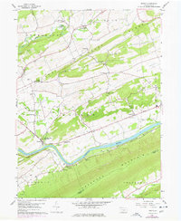
USGS Historical Quadrangle in GeoPDF.
This sampling frame is a set of grid-based finite-area frames spanning Canada, the United States, and Mexico. The grid for the United States is broken into individual grids for the continental United States, Hawaii, and Puerto Rico. Alaska is combined with Canada into a single grid. Each country/state/territory extent consists of four nested sampling grids at 50x50km, 10x10km, 5x5km, and 1x1km resolutions. The original 10x10km continental United States grid was developed by the Forest Service, U.S. Department of Agriculture for use in the interagency “Bat Grid” monitoring program in the Pacific Northwest and was expanded across Canada, the United States, and Mexico for the North American Bat Monitoring Program (NABat)....
This sampling frame is a set of grid-based finite-area frames spanning Canada, the United States, and Mexico. The grid for the United States is broken into individual grids for the continental United States, Hawaii, and Puerto Rico. Alaska is combined with Canada into a single grid. Each country/state/territory extent consists of four nested sampling grids at 50x50km, 10x10km, 5x5km, and 1x1km resolutions. The original 10x10km continental United States grid was developed by the Forest Service, U.S. Department of Agriculture for use in the interagency “Bat Grid” monitoring program in the Pacific Northwest and was expanded across Canada, the United States, and Mexico for the North American Bat Monitoring Program (NABat)....
Categories: Data;
Types: Downloadable,
Map Service,
OGC WFS Layer,
OGC WMS Layer,
Shapefile;
Tags: Alaska,
Canada,
Hawaii,
Mexico,
Puerto Rico,
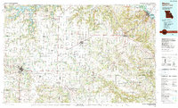
USGS Historical Quadrangle in GeoPDF.
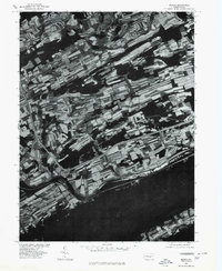
USGS Historical Quadrangle in GeoPDF.

The National Hydrography Dataset (NHD) is a feature-based database that interconnects and uniquely identifies the stream segments or reaches that make up the nation's surface water drainage system. NHD data was originally developed at 1:100,000-scale and exists at that scale for the whole country. This high-resolution NHD, generally developed at 1:24,000/1:12,000 scale, adds detail to the original 1:100,000-scale NHD. (Data for Alaska, Puerto Rico and the Virgin Islands was developed at high-resolution, not 1:100,000 scale.) Local resolution NHD is being developed where partners and data exist. The NHD contains reach codes for networked features, flow direction, names, and centerline representations for areal water...

Multi Order Hydrologic Position (MOHP) raster datasets: Distance from Stream to Divide (DSD) and Lateral Position (LP) have been produced nationally for the 48 contiguous United States at a 30-meter resolution for stream orders 1 through 9. These data are available for testing as predictor variables for various regional and national groundwater-flow and groundwater-quality statistical models. The concept behind MOHP is that for any given point on the earth’s surface there is the potential for longer and longer groundwater flow paths as one goes deeper and deeper beneath the land surface. These increasing depths correspond to increasing stream orders. Or in other words, with increasing depth these paths of groundwater...
Migratory species provide ecosystem goods and services throughout their annual cycles, often over long distances. Designing effective conservation solutions for migratory species requires knowledge of both species ecology and the socioeconomic context of their migrations. We present a framework built around the concept that migratory species act as carriers, delivering benefit flows to people throughout their annual cycle that are supported by the network of ecosystems upon which the species depend. We apply this framework to the monarch butterfly (Danaus plexippus) migration of eastern North America by calculating their spatial subsidies. Spatial subsidies are the net ecosystem service flows throughout a species’...
This sampling frame is a set of grid-based finite-area frames spanning Canada, the United States, and Mexico. The grid for the United States is broken into individual grids for the continental United States, Hawaii, and Puerto Rico. Alaska is combined with Canada into a single grid. Each country/state/territory extent consists of four nested sampling grids at 50x50km, 10x10km, 5x5km, and 1x1km resolutions. The original 10x10km continental United States grid was developed by the Forest Service, U.S. Department of Agriculture for use in the interagency “Bat Grid” monitoring program in the Pacific Northwest and was expanded across Canada, the United States, and Mexico for the North American Bat Monitoring Program (NABat)....
Categories: Data;
Types: Downloadable,
Map Service,
OGC WFS Layer,
OGC WMS Layer,
Shapefile;
Tags: Alaska,
Canada,
Hawaii,
Mexico,
Puerto Rico,
These data are a compilation of four mask layers (regions), and enhanced vegetation indices calculated from airborne or satellite imagery. The mask layers were used created to extract satellite EVI data from the four airborne or satellite imagery datasets. The Enhanced Vegetation Index (EVI) is a key Earth science parameter used to assess vegetation, originally developed and calibrated for the Moderate Resolution Imaging Spectroradiometer (MODIS) aboard the Terra and Aqua satellites. With the impending decommissioning of the MODIS sensors by the year 2020/2022, alternative platforms will need to be used to estimate EVI. These data were created to compare Landsat 5 (2000–2011), 8 (2013–2016) and the Visible Infrared...
USGS Historical Quadrangle in GeoPDF.
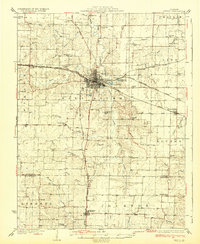
USGS Historical Quadrangle in GeoPDF.
The Desert LCC identified the need for a Protected Areas spatial database that showed land ownership, management designations and conservation status for lands in the United States and Mexico. However, the existing Protected Areas database was found to be particularly prone to boundary and database errors that affected its potential use. This USGS project will develop a single, seamless, error-free Protected Areas dataset for the full geographic scope of the Desert LCC. This will involve acquiring numerous spatial layers from Federal, State, and NGO organizations which are responsible for administering and/or managing areas that have a designated protected status. Protected Area will be categorized as defined by...
Categories: Data,
Project;
Types: Map Service,
OGC WFS Layer,
OGC WMS Layer,
OGC WMS Service;
Tags: 2012,
AZ-01,
AZ-02,
AZ-03,
AZ-04,
The 2020 North American Land Cover 30-meter dataset was produced as part of the North American Land Change Monitoring System (NALCMS), a trilateral effort between Natural Resources Canada, the United States Geological Survey, and three Mexican organizations including the National Institute of Statistics and Geography (Instituto Nacional de Estadística y Geografía), National Commission for the Knowledge and Use of the Biodiversity (Comisión Nacional Para el Conocimiento y Uso de la Biodiversidad), and the National Forestry Commission of Mexico (Comisión Nacional Forestal). The collaboration is facilitated by the Commission for Environmental Cooperation, an international organization created by the Canada, Mexico,...
This sampling frame is a set of grid-based finite-area frames spanning Canada, the United States, and Mexico. The grid for the United States is broken into individual grids for the continental United States, Hawaii, and Puerto Rico. Alaska is combined with Canada into a single grid. Each country/state/territory extent consists of four nested sampling grids at 50x50km, 10x10km, 5x5km, and 1x1km resolutions. The original 10x10km continental United States grid was developed by the Forest Service, U.S. Department of Agriculture for use in the interagency “Bat Grid” monitoring program in the Pacific Northwest and was expanded across Canada, the United States, and Mexico for the North American Bat Monitoring Program (NABat)....
Categories: Data;
Types: Downloadable,
Map Service,
OGC WFS Layer,
OGC WMS Layer,
Shapefile;
Tags: Alaska,
Canada,
Hawaii,
Mexico,
Puerto Rico,
USGS Historical Quadrangle in GeoPDF.
|

|
