Filters: Tags: Mexico (X)
305 results (86ms)|
Filters
Date Range
Extensions Types
Contacts
Categories Tag Types
|
This part of the Data Release contains the raster representation of the water-level altitude and water-level change maps developed every 5 years from 1980-2015 for the upper Rio Grande Focus Area Study. The input point data used to generate the water-level altitude maps can be found in the "Groundwater level measurement data used to develop water-level altitude maps in the upper Rio Grande Alluvial Basins" child item of this data release. These digital data accompany Houston, N.A., Thomas, J.V., Foster, L.K., Pedraza, D.E., and Welborn, T.L., 2020, Hydrogeologic framework, groundwater-level altitudes, groundwater-level changes, and groundwater-storage changes in selected alluvial basins of the upper Rio Grande...
Types: Map Service,
OGC WFS Layer,
OGC WMS Layer,
OGC WMS Service;
Tags: Abiquiu Reservoir,
Ahumada,
Alamosa,
Alamosa County,
Alamosa Creek,
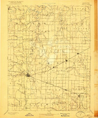
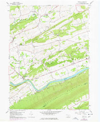
USGS Historical Quadrangle in GeoPDF.
DLCC’s Vegetation Map Pilot is a project envisioned initially as a supervised classification of two or three small areas of the DLCC. DLCC technical stakeholders advised changing from a supervised classification to an object oriented classification (OOC) method.This report presents the findings, feasibility, and lessons-learned during the exploration and object oriented classification process and results of the two sites on the United States-Mexico border, this is needed information before considering a full-scale, Vegetation Mapping Project, to include bigger areas or the totality of the Desert LCC region.
Categories: Data;
Tags: Academics & scientific researchers,
Aquascalientes,
Aquascalientes,
Arizona,
Arizona,
WHISPers stands for Wildlife Health Information Sharing Partnership - event reporting system. It is a web-based repository for sharing basic information about historic and ongoing wildlife mortality (death) and morbidity (illness) events. The system possesses a searchable archive of wildlife mortality and morbidity event data that is available to the public. The information is opportunistically collected and does not reflect all the mortality events that occur in North America.
The NABat sampling frame is a grid-based finite-area frame spanning Canada, the United States, and Mexico consisting of N total number of 10- by 10-km (100-km2) grid cell sample units for the continental United States, Canada, and Alaska and 5- by 5-km (25km2) for Hawaii and Puerto Rico. This grain size is biologically appropriate given the scale of movement of most bat species, which routinely travel many kilometers each night between roosts and foraging areas and along foraging routes. A Generalized Random-Tessellation Stratified (GRTS) Survey Design draw was added to the sample units from the raw sampling grids (https://doi.org/10.5066/P9M00P17). This dataset represents the final 2018 NABat Sampling grid with...
Categories: Data;
Types: Downloadable,
Map Service,
OGC WFS Layer,
OGC WMS Layer,
Shapefile;
Tags: Alaska,
Canada,
Hawaii,
Mexico,
Puerto Rico,
This sampling frame is a set of grid-based finite-area frames spanning Canada, the United States, and Mexico. The grid for the United States is broken into individual grids for the continental United States, Hawaii, and Puerto Rico. Alaska is combined with Canada into a single grid. Each country/state/territory extent consists of four nested sampling grids at 50x50km, 10x10km, 5x5km, and 1x1km resolutions. The original 10x10km continental United States grid was developed by the Forest Service, U.S. Department of Agriculture for use in the interagency “Bat Grid” monitoring program in the Pacific Northwest and was expanded across Canada, the United States, and Mexico for the North American Bat Monitoring Program (NABat)....
This sampling frame is a set of grid-based finite-area frames spanning Canada, the United States, and Mexico. The grid for the United States is broken into individual grids for the continental United States, Hawaii, and Puerto Rico. Alaska is combined with Canada into a single grid. Each country/state/territory extent consists of four nested sampling grids at 50x50km, 10x10km, 5x5km, and 1x1km resolutions. The original 10x10km continental United States grid was developed by the Forest Service, U.S. Department of Agriculture for use in the interagency “Bat Grid” monitoring program in the Pacific Northwest and was expanded across Canada, the United States, and Mexico for the North American Bat Monitoring Program (NABat)....
Categories: Data;
Types: Downloadable,
Map Service,
OGC WFS Layer,
OGC WMS Layer,
Shapefile;
Tags: Alaska,
Canada,
Hawaii,
Mexico,
Puerto Rico,
This sampling frame is a set of grid-based finite-area frames spanning Canada, the United States, and Mexico. The grid for the United States is broken into individual grids for the continental United States, Hawaii, and Puerto Rico. Alaska is combined with Canada into a single grid. Each country/state/territory extent consists of four nested sampling grids at 50x50km, 10x10km, 5x5km, and 1x1km resolutions. The original 10x10km continental United States grid was developed by the Forest Service, U.S. Department of Agriculture for use in the interagency “Bat Grid” monitoring program in the Pacific Northwest and was expanded across Canada, the United States, and Mexico for the North American Bat Monitoring Program (NABat)....
Categories: Data;
Types: Downloadable,
Map Service,
OGC WFS Layer,
OGC WMS Layer,
Shapefile;
Tags: Alaska,
Canada,
Hawaii,
Mexico,
Puerto Rico,
Subterranean estuaries extend inland into density-stratified coastal carbonate aquifers that contain a surprising diversity of endemic animals (mostly crustaceans) within a highly oligotrophic environment. How complex ecosystems thrive in this globally-distributed, cryptic habitat (termed anchialine) is poorly understood. The northeastern margin of the Yucatan Peninsula contains over 250 km of mapped, diver-accessible caves passages where previous studies have suggested chemoautotrophic processes are the source of carbon and energy sustaining the anchialine food web. This dataset, collected during four field events during U.S. Geological Survey (USGS) Coastal and Marine Geology Program Field Activities 2015-013-FA...
Categories: Data;
Types: Citation;
Tags: Cenote Bang,
Mexico,
Ox Bel Ha Cave System,
Quintana Roo, Mexico,
Yucatan Peninsula,
This data set contains imagery from the National Agriculture Imagery Program (NAIP). The NAIP program is administered by USDA FSA and has been established to support two main FSA strategic goals centered on agricultural production. These are, increase stewardship of America's natural resources while enhancing the environment, and to ensure commodities are procured and distributed effectively and efficiently to increase food security. The NAIP program supports these goals by acquiring and providing ortho imagery that has been collected during the agricultural growing season in the U.S. The NAIP ortho imagery is tailored to meet FSA requirements and is a fundamental tool used to support FSA farm and conservation programs....
The NABat sampling frame is a grid-based finite-area frame spanning Canada, the United States, and Mexico consisting of N total number of 10- by 10-km (100-km2) grid cell sample units. This grain size is biologically appropriate given the scale of movement of most bat species, which routinely travel many kilometers each night between roosts and foraging areas and along foraging routes. A draw of sample units from a finite sampling frame using the GRTS design produces an ordered list of units such that any ordered subset of that list is also randomized and spatially balanced. This vector dataset is the individual grid-based sampling grid for Continental United States at a 10x10km resolution.
Categories: Data;
Types: Downloadable,
Map Service,
OGC WFS Layer,
OGC WMS Layer,
Shapefile;
Tags: Alaska,
Canada,
Hawaii,
Mexico,
Puerto Rico,
This dataset includes all North American Breeding Bird Survey data collected in Mexico between 2008-2018. These data were used as the basis for all analyses discussed in an associated publication: The North American Breeding Bird Survey in Mexico, 2008-2018 — A Status Report; https:doi.org/10.3133/cir1479. The records include avian point count data for all reported taxa (species, races, and unidentified species groupings). In addition to avian count data, this dataset also contains survey date, survey start and end times, start and end weather conditions, a unique observer identification number, route identification information, and route location information including country, state, and BCR, as well as geographic...
Categories: Data;
Tags: Birds,
Mexico,
North America,
USGS Science Data Catalog (SDC),
Wildlife Biology,
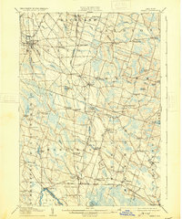
USGS Historical Quadrangle in GeoPDF.
USGS Historical Quadrangle in GeoPDF.
These data were compiled to understand the effects of riparian vegetation health on local abundance and species diversity of land birds. The primary objective of our study was to to determine the effects of riparian restoration on birds in the Colorado River delta. These tabular data represent vegetation indices and evapotranspiration (ET) data at varying spatial scales that correspond to avian use circles of 100 to 2000 meters. Three vegetation reflectance indices (VIs): NDVI, EVI, and EVI2 were obtained from Landsat imagery with a biweekly temporal frequency, and covering the entire period of bird surveys (2002-2020). The Normalized Difference Vegetation Index (NDVI) and Enhanced Vegetation Index (EVI) and two-band...
Album Caption: Monterey ten miles below Purisima. Baja California, Mexico.
There are few resources that provide managers cross-scale information for planning climate adaptation strategies for species and taxa at risk. Appropriate allocation of resources requires an understanding of mechanisms influencing a species’ risk to global change. Dr. Griffis-Kyle will produce a manuscript for peer-reviewed publication and create content for web pages that can be included on the Desert LCC website that provide modules on amphibian climate adaptation strategies. This work is associated with addressing Desert LCC Critical Management Question 4: Physiological Stress of Climate Change and follows a webinar that Dr. Griffis-Kyle presented for the Desert LCC’s CMQ 4 team, titled “Climate and Desert Amphibian...
Categories: Data,
Web Site;
Types: Map Service,
OGC WFS Layer,
OGC WMS Layer,
OGC WMS Service;
Tags: 2014,
AZ-01,
AZ-02,
AZ-03,
AZ-04,
The Desert Landscape Conservation Cooperative (LCC) is a partnership formed and directed by resource management entities as well as interested public and private entities in the Mojave, Sonoran, and Chihuahuan Desert and montane sky island regions of the southwestern United States and northern Mexico. Desert LCC science depends on access to transboundary base datasets. Given the importance of vegetation such as grasslands and riparian vegetation in conservation science, a bi-national, landscape-scale vegetation data layer with classes relevant to Desert LCC research is crucial. One objective of this project is to investigate appropriate methodologies and landscape scales to create a Desert LCC binational land cover...
Categories: Data;
Tags: Academics & scientific researchers,
Aquascalientes,
Arizona,
Baja California,
California,
The National Hydrography Dataset (NHD) is a feature-based database that interconnects and uniquely identifies the stream segments or reaches that make up the nation's surface water drainage system. NHD data was originally developed at 1:100,000-scale and exists at that scale for the whole country. This high-resolution NHD, generally developed at 1:24,000/1:12,000 scale, adds detail to the original 1:100,000-scale NHD. (Data for Alaska, Puerto Rico and the Virgin Islands was developed at high-resolution, not 1:100,000 scale.) Local resolution NHD is being developed where partners and data exist. The NHD contains reach codes for networked features, flow direction, names, and centerline representations for areal water...
|

|
