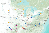
Filters: Tags: Midwest (X)
148 results (53ms)|
Filters
Date Range
Extensions (Less) Types (Less)
Contacts (Less)
Categories (Less) Tag Types
|

Louisiana Waterthrush - VizBand/Land AIC Model Selection Created: 05-Oct-2011 Louisiana Waterthrush annual capture rate of adult (ADULT) individuals (log transformed) ranged between -0.220 and +2.009 with a mean value of +0.895 and a median value of +0.794. ________________________________________ Model 1 (2 parameters) Louisiana Waterthrush annual capture rate of adult (ADULT) individuals (log transformed) was a function of: a) DIST2RIV15 (-0.30142) - distance (m) to stream, ranged between -1.104 and +0.772 (95% CL) with a mean value of -0.166 and a median value of -0.121, b) NLCD06DE33P (+0.46681) - percent deciduous forest cover, 990m-resolution (33x aggregation of 30m-resolution), ranged between +1.446 and...

Midwest MAPS Stations that operated 4 or more years between 1992 and 2008. Stations are classified by three categories of ability to effectively monitor priority species of continental concern and whether they were active in 2011. High Medium Total number of Species Captured >=15 >=10 Mean Capture Rate of Priority Species >=0.5 >=0.4 Total Number of Priority Species >=8 >=6 Percentage of Priority Species >=20 >=10 Other stations may be directed at restoration or single species MAPS Website

Distribution of hite-eyed Vireo mean adult day of capture at MAPS stations during the period 1992-2008 throughout Midwestern states (plus 250km buffer).
Distribution of Indigo Bunting adult captures at MAPS stations during the period 1992-2008 throughout Midwestern states (plus 250km buffer).

Breeding Bird Survey Relative Abundance for Acadian Flycatcher
Wood Thrush (Midwest) results from Midwest MAPS stations
As part of the State Wildlife Grant Fund, states are required to submit State Wildlife Plans (SWAPs) every 10 years detailing threats to habitats and species and conservation plans. However, incorporating climate change in SWAPs is voluntary, and capacity/expertise limitations at state agencies have resulted in varied and often only partial consideration of climate change impacts. In response, the MW CASC will conduct literature reviews to assess climate stressors and impacts to habitats and key species and to identify relevant adaptation actions for 13 different Level 2/3 EPA Ecoregions contained within the MW CASC area states. This work will provide a foundation for future habitat vulnerability assessments. ...
Categories: Project;
Types: Map Service,
OGC WFS Layer,
OGC WMS Layer,
OGC WMS Service;
Tags: 2023,
CASC,
Midwest,
Midwest CASC,
Projects by Region,
Future climate conditions in the Upper Mississippi River Basin are projected to include many more extreme precipitation events. These intense periods of rain can lead to flooding of the Mississippi River itself, as well the small streams and rivers that feed it. This flooding presents a challenge for local communities, farmers, small businesses, river users, and the ecosystems and wildlife in the area. To reduce the damage done by these extreme rainfall events, ‘natural solutions’ are often helpful. This might include preserving forests and grasslands to absorb rainwater before it arrives at streams or restoring wetlands to slow and clean runoff water. For river and natural resource managers to adapt to future climate...
Categories: Project;
Types: Map Service,
OGC WFS Layer,
OGC WMS Layer,
OGC WMS Service;
Tags: 2022,
CASC,
Drought, Fire and Extreme Weather,
Drought, Fire and Extreme Weather,
Extreme Weather,
The Midwest has experienced some of the costliest flooding events in U.S. history, including many billions of dollars during the past decade alone. The Midwest’s susceptibility to flooding has been exacerbated by a long-term increase in total precipitation and extreme rainfalls, with the 2010s being the region’s wettest decade on record Climate models strongly indicate that these recent trends will continue, such that the warming Midwest will experience wetter winters and springs, shortened snow seasons, and extreme year-round precipitation in the future. Despite this high level of confidence in climate trends, there is limited knowledge of how these will translate to flood likelihood and the associated societal...
Categories: Project;
Types: Map Service,
OGC WFS Layer,
OGC WMS Layer,
OGC WMS Service;
Tags: 2022,
CASC,
Drought, Fire and Extreme Weather,
Drought, Fire and Extreme Weather,
Extreme Weather,
River valley boundary extents were generated for select large river floodplains of the Upper Midwest, United States. These polygons were delineated using a method that incorporated interpolating a water surface elevation that completely over-topped water-control structures within the valley such as levees, flood walls, and roadways. The intersection of this derived water surface and land elevation at the outermost edge of the floodplain was used to delineate the approximate extent of the river valley boundary. We used best professional judgment to approximate this water surface elevation.
Categories: Data;
Types: Downloadable,
Map Service,
OGC WFS Layer,
OGC WMS Layer,
Shapefile;
Tags: Illinois,
Indiana,
Iowa,
Kansas,
Kentucky,

Midwest MAPS Stations that operated 4 or more years between 1992 and 2008. Stations are classified by the number of years operated MAPS Website

Blue-winged Warbler - VizBand/Land AIC Model Selection Created: 03-Jun-2011 Blue-winged Warbler annual capture rate of adult (ADULT) individuals (log transformed) ranged between -0.418 and +2.515 with a mean value of +1.049 and a median value of +0.902. ________________________________________ Model 1 (1 parameters) Blue-winged Warbler annual capture rate of adult (ADULT) individuals (log transformed) was a function of: a) NLCD06DE5KP (+0.27513) - percent deciduous forest cover, 990m-resolution in a landscape context of 5km radius, ranged between +2.449 and +5.203 (95% CL) with a mean value of +3.826 and a median value of +4.190. This model included data from 44 stations, explained 4 percent of the variation, and...

Distribution of Kentucky Warbler adult captures at MAPS stations during the period 1992-2008 throughout Midwestern states (plus 250km buffer).

Distribution of Acadian Flycatcher productivity at MAPS stations during the period 1992-2008 throughout Midwestern states (plus 250km buffer).

Midwest MAPS Stations that operated 4 or more years between 1992 and 2008. Stations are classified by three categories of ability to effectively monitor species of continental concern. High Medium Total number of Species Captured >=15 >=10 Mean Capture Rate of Priority Species >=0.5 >=0.4 Total Number of Priority Species >=8 >=6 Percentage of Priority Species >=20 >=10 Other stations may be directed at restoration or single species MAPS Website
Direct and indirect ecological effects of the widely used insecticide bifenthrin on stream ecosystems are largely unknown. To investigate such effects, a manipulative experiment was conducted in stream mesocosms that were colonized by aquatic insect communities and exposed to bifenthrin-contaminated sediment; implications for natural streams were interpreted through comparison of mesocosm results to a survey of 100 Midwestern streams, USA. In the mesocosm experiment, direct effects of bifenthrin exposure included reduced larval macroinvertebrate abundance, richness, and biomass at concentrations (EC50s ranged 197.6 – 233.5 ng bifenthrin/ g organic carbon) previously thought safe for aquatic life. Indirect effects...
Species are adapted to particular environmental conditions, but are threatened as climate change shifts habitat conditions. One way species can respond is by moving to new suitable locations, known as climate-driven range shifts. But some species can move more easily and/or more quickly than others, and some landscapes are more difficult to cross. In the upper Midwest, the movement potential of many species is reduced by broad expanses of row-crop agriculture, roads and other types of development that fragment the remaining habitat. It is important to sustain and improve connectivity across landscapes so they can continue to support biodiversity and ecosystem services like water filtration, carbon storage, pollinator...
Categories: Project;
Types: Map Service,
OGC WFS Layer,
OGC WMS Layer,
OGC WMS Service;
Tags: 2023,
CASC,
Landscapes,
Landscapes,
Midwest,
The Midwest CASC consortium’s vision is to advance climate adaptation science and practice across all components of the climate adaptation cycle by pursuing region-specific, collaborative, synthesis projects that build on past work, provide new resources and tools, and catalyze adaptation capacity across the Midwest. The Midwest CASC consortium pursues synthesis research projects that address emerging topics in climate adaptation with potential for national-scale replicability and benefits. Each synthesis project is based at a Midwest CASC consortium institution, and is guided by a collaborative working group of three or more consortium members and a postdoctoral research scholar. Projects must address USGS priorities...
Categories: Project;
Types: Map Service,
OGC WFS Layer,
OGC WMS Layer,
OGC WMS Service;
Tags: 2022,
CASC,
Midwest,
Midwest CASC,
Projects by Region
Land use was quantified within a 4-km radius around 36 apiaries in North Dakota, South Dakota, and Minnesota over two years, 2015-16 and 2016-17. The area (hectares) of Ag (corn, soy, small grains), Grass (pasture, grassland, fallow land, wildflowers, shrub land, and hay land), Wetlands (herbaceous and woody), and Bee crops (alfalfa, canola, sunflower) were quantified around each apiary in each year. Within each apiary, the average change in frames of adult bees among all colonies from June to September was calculated. Additionally, the average September Varroa mite infestation rate, the average adult population size during almond pollination, the count of colonies exhibiting queen events in September, and the count...

Distribution of Eastern Towhee adult captures at MAPS stations during the period 1992-2008 throughout Midwestern states (plus 250km buffer).
|

|
