Filters: Tags: Mill Creek (X)
59 results (33ms)|
Filters
Date Range
Extensions Types
Contacts
Categories Tag Types
|
This data set contains imagery from the National Agriculture Imagery Program (NAIP). The NAIP program is administered by USDA FSA and has been established to support two main FSA strategic goals centered on agricultural production. These are increase stewardship of America's natural resources while enhancing the environment, and to ensure commodities are procured and distributed effectively and efficiently to increase food security. The NAIP program supports these goals by acquiring and providing ortho imagery that has been collected during the agricultural growing season in the U.S. The NAIP ortho imagery is tailored to meet FSA requirements and is a fundamental tool used to support FSA farm and conservation programs....
Hurricane Harvey made landfall near Rockport, Texas on August 25 as a category 4 hurricane with wind gusts exceeding 150 miles per hour. As Harvey moved inland the forward motion of the storm slowed down and produced tremendous rainfall amounts to southeastern Texas and southwestern Louisiana. Historic flooding occurred in Texas and Louisiana as a result of the widespread, heavy rainfall over an 8-day period in Louisiana in August and September 2017. Following the storm event, U.S. Geological Survey (USGS) hydrographers recovered and documented 2,123 high-water marks in Texas, noting location and height of the water above land surface. Many of these high-water marks were used to create flood-inundation maps for...
Types: Map Service,
OGC WFS Layer,
OGC WMS Layer,
OGC WMS Service;
Tags: Austin County,
Bellville,
Bessies Creek,
Booth,
Brazoria County,
Freshwater mussels (Unionidae) are among the most imperiled groups of organisms in the world. Unionids are plagued with a lack of basic information regarding species distributions, life history characteristics, and ecological and biological requirements. We assessed the influence of hydrologic factors on the occurrence of the Suwannee Moccasinshell, Medionidus walkeri, a federally threatened freshwater mussel species endemic to the Suwannee River basin in Georgia and Florida. We also assessed the influence of survey effort on detection of M. walkeri during field surveys. All current (2013-2016) mussel survey records in the Suwannee River Basin were compiled, and cumulative discharge contributed by upstream springs...
Categories: Data;
Tags: Conservation,
Distribution,
Hydrology,
Ichetucknee River,
Imperiled species,
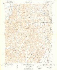
USGS Historical Quadrangle in GeoPDF.
The geology of an area of 660 square miles mostly in the northeastern corner of Tennessee and small adjacent areas in Virginia and North Carolina is the subject of this report. The region lies principally in the Unaka province, with extensions northwestward into the Appalachian Valley and southwestward into the Blue Ridge province. The report combines results of surveys made between 1941 and 1953 by the U. S. Geological Survey, the Tennessee Division of Geology, and the Tennessee Valley Authority, and is published in cooperation with the Tennessee Division of Geology. Northeasternmost Tennessee is a region of widespread mineralization and was formerly important for mineral production. Iron, manganese, and bauxite...
Panoramic view up the canyon.
Categories: Image;
Tags: Fremont County, Wyoming,
Lee, W.T. Collection,
Mill Creek,
Mills, Mines, Quarries,
Photographers,
USGS Historical Quadrangle in GeoPDF.
The Homestake Reservoir 7.5' quadrangle lies at the northwestern end of the Upper Arkansas Valley, and headwaters of the Arkansas River, and the Roaring Fork, Fryingpan, and Eagle Rivers of the Colorado River system. The quadrangle lies within tectonic provinces of the 1.4 Ga Picuris Orogeny, the late Paleozoic Ancestral Rockies, Late Cretaceous-Paleocene Laramide orogeny, Oligocene to Miocene, and Pliocene?, volcanism, and Miocene to the present Rio Grande rift extensional tectonics. In the eastern half of the quadrangle, high-angle, east-dipping, Neogene normal faults displace Proterozoic rocks, and locally Mio-Pliocene? volcanic rocks. Many quartz veins and hydrothermally altered zones are exposed along the eastern...
Categories: Data;
Types: Downloadable,
GeoTIFF,
Map Service,
Raster;
Tags: 10Be, 26Al,
10th Mountain Division Hut,
Bald Eagle Mountain,
Bear Lake,
Brady Lake,
Gullies developed as a result of overgrazing.
Categories: Image;
Tags: Gilbert, G.K. Collection,
Mill Creek,
Mills, Mines, Quarries,
Photographers,
Tuolumne County, California,
Note pronounced U-shape of valley, narrowing toward the lower part.
Categories: Image;
Tags: Lindgren, W. Collection,
Mill Creek,
Mills, Mines, Quarries,
Photographers,
Ravalli County, Montana,
Mountains of granite and gneiss (Snowy Range) north of Mill Creek. Deer Lodge County, Montana. 1922.
View southeast across Yellowstone valley, about 16 miles above Livingston.
Categories: Image;
Tags: Alden, W.C. Collection,
Deer Lodge County, Montana,
Mill Creek,
Mills, Mines, Quarries,
Photographers,
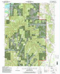
Cow Creek and Mill Creek Riparian Mapping and Conditions Assessment
Categories: Data;
Types: ArcGIS REST Map Service,
ArcGIS Service Definition,
Downloadable,
Map Service;
Tags: Cow Creek,
Mill Creek
This data set contains imagery from the National Agriculture Imagery Program (NAIP). The NAIP program is administered by USDA FSA and has been established to support two main FSA strategic goals centered on agricultural production. These are, increase stewardship of America's natural resources while enhancing the environment, and to ensure commodities are procured and distributed effectively and efficiently to increase food security. The NAIP program supports these goals by acquiring and providing ortho imagery that has been collected during the agricultural growing season in the U.S. The NAIP ortho imagery is tailored to meet FSA requirements and is a fundamental tool used to support FSA farm and conservation programs....
USGS Historical Quadrangle in GeoPDF.
A series of tools (spreadsheets, a database and a document) to be used in conjunction with the SELDM simulations used in the publication: Stonewall, A.J., and Granato, G.E., 2019, Assessing potential effects of highway and urban runoff on receiving streams in total maximum daily load watersheds in Oregon using the Stochastic Empirical Loading and Dilution Model: U.S. Geological Survey Scientific Investigations Report 2019-5053, 116 p., https://doi.org/10.3133/sir20195053
This R script can be used to analyze SELDM results. The script is specifically tailored for the SELDM simulations used in the publication: Stonewall, A.J., and Granato, G.E., 2019, Assessing potential effects of highway and urban runoff on receiving streams in total maximum daily load watersheds in Oregon using the Stochastic Empirical Loading and Dilution Model: U.S. Geological Survey Scientific Investigations Report 2019-5053, 116 p., https://doi.org/10.3133/sir20195053
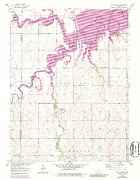
Illinoian drift area, upland flat, relief 80-90 feet.
Categories: Image;
Types: Map Service,
OGC WFS Layer,
OGC WMS Layer,
OGC WMS Service;
Tags: Alden, W.C. Collection,
Mill Creek,
Mills, Mines, Quarries,
Photographers,
Rock Island County, Illinois,
Action areas, represented as lines or polygons, for Cow or Mill Creeks. Action area locations identified through image interpretation using Google Earth imagery dated 8/27/2013 by A.G. Merrill of Stillwater Sciences in March 2015.For more information see Section 6 in: Stillwater Sciences and Aerial Information Systems. 2015. Cow Creek and Mill Creek Riparian mapping and conditions assessment. Prepared by Stillwater Sciences, Berkeley, California and Aerial Information Systems for U.S. Fish and Wildlife Service, Red Bluff, California. Financial Assistance Agreement F10AC00778.
Categories: Data;
Types: ArcGIS REST Map Service,
ArcGIS Service Definition,
Downloadable,
Map Service;
Tags: California,
Cow Creek,
Mill Creek,
Restoration,
Riparian Mapping, Conditions Assessment, Action Areas,
This data set contains imagery from the National Agriculture Imagery Program (NAIP). The NAIP program is administered by USDA FSA and has been established to support two main FSA strategic goals centered on agricultural production. These are, increase stewardship of America's natural resources while enhancing the environment, and to ensure commodities are procured and distributed effectively and efficiently to increase food security. The NAIP program supports these goals by acquiring and providing ortho imagery that has been collected during the agricultural growing season in the U.S. The NAIP ortho imagery is tailored to meet FSA requirements and is a fundamental tool used to support FSA farm and conservation programs....
This data set contains imagery from the National Agriculture Imagery Program (NAIP). The NAIP program is administered by USDA FSA and has been established to support two main FSA strategic goals centered on agricultural production. These are, increase stewardship of America's natural resources while enhancing the environment, and to ensure commodities are procured and distributed effectively and efficiently to increase food security. The NAIP program supports these goals by acquiring and providing ortho imagery that has been collected during the agricultural growing season in the U.S. The NAIP ortho imagery is tailored to meet FSA requirements and is a fundamental tool used to support FSA farm and conservation programs....
|

|
