Filters: Tags: Mojave (X)
224 results (27ms)|
Filters
Date Range
Extensions Types Contacts
Categories Tag Types
|
Preserving native species diversity is fundamental to ecosystem conservation. Selecting appropriate native species for use in restoration is a critical component of project design and may emphasize species attributes such as life history, functional type, pollinator services, and nutritional value for wildlife. Determining which species are likely to establish and persist in a particular environment is a key consideration. Species distribution models (SDMs) characterize relationships between species occurrences and the physical environment (e.g., climate, soil, topographic relief) and provide a mechanism for assessing which species may successfully propagate at a restoration site. In conjunction with information...
Categories: Data;
Types: Downloadable,
GeoTIFF,
Map Service,
Raster;
Tags: Arizona,
California,
Mojave,
Nevada,
Utah,
The U.S. Army Fort Irwin National Training Center (NTC), approximately 35 miles north-northeast of Barstow, California, obtains all of its potable water supply from three groundwater basins (Irwin, Langford, and Bicycle Basins) within the NTC boundaries. In these basins, groundwater withdrawals exceed natural recharge, resulting in water-level declines. However, managed aquifer recharge using recycled water (treated wastewater) has offset water-level declines in Irwin Basin. Additionally, localized water-quality changes have occurred in some parts of Irwin Basin as a result of human activities (for example, wastewater disposal practices, landscape irrigation, and (or) leaking pipes). As part of a research study...
Categories: Data;
Types: Map Service,
OGC WFS Layer,
OGC WMS Layer,
OGC WMS Service;
Tags: Fort Irwin,
Hydrology,
Mojave,
San Bernardino,
Soil Sciences,
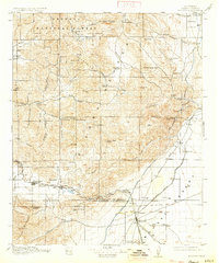
USGS Historical Quadrangle in GeoPDF.
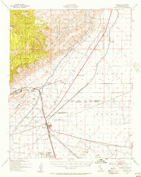
USGS Historical Quadrangle in GeoPDF.
The RCMAP (Rangeland Condition Monitoring Assessment and Projection) dataset quantifies the percent cover of rangeland components across western North America using Landsat imagery from 1985-2023. The RCMAP product suite consists of ten fractional components: annual herbaceous, bare ground, herbaceous, litter, non-sagebrush shrub, perennial herbaceous, sagebrush, shrub, tree, and shrub height in addition to the temporal trends of each component. Several enhancements were made to the RCMAP process relative to prior generations. First, high-resolution training was revised using an improved neural-net classifier and modelling approach. These data serve as foundation to the RCMAP approach. The training database was...
The RCMAP (Rangeland Condition Monitoring Assessment and Projection) dataset quantifies the percent cover of rangeland components across western North America using Landsat imagery from 1985-2023. The RCMAP product suite consists of ten fractional components: annual herbaceous, bare ground, herbaceous, litter, non-sagebrush shrub, perennial herbaceous, sagebrush, shrub, tree, and shrub height in addition to the temporal trends of each component. Several enhancements were made to the RCMAP process relative to prior generations. First, high-resolution training was revised using an improved neural-net classifier and modelling approach. These data serve as foundation to the RCMAP approach. The training database was...
The RCMAP (Rangeland Condition Monitoring Assessment and Projection) dataset quantifies the percent cover of rangeland components across the western U.S. using Landsat imagery from 1985-2020. The RCMAP product suite consists of eight fractional components: annual herbaceous, bare ground, herbaceous, litter, non-sagebrush shrub, perennial herbaceous, sagebrush, shrub and rule-based error maps including the temporal trends of each component. Several enhancements were made to the RCMAP process relative to prior generations. We used an updated version of the 2016 base training data, with a more aggressive forest mask and reduced shrub and sagebrush cover bias in pinyon-juniper woodlands. We pooled training data in areas...
The RCMAP (Rangeland Condition Monitoring Assessment and Projection) dataset quantifies the percent cover of rangeland components across the western U.S. using Landsat imagery from 1985-2020. The RCMAP product suite consists of eight fractional components: annual herbaceous, bare ground, herbaceous, litter, non-sagebrush shrub, perennial herbaceous, sagebrush, shrub and rule-based error maps including the temporal trends of each component. Several enhancements were made to the RCMAP process relative to prior generations. We used an updated version of the 2016 base training data, with a more aggressive forest mask and reduced shrub and sagebrush cover bias in pinyon-juniper woodlands. We pooled training data in areas...
The RCMAP (Rangeland Condition Monitoring Assessment and Projection) dataset quantifies the percent cover of rangeland components across the western U.S. using Landsat imagery from 1985-2021. The RCMAP product suite consists of nine fractional components: annual herbaceous, bare ground, herbaceous, litter, non-sagebrush shrub, perennial herbaceous, sagebrush, shrub, and tree, in addition to the temporal trends of each component. Several enhancements were made to the RCMAP process relative to prior generations. First, we have trained time-series predictions directly from 331 high-resolution sites collected from 2013-2018 from Assessment, Inventory, and Monitoring (AIM) instead of using the 2016 “base” map as an intermediary....
This dataset consists of 65 magnetotelluric (MT) stations collected in 2015 near Mountain Pass, California. The U.S. Geological Survey acquired these data to create a regional conductivity model near the Mountain Pass mine. This work is in support of characterizing mineral deposits.
This dataset consists of 65 magnetotelluric (MT) stations collected in 2015 near Mountain Pass, California. The U.S. Geological Survey acquired these data to create a regional conductivity model near the Mountain Pass mine. This work is in support of characterizing mineral deposits.
This dataset consists of 65 magnetotelluric (MT) stations collected in 2015 near Mountain Pass, California. The U.S. Geological Survey acquired these data to create a regional conductivity model near the Mountain Pass mine. This work is in support of characterizing mineral deposits.
This dataset consists of 65 magnetotelluric (MT) stations collected in 2015 near Mountain Pass, California. The U.S. Geological Survey acquired these data to create a regional conductivity model near the Mountain Pass mine. This work is in support of characterizing mineral deposits.
This dataset consists of 65 magnetotelluric (MT) stations collected in 2015 near Mountain Pass, California. The U.S. Geological Survey acquired these data to create a regional conductivity model near the Mountain Pass mine. This work is in support of characterizing mineral deposits.
This dataset consists of 65 magnetotelluric (MT) stations collected in 2015 near Mountain Pass, California. The U.S. Geological Survey acquired these data to create a regional conductivity model near the Mountain Pass mine. This work is in support of characterizing mineral deposits.

Percent rocks. Obtained from STATSGO soils database.

Average soil depth to bedrock. Obtained from STATSGO soils database.
Habitat modeling is an important tool used to simulate the potential distribution of a species for a variety of basic and applied questions. The desert tortoise (Gopherus agassizii) is a federally listed threatened species in the Mojave Desert and parts of the Sonoran Desert of California, Nevada, Utah, and Arizona. Land managers in this region require reliable information about the potential distribution of desert tortoise habitat to plan conservation efforts, guide monitoring activities, monitor changes in the amount and quality of habitat available, minimize and mitigate disturbances, and ultimately to assess the status of the tortoise and its habitat toward recovery of the species. By applying information from...
Preserving native species diversity is fundamental to ecosystem conservation. Selecting appropriate native species for use in restoration is a critical component of project design and may emphasize species attributes such as life history, functional type, pollinator services, and nutritional value for wildlife. Determining which species are likely to establish and persist in a particular environment is a key consideration. Species distribution models (SDMs) characterize relationships between species occurrences and the physical environment (e.g., climate, soil, topographic relief) and provide a mechanism for assessing which species may successfully propagate at a restoration site. In conjunction with information...
Categories: Data;
Types: Downloadable,
GeoTIFF,
Map Service,
Raster;
Tags: Arizona,
California,
Mojave,
Nevada,
Utah,
|

|
