Filters: Tags: Mojave (X)
206 results (65ms)|
Filters
Date Range
Extensions Types Contacts
Categories Tag Types
|
This dataset consists of 65 magnetotelluric (MT) stations collected in 2015 near Mountain Pass, California. The U.S. Geological Survey acquired these data to create a regional conductivity model near the Mountain Pass mine. This work is in support of characterizing mineral deposits.
This dataset consists of 65 magnetotelluric (MT) stations collected in 2015 near Mountain Pass, California. The U.S. Geological Survey acquired these data to create a regional conductivity model near the Mountain Pass mine. This work is in support of characterizing mineral deposits.
This dataset consists of 65 magnetotelluric (MT) stations collected in 2015 near Mountain Pass, California. The U.S. Geological Survey acquired these data to create a regional conductivity model near the Mountain Pass mine. This work is in support of characterizing mineral deposits.
This dataset consists of 65 magnetotelluric (MT) stations collected in 2015 near Mountain Pass, California. The U.S. Geological Survey acquired these data to create a regional conductivity model near the Mountain Pass mine. This work is in support of characterizing mineral deposits.
Preserving native species diversity is fundamental to ecosystem conservation. Selecting appropriate native species for use in restoration is a critical component of project design and may emphasize species attributes such as life history, functional type, pollinator services, and nutritional value for wildlife. Determining which species are likely to establish and persist in a particular environment is a key consideration. Species distribution models (SDMs) characterize relationships between species occurrences and the physical environment (e.g., climate, soil, topographic relief) and provide a mechanism for assessing which species may successfully propagate at a restoration site. In conjunction with information...
Categories: Data;
Types: Downloadable,
GeoTIFF,
Map Service,
Raster;
Tags: Arizona,
California,
Mojave,
Nevada,
Utah,
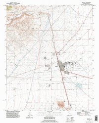
USGS Historical Quadrangle in GeoPDF.
This data release provides access to an aeromagnetic survey and magnetization boundaries over Garlock, California and surrounding areas in southern California. The survey extends from the city of Bakersfield across the southern Sierra Nevada and Tehachapi Mountains and west over Indian Wells Valley and the towns of Mojave and Rosamond to just northwest of the town of Barstow. These data were acquired between November 20, 2021 and January 17, 2022, by Eon Geosciences Inc., working under contract to the U.S. Geological Survey. The nominal flying height was based on a best fit, pre-planned, three-dimensional draped surface targeted at 305 m above terrain and a slope of 7%, subject to aircraft climb and descent limitations....
Data for groundwater-levels measured in 707 wells during January-July 2018 by the United States Geological Survey (USGS), the Mojave Water Agency (MWA), and other local water districts were compiled to construct a regional water-table shapefile for 2018. The regional water-table shapefile shows the elevation of the water table in and around the Mojave River and Morongo areas, in San Bernardino County, California.
Types: Map Service,
OGC WFS Layer,
OGC WMS Layer,
OGC WMS Service;
Tags: Barstow,
California,
Coyote Lake,
Hydrology,
Joshua Tree North,
Synopsis: This study examines the influence of landscape fragmentation on trophic cascades in southern California. Results indicate that, as habitat fragmentation negatively affects the persistence of coyote populations, the abundance of smaller meso-predators increase, resulting in higher mortality rates in scrub-breeding birds. Fragment size was a strong indicator of coyote abundance, and coyote abundance was a strong indicator of bird diversity, as coyotes kept down the number of meso-predators that prey on birds. The positive effect of fragment area and the negative effect of fragment age were the strongest determinants of bird diversity in this system. Conclusions: Fragment size correlates with coyote abundance,...
Categories: Publication;
Types: Citation,
Map Service,
OGC WFS Layer,
OGC WMS Layer,
OGC WMS Service;
Tags: California,
California coastal sage,
Chaparral,
Landscape fragmentation,
Mojave,
The RCMAP (Rangeland Condition Monitoring Assessment and Projection) dataset quantifies the percent cover of rangeland components across western North America using Landsat imagery from 1985-2023. The RCMAP product suite consists of ten fractional components: annual herbaceous, bare ground, herbaceous, litter, non-sagebrush shrub, perennial herbaceous, sagebrush, shrub, tree, and shrub height in addition to the temporal trends of each component. Several enhancements were made to the RCMAP process relative to prior generations. First, high-resolution training was revised using an improved neural-net classifier and modelling approach. These data serve as foundation to the RCMAP approach. The training database was...
The RCMAP (Rangeland Condition Monitoring Assessment and Projection) dataset quantifies the percent cover of rangeland components across western North America using Landsat imagery from 1985-2023. The RCMAP product suite consists of ten fractional components: annual herbaceous, bare ground, herbaceous, litter, non-sagebrush shrub, perennial herbaceous, sagebrush, shrub, tree, and shrub height in addition to the temporal trends of each component. Several enhancements were made to the RCMAP process relative to prior generations. First, high-resolution training was revised using an improved neural-net classifier and modelling approach. These data serve as foundation to the RCMAP approach. The training database was...
This dataset consists of 65 magnetotelluric (MT) stations collected in 2015 near Mountain Pass, California. The U.S. Geological Survey acquired these data to create a regional conductivity model near the Mountain Pass mine. This work is in support of characterizing mineral deposits.
This dataset consists of 65 magnetotelluric (MT) stations collected in 2015 near Mountain Pass, California. The U.S. Geological Survey acquired these data to create a regional conductivity model near the Mountain Pass mine. This work is in support of characterizing mineral deposits.
This dataset consists of 65 magnetotelluric (MT) stations collected in 2015 near Mountain Pass, California. The U.S. Geological Survey acquired these data to create a regional conductivity model near the Mountain Pass mine. This work is in support of characterizing mineral deposits.
This dataset consists of 65 magnetotelluric (MT) stations collected in 2015 near Mountain Pass, California. The U.S. Geological Survey acquired these data to create a regional conductivity model near the Mountain Pass mine. This work is in support of characterizing mineral deposits.
|

|
