Filters: Tags: Monarch (X)
50 results (132ms)|
Filters
Date Range
Extensions Types Contacts
Categories Tag Types
|
Lining of the leach pad at the Klondyke and Golden Door mine with two men, some buildings, and vehicles.
The USGS Upper Midwest Environmental Sciences Center developed a Monarch Relevant Land Cover data set covering the area of Canada. We used the 2010 land cover data set produced by the tri-national North American Land Change Monitoring System (NALCMS) and supported by the Commission for Environmental Cooperation (CEC) that depicts year 2010 land cover across North America at 30-meter spatial resolution, and incorporated additional spatially-explicit information to develop this land cover map. Additional sources of information included 2004 railroad data provided by The Atlas of Canada and the CEC, 2017 roads data provided by Statistics Canada, 2017 protected areas data provided by the CEC, and 2016 Canada provincial/territory...
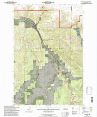
USGS Historical Quadrangle in GeoPDF.
This data set contains imagery from the National Agriculture Imagery Program (NAIP). The NAIP program is administered by USDA FSA and has been established to support two main FSA strategic goals centered on agricultural production. These are, increase stewardship of America's natural resources while enhancing the environment, and to ensure commodities are procured and distributed effectively and efficiently to increase food security. The NAIP program supports these goals by acquiring and providing ortho imagery that has been collected during the agricultural growing season in the U.S. The NAIP ortho imagery is tailored to meet FSA requirements and is a fundamental tool used to support FSA farm and conservation programs....
Draft map 2 of 6 for Anne Kinsinger's USGS Ecosystems briefing to DOI and the pollinator meeting in Mexico during July-August, 2014.
Types: Map Service,
OGC WFS Layer,
OGC WMS Layer,
OGC WMS Service;
Tags: Central United States,
Collection,
butterflies,
monarch,
pollinators
Draft map 6 of 6 for Anne Kinsinger's USGS Ecosystems briefing to DOI and the pollinator meeting in Mexico during July-August, 2014.
Types: Map Service,
OGC WFS Layer,
OGC WMS Layer,
OGC WMS Service;
Tags: Central United States,
Collection,
butterflies,
monarch,
pollinators
This data set contains imagery from the National Agriculture Imagery Program (NAIP). The NAIP program is administered by USDA FSA and has been established to support two main FSA strategic goals centered on agricultural production. These are, increase stewardship of America's natural resources while enhancing the environment, and to ensure commodities are procured and distributed effectively and efficiently to increase food security. The NAIP program supports these goals by acquiring and providing ortho imagery that has been collected during the agricultural growing season in the U.S. The NAIP ortho imagery is tailored to meet FSA requirements and is a fundamental tool used to support FSA farm and conservation programs....
We studied the direct and indirect impacts of using fire and grazing to manage remnant prairies on adult monarch abundance. This dataset consists of data collected at 10 burned and 10 grazed remnant Minnesota prairies during the summers of 2016 and 2017. We measured Asclepias spp. (milkweeds, monarch host plants) frequency, forb frequency, and adult monarch butterfly abundance at sites owned and managed by the Minnesota DNR, U.S. Fish and Wildlife Service, The Nature Conservancy, and private landowners.

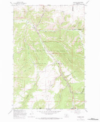
USGS Historical Quadrangle in GeoPDF.
Monarch butterfly habitat—including milkweed host plants and nectar food sources—has declined drastically throughout most of the United States. Observed overwinter population levels have also exhibited a long-term downward trend that suggests a strong relationship between habitat loss and monarch population declines. To try and reverse this trend, there has been a call to action to engage in monarch conservation across all landscapes within the migratory pathway—and urban areas could play a critical role, but how?The Field Museum, in partnership with the U.S. Fish and Wildlife Service, have spent the last year working on an Urban Monarch landscape conservation design (LCD), or a “Monarch’s view of the city”, project...
The gate of the Klondyke and Golden Door mine in the foreground with mobile homes in the background.
The road into the Klondyke and Golden Door mine with buildings in the distance.
The leach pad at the Klondyke and Golden Door mine.
Carbon columns and leach pad at the Klondyke and Golden Door mine.
USGS Historical Quadrangle in GeoPDF.
This data set contains imagery from the National Agriculture Imagery Program (NAIP). The NAIP program is administered by USDA FSA and has been established to support two main FSA strategic goals centered on agricultural production. These are, increase stewardship of America's natural resources while enhancing the environment, and to ensure commodities are procured and distributed effectively and efficiently to increase food security. The NAIP program supports these goals by acquiring and providing ortho imagery that has been collected during the agricultural growing season in the U.S. The NAIP ortho imagery is tailored to meet FSA requirements and is a fundamental tool used to support FSA farm and conservation programs....
This data set contains imagery from the National Agriculture Imagery Program (NAIP). The NAIP program is administered by USDA FSA and has been established to support two main FSA strategic goals centered on agricultural production. These are, increase stewardship of America's natural resources while enhancing the environment, and to ensure commodities are procured and distributed effectively and efficiently to increase food security. The NAIP program supports these goals by acquiring and providing ortho imagery that has been collected during the agricultural growing season in the U.S. The NAIP ortho imagery is tailored to meet FSA requirements and is a fundamental tool used to support FSA farm and conservation programs....
The USGS Upper Midwest Environmental Sciences Center developed a Monarch Relevant Land Cover data set covering the area of Mexico. We used the 2010 land cover data set produced by the tri-national North American Land Change Monitoring System (NALCMS) and supported by the Commission for Environmental Cooperation (CEC) that depicts year 2010 land cover across North America at 30-meter spatial resolution, and incorporated additional spatially-explicit information to develop this land cover map. Additional sources of information included 2004 railroad data provided by Instituto Nacional de Estadística y Geografía and the CEC, 2011 roads data provided by Instituto Nacional de Estadística y Geografía, 2017 protected areas...
Core Research Center, core E958, from well operated by J.M. HUBERRaw Properties from download, web scrape, MapServer, and Macrostrat API{"Lib Num": "E958", "API Num": "4903322584", "Operator": "J.M. HUBER", "Well Name": "14-36-58-83 TREMBATH", "Field": "PRAIRIE DOG CREEK", "State": "WY", "County": "SHERIDAN", "Type": "SLABBED", "Photos": "T", "Thin Sec": "F", "Analysis": "F", "Latitude": "44.95456", "Longitude": "-106.81477", "coordinates_geohash": "9xup9rez73qe", "Source": "FROM STATE RECORDS", "Security Flag": "NO SPECIAL RESTRICTIONS", "crc_collection_name": "core", "sb_parent_id": "4f4e49dae4b07f02db5e0486", "intervals": [{"Formation": "ANDERSON COAL / DIETZ COAL 2", "Age": null, "Min Depth": "509", "Max Depth":...
Categories: Physical Item;
Tags: ANDERSON COAL / DIETZ COAL 2,
DIETZ COAL 2,
DIETZ COAL 3,
Holocene/Pleistocene,
MONARCH,
The face and floor of the pit at the Klondyke and Golden Door mine, showing mineralization.
|

|
