Filters: Tags: Moravia (X)
52 results (11ms)|
Filters
Date Range
Extensions Types
Contacts
Categories Tag Types
|
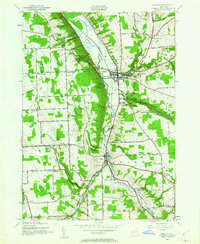
USGS Historical Quadrangle in GeoPDF.
USGS Historical Quadrangle in GeoPDF.
USGS Historical Quadrangle in GeoPDF.
This child item dataset contains a shapefile of labels for hydrogeologic sections illustrated in Heisig, 2023 (figure 3, plate 1). The "Sec_ID" attribute lists letter-number designations for the ends of each section. Hydrogeologic section labels are in the format x - x'. By convention, the x is on the west side and the x' is on the east side of generally horizontal sections. In generally vertical sections, the x is the westernmost of the section ends and the x' is the eastermost end of the section line.
Categories: Data;
Types: Downloadable,
Map Service,
OGC WFS Layer,
OGC WMS Layer,
Shapefile;
Tags: Aquifer Mapping,
Basin & Hydrogeologic Characterization,
Cayuga County,
Freeville,
Groton,
USGS Historical Quadrangle in GeoPDF.
USGS Historical Quadrangle in GeoPDF.
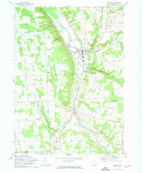
USGS Historical Quadrangle in GeoPDF.
USGS Historical Quadrangle in GeoPDF.
This child item dataset contains a shapefile that delineates the surficial geology of the Owasco Inlet watershed.
Categories: Data;
Types: Downloadable,
Map Service,
OGC WFS Layer,
OGC WMS Layer,
Shapefile;
Tags: Aquifer Mapping,
Basin & Hydrogeologic Characterization,
Cayuga County,
Freeville,
Groton,
This child item dataset contains a shapefile that delineates the Owasco Inlet watershed.
Categories: Data;
Types: Downloadable,
Map Service,
OGC WFS Layer,
OGC WMS Layer,
Shapefile;
Tags: Aquifer Mapping,
Basin & Hydrogeologic Characterization,
Cayuga County,
Freeville,
Groton,
This child item dataset contains a shapefile that delineates areas of known or inferred confined aquifers within the Owasco Inlet watershed.
Categories: Data;
Types: Downloadable,
Map Service,
OGC WFS Layer,
OGC WMS Layer,
Shapefile;
Tags: Aquifer Mapping,
Basin & Hydrogeologic Characterization,
Cayuga County,
Freeville,
Groton,
This data set contains imagery from the National Agriculture Imagery Program (NAIP). The NAIP program is administered by USDA FSA and has been established to support two main FSA strategic goals centered on agricultural production. These are, increase stewardship of America's natural resources while enhancing the environment, and to ensure commodities are procured and distributed effectively and efficiently to increase food security. The NAIP program supports these goals by acquiring and providing ortho imagery that has been collected during the agricultural growing season in the U.S. The NAIP ortho imagery is tailored to meet FSA requirements and is a fundamental tool used to support FSA farm and conservation programs....
This data set contains imagery from the National Agriculture Imagery Program (NAIP). The NAIP program is administered by USDA FSA and has been established to support two main FSA strategic goals centered on agricultural production. These are, increase stewardship of America's natural resources while enhancing the environment, and to ensure commodities are procured and distributed effectively and efficiently to increase food security. The NAIP program supports these goals by acquiring and providing ortho imagery that has been collected during the agricultural growing season in the U.S. The NAIP ortho imagery is tailored to meet FSA requirements and is a fundamental tool used to support FSA farm and conservation programs....
This data set contains imagery from the National Agriculture Imagery Program (NAIP). The NAIP program is administered by USDA FSA and has been established to support two main FSA strategic goals centered on agricultural production. These are increase stewardship of America's natural resources while enhancing the environment, and to ensure commodities are procured and distributed effectively and efficiently to increase food security. The NAIP program supports these goals by acquiring and providing ortho imagery that has been collected during the agricultural growing season in the U.S. The NAIP ortho imagery is tailored to meet FSA requirements and is a fundamental tool used to support FSA farm and conservation programs....
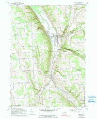
USGS Historical Quadrangle in GeoPDF.

USGS Historical Quadrangle in GeoPDF.
This child item dataset contains a shapefile that delineates ice-margin positions in the Owasco Inlet watershed and surrounding area. Ice positions mostly represent pauses during the final retreat of the ice sheet from the area. Ice-margin positions are delineated by moraines (mostly till) in upland areas and by ice-contact deposits in the valleys.
Categories: Data;
Types: Downloadable,
Map Service,
OGC WFS Layer,
OGC WMS Layer,
Shapefile;
Tags: Aquifer Mapping,
Basin & Hydrogeologic Characterization,
Cayuga County,
Freeville,
Groton,
This data set contains imagery from the National Agriculture Imagery Program (NAIP). The NAIP program is administered by USDA FSA and has been established to support two main FSA strategic goals centered on agricultural production. These are, increase stewardship of America's natural resources while enhancing the environment, and to ensure commodities are procured and distributed effectively and efficiently to increase food security. The NAIP program supports these goals by acquiring and providing ortho imagery that has been collected during the agricultural growing season in the U.S. The NAIP ortho imagery is tailored to meet FSA requirements and is a fundamental tool used to support FSA farm and conservation programs....
This data set contains imagery from the National Agriculture Imagery Program (NAIP). The NAIP program is administered by USDA FSA and has been established to support two main FSA strategic goals centered on agricultural production. These are increase stewardship of America's natural resources while enhancing the environment, and to ensure commodities are procured and distributed effectively and efficiently to increase food security. The NAIP program supports these goals by acquiring and providing ortho imagery that has been collected during the agricultural growing season in the U.S. The NAIP ortho imagery is tailored to meet FSA requirements and is a fundamental tool used to support FSA farm and conservation programs....
Introduction Detailed mapping of the valley-fill aquifer within the Owasco Inlet valley and adjacent tributary valleys in Cayuga County (Towns of Moravia and Locke) and Tompkins County (Town of Groton) is the latest study in the cooperative Detailed Aquifer Mapping Program between the US Geological Survey (USGS) and the New York State Department of Environmental Conservation (NYSDEC). The aim of the program is to map sand and gravel aquifers in New York State at a scale of 1:24,000. This information is used by NYSDEC Division of Water and others to delineate groundwater contributing areas, assess potential threats to aquifers from both point and non-point sources, respond to contamination from spills or leaks...
Categories: Data,
Project;
Types: Downloadable,
Map Service,
OGC WFS Layer,
OGC WMS Layer,
Shapefile;
Tags: Aquifer Mapping,
Aquifer Mapping,
Aquifer Mapping,
Cayuga county,
Cooperative Water Program,
|

|
