Filters: Tags: Moscow Mountain (X)
13 results (37ms)|
Filters
Date Range
Extensions Types Contacts
Categories Tag Types Tag Schemes |
Remote camera data on snow presence, snow depth, and wildlife detections on Moscow Mountain in Latah County, ID, USA. Reconyx Hyperfire I and Hyperfire II cameras were used and set to take hourly timelapse images and motion-triggered images. The cameras were deployed from October 2020 - May 2021. Snow presence was assessed up to 15 m from the camera. Snow depth was measured using virtual snow stakes created with the edger R package created by the author. Wildlife were marked as present in all photos in which they appear, and new individuals were counted. Snow density was collected using a federal or prairie snow sampler. Snow hardness was collected using a ram penetrometer. Solar radiation was calculated using hemispherical...
Categories: Data,
Publication;
Types: Citation;
Tags: Idaho,
Latah,
Moscow Mountain,
Odocoileus hemionus,
Odocoileus virginianus,
We collected snow density measurements at camera sites from December 2020 - April 2021, at the same time as snow hardness measurements. We took measurements every few weeks as logistics allowed. We took samples near the camera site in snow visually similar to the snow in the camera viewshed (the geographical area that is visible from a location) to prevent snow conditions from being disturbed beyond normal camera deployment. We took snow density samples using a homemade prairie sampler in snow depths < 100 cm and using a federal snow sampler in snow depths > 100 cm. The sampler was inserted into the snow to remove a snow core. We retained the core if the depth of snow in the sampler was at least 90% of the actual...
Categories: Data,
Publication;
Types: Citation;
Tags: Idaho,
Latah,
Moscow Mountain,
Odocoileus virginianus,
biota,
Attributes of remote camera stations on Moscow Mountain in Latah County, ID including georeferencing information and camera deployment information. Remote cameras were used to collect data on snow presence, snow depth, and wildlife detections on Moscow Mountain in Latah County, ID, USA. Reconyx Hyperfire I and Hyperfire II cameras were used and set to take hourly timelapse images and motion-triggered images. The cameras were deployed from October 2020 - May 2021.
Categories: Data,
Publication;
Types: Citation;
Tags: Idaho,
Latah,
Moscow Mountain,
location,
snow and ice cover
This data set contains imagery from the National Agriculture Imagery Program (NAIP). The NAIP program is administered by USDA FSA and has been established to support two main FSA strategic goals centered on agricultural production. These are, increase stewardship of America's natural resources while enhancing the environment, and to ensure commodities are procured and distributed effectively and efficiently to increase food security. The NAIP program supports these goals by acquiring and providing ortho imagery that has been collected during the agricultural growing season in the U.S. The NAIP ortho imagery is tailored to meet FSA requirements and is a fundamental tool used to support FSA farm and conservation programs....
This data set contains imagery from the National Agriculture Imagery Program (NAIP). The NAIP program is administered by USDA FSA and has been established to support two main FSA strategic goals centered on agricultural production. These are, increase stewardship of America's natural resources while enhancing the environment, and to ensure commodities are procured and distributed effectively and efficiently to increase food security. The NAIP program supports these goals by acquiring and providing ortho imagery that has been collected during the agricultural growing season in the U.S. The NAIP ortho imagery is tailored to meet FSA requirements and is a fundamental tool used to support FSA farm and conservation programs....
We took hemispherical photographs (hemiphotos) at each camera station to estimate incoming shortwave radiation. We used a Canon EOS 70D SLR camera with a Sigma 8mm circular fisheye lens. We took hemiphotos on days with little to no wind or precipitation and early in the morning (5AM – 7AM), late in the evening (7PM – 9PM), or on overcast days to maximize the contrast between sky and vegetation. We took hemiphotos in June - July 2021, but nine camera sites were re-photographed in October 2021 due to poor quality of initial photographs. Overstory deciduous vegetation is rare at the study site, so summer changes in canopy cover are negligible. At each camera site, we placed the DSLR camera with attached lens on a tripod...
Categories: Data,
Publication;
Types: Citation;
Tags: Hemispherical Photograph,
Idaho,
Latah,
Moscow Mountain,
biota
Snow hardness measurements were collected at camera sites from December 2020 - April 2021, at the same time as snow density. Camera sites were chosen by stratified non-random sampling. Cameras were never closer than 25m to other cameras, nor were they placed facing trails. Measurements were collected every few weeks as logistics allowed. Samples were collected near the camera site in snow visually similar to the snow in the camera viewshed to prevent snow conditions from being disturbed beyond normal camera deployment. Snow hardness was measured using a ram penetrometer or “ramsonde” (Snowmetrics; Fort Collins, CO). A ramsonde is composed of a hammer, anvil, and rod. The hammer is dropped onto the anvil from a known...
Categories: Data,
Publication;
Types: Citation;
Tags: Idaho,
Latah,
Moscow Mountain,
Odocoileus hemionus,
Odocoileus virginianus,
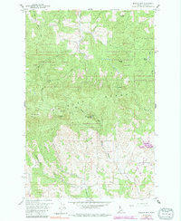
USGS Historical Quadrangle in GeoPDF.
This data set contains imagery from the National Agriculture Imagery Program (NAIP). The NAIP program is administered by USDA FSA and has been established to support two main FSA strategic goals centered on agricultural production. These are, increase stewardship of America's natural resources while enhancing the environment, and to ensure commodities are procured and distributed effectively and efficiently to increase food security. The NAIP program supports these goals by acquiring and providing ortho imagery that has been collected during the agricultural growing season in the U.S. The NAIP ortho imagery is tailored to meet FSA requirements and is a fundamental tool used to support FSA farm and conservation programs....
Remote camera data on snow presence, snow depth, and wildlife detections on Moscow Mountain in Latah County, ID, USA. Reconyx Hyperfire I and Hyperfire II cameras were set to take hourly timelapse images and motion-triggered images from October 2020 - May 2021 at 5 elevation categories (800-925m, 925-1050m, 1050-1175m, 1775-1300m, and > 1300m), 4 aspects (N, S, E, and W), and 3 canopy densities (Sparse [0-35%], Moderate [35-75%], and Dense [75-100%]), in duplicate, plus 17 selected microclimates (137 locations total), on Moscow Mountain in Latah County, ID. Images from 27 other locations were part of a pilot experiment during January to May 2020. Data in the CSVs include image metadata, camera site characteristics,...
Categories: Data,
Publication;
Types: Citation;
Tags: Idaho,
Latah,
Moscow Mountain,
Odocoileus hemionus,
Odocoileus virginianus,
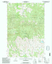
USGS Historical Quadrangle in GeoPDF.
This data set contains imagery from the National Agriculture Imagery Program (NAIP). The NAIP program is administered by USDA FSA and has been established to support two main FSA strategic goals centered on agricultural production. These are, increase stewardship of America's natural resources while enhancing the environment, and to ensure commodities are procured and distributed effectively and efficiently to increase food security. The NAIP program supports these goals by acquiring and providing ortho imagery that has been collected during the agricultural growing season in the U.S. The NAIP ortho imagery is tailored to meet FSA requirements and is a fundamental tool used to support FSA farm and conservation programs....
Predicted snow disappearance dates on Moscow Mountain in Latah County, ID. Predictors used to make the map are elevation, aspect, canopy cover, and cold-air pooling.
|

|
