Filters: Tags: Mount Adams (X)
14 results (14ms)|
Filters
Date Range
Extensions Types Contacts
Categories Tag Types Tag Schemes |
Hydrothermally altered rocks, particularly if water saturated, can weaken stratovolcanoes, thereby increasing the potential for catastrophic sector collapses that can lead to far-traveled, destructive debris flows, which are the largest volcanic hazards for Mount Adams and Mount Baker. Evaluating the hazards associated with such alteration is difficult because much of the alteration is obscured by ice and its depth extent is unknown. Intense hydrothermal alteration significantly reduces the resistivity and magnetization of volcanic rock and therefore hydrothermally altered rocks are identified with helicopter electromagnetic and magnetic measurements at Mount Baker and Mount Adams. High resolution magnetic and electromagnetic...
Categories: Data;
Types: Citation,
Downloadable,
Map Service,
OGC WFS Layer,
OGC WMS Layer,
Shapefile;
Tags: CGGSC,
Crustal Geophysics and Geochemistry Science Center,
Fugro Airborne Surveys,
Mount Adams,
Washington,
This data release provides access to a low-altitude aeromagnetic survey flown over a part of the Cascade Range of the US Pacific Northwest, approximately centered over the town of Cascade Locks, Oregon. The Cascade Locks magnetic survey encompasses two large stratovolcanoes of the Cascade Range: Mt. Hood (3426 m) in Oregon and Mt. Adams (3742 m) in Washington. Data were acquired between October 17, 2021, and February 26, 2022, by KBM Resources Group, Thunder Bay, Ontario, Canada, working under contract to the U.S. Geological Survey. The survey is underlain by a diverse magnetic terrane, including Miocene flood basalts of the Columbia River Basalt Group and Tertiary to Quaternary volcanic and intrusive rocks of the...
Categories: Data;
Tags: Cascade Range,
Cascadia,
Clackamas County,
Clark County,
Columbia River Gorge National Scenic Area,
This data set contains imagery from the National Agriculture Imagery Program (NAIP). The NAIP program is administered by USDA FSA and has been established to support two main FSA strategic goals centered on agricultural production. These are, increase stewardship of America's natural resources while enhancing the environment, and to ensure commodities are procured and distributed effectively and efficiently to increase food security. The NAIP program supports these goals by acquiring and providing ortho imagery that has been collected during the agricultural growing season in the U.S. The NAIP ortho imagery is tailored to meet FSA requirements and is a fundamental tool used to support FSA farm and conservation programs....

USGS Historical Quadrangle in GeoPDF.
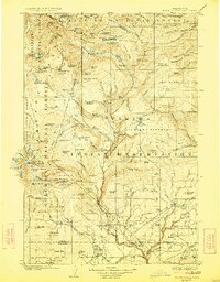
USGS Historical Quadrangle in GeoPDF.
This data set contains imagery from the National Agriculture Imagery Program (NAIP). The NAIP program is administered by USDA FSA and has been established to support two main FSA strategic goals centered on agricultural production. These are, increase stewardship of America's natural resources while enhancing the environment, and to ensure commodities are procured and distributed effectively and efficiently to increase food security. The NAIP program supports these goals by acquiring and providing ortho imagery that has been collected during the agricultural growing season in the U.S. The NAIP ortho imagery is tailored to meet FSA requirements and is a fundamental tool used to support FSA farm and conservation programs....

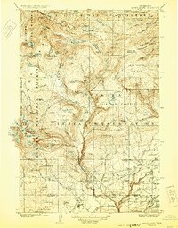
USGS Historical Quadrangle in GeoPDF.
Mount Adams, also known by the Native American names "Klickitat" or "Pahto", is a 3,742 meter-tall (12,278 feet) stratovolcano located 53 km (33 miles) north of the Columbia river straddling the borders of Skamania County, Yakima County and the Yakama Nation Reservation. Mount Adams lies in the middle of the Mount Adams volcanic field—a 1,250 square kilometer area (about 480 square miles) comprising at least 120, mostly basaltic volcanoes that form spatter and scoria cones, shield volcanoes, and some extensive lava flows. The volcanic field has been active for at least the past one million years. Mount Adams was active from about 520,000 to about 1,000 years ago and has erupted mostly andesite. Eruptions have occurred...
Categories: Data;
Types: Downloadable,
GeoTIFF,
Map Service,
Raster;
Tags: Bare Earth,
Bare Earth Hydroflattened,
Breaklines,
Clark County,
DEM,
This data set contains imagery from the National Agriculture Imagery Program (NAIP). The NAIP program is administered by USDA FSA and has been established to support two main FSA strategic goals centered on agricultural production. These are, increase stewardship of America's natural resources while enhancing the environment, and to ensure commodities are procured and distributed effectively and efficiently to increase food security. The NAIP program supports these goals by acquiring and providing ortho imagery that has been collected during the agricultural growing season in the U.S. The NAIP ortho imagery is tailored to meet FSA requirements and is a fundamental tool used to support FSA farm and conservation programs....
USGS Historical Quadrangle in GeoPDF.
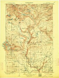
USGS Historical Quadrangle in GeoPDF.
This data set contains imagery from the National Agriculture Imagery Program (NAIP). The NAIP program is administered by USDA FSA and has been established to support two main FSA strategic goals centered on agricultural production. These are, increase stewardship of America's natural resources while enhancing the environment, and to ensure commodities are procured and distributed effectively and efficiently to increase food security. The NAIP program supports these goals by acquiring and providing ortho imagery that has been collected during the agricultural growing season in the U.S. The NAIP ortho imagery is tailored to meet FSA requirements and is a fundamental tool used to support FSA farm and conservation programs....

USGS Historical Quadrangle in GeoPDF.

USGS Historical Quadrangle in GeoPDF.
|

|
