Filters: Tags: Muddy Creek (X)
14 results (54ms)|
Filters
Date Range
Types Contacts
Categories Tag Types Tag Schemes |
The U.S. Geological Survey (USGS), in cooperation with the city of Harrisonville, Missouri, assessed flooding of Muddy Creek resulting from varying precipitation magnitudes and durations, antecedent soil moisture conditions, and channel conditions. The precipitation scenarios were used to develop a library of flood-inundation maps that included a 3.8-mile reach of Muddy Creek and tributaries within and adjacent to the city. Hydrologic and hydraulic models of the upper Muddy Creek Basin were used to assess streamflow magnitudes associated with simulated precipitation amounts and the resulting flood-inundation conditions. The U.S. Army Corps of Engineers Hydrologic Engineering Center-Hydrologic Modeling System (HEC–HMS;...
These data were used to examine drivers behind changes in water temperature downriver of dams across the western U.S. from 1995-2015 and the influence of such changes on rainbow trout recruitment and rainbow and brown trout adult length. First, we linked reservoir storage capacity and dam size to the warmest monthly water temperature per water year (WY) to assess the influence of low storage capacity (shallow reservoirs) on downstream water temperature. We then took results from previously published Generalized Linear Mixed Models (GLMM) that assessed the influence of physical and biological predictors (e.g., flow, trout density, reservoir metrics) on trout recruitment and adult size and added mean annual, maximum...
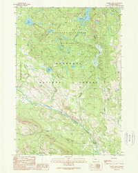
USGS Historical Quadrangle in GeoPDF.
This data set contains imagery from the National Agriculture Imagery Program (NAIP). The NAIP program is administered by USDA FSA and has been established to support two main FSA strategic goals centered on agricultural production. These are, increase stewardship of America's natural resources while enhancing the environment, and to ensure commodities are procured and distributed effectively and efficiently to increase food security. The NAIP program supports these goals by acquiring and providing ortho imagery that has been collected during the agricultural growing season in the U.S. The NAIP ortho imagery is tailored to meet FSA requirements and is a fundamental tool used to support FSA farm and conservation programs....
This data set contains imagery from the National Agriculture Imagery Program (NAIP). The NAIP program is administered by USDA FSA and has been established to support two main FSA strategic goals centered on agricultural production. These are, increase stewardship of America's natural resources while enhancing the environment, and to ensure commodities are procured and distributed effectively and efficiently to increase food security. The NAIP program supports these goals by acquiring and providing ortho imagery that has been collected during the agricultural growing season in the U.S. The NAIP ortho imagery is tailored to meet FSA requirements and is a fundamental tool used to support FSA farm and conservation programs....
We used a before-and-after study design to examine effects of changes in cattle grazing practices on channel stability in Muddy Creek, an arroyo in the Colorado River headwaters. The changes in grazing practices were abrupt and focused on keeping cattle out of the riparian zone and increasing herd movement. We digitized 620 meander loop cutoff geometries within the alluvial valley bottom of Muddy Creek. Poisson regression modeling of meander loop cutoff rate indicated that the change in grazing practices caused a decline in meander loop cutoff rate that was on the scale of an order of magnitude and independent of other hydroclimatic and human-caused factors. The polyline data released here was used in our analysis...
Types: Map Service,
OGC WFS Layer,
OGC WMS Layer,
OGC WMS Service;
Tags: Colorado River,
Little Snake River,
Muddy Creek,
Wyoming,
water
Dataset includes the analysis results of 49 inorganic chemical elements bound to suspended-sediment particles below Paonia Reservoir during a sediment release in September 2017. Suspended-sediment samples were collected at U.S. Geological Survey (USGS) station number 385626107212000 by following data collection procedures and protocols in Edwards and Glysson (1999). The samples were freeze-dried after collection and then decomposed using a mixture of nitric, hydrofluoric, and perchloric acids. The dried residue after acid digestion was analyzed by atomic absorption spectrometry and inductively coupled plasma-mass spectrometry following procedures and protocols in Taggart (2002). Reference samples of flue gas desulfurization...
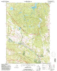
USGS Historical Quadrangle in GeoPDF.
This data set contains imagery from the National Agriculture Imagery Program (NAIP). The NAIP program is administered by USDA FSA and has been established to support two main FSA strategic goals centered on agricultural production. These are, increase stewardship of America's natural resources while enhancing the environment, and to ensure commodities are procured and distributed effectively and efficiently to increase food security. The NAIP program supports these goals by acquiring and providing ortho imagery that has been collected during the agricultural growing season in the U.S. The NAIP ortho imagery is tailored to meet FSA requirements and is a fundamental tool used to support FSA farm and conservation programs....
This dataset contains cross-section geometry and sediment-size data collected in the fall of 2019 from Muddy Creek and North Fork Gunnison River below Paonia Reservoir, western Colorado. Six cross sections were surveyed using Real-Time Kinematic Global Navigation Satellite System (RTK-GNSS) methods to document channel geometry below Paonia Reservoir. One cross section was surveyed on Muddy Creek below Paonia Reservoir, and five cross sections were surveyed from North Fork Gunnison River below Paonia Reservoir. All six cross sections are incorporated in this data release within one shapefile. Pebble counts were performed at each of the six cross sections to document sediment-size distributions downstream from the...
Samples were collected, processed, and analyzed for organics, estrogen equivalents, and fecal indicator bacteria. Filtered organic samples were sent to the National Water Quality Laboratory in Denver, Colorado. Unfiltered estrogen equivalent samples were sent to the Organic Geochemistry Research Lab in Lawrence, Kansas, for extraction, after which they were sent to the National Fish Health Research Laboratory in Leetown, West Virginia. Bacteria samples were processed at the Central-Midwest Water Science Center Iowa City, Iowa, office. Staff collected field parameters in-situ.
This data is a compilation of fishery monitoring data collected by state agencies over several decades in tailwaters downriver of dams in Colorado, Utah, Montana, Wyoming, Idaho, New Mexico, Arizona, California, and Oregon. Specifically, the data contained herein is summary data used in four generalized linear mixed models that were developed to assess the biological and hydrologic factors that influence rainbow and brown trout recruitment and adult size in tailwaters across the western United States.
Categories: Data;
Types: Citation;
Tags: Anderson Ranch dam,
Beaverhead River,
Bighorn River,
Blue River,
Boysen dam,
This data set contains imagery from the National Agriculture Imagery Program (NAIP). The NAIP program is administered by USDA FSA and has been established to support two main FSA strategic goals centered on agricultural production. These are, increase stewardship of America's natural resources while enhancing the environment, and to ensure commodities are procured and distributed effectively and efficiently to increase food security. The NAIP program supports these goals by acquiring and providing ortho imagery that has been collected during the agricultural growing season in the U.S. The NAIP ortho imagery is tailored to meet FSA requirements and is a fundamental tool used to support FSA farm and conservation programs....
We used a before-and-after study design to examine effects of changes in cattle grazing practices on channel stability in Muddy Creek, an arroyo in the Colorado River headwaters. The changes in grazing practices were abrupt and focused on keeping cattle out of the riparian zone and increasing herd movement. We digitized 620 meander loop cutoff geometries within the alluvial valley bottom of Muddy Creek and used the meander loop cutoff rate as a broad measure of channel stability. Poisson regression modeling of meander loop cutoff rate indicated that the change in grazing practices caused a decline in meander loop cutoff rate that was on the scale of an order of magnitude and independent of other hydroclimatic and...
Types: Map Service,
OGC WFS Layer,
OGC WMS Layer,
OGC WMS Service;
Tags: Colorado River,
Little Snake River,
Muddy Creek,
Wyoming,
water
|

|
