Filters: Tags: Mule Deer (X) > partyWithName: Conservation Biology Institute (X)
14 results (9ms)|
Filters
Date Range
Tag Schemes |

MuleDeerWinterRange is an ESRI SDE Feature Class showing that part of the overall range where 90% of the individuals are located during the average five winters out of ten from the first heavy snowfall to spring green-up, or during a site specific period of winter as defined for each Date Analysis Unit. This information was derived from field personnel. A variety of data capture techniques were used including drawing on mylar overlays at 1:50,000 scale USGS county mapsheets and implementation of the SmartBoard Interactive Whiteboard using stand-up, real-time digitizing at various scales (Cowardin, M., M. Flenner. March 2003. Maximizing Mapping Resources. GeoWorld 16(3):32-35). Dataset was acquired from a third...

MuleDeerConcentrationArea is an ESRI SDE Feature Classshowing that part of the overall range where higher quality habitat supports significantly higher densities than surrounding areas. These areas are typically occupied year round and are not necessarily associated with a specific season. Includes rough break country, riparian areas, small drainages, and large areas of irrigated cropland. This information was derived from field personnel. A variety of data capture techniques were used including drawing on mylar overlays at 1:50,000 scale USGS county mapsheets and implementation of the SmartBoard Interactive Whiteboard using stand-up, real-time digitizing at various scales (Cowardin, M., M. Flenner. March 2003....

MuleDeerMigrationPatterns is an ESRI SDE Feature Class showing a subjective indication of the general direction of the movements of migratory ungulate herds. This information was derived from field personnel. A variety of data capture techniques were used including drawing on mylar overlays at 1:50,000 scale USGS county mapsheets and implementation of the SmartBoard Interactive Whiteboard using stand-up, real-time digitizing at various scales (Cowardin, M., M. Flenner. March 2003. Maximizing Mapping Resources. GeoWorld 16(3):32-35). Dataset was acquired from a third party distributor who obtained it from CDOW in January 2011. The authoritative data source is available on ArcGIS.com (http://www.arcgis.com/home/item.html?id=e10b0db0167a4dde909357b5c13354f1)...

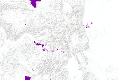
General and winter distribution of Mule Deer in Montana (USA).

Mule Deer Critical Winter Range is a delineation of those parts of Mule Deer Winter Range that CDOW considers to be of highest priority for protection from disturbance from development. Protection of these parts of Mule Deer Winter Range is considered critical to sustain mule deer populations across Colorado. Mule Deer Critical Winter Range was created by combining subsets of Mule Deer Winter Concentration Areas, high-density Mule Deer Severe Winter Range, and Deer Data Analysis Units (DAUs). The high density severe winter range was created by calculating the 2006 post-hunt population estimate divided by the total winter range for each DAU. This was used to map to identify a "higher" and "lower" density threshold....

This dataset represents MULE DEER use areas in Utah as determined by wildlife biologists during 2001. It was updated in the southwestern part of Utah during the spring of 2004. Additional updates were made in October and November 2004. In May 2006 the dataset was converted from a Critical, High, Substantial and Limited value system to a Crucial/Substantial value system. The southeastern portion of the state was again updated in August 2007.

MuleDeerHighwayCrossing is an ESRI SDE Feature Class showing those areas where mule deer movements traditionally cross roads or railroads, presenting potential conflicts between mule deer and motorists/trains. (More than six highway mortalities per mile of highway or railroad per year is a guide that may be used to indicate highway crossings). This information was derived from field personnel. A variety of data capture techniques were used including drawing on mylar overlays at 1:50,000 scale USGS county mapsheets and implementation of the SmartBoard Interactive Whiteboard using stand-up, real-time digitizing at various scales (Cowardin, M., M. Flenner. March 2003. Maximizing Mapping Resources. GeoWorld 16(3):32-35)....

MuleDeerOverallRange is an ESRI SDE Feature Class showing the area which encompasses all known seasonal activity areas within the observed range of a mule deer population. This information was derived from field personnel. A variety of data capture techniques were used including drawing on mylar overlays at 1:50,000 scale USGS county mapsheets and implementation of the SmartBoard Interactive Whiteboard using stand-up, real-time digitizing at various scales (Cowardin, M., M. Flenner. March 2003. Maximizing Mapping Resources. GeoWorld 16(3):32-35). Dataset was acquired from a third party distributor who obtained it from CDOW in January 2011. The authoritative data source is available on ArcGIS.com (http://www.arcgis.com/home/item.html?id=e10b0db0167a4dde909357b5c13354f1)...

MuleDeerMigrationCorridors is an ESRI SDE Feature Class showing a specific mappable site through which large numbers of animals migrate and loss of which would change migration routes. This information was derived from field personnel. A variety of data capture techniques were used including drawing on mylar overlays at 1:50,000 scale USGS county mapsheets and implementation of the SmartBoard Interactive Whiteboard using stand-up, real-time digitizing at various scales (Cowardin, M., M. Flenner. March 2003. Maximizing Mapping Resources. GeoWorld 16(3):32-35). Dataset was acquired from a third party distributor who obtained it from CDOW in January 2011. The authoritative data source is available on ArcGIS.com (http://www.arcgis.com/home/item.html?id=e10b0db0167a4dde909357b5c1335...

MuleDeerWinterConcentrationArea is an ESRI SDE Feature Class showing that part of the winter range where densities are at least 200% greater than the surrounding winter range density during the same period used to define winter range in the average five winters out of ten. This information was derived from field personnel. A variety of data capture techniques were used including drawing on mylar overlays at 1:50,000 scale USGS county mapsheets and implementation of the SmartBoard Interactive Whiteboard using stand-up, real-time digitizing at various scales (Cowardin, M., M. Flenner. March 2003. Maximizing Mapping Resources. GeoWorld 16(3):32-35). Dataset was acquired from a third party distributor who obtained...

MuleDeerResidentPopulationArea is an ESRI SDE Feature Class showing an area that provides year-round range for a population of mule deer. The resident mule deer use all of the area all year; it cannot be subdivided into seasonal ranges although it may be included within the overall range of the larger population. This information was derived from field personnel. A variety of data capture techniques were used including drawing on mylar overlays at 1:50,000 scale USGS county mapsheets and implementation of the SmartBoard Interactive Whiteboard using stand-up, real-time digitizing at various scales (Cowardin, M., M. Flenner. March 2003. Maximizing Mapping Resources. GeoWorld 16(3):32-35). Dataset was acquired from...
MuleDeerLimitedUseArea is an ESRI SDE Feature Class showing an area within the overall range of mule deer that is only occasionally inhabited and/or contains only a small population of scattered mule deer. This information was derived from field personnel. A variety of data capture techniques were used including drawing on mylar overlays at 1:50,000 scale USGS county mapsheets and implementation of the SmartBoard Interactive Whiteboard using stand-up, real-time digitizing at various scales (Cowardin, M., M. Flenner. March 2003. Maximizing Mapping Resources. GeoWorld 16(3):32-35). Dataset was acquired from a third party distributor who obtained it from CDOW in January 2011. The authoritative data source is available...

MuleDeerSummerRange is an ESRI SDE Feature Class showing that part of the overall range where 90% of the individuals are located between spring green-up and the first heavy snowfall. Summer range is not necessarily exclusive of winter range; in some areas winter range and summer range may overlap. This information was derived from field personnel. A variety of data capture techniques were used including drawing on mylar overlays at 1:50,000 scale USGS county mapsheets and implementation of the SmartBoard Interactive Whiteboard using stand-up, real-time digitizing at various scales (Cowardin, M., M. Flenner. March 2003. Maximizing Mapping Resources. GeoWorld 16(3):32-35). Dataset was acquired from a third party...

MuleDeerSevereWinterRange is an ESRI SDE Feature Class showing that part of the overall range where 90% of the individuals are located when the annual snowpack is at its maximum and/or temperatures are at a minimum in the two worst winters out of ten. This information was derived from field personnel. A variety of data capture techniques were used including drawing on mylar overlays at 1:50,000 scale USGS county mapsheets and implementation of the SmartBoard Interactive Whiteboard using stand-up, real-time digitizing at various scales (Cowardin, M., M. Flenner. March 2003. Maximizing Mapping Resources. GeoWorld 16(3):32-35). Dataset was acquired from a third party distributor who obtained it from CDOW in January...
|

|
