Filters: Tags: NIOBRARA (X)
553 results (152ms)|
Filters
Date Range
Extensions Types Contacts
Categories Tag Types Tag Schemes |
This data set contains imagery from the National Agriculture Imagery Program (NAIP). The NAIP program is administered by USDA FSA and has been established to support two main FSA strategic goals centered on agricultural production. These are, increase stewardship of America's natural resources while enhancing the environment, and to ensure commodities are procured and distributed effectively and efficiently to increase food security. The NAIP program supports these goals by acquiring and providing ortho imagery that has been collected during the agricultural growing season in the U.S. The NAIP ortho imagery is tailored to meet FSA requirements and is a fundamental tool used to support FSA farm and conservation programs....
This data set contains imagery from the National Agriculture Imagery Program (NAIP). The NAIP program is administered by USDA FSA and has been established to support two main FSA strategic goals centered on agricultural production. These are, increase stewardship of America's natural resources while enhancing the environment, and to ensure commodities are procured and distributed effectively and efficiently to increase food security. The NAIP program supports these goals by acquiring and providing ortho imagery that has been collected during the agricultural growing season in the U.S. The NAIP ortho imagery is tailored to meet FSA requirements and is a fundamental tool used to support FSA farm and conservation programs....
This data set contains imagery from the National Agriculture Imagery Program (NAIP). The NAIP program is administered by USDA FSA and has been established to support two main FSA strategic goals centered on agricultural production. These are, increase stewardship of America's natural resources while enhancing the environment, and to ensure commodities are procured and distributed effectively and efficiently to increase food security. The NAIP program supports these goals by acquiring and providing ortho imagery that has been collected during the agricultural growing season in the U.S. The NAIP ortho imagery is tailored to meet FSA requirements and is a fundamental tool used to support FSA farm and conservation programs....
This data set contains imagery from the National Agriculture Imagery Program (NAIP). The NAIP program is administered by USDA FSA and has been established to support two main FSA strategic goals centered on agricultural production. These are, increase stewardship of America's natural resources while enhancing the environment, and to ensure commodities are procured and distributed effectively and efficiently to increase food security. The NAIP program supports these goals by acquiring and providing ortho imagery that has been collected during the agricultural growing season in the U.S. The NAIP ortho imagery is tailored to meet FSA requirements and is a fundamental tool used to support FSA farm and conservation programs....
This data set contains imagery from the National Agriculture Imagery Program (NAIP). The NAIP program is administered by USDA FSA and has been established to support two main FSA strategic goals centered on agricultural production. These are, increase stewardship of America's natural resources while enhancing the environment, and to ensure commodities are procured and distributed effectively and efficiently to increase food security. The NAIP program supports these goals by acquiring and providing ortho imagery that has been collected during the agricultural growing season in the U.S. The NAIP ortho imagery is tailored to meet FSA requirements and is a fundamental tool used to support FSA farm and conservation programs....
This data set contains imagery from the National Agriculture Imagery Program (NAIP). The NAIP program is administered by USDA FSA and has been established to support two main FSA strategic goals centered on agricultural production. These are, increase stewardship of America's natural resources while enhancing the environment, and to ensure commodities are procured and distributed effectively and efficiently to increase food security. The NAIP program supports these goals by acquiring and providing ortho imagery that has been collected during the agricultural growing season in the U.S. The NAIP ortho imagery is tailored to meet FSA requirements and is a fundamental tool used to support FSA farm and conservation programs....
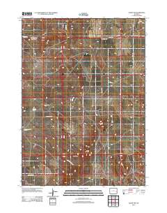
Layered GeoPDF 7.5 Minute Quadrangle Map. Layers of geospatial data include orthoimagery, roads, grids, geographic names, elevation contours, hydrography, and other selected map features.
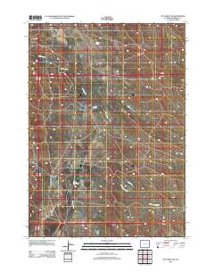
Layered GeoPDF 7.5 Minute Quadrangle Map. Layers of geospatial data include orthoimagery, roads, grids, geographic names, elevation contours, hydrography, and other selected map features.
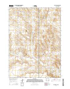
Layered GeoPDF 7.5 Minute Quadrangle Map. Layers of geospatial data include orthoimagery, roads, grids, geographic names, elevation contours, hydrography, and other selected map features.
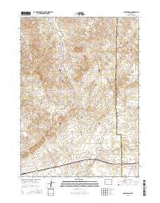
Layered GeoPDF 7.5 Minute Quadrangle Map. Layers of geospatial data include orthoimagery, roads, grids, geographic names, elevation contours, hydrography, and other selected map features.
Layered GeoPDF 7.5 Minute Quadrangle Map. Layers of geospatial data include orthoimagery, roads, grids, geographic names, elevation contours, hydrography, and other selected map features.
Layered GeoPDF 7.5 Minute Quadrangle Map. Layers of geospatial data include orthoimagery, roads, grids, geographic names, elevation contours, hydrography, and other selected map features.
Core Research Center, core F197, from well operated by OHIO OIL CORaw Properties from download, web scrape, MapServer, and Macrostrat API{"Lib Num": "F197", "API Num": "4902506008", "Operator": "OHIO OIL CO", "Well Name": "1 BOSTON GOVERNMENT", "Field": "HELLS HALF ACRE", "State": "WY", "County": "NATRONA", "Type": "THIN - DISCONTINUOUS SEGMENTS", "Photos": "T", "Thin Sec": "T", "Analysis": "F", "Latitude": "43.0479", "Longitude": "-107.05563", "coordinates_geohash": "9xeuguskpn0t", "Source": "FROM STATE RECORDS", "Security Flag": "NO SPECIAL RESTRICTIONS", "crc_collection_name": "core", "sb_parent_id": "4f4e49dae4b07f02db5e0486", "intervals": [{"Formation": "NIOBRARA", "Age": "CRET", "Min Depth": "1150", "Max Depth":...
Core Research Center, core F031, from well operated by WELLFLEET DRILLINGRaw Properties from download, web scrape, MapServer, and Macrostrat API{"Lib Num": "F031", "API Num": "2604121010", "Operator": "WELLFLEET DRILLING", "Well Name": "27-1 WALKER", "Field": "WILDCAT", "State": "NE", "County": "CUSTER", "Type": "SLABBED", "Photos": "T", "Thin Sec": "T", "Analysis": "T", "Latitude": "41.24715", "Longitude": "-99.247233", "coordinates_geohash": "9z36tsf65f53", "Source": "FROM STATE RECORDS", "Security Flag": "NO SPECIAL RESTRICTIONS", "crc_collection_name": "core", "sb_parent_id": "4f4e49dae4b07f02db5e0486", "intervals": [{"Formation": "NIOBRARA", "Age": "CRETACEOUS", "Min Depth": "892", "Max Depth": "910"}, {"Formation":...
Core Research Center, core D708, from well operated by CHAMPLIN PETROLEUMRaw Properties from download, web scrape, MapServer, and Macrostrat API{"Lib Num": "D708", "API Num": "4902120349", "Operator": "CHAMPLIN PETROLEUM", "Well Name": "1 LEE 41-5", "Field": "SILO", "State": "WY", "County": "LARAMIE", "Type": "SLABBED", "Photos": "T", "Thin Sec": "T", "Analysis": "T", "Latitude": "41.30142", "Longitude": "-104.56107", "coordinates_geohash": "9xmduwsynqxq", "Source": "FROM STATE RECORDS", "Security Flag": "NO SPECIAL RESTRICTIONS", "crc_collection_name": "core", "sb_parent_id": "4f4e49dae4b07f02db5e0486", "intervals": [{"Formation": "NIOBRARA", "Age": "CRET", "Min Depth": "7980", "Max Depth": "8017"}], "crcwc_url":...
Categories: Physical Item;
Tags: CRET,
NIOBRARA,
Ogallala Formation,
Ogallala Formation,
Upper and Middle Miocene,
Core Research Center, core T353, from well operated by INCREMENTAL OIL AND GASRaw Properties from download, web scrape, MapServer, and Macrostrat API{"Lib Num": "T353", "API Num": "0504306182", "Operator": "INCREMENTAL OIL AND GAS", "Well Name": "PATTI 32-29", "Field": "FLORENCE", "State": "CO", "County": "FREMONT", "Type": "THIN SLAB", "Photos": "T", "Thin Sec": "T", "Analysis": "F", "Latitude": "38.368717", "Longitude": "-105.133003", "coordinates_geohash": "9wv4r8u3zrr0", "Source": "PROVIDED BY DONOR", "Security Flag": "NO SPECIAL RESTRICTIONS", "crc_collection_name": "core", "sb_parent_id": "4f4e49dae4b07f02db5e0486", "intervals": [{"Formation": "NIOBRARA", "Age": "CRETACEOUS", "Min Depth": "4324", "Max Depth":...
Categories: Physical Item;
Tags: CRETACEOUS,
Late Cretaceous,
NIOBRARA,
Pierre Shale,
Pierre Shale--Upper unit,
Core Research Center, core T355, from well operated by PINE RIDGE OIL AND GASRaw Properties from download, web scrape, MapServer, and Macrostrat API{"Lib Num": "T355", "API Num": "0504306158", "Operator": "PINE RIDGE OIL AND GAS", "Well Name": "BULL #42-4", "Field": "FLORENCE", "State": "CO", "County": "FREMONT", "Type": "SLABBED", "Photos": "T", "Thin Sec": "T", "Analysis": "T", "Latitude": "38.339161", "Longitude": "-105.108953", "coordinates_geohash": "9wv605mvzcs5", "Source": "PROVIDED BY DONOR", "Security Flag": "NO SPECIAL RESTRICTIONS", "crc_collection_name": "core", "sb_parent_id": "4f4e49dae4b07f02db5e0486", "intervals": [{"Formation": "SHARON SPRINGS", "Age": "CRETACEOUS", "Min Depth": "2963", "Max Depth":...
Core Research Center, core B329, from well operated by GRAVES DRILLINGRaw Properties from download, web scrape, MapServer, and Macrostrat API{"Lib Num": "B329", "API Num": "4011720004", "Operator": "GRAVES DRILLING", "Well Name": "1 NEMEC", "Field": "WILDCAT", "State": "SD", "County": "STANLEY", "Type": "SLABBED", "Photos": "T", "Thin Sec": "T", "Analysis": "T", "Latitude": "44.199135", "Longitude": "-101.084406", "coordinates_geohash": "9zb57y0wdegy", "Source": "FROM STATE RECORDS", "Security Flag": "NO SPECIAL RESTRICTIONS", "crc_collection_name": "core", "sb_parent_id": "4f4e49dae4b07f02db5e0486", "intervals": [{"Formation": "NIOBRARA", "Age": "CRET", "Min Depth": "1124", "Max Depth": "1139"}, {"Formation": "NIOBRARA",...
Core Research Center, core C780, from well operated by FENIX & SCISSONRaw Properties from download, web scrape, MapServer, and Macrostrat API{"Lib Num": "C780", "API Num": "4902510655", "Operator": "FENIX & SCISSON", "Well Name": "38-AX-10 NPR-3", "Field": "TEAPOT DOME", "State": "WY", "County": "NATRONA", "Type": "SLABBED", "Photos": "T", "Thin Sec": "T", "Analysis": "T", "Latitude": "43.27118", "Longitude": "-106.20328", "coordinates_geohash": "9xsqpm30uhwd", "Source": "FROM STATE RECORDS", "Security Flag": "NO SPECIAL RESTRICTIONS", "crc_collection_name": "core", "sb_parent_id": "4f4e49dae4b07f02db5e0486", "intervals": [{"Formation": "STEELE", "Age": "CRET", "Min Depth": "1851", "Max Depth": "1873"}, {"Formation":...
Core Research Center, core F123, from well operated by AMOCORaw Properties from download, web scrape, MapServer, and Macrostrat API{"Lib Num": "F123", "API Num": "0512307217", "Operator": "AMOCO", "Well Name": "1 UPRR 43 PAN AM", "Field": "SPINDLE", "State": "CO", "County": "WELD", "Type": "SLABBED", "Photos": "T", "Thin Sec": "F", "Analysis": "F", "Latitude": "40.074807", "Longitude": "-104.996606", "coordinates_geohash": "9xj7fxru9v2p", "Source": "PROVIDED BY DONOR", "Security Flag": null, "crc_collection_name": "core", "sb_parent_id": "4f4e49dae4b07f02db5e0486", "intervals": [{"Formation": "NIOBRARA", "Age": "CRETACEOUS", "Min Depth": "8008", "Max Depth": "8021"}, {"Formation": "MUDDY", "Age": "CRETACEOUS", "Min...
Categories: Physical Item;
Tags: CRETACEOUS,
CRETACEOUS,
Eolium (Windblown Clay, Silt (Loess), Sand And Granules),
MUDDY,
NIOBRARA,
|

|
