Filters: Tags: Newcastle (X)
78 results (23ms)|
Filters
Date Range
Types Contacts
Categories Tag Types Tag Schemes |
This data set contains imagery from the National Agriculture Imagery Program (NAIP). The NAIP program is administered by USDA FSA and has been established to support two main FSA strategic goals centered on agricultural production. These are, increase stewardship of America's natural resources while enhancing the environment, and to ensure commodities are procured and distributed effectively and efficiently to increase food security. The NAIP program supports these goals by acquiring and providing ortho imagery that has been collected during the agricultural growing season in the U.S. The NAIP ortho imagery is tailored to meet FSA requirements and is a fundamental tool used to support FSA farm and conservation programs....
This data set contains imagery from the National Agriculture Imagery Program (NAIP). The NAIP program is administered by USDA FSA and has been established to support two main FSA strategic goals centered on agricultural production. These are, increase stewardship of America's natural resources while enhancing the environment, and to ensure commodities are procured and distributed effectively and efficiently to increase food security. The NAIP program supports these goals by acquiring and providing ortho imagery that has been collected during the agricultural growing season in the U.S. The NAIP ortho imagery is tailored to meet FSA requirements and is a fundamental tool used to support FSA farm and conservation programs....
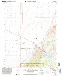
USGS Historical Quadrangle in GeoPDF.

USGS Historical Quadrangle in GeoPDF.
Core Research Center, core B513, from well operated by MOBIL OILRaw Properties from download, web scrape, MapServer, and Macrostrat API{"Lib Num": "B513", "API Num": "4900505403", "Operator": "MOBIL OIL", "Well Name": "F-34-16 STATE", "Field": "WILDCAT", "State": "WY", "County": "CAMPBELL", "Type": "SLABBED", "Photos": "F", "Thin Sec": "T", "Analysis": "T", "Latitude": "44.22191", "Longitude": "-105.15148", "coordinates_geohash": "9xv5x4r52ct8", "Source": "FROM STATE RECORDS", "Security Flag": "NO SPECIAL RESTRICTIONS", "crc_collection_name": "core", "sb_parent_id": "4f4e49dae4b07f02db5e0486", "intervals": [{"Formation": "NEWCASTLE", "Age": "CRET", "Min Depth": "6791", "Max Depth": "6811"}, {"Formation": "MINNELUSA",...
Core Research Center, core B777, from well operated by PLANET ASSOCIATESRaw Properties from download, web scrape, MapServer, and Macrostrat API{"Lib Num": "B777", "API Num": "4901120926", "Operator": "PLANET ASSOCIATES", "Well Name": "55B-34 WATERS", "Field": "CYCLONE CANYON", "State": "WY", "County": "CROOK", "Type": "SLABBED", "Photos": "F", "Thin Sec": "F", "Analysis": "F", "Latitude": "44.44796", "Longitude": "-104.89084", "coordinates_geohash": "9xvkv5sb4k2c", "Source": "FROM STATE RECORDS", "Security Flag": "NO SPECIAL RESTRICTIONS", "crc_collection_name": "core", "sb_parent_id": "4f4e49dae4b07f02db5e0486", "intervals": [{"Formation": "NEWCASTLE", "Age": "CRET", "Min Depth": "471", "Max Depth": "501"}], "crcwc_url":...
Categories: Physical Item;
Tags: Belle Fourche Shale,
Belle Fourche Shale,
CRET,
Late Cretaceous,
NEWCASTLE,
This data set contains imagery from the National Agriculture Imagery Program (NAIP). The NAIP program is administered by USDA FSA and has been established to support two main FSA strategic goals centered on agricultural production. These are, increase stewardship of America's natural resources while enhancing the environment, and to ensure commodities are procured and distributed effectively and efficiently to increase food security. The NAIP program supports these goals by acquiring and providing ortho imagery that has been collected during the agricultural growing season in the U.S. The NAIP ortho imagery is tailored to meet FSA requirements and is a fundamental tool used to support FSA farm and conservation programs....
This data set contains imagery from the National Agriculture Imagery Program (NAIP). The NAIP program is administered by USDA FSA and has been established to support two main FSA strategic goals centered on agricultural production. These are, increase stewardship of America's natural resources while enhancing the environment, and to ensure commodities are procured and distributed effectively and efficiently to increase food security. The NAIP program supports these goals by acquiring and providing ortho imagery that has been collected during the agricultural growing season in the U.S. The NAIP ortho imagery is tailored to meet FSA requirements and is a fundamental tool used to support FSA farm and conservation programs....
Core Research Center, core D011, from well operated by GREAT NORTHERN DRLGRaw Properties from download, web scrape, MapServer, and Macrostrat API{"Lib Num": "D011", "API Num": "2507505060", "Operator": "GREAT NORTHERN DRLG", "Well Name": "1 GOVERNMENT", "Field": "HAT CREEK AREA", "State": "MT", "County": "POWDER RIVER", "Type": "SLABBED", "Photos": "F", "Thin Sec": "T", "Analysis": "F", "Latitude": "45.396637", "Longitude": "-105.153664", "coordinates_geohash": "c8j4r0jqw43p", "Source": "FROM STATE RECORDS", "Security Flag": "NO SPECIAL RESTRICTIONS", "crc_collection_name": "core", "sb_parent_id": "4f4e49dae4b07f02db5e0486", "intervals": [{"Formation": "MINNELUSA", "Age": "PENN", "Min Depth": "6575", "Max Depth":...
Categories: Physical Item;
Tags: CRET,
Campanian - Maastrichtian,
Hell Creek Formation,
Hell Creek Formation,
MINNELUSA,

USGS Historical Quadrangle in GeoPDF.
Core Research Center, core S713, from well operated by JUNIPER O&GRaw Properties from download, web scrape, MapServer, and Macrostrat API{"Lib Num": "S713", "API Num": "4904520452", "Operator": "JUNIPER O&G", "Well Name": "7-16 TRACT 7", "Field": "OSAGE", "State": "WY", "County": "WESTON", "Type": "FULL", "Photos": "F", "Thin Sec": "F", "Analysis": "F", "Latitude": "43.91993", "Longitude": "-104.47864", "coordinates_geohash": "9xv9ye2uphre", "Source": "FROM STATE RECORDS", "Security Flag": "NO SPECIAL RESTRICTIONS", "crc_collection_name": "core", "sb_parent_id": "4f4e49dae4b07f02db5e0486", "intervals": [{"Formation": "NEWCASTLE", "Age": "CRET", "Min Depth": "1740", "Max Depth": "1780"}], "crcwc_url": "https://my.usgs.gov/crcwc/core/report/13759",...
This data set contains imagery from the National Agriculture Imagery Program (NAIP). The NAIP program is administered by USDA FSA and has been established to support two main FSA strategic goals centered on agricultural production. These are, increase stewardship of America's natural resources while enhancing the environment, and to ensure commodities are procured and distributed effectively and efficiently to increase food security. The NAIP program supports these goals by acquiring and providing ortho imagery that has been collected during the agricultural growing season in the U.S. The NAIP ortho imagery is tailored to meet FSA requirements and is a fundamental tool used to support FSA farm and conservation programs....
This data set contains imagery from the National Agriculture Imagery Program (NAIP). The NAIP program is administered by USDA FSA and has been established to support two main FSA strategic goals centered on agricultural production. These are increase stewardship of America's natural resources while enhancing the environment, and to ensure commodities are procured and distributed effectively and efficiently to increase food security. The NAIP program supports these goals by acquiring and providing ortho imagery that has been collected during the agricultural growing season in the U.S. The NAIP ortho imagery is tailored to meet FSA requirements and is a fundamental tool used to support FSA farm and conservation programs....
Core Research Center, core E368, from well operated by ENSTAR PETROLEUMRaw Properties from download, web scrape, MapServer, and Macrostrat API{"Lib Num": "E368", "API Num": "4904522249", "Operator": "ENSTAR PETROLEUM", "Well Name": "43 SKULL CREEK UNIT", "Field": "SKULL CREEK", "State": "WY", "County": "WESTON", "Type": "SLABBED", "Photos": "T", "Thin Sec": "F", "Analysis": "T", "Latitude": "43.79016", "Longitude": "-104.2984", "coordinates_geohash": "9xvc4eu0pjkp", "Source": "FROM STATE RECORDS", "Security Flag": "NO SPECIAL RESTRICTIONS", "crc_collection_name": "core", "sb_parent_id": "4f4e49dae4b07f02db5e0486", "intervals": [{"Formation": "MOWRY", "Age": "CRET", "Min Depth": "3209", "Max Depth": "3255"}, {"Formation":...
Categories: Physical Item;
Tags: CRET,
CRET,
Kara Bentonitic Member; Red Bird Silty Member; Mitten Black Shale Member,
MOWRY,
NEWCASTLE,
Core Research Center, core S679, from well operated by JUNIPER O&GRaw Properties from download, web scrape, MapServer, and Macrostrat API{"Lib Num": "S679", "API Num": "4904520333", "Operator": "JUNIPER O&G", "Well Name": "4-5 TRACT 4", "Field": "OSAGE", "State": "WY", "County": "WESTON", "Type": "FULL", "Photos": "F", "Thin Sec": "F", "Analysis": "F", "Latitude": "43.93006", "Longitude": "-104.46407", "coordinates_geohash": "9xv9yv5x4sxx", "Source": "FROM STATE RECORDS", "Security Flag": "NO SPECIAL RESTRICTIONS", "crc_collection_name": "core", "sb_parent_id": "4f4e49dae4b07f02db5e0486", "intervals": [{"Formation": "NEWCASTLE", "Age": null, "Min Depth": "1390", "Max Depth": "1410"}], "crcwc_url": "https://my.usgs.gov/crcwc/core/report/13728",...
Categories: Physical Item;
Tags: Carlile Shale,
NEWCASTLE,
Sage Breaks Member; Turner Sandy Member,
Upper Cretaceous
USGS Historical Quadrangle in GeoPDF.
USGS Historical Quadrangle in GeoPDF.
USGS Historical Quadrangle in GeoPDF.
USGS Historical Quadrangle in GeoPDF.
This data set contains imagery from the National Agriculture Imagery Program (NAIP). The NAIP program is administered by USDA FSA and has been established to support two main FSA strategic goals centered on agricultural production. These are, increase stewardship of America's natural resources while enhancing the environment, and to ensure commodities are procured and distributed effectively and efficiently to increase food security. The NAIP program supports these goals by acquiring and providing ortho imagery that has been collected during the agricultural growing season in the U.S. The NAIP ortho imagery is tailored to meet FSA requirements and is a fundamental tool used to support FSA farm and conservation programs....
|

|
