Filters: Tags: Newfield (X)
43 results (52ms)|
Filters
Date Range
Extensions Types
Contacts
Categories Tag Types
|
This data set contains imagery from the National Agriculture Imagery Program (NAIP). The NAIP program is administered by USDA FSA and has been established to support two main FSA strategic goals centered on agricultural production. These are, increase stewardship of America's natural resources while enhancing the environment, and to ensure commodities are procured and distributed effectively and efficiently to increase food security. The NAIP program supports these goals by acquiring and providing ortho imagery that has been collected during the agricultural growing season in the U.S. The NAIP ortho imagery is tailored to meet FSA requirements and is a fundamental tool used to support FSA farm and conservation programs....
In 2011, the U.S. Geological Survey, in cooperation with the Town of Newfield and the Tompkins County Planning Department, began a study of the stratified-drift aquifers in the West Branch Cayuga Inlet and Fish Kill valleys in the Town of Newfield, Tompkins County, New York. The objective of this study was to characterize the hydrogeology and water quality of the stratified-drift aquifers in the West Branch Cayuga Inlet and Fish Kill valleys and produce a summary report of the findings. This dataset contains locations of unconfined aquifer boundaries in West Branch Cayuga Inlet and Fish Kill Valleys, Newfield, Tompkins County, New York.
Categories: Data;
Types: Downloadable,
Map Service,
OGC WFS Layer,
OGC WMS Layer,
Shapefile;
Tags: Aquifer,
Aquifer Mapping,
Groundwater,
Hydrogeologic Characterization,
New York,
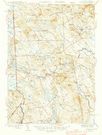
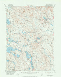
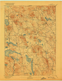
USGS Historical Quadrangle in GeoPDF.
USGS Historical Quadrangle in GeoPDF.
USGS Historical Quadrangle in GeoPDF.
This data set contains imagery from the National Agriculture Imagery Program (NAIP). The NAIP program is administered by USDA FSA and has been established to support two main FSA strategic goals centered on agricultural production. These are, increase stewardship of America's natural resources while enhancing the environment, and to ensure commodities are procured and distributed effectively and efficiently to increase food security. The NAIP program supports these goals by acquiring and providing ortho imagery that has been collected during the agricultural growing season in the U.S. The NAIP ortho imagery is tailored to meet FSA requirements and is a fundamental tool used to support FSA farm and conservation programs....
This data set contains imagery from the National Agriculture Imagery Program (NAIP). The NAIP program is administered by USDA FSA and has been established to support two main FSA strategic goals centered on agricultural production. These are, increase stewardship of America's natural resources while enhancing the environment, and to ensure commodities are procured and distributed effectively and efficiently to increase food security. The NAIP program supports these goals by acquiring and providing ortho imagery that has been collected during the agricultural growing season in the U.S. The NAIP ortho imagery is tailored to meet FSA requirements and is a fundamental tool used to support FSA farm and conservation programs....
In 2011, the U.S. Geological Survey, in cooperation with the Town of Newfield and the Tompkins County Planning Department, began a study of the stratified-drift aquifers in the West Branch Cayuga Inlet and Fish Kill valleys in the Town of Newfield, Tompkins County, New York. The objective of this study was to characterize the hydrogeology and water quality of the stratified-drift aquifers in the West Branch Cayuga Inlet and Fish Kill valleys and produce a summary report of the findings. This dataset contains locations of surface water discharge and water quality sites in West Branch Cayuga Inlet and Fish Kill Valleys, Newfield, Tompkins County, New York.
Categories: Data;
Types: Downloadable,
Map Service,
OGC WFS Layer,
OGC WMS Layer,
Shapefile;
Tags: Aquifer,
Aquifer Mapping,
Groundwater,
Hydrogeologic Characterization,
New York,
USGS Historical Quadrangle in GeoPDF.
In 2011, the U.S. Geological Survey, in cooperation with the Town of Newfield and the Tompkins County Planning Department, began a study of the stratified-drift aquifers in the West Branch Cayuga Inlet and Fish Kill valleys in the Town of Newfield, Tompkins County, New York. The objective of this study was to characterize the hydrogeology and water quality of the stratified-drift aquifers in the West Branch Cayuga Inlet and Fish Kill valleys and produce a summary report of the findings. This dataset contains locations of crevasse fillings in West Branch Cayuga Inlet and Fish Kill Valleys, Newfield, Tompkins County, New York.
Categories: Data;
Types: Downloadable,
Map Service,
OGC WFS Layer,
OGC WMS Layer,
Shapefile;
Tags: Aquifer,
Aquifer Mapping,
Groundwater,
Hydrogeologic Characterization,
New York,
In 2011, the U.S. Geological Survey, in cooperation with the Town of Newfield and the Tompkins County Planning Department, began a study of the stratified-drift aquifers in the West Branch Cayuga Inlet and Fish Kill valleys in the Town of Newfield, Tompkins County, New York. The objective of this study was to characterize the hydrogeology and water quality of the stratified-drift aquifers in the West Branch Cayuga Inlet and Fish Kill valleys and produce a summary report of the findings. This dataset contains locations of drainage divides in West Branch Cayuga Inlet and Fish Kill Valleys, Newfield, Tompkins County, New York.
Categories: Data;
Types: Downloadable,
Map Service,
OGC WFS Layer,
OGC WMS Layer,
Shapefile;
Tags: Aquifer,
Aquifer Mapping,
Groundwater,
Hydrogeologic Characterization,
New York,
In 2011, the U.S. Geological Survey, in cooperation with the Town of Newfield and the Tompkins County Planning Department, began a study of the stratified-drift aquifers in the West Branch Cayuga Inlet and Fish Kill valleys in the Town of Newfield, Tompkins County, New York. The objective of this study was to characterize the hydrogeology and water quality of the stratified-drift aquifers in the West Branch Cayuga Inlet and Fish Kill valleys and produce a summary report of the findings. The spatial extent and hydrogeologic framework of these unconsolidated aquifers were delineated using existing data, including soils maps, well records, geologic logs, topographic data, and published reports. These geospatial datasets...
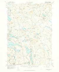
USGS Historical Quadrangle in GeoPDF.
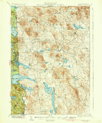
USGS Historical Quadrangle in GeoPDF.
In 2011, the U.S. Geological Survey, in cooperation with the Town of Newfield and the Tompkins County Planning Department, began a study of the stratified-drift aquifers in the West Branch Cayuga Inlet and Fish Kill valleys in the Town of Newfield, Tompkins County, New York. The objective of this study was to characterize the hydrogeology and water quality of the stratified-drift aquifers in the West Branch Cayuga Inlet and Fish Kill valleys and produce a summary report of the findings. This dataset contains locations and unit labels of the surficial geologic units in West Branch Cayuga Inlet and Fish Kill Valleys, Newfield, Tompkins County, New York.
Categories: Data;
Types: Downloadable,
Map Service,
OGC WFS Layer,
OGC WMS Layer,
Shapefile;
Tags: Aquifer,
Aquifer Mapping,
Groundwater,
Hydrogeologic Characterization,
New York,
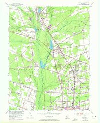
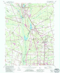
USGS Historical Quadrangle in GeoPDF.

USGS Historical Quadrangle in GeoPDF.
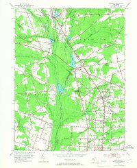
USGS Historical Quadrangle in GeoPDF.
USGS Historical Quadrangle in GeoPDF.
In 2011, the U.S. Geological Survey, in cooperation with the Town of Newfield and the Tompkins County Planning Department, began a study of the stratified-drift aquifers in the West Branch Cayuga Inlet and Fish Kill valleys in the Town of Newfield, Tompkins County, New York. The objective of this study was to characterize the hydrogeology and water quality of the stratified-drift aquifers in the West Branch Cayuga Inlet and Fish Kill valleys and produce a summary report of the findings. This dataset contains locations of confined aquifer boundaries in West Branch Cayuga Inlet and Fish Kill Valleys, Newfield, Tompkins County, New York.
Categories: Data;
Types: Downloadable,
Map Service,
OGC WFS Layer,
OGC WMS Layer,
Shapefile;
Tags: Aquifer,
Aquifer Mapping,
Groundwater,
Hydrogeologic Characterization,
New York,
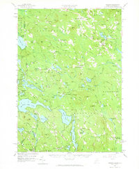
|

|
