Filters: Tags: North Edwards (X)
10 results (33ms)|
Filters
Date Range
Extensions Types
Contacts
Categories Tag Types Tag Schemes |
Passive seismic data collection was done northwest of the Air Force Research Laboratory (AFRL) at Edwards Air Force Base using the horizontal-to-vertical spectral ratio (HVSR) technique. HVSR surveys were done at 43 locations between May and September 2018 to refine the understanding of the bedrock-alluvial aquifer transition zone downgradient from the AFRL. Specifically, the data were collected to help determine the depth to bedrock. The HVSR method is a passive seismic technique that uses a three-component seismometer to measure the vertical and horizontal components of ambient seismic noise. Seismic noise in the range of ~0.1 to 1 Hertz (Hz) is caused by ocean waves, large regional storms, and tectonic sources....
Categories: Data;
Tags: Antelope-Fremont Valleys,
Boron,
California,
Edwards Air Force Base,
Kern County,
This data set contains imagery from the National Agriculture Imagery Program (NAIP). The NAIP program is administered by USDA FSA and has been established to support two main FSA strategic goals centered on agricultural production. These are, increase stewardship of America's natural resources while enhancing the environment, and to ensure commodities are procured and distributed effectively and efficiently to increase food security. The NAIP program supports these goals by acquiring and providing ortho imagery that has been collected during the agricultural growing season in the U.S. The NAIP ortho imagery is tailored to meet FSA requirements and is a fundamental tool used to support FSA farm and conservation programs....
Electrical resistivity tomography (ERT) surveys were done northwest of the Air Force Research Laboratory (AFRL) at Edwards Air Force Base. ERT surveys were done at four locations in May through June of 2018 to refine the understanding of the bedrock-alluvial aquifer transition zone downgradient from the AFRL. The ERT technique injects direct-current electricity with known voltage and current into the earth using a series of electrodes and measures the resulting resistivity. This technique is generally limited to investigations of aquifer properties less than 100 meters below land surface. Data from other geophysical techniques co-located with the ERT data, including time-domain electromagnetics and horizontal-to-vertical...
Categories: Data;
Types: Downloadable,
Map Service,
OGC WFS Layer,
OGC WMS Layer,
OGC WMS Service,
Shapefile;
Tags: Antelope-Fremont Valleys,
Boron,
California,
California Water Science Center,
Edwards Air Force Base,
The Air Force Research Laboratory (AFRL) is about 7 kilometers southwest of Boron, California, and covers 320 square kilometers of Edwards Air Force Base. The AFRL consists of 12 facilities for testing full-size rocket engines, engine components, and liquid and solid propellants. The historical release of contaminants from rocket test stands, evaporation ponds, burn pits, catch basins, and leaking waste-collection tanks has contaminated groundwater in the AFRL. Groundwater aquifers near the AFRL are mostly restricted to fractured granitic bedrock, but previous studies indicate that groundwater and associated contaminants have moved into alluvium to the north and northwest. The U.S. Geological Survey (USGS) and the...
Time-domain electromagnetic (TEM) surveys were done northwest of the Air Force Research Laboratory (AFRL) at Edwards Air Force Base. TEM surveys were done at 33 locations between May and October 2018 to refine the understanding of the bedrock-alluvial aquifer transition zone downgradient from the AFRL. TEM surveys (also called transient electromagnetic surveys) provide 1D resistivity soundings of the subsurface, which can be related to lithology and hydrogeology. In the TEM method, electrical current is cycled through a transmitter loop (Tx) wire, which in turn produces a primary magnetic field. When the current is abruptly terminated, a secondary magnetic field is induced in the earth, and it moves downward and...
Categories: Data;
Types: Downloadable,
Map Service,
OGC WFS Layer,
OGC WMS Layer,
OGC WMS Service,
Shapefile;
Tags: Antelope-Fremont Valleys,
Boron,
California,
Edwards Air Force Base,
Kern County,
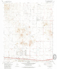
USGS Historical Quadrangle in GeoPDF.
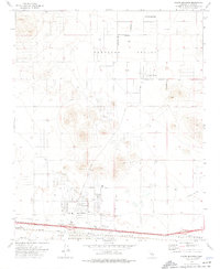
USGS Historical Quadrangle in GeoPDF.
This data set contains imagery from the National Agriculture Imagery Program (NAIP). The NAIP program is administered by USDA FSA and has been established to support two main FSA strategic goals centered on agricultural production. These are, increase stewardship of America's natural resources while enhancing the environment, and to ensure commodities are procured and distributed effectively and efficiently to increase food security. The NAIP program supports these goals by acquiring and providing ortho imagery that has been collected during the agricultural growing season in the U.S. The NAIP ortho imagery is tailored to meet FSA requirements and is a fundamental tool used to support FSA farm and conservation programs....
This data set contains imagery from the National Agriculture Imagery Program (NAIP). The NAIP program is administered by USDA FSA and has been established to support two main FSA strategic goals centered on agricultural production. These are, increase stewardship of America's natural resources while enhancing the environment, and to ensure commodities are procured and distributed effectively and efficiently to increase food security. The NAIP program supports these goals by acquiring and providing ortho imagery that has been collected during the agricultural growing season in the U.S. The NAIP ortho imagery is tailored to meet FSA requirements and is a fundamental tool used to support FSA farm and conservation programs....
This data set contains imagery from the National Agriculture Imagery Program (NAIP). The NAIP program is administered by USDA FSA and has been established to support two main FSA strategic goals centered on agricultural production. These are, increase stewardship of America's natural resources while enhancing the environment, and to ensure commodities are procured and distributed effectively and efficiently to increase food security. The NAIP program supports these goals by acquiring and providing ortho imagery that has been collected during the agricultural growing season in the U.S. The NAIP ortho imagery is tailored to meet FSA requirements and is a fundamental tool used to support FSA farm and conservation programs....
|

|
