Filters: Tags: North Pacific (X)
29 results (45ms)|
Filters
Date Range
Extensions Types Contacts
Categories Tag Types
|
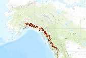
Subalpine Connectivity of areas of high elevation and high human footprint in the North Pacific Landscape Conservation Cooperative study area. This application provides Subalpine Connectivity for 2000 and 2080 (A1B). The North Pacific Forest Landscape Connectivity Project uses three main geospatial layers as inputs into the creation of resistance map grids.  One-km was decided as the resolution for the final resistance grids.  The three primary geospatial layers used in this analysis were a digital elevation model (DEM), a vegetation layer, and a human footprint layer.  Due to the geographic extent of the North Pacific Landscape Conservation Cooperative, digital elevation models from different sources had to...
This dataset was developed for the Atlas of Pacific Salmon: The First Map-Based Status Assessment of Salmon in the North Pacific. (2005)
Categories: Data;
Types: Downloadable,
Map Service,
OGC WFS Layer,
OGC WMS Layer,
Shapefile;
Tags: Oncorhynchus gorbuscha,
Oncorhynchus tschawytscha,
Anadromous Resources,
Chum,
Coho ,

Subalpine Connectivity of areas of low elevation and low human footprint in the North Pacific Landscape Conservation Cooperative study area. This application provides Subalpine Connectivity for 2000 and 2080 (A1B).The North Pacific Forest Landscape Connectivity Project uses three main geospatial layers as inputs into the creation of resistance map grids. One-km was decided as the resolution for the final resistance grids. The three primary geospatial layers used in this analysis were a digital elevation model (DEM), a vegetation layer, and a human footprint layer. Due to the geographic extent of the North Pacific Landscape Conservation Cooperative, digital elevation models from different sources had to be...
The Sea Surface Temperature (SST) data of the nearshore region of the North Pacific show temperature ranges in degrees C using points whose locations correspond to the centroids of AVHRR Pathfinder version 5 monthly, global, 4 km data set (PFSST V50). The pathfinder rasters are available from the Physical Oceanography Distributed Active Archive Center (PO.DAAC), hosted by NASA JPL. The data points in this dataset lie within a 20 km buffer from the GSHHS (Global Self-consistent, Hierarchical, High-resolution Shoreline) coastline. The GSHHS vector data are available from the National Geophysical Data Center (NGDC). Furthermore, each point in the SST dataset is categorized by the ecoregion in which it is located. This...
A combination of focus groups and usability tests were used to explore the needs and preferences of a variety of NPLCC stakeholders as regards data management platform content, format, and features. This information was used to inform NPLCC decisions about how best to meet needs not currently met by LC MAP through adjustments or enhancements to LC MAP itself or by connecting stakeholders with other platforms or portals.
Categories: Data;
Types: Map Service,
OGC WFS Layer,
OGC WMS Layer,
OGC WMS Service;
Tags: Academics & scientific researchers,
CA-2,
Data Acquisition and Development,
Data Management and Integration,
Data Platform,

Montane Conifer Connectivity of areas of high elevation and high human footprint in the North Pacific Landscape Conservation Cooperative study area. This application provides Montane Conifer Connectivity for 2000 and 2080 (A1B). The North Pacific Forest Landscape Connectivity Project uses three main geospatial layers as inputs into the creation of resistance map grids. One-km was decided as the resolution for the final resistance grids. The three primary geospatial layers used in this analysis were a digital elevation model (DEM), a vegetation layer, and a human footprint layer. Due to the geographic extent of the North Pacific Landscape Conservation Cooperative, digital elevation models from different sources...
Montane Conifer Connectivity of areas of low elevation and low human footprint in the North Pacific Landscape Conservation Cooperative study area. This application provides Montane Conifer Connectivity for 2000 and 2080 (A1B). The North Pacific Forest Landscape Connectivity Project uses three main geospatial layers as inputs into the creation of resistance map grids. One-km was decided as the resolution for the final resistance grids. The three primary geospatial layers used in this analysis were a digital elevation model (DEM), a vegetation layer, and a human footprint layer. Due to the geographic extent of the North Pacific Landscape Conservation Cooperative, digital elevation models from different sources...
This shapefile approximates the area less than 20 km offshore of the North Pacific Coastline as defined by the "World Country Boundaries (Generalized)" shapefile distributed by ESRI as part of their Data & Maps data series.
Categories: Data;
Types: Citation,
Downloadable,
Map Service,
OGC WFS Layer,
OGC WMS Layer,
Shapefile;
Tags: Asian Pacific,
National CASC,
North Pacific,
Pacific Coast,
Pacific Northwest,
This theme shows the Key Watersheds that are located on BLM lands and adjacent Forest Service Lands, as identified during the Forest Ecosystem Management Assessment effort (Northwest Forest Plan - Record of Decision 1994). The initial mapping done in 1994 was a very generalized representation and was done prior to the development of the interagency standard 5th and 6th field watershed boundaries. The line work has been made coincident with the 5th and 6th field watershed lines where the Key Watershed Boundaries clearly intended to use a watershed as the boundary. District personnel have reviewed these edits to conform to the 5th and 6th field boundaries and have incorporated other edits to follow operationally identifiable...
Categories: Data;
Types: Downloadable,
Map Service,
OGC WFS Layer,
OGC WMS Layer,
Shapefile;
Tags: Conservation Priority Area,
Effects of changes in hydrologic regimes on anadromous fish,
Effects of hydrologic regime shifts on rivers, streams, and riparian corridors,
Forest Service Land,
Key Watersheds,
The rasters 22 classes of forest vegetation from potential forest (value 1) through large multistory conifer (value 22) plus water, barren lands, etc. at 25 meter resolution. Source data was Interagency Vegetation Mapping Project (IVMP) coverages for quadratic mean diameter (QMD), stand structure, and conifer vegetation from Landsat TM ca. 1996. Accuracy Assessment not valid for land areas smaller than physiographic province. Mapped by the Regional Interagency Effectiveness Monitoring Program, NW Forest Plan, R6/PNW in 2005. LANDSAT TM ca. 1996; IVMP quadratic mean diameter, species, canopy structure
Categories: Data;
Types: Downloadable,
Map Service,
OGC WFS Layer,
OGC WMS Layer,
Shapefile;
Tags: Effects of change in air temperature and precipitation on Forests,
Forest Service,
Land Cover,
Late Successional,
NPLCC,
This point shapefile approximates locations within 20 km of the North Pacific Coastline, as defined by the "World Country Boundaries (Generalized)" shapefile distributed by ESRI as part of their Data & Maps data series. They are based on raster data at 4 km resolution. Therefore there are between 3-5 points extending out from each location along the shoreline (at 4 km intervals).
Categories: Data;
Types: Citation,
Downloadable,
Map Service,
OGC WFS Layer,
OGC WMS Layer,
Shapefile;
Tags: Aleutian,
Asian Pacific,
BC,
Baja,
British Columbia,
The Sea Surface Temperature (SST) data of the nearshore region of the North Pacific show temperature ranges in degrees C using points whose locations correspond to the centroids of AVHRR Pathfinder version 5 monthly, global, 4 km data set (PFSST V50). The pathfinder rasters are available from the Physical Oceanography Distributed Active Archive Center (PO.DAAC), hosted by NASA JPL. The data points in this dataset lie within a 20 km buffer from the GSHHS (Global Self-consistent, Hierarchical, High-resolution Shoreline) coastline. The GSHHS vector data are available from the National Geophysical Data Center (NGDC). Furthermore, each point in the SST dataset is categorized by the ecoregion in which it is located. This...
Landscape Conservation Cooperatives (LCCs) are public-private partnerships composed of states, tribes, federal agencies, non-governmental organizations, universities, international jurisdictions, and others working together to address landscape and seascape scale conservation issues. LCCs inform resource management decisions to address broad-scale stressors-including habitat fragmentation, genetic isolation, spread of invasive species, and water scarcity-all of which are magnified by a rapidly changing climate. For further information go to https://www.fws.gov/science/catalog. The previous 2011 LCC Network Areas data is available at https://www.sciencebase.gov/catalog/item/52f2735ee4b0a6f0bd498c2f
Categories: Data,
Publication;
Types: ArcGIS Map Package,
ArcGIS REST Map Service,
ArcGIS Service Definition,
Citation,
Downloadable,
Map Service;
Tags: Aleutian and Bering Sea Islands,
Appalachian,
Arctic,
California,
Caribbean,
Landscape Conservation Cooperatives (LCCs) are public-private partnerships composed of states, tribes, federal agencies, non-governmental organizations, universities, international jurisdictions, and others working together to address landscape and seascape scale conservation issues. LCCs inform resource management decisions to address broad-scale stressors-including habitat fragmentation, genetic isolation, spread of invasive species, and water scarcity-all of which are magnified by a rapidly changing climate. For further information go to https://www.fws.gov/science/catalog. The previous 2011 LCC Network Areas data is available at https://www.sciencebase.gov/catalog/item/52f2735ee4b0a6f0bd498c2f
Categories: Data,
Publication;
Types: Citation,
Downloadable,
Map Service,
OGC WFS Layer,
OGC WMS Layer,
Shapefile;
Tags: Aleutian and Bering Sea Islands,
Appalachian,
Arctic,
California,
Caribbean,
Project Summary In September, 2011, The North Pacific Land Conservation Cooperative (NPLCC) awarded Ecotrust a grant to develop a conservation priorities tool intended to assist the NPLCC and other natural resource managers, individuals, and community organizations in accessing, understanding and visualizing a wide variety of data sets pertaining to aquatic and terrestrial species, anthropogenic threats and potential vulnerabilities to climate change for freshwater and forest ecosystems throughout the NPLCC geographic area. Over the course of the grant period, Ecotrust developed a custom, spatially explicit, on-line decision support tool that was designed to both visualize these data and to identify regional...
Categories: Data;
Types: Map Service,
OGC WFS Layer,
OGC WMS Layer,
OGC WMS Service;
Tags: Conservation,
LCC Network Science Catalog,
North Pacific,
completed,
conservation prioritization,
The Sea Surface Temperature (SST) data of the nearshore region of the North Pacific show temperature ranges in degrees C using points whose locations correspond to the centroids of AVHRR Pathfinder version 5 monthly, global, 4 km data set (PFSST V50). The pathfinder rasters are available from the Physical Oceanography Distributed Active Archive Center (PO.DAAC), hosted by NASA JPL. The data points in this dataset lie within a 20 km buffer from the GSHHS (Global Self-consistent, Hierarchical, High-resolution Shoreline) coastline. The GSHHS vector data are available from the National Geophysical Data Center (NGDC). Furthermore, each point in the SST dataset is categorized by the ecoregion in which it is located. This...
The Sea Surface Temperature (SST) data of the nearshore region of the North Pacific show temperature ranges in degrees C using points whose locations correspond to the centroids of AVHRR Pathfinder version 5 monthly, global, 4 km data set (PFSST V50). The pathfinder rasters are available from the Physical Oceanography Distributed Active Archive Center (PO.DAAC), hosted by NASA JPL. The grid cells in this dataset lie within a 20 km buffer from the GSHHS (Global Self-consistent, Hierarchical, High-resolution Shoreline) coastline. The GSHHS vector data are available from the National Geophysical Data Center (NGDC). These data have been QA'd in that we have selected only data values with associated quality flags of...
Under the Canadian Species at Risk Act (SARA), Garry oak (Quercus garryana) ecosystems are listed as ‘‘at-risk’’ and act as an umbrella for over one hundred species that are endangered to some degree. Understanding Garry oak responses to future climate scenarios at scales relevant to protected area managers is essential to effectively manage existing protected area networks and to guide the selection of temporally connected migration corridors, additional protected areas, and to maintain Garry oak populations over the next century. We present Garry oak distribution scenarios using two random forest models calibrated with down-scaled bioclimatic data for British Columbia, Washington, and Oregon based on 1961–1990...
This dataset was created in order to facilitate transboundary conservation work and research projects, by integrating land cover maps into a single dataset from Cape Caution, BC, to Yakutat Bay, AK. It includes three levels of land classification, site index, elevation, hydric soils (yes/no), karst (yes/no), primary and secondary species, size class, and volume class. It also includes a number of other important attributes from individual datasets, which were not crosswalked between the different areas. Audubon Alaska, The Nature Conservancy, U.S. Forest Service, Province of British Columbia, GeoBase®, USGS, Glacier Bay National Park, Dave Leversee Please cite Audubon Alaska and the data contributors listed...
Here we describe one conservation tool that will help to identify particularly significant river basins of the North Pacific for the conservation of salmon: the first Pacific-Rim wide assessment of salmon populations at a consistent scale. In conjunction with a scientific advisory panel and a peer review workshop we developed four criteria for the Pacific Salmon Conservation Assessment (PSCA) to provide an indication of aquatic ecosystem and salmon population resilience at the basin scale. These criteria are salmon abundance, diversity, hatchery influence, and landscape suitability. Highly abundant salmon populations have more “cushion” with which to absorb anthropogenic or natural disturbance (Quigley and...
Categories: Data;
Types: Downloadable,
Map Service,
OGC WFS Layer,
OGC WMS Layer,
Shapefile;
Tags: Anadromous Resources,
Chinook salmon,
Chum,
Effects of changes in hydrologic regimes on anadromous fish,
Freshwater Resources,
|

|
