Filters: Tags: North Slope (X)
1,571 results (11ms)|
Filters
Contacts
(Less)
|
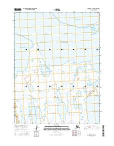
Layered geospatial PDF Map. Layers of geospatial data include orthoimagery, roads, grids, geographic names, elevation contours, hydrography, and other selected map features.
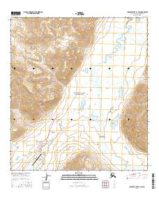
Layered geospatial PDF Map. Layers of geospatial data include orthoimagery, roads, grids, geographic names, elevation contours, hydrography, and other selected map features.
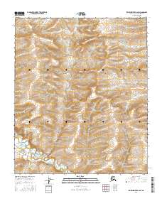
Layered geospatial PDF Map. Layers of geospatial data include orthoimagery, roads, grids, geographic names, elevation contours, hydrography, and other selected map features.
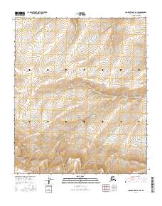
Layered geospatial PDF Map. Layers of geospatial data include orthoimagery, roads, grids, geographic names, elevation contours, hydrography, and other selected map features.
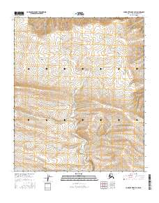
Layered geospatial PDF Map. Layers of geospatial data include orthoimagery, roads, grids, geographic names, elevation contours, hydrography, and other selected map features.
Some of the NOS rasters intentionally do not align or have the same extent. These rasters were not snapped to a common raster per the authors' discretion. Please review selected rasters prior to use. These varying alignments are a result of the use of differing source data sets and all products derived from them. We recommend that users snap or align rasters as best suits their own projects. - This file includes a downscaled projection of decadal Mean Annual Ground Temperature at 1 Meter Depth (°C) for the decades 2010-2019, 2020-2029, and 2060-2069 at 2km spatial resolution. It represents the A2 emissions scenario and the spatial extent is the NOS REA study area.
Some of the NOS rasters intentionally do not align or have the same extent. These rasters were not snapped to a common raster per the authors' discretion. Please review selected rasters prior to use. These varying alignments are a result of the use of differing source data sets and all products derived from them. We recommend that users snap or align rasters as best suits their own projects. - This file includes a downscaled projection of decadal average January temperature (in °C) for the decades 2010-2019, 2020-2029, and 2060-2069 at 771x771 meter spatial resolution. The file represents a decadal mean calculated from monthly totals, using the A2 emissions scenario. The spatial extent is clipped to the NOS REA...
Some of the NOS rasters intentionally do not align or have the same extent. These rasters were not snapped to a common raster per the authors' discretion. Please review selected rasters prior to use. These varying alignments are a result of the use of differing source data sets and all products derived from them. We recommend that users snap or align rasters as best suits their own projects. - This file includes a downscaled projection of decadal average May temperature (in °C) for the decades 2010-2019, 2020-2029, and 2060-2069 at 771x771 meter spatial resolution. The file represents a decadal mean calculated from monthly totals, using the A2 emissions scenario. The spatial extent is clipped to the NOS REA study...
Some of the NOS rasters intentionally do not align or have the same extent. These rasters were not snapped to a common raster per the authors' discretion. Please review selected rasters prior to use. These varying alignments are a result of the use of differing source data sets and all products derived from them. We recommend that users snap or align rasters as best suits their own projects. - This file includes a downscaled projection of decadal average of spring (March, April, May) total precipitation (in millimeters) for the decades 2010-2019, 2020-2029, and 2060-2069 at 771x771 meter spatial resolution. The file represents a decadal mean of seasonal totals calculated from monthly totals, using the A2 emissions...
Current (2015), Medium (2040), and High Scenario (2040) landscape condition and Current (2015), Medium (2040), and High Scenario (2040) landscape condition at 5th-level HUC resolution. These data are provided by Bureau of Land Management (BLM) "as is" and may contain errors or omissions. The User assumes the entire risk associated with its use of these data and bears all responsibility in determining whether these data are fit for the User's intended use. These data may not have the accuracy, resolution, completeness, timeliness, or other characteristics appropriate for applications that potential users of the data may contemplate. The User is encouraged to carefully consider the content of the metadata file associated...
Some of the NOS rasters intentionally do not align or have the same extent. These rasters were not snapped to a common raster per the authors' discretion. Please review selected rasters prior to use. These varying alignments are a result of the use of differing source data sets and all products derived from them. We recommend that users snap or align rasters as best suits their own projects. - The fine-scale invasion vulnerability model, combining higher probability sites for non-native plant importation and establishment, suggests that the region currently and into the near term is likely to have a non-native plant species restricted to a very small area. By 2060 however, all villages and the human footprint associated...
Some of the NOS rasters intentionally do not align or have the same extent. These rasters were not snapped to a common raster per the authors' discretion. Please review selected rasters prior to use. These varying alignments are a result of the use of differing source data sets and all products derived from them. We recommend that users snap or align rasters as best suits their own projects. - As a final measure of potential human impacts to the ecoregions, the impacts of current anthropogenic development are summarized in a 60 x 60 m grid by the landscape condition model (LCM). The LCM weights the relative influence of different types of human footprints based on factors like permanence, nature of the activity,...
Some of the NOS rasters intentionally do not align or have the same extent. These rasters were not snapped to a common raster per the authors' discretion. Please review selected rasters prior to use. These varying alignments are a result of the use of differing source data sets and all products derived from them. We recommend that users snap or align rasters as best suits their own projects. - Assessing the impact of oil and gas development on vegetation and hydrology on the North Slope study area involves identifying the accumulation of effects and assessing the relative magnitude of each. Impacts on vegetation include the direct effects associated with the construction of pipelines, roads, gravel pads, and seismic...
Some of the NOS rasters intentionally do not align or have the same extent. These rasters were not snapped to a common raster per the authors' discretion. Please review selected rasters prior to use. These varying alignments are a result of the use of differing source data sets and all products derived from them. We recommend that users snap or align rasters as best suits their own projects. - Growing season length and change in growing season length were extracted to the distribution of foothills tussock tundra. Near-term (2020s) increases in July temperature are not expected to be significant; however significant increases are projected across 72% of the of foothills tussock tundra distribution in the long term...
Some of the NOS rasters intentionally do not align or have the same extent. These rasters were not snapped to a common raster per the authors' discretion. Please review selected rasters prior to use. These varying alignments are a result of the use of differing source data sets and all products derived from them. We recommend that users snap or align rasters as best suits their own projects. - This file includes a downscaled projection of Snow Day Fraction (%) for the decades 2010-2019, 2020-2029, and 2060-2069, and months January, February, March, April, May, September, October, November, and December at 771x771 meter spatial resolution. The file represents a decadal mean calculated from monthly means, using the...
Some of the NOS rasters intentionally do not align or have the same extent. These rasters were not snapped to a common raster per the authors' discretion. Please review selected rasters prior to use. These varying alignments are a result of the use of differing source data sets and all products derived from them. We recommend that users snap or align rasters as best suits their own projects. - This file includes a downscaled projection of Snow Day Fraction (%) for the decades 2010-2019, 2020-2029, and 2060-2069, and months January, February, March, April, May, September, October, November, and December at 771x771 meter spatial resolution. The file represents a decadal mean calculated from monthly means, using the...
Some of the NOS rasters intentionally do not align or have the same extent. These rasters were not snapped to a common raster per the authors' discretion. Please review selected rasters prior to use. These varying alignments are a result of the use of differing source data sets and all products derived from them. We recommend that users snap or align rasters as best suits their own projects. - This file includes a downscaled projection of Snow Day Fraction (%) for the decades 2010-2019, 2020-2029, and 2060-2069, and months January, February, March, April, May, September, October, November, and December at 771x771 meter spatial resolution. The file represents a decadal mean calculated from monthly means, using the...
Some of the NOS rasters intentionally do not align or have the same extent. These rasters were not snapped to a common raster per the authors' discretion. Please review selected rasters prior to use. These varying alignments are a result of the use of differing source data sets and all products derived from them. We recommend that users snap or align rasters as best suits their own projects. - The fine-scale invasion vulnerability model, combining higher probability sites for non-native plant importation and establishment, suggests that the region currently and into the near term is likely to have a non-native plant species restricted to a very small area. By 2060 however, all villages and the human footprint associated...
Some of the NOS rasters intentionally do not align or have the same extent. These rasters were not snapped to a common raster per the authors' discretion. Please review selected rasters prior to use. These varying alignments are a result of the use of differing source data sets and all products derived from them. We recommend that users snap or align rasters as best suits their own projects. - Assessing the impact of oil and gas development on vegetation and hydrology on the North Slope study area involves identifying the accumulation of effects and assessing the relative magnitude of each. Impacts on vegetation include the direct effects associated with the construction of pipelines, roads, gravel pads, and seismic...
Some of the NOS rasters intentionally do not align or have the same extent. These rasters were not snapped to a common raster per the authors' discretion. Please review selected rasters prior to use. These varying alignments are a result of the use of differing source data sets and all products derived from them. We recommend that users snap or align rasters as best suits their own projects. - Growing season length and change in growing season length were extracted to the distribution of sand sheet moist tundra and wetland. Increases in July temperature both in the near and long term are not expected to be significant across most of the coastal plain ecoregion, including the arctic sandy lowland region. By the 2060s...
|

|
