Filters: Tags: Novato (X)
13 results (10ms)|
Filters
Date Range
Types Contacts
Categories Tag Types Tag Schemes |
This data set contains imagery from the National Agriculture Imagery Program (NAIP). The NAIP program is administered by USDA FSA and has been established to support two main FSA strategic goals centered on agricultural production. These are, increase stewardship of America's natural resources while enhancing the environment, and to ensure commodities are procured and distributed effectively and efficiently to increase food security. The NAIP program supports these goals by acquiring and providing ortho imagery that has been collected during the agricultural growing season in the U.S. The NAIP ortho imagery is tailored to meet FSA requirements and is a fundamental tool used to support FSA farm and conservation programs....
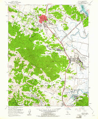
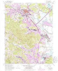
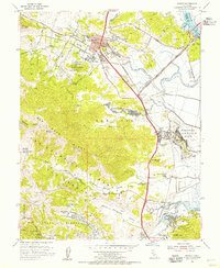
USGS Historical Quadrangle in GeoPDF.
USGS Historical Quadrangle in GeoPDF.
The Hamilton Wetland Restoration Project (HWRP) is a joint venture between the US Army Corps of Engineers (USACE; San Francisco District) and the California State Coastal Conservancy. The site is located on the property of the former Hamilton Army Airfield in Novato, California, along the western edge of San Pablo Bay, which is part of northern San Francisco Bay. The initial stages of wetland restoration, which included dredged sediment reuse, took place during 2009–2011. From 2011 until April 2014, the site was maintained as partially flooded through a temporary one-way culvert that allowed bay water onto the site. On April 25th, 2014, the outboard levee towards the north-eastern corner of the site was breached...
Categories: Data,
Data Release - Revised;
Tags: Novato,
San Francisco Bay,
San Pablo Bay,
USGS Science Data Catalog (SDC),
biochemistry,
Note: This data release has been superseded by version 3.0, available here: https://doi.org/10.5066/P9Q2YP9K. The Hamilton Wetland Restoration Project (HWRP) is a joint venture between the US Army Corps of Engineers (USACE; San Francisco District) and the California State Coastal Conservancy. The site is located on the property of the former Hamilton Army Airfield in Novato, California, along the western edge of San Pablo Bay, which is part of northern San Francisco Bay. The initial stages of wetland restoration, which included dredged sediment reuse, took place during 2009–2011. From 2011 until April 2014, the site was maintained as partially flooded through a temporary one-way culvert that allowed bay water onto...
Categories: Data,
Data Release - Revised;
Tags: Geochemistry,
Novato,
San Francisco Bay,
San Pablo Bay,
USGS Science Data Catalog (SDC),
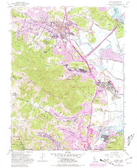
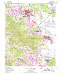
USGS Historical Quadrangle in GeoPDF.
USGS Historical Quadrangle in GeoPDF.
This data set contains imagery from the National Agriculture Imagery Program (NAIP). The NAIP program is administered by USDA FSA and has been established to support two main FSA strategic goals centered on agricultural production. These are, increase stewardship of America's natural resources while enhancing the environment, and to ensure commodities are procured and distributed effectively and efficiently to increase food security. The NAIP program supports these goals by acquiring and providing ortho imagery that has been collected during the agricultural growing season in the U.S. The NAIP ortho imagery is tailored to meet FSA requirements and is a fundamental tool used to support FSA farm and conservation programs....
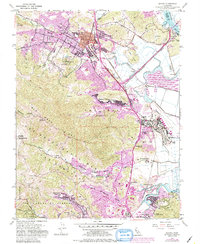
USGS Historical Quadrangle in GeoPDF.
USGS Historical Quadrangle in GeoPDF.
This data set contains imagery from the National Agriculture Imagery Program (NAIP). The NAIP program is administered by USDA FSA and has been established to support two main FSA strategic goals centered on agricultural production. These are, increase stewardship of America's natural resources while enhancing the environment, and to ensure commodities are procured and distributed effectively and efficiently to increase food security. The NAIP program supports these goals by acquiring and providing ortho imagery that has been collected during the agricultural growing season in the U.S. The NAIP ortho imagery is tailored to meet FSA requirements and is a fundamental tool used to support FSA farm and conservation programs....
Note: This data release has been superseded by version 2.0, available here: https://doi.org/10.5066/P9VO9WM7. The Hamilton Wetland Restoration Project (HWRP) is a joint venture between the US Army Corps of Engineers (USACE; San Francisco District) and the California State Coastal Conservancy. The site is located on the property of the former Hamilton Army Airfield in Novato, California, along the western edge of San Pablo Bay, which is part of northern San Francisco Bay. The initial stages of wetland restoration, which included dredged sediment reuse, took place during 2009–2011. From 2011 until April 2014, the site was maintained as partially flooded through a temporary one-way culvert that allowed bay water onto...
Categories: Data;
Tags: Geochemistry,
Novato,
San Francisco Bay,
San Pablo Bay,
USGS Science Data Catalog (SDC),
This data set contains imagery from the National Agriculture Imagery Program (NAIP). The NAIP program is administered by USDA FSA and has been established to support two main FSA strategic goals centered on agricultural production. These are, increase stewardship of America's natural resources while enhancing the environment, and to ensure commodities are procured and distributed effectively and efficiently to increase food security. The NAIP program supports these goals by acquiring and providing ortho imagery that has been collected during the agricultural growing season in the U.S. The NAIP ortho imagery is tailored to meet FSA requirements and is a fundamental tool used to support FSA farm and conservation programs....
|

|
