Filters: Tags: Nuevo Leon (X)
44 results (12ms)|
Filters
Date Range
Extensions Types
Contacts
Categories Tag Types
|
The National Hydrography Dataset (NHD) is a feature-based database that interconnects and uniquely identifies the stream segments or reaches that make up the nation's surface water drainage system. NHD data was originally developed at 1:100,000-scale and exists at that scale for the whole country. This high-resolution NHD, generally developed at 1:24,000/1:12,000 scale, adds detail to the original 1:100,000-scale NHD. (Data for Alaska, Puerto Rico and the Virgin Islands was developed at high-resolution, not 1:100,000 scale.) Local resolution NHD is being developed where partners and data exist. The NHD contains reach codes for networked features, flow direction, names, and centerline representations for areal water...
Projected water deficits mean that land and water managers must be proactive in their management of rivers and shallow aquifers, if they want to maintain the ecosystems dependent upon them. To do this, managers and decision makers need easy access to the best techniques available for determining how much water ecosystems need. This project will result in a Desert LCC-wide database of environmental flow needs and responses (environmental water demands) to help water and land managers make management decisions. This project will identify critical data gaps in flow need and flow response data in the Desert LCC (especially related to baseflow dependent streams) and result in a user-friendly, one-stop-shop for managers...
Categories: Data,
Project;
Types: Map Service,
OGC WFS Layer,
OGC WMS Layer,
OGC WMS Service;
Tags: 2014,
AZ-01,
AZ-02,
AZ-03,
AZ-04,
Understanding the physiological impacts of climate change on arid lands species is a critical step towards ensuring the resilience and persistence of such species under changing temperature and moisture regimes. Varying degrees of vulnerability among different species will largely determine their future distributions in the face of climate change. Studies have indicated that Northern Mexico and the Southwestern United States are likely to become climate change hotspots, experiencing significantly drier and warmer average conditions by the end of the 21st century. However, relatively few studies have examined specifically the physiological effects of climate change on species inhabiting this region. This manuscript...
Categories: Data,
Project;
Types: Map Service,
OGC WFS Layer,
OGC WMS Layer,
OGC WMS Service;
Tags: 2014,
AZ-01,
AZ-02,
AZ-03,
AZ-04,
Executive SummaryIn 2015 the Desert Landscape Conservation Cooperative (Desert LCC) made significant progress toward developing a climate smart Landscape Conservation Design for their geography. They developed a methodology for engaging interested partners in conservation planning, hosted two Landscape Conservation Design workshops (one in the U.S. and one in Mexico), developed an understanding of the highest impact pressures and stressors affecting focal ecosystems (springs, including aquatic and riparian resources, streams, including aquatic and riparian resources, and grasslands and shrublands), conducted outreach across the Desert LCC geography to familiarize partners with the Landscape Conservation Design approach...
Categories: Data;
Types: Map Service,
OGC WFS Layer,
OGC WMS Layer,
OGC WMS Service;
Tags: 2014,
AZ-01,
AZ-02,
AZ-03,
AZ-04,
The Desert LCC's primary goal for landscape conservation planning and design is to "add value to, and further our partner’s ongoing work to build resource resilience in the face of climate change and other ecosystem stressors."
Categories: Data;
Types: Map Service,
OGC WFS Layer,
OGC WMS Layer,
OGC WMS Service;
Tags: AZ-01,
AZ-02,
AZ-03,
AZ-04,
AZ-05,
DLCC’s Vegetation Map Pilot is a project envisioned initially as a supervised classification of two or three small areas of the DLCC. DLCC technical stakeholders advised changing from a supervised classification to an object oriented classification (OOC) method.This report presents the findings, feasibility, and lessons-learned during the exploration and object oriented classification process and results of the two sites on the United States-Mexico border, this is needed information before considering a full-scale, Vegetation Mapping Project, to include bigger areas or the totality of the Desert LCC region.
Categories: Data;
Tags: Academics & scientific researchers,
Aquascalientes,
Aquascalientes,
Arizona,
Arizona,

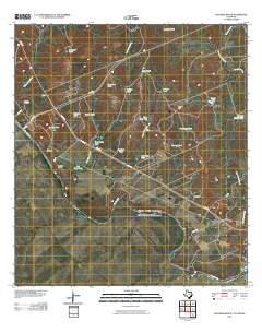
Layered GeoPDF 7.5 Minute Quadrangle Map. Layers of geospatial data include orthoimagery, roads, grids, geographic names, elevation contours, hydrography, and other selected map features.
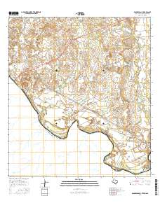
Layered GeoPDF 7.5 Minute Quadrangle Map. Layers of geospatial data include orthoimagery, roads, grids, geographic names, elevation contours, hydrography, and other selected map features.
There are few resources that provide managers cross-scale information for planning climate adaptation strategies for species and taxa at risk. Appropriate allocation of resources requires an understanding of mechanisms influencing a species’ risk to global change. Dr. Griffis-Kyle will produce a manuscript for peer-reviewed publication and create content for web pages that can be included on the Desert LCC website that provide modules on amphibian climate adaptation strategies. This work is associated with addressing Desert LCC Critical Management Question 4: Physiological Stress of Climate Change and follows a webinar that Dr. Griffis-Kyle presented for the Desert LCC’s CMQ 4 team, titled “Climate and Desert Amphibian...
Categories: Data,
Web Site;
Types: Map Service,
OGC WFS Layer,
OGC WMS Layer,
OGC WMS Service;
Tags: 2014,
AZ-01,
AZ-02,
AZ-03,
AZ-04,
The Desert Landscape Conservation Cooperative (LCC) is a partnership formed and directed by resource management entities as well as interested public and private entities in the Mojave, Sonoran, and Chihuahuan Desert and montane sky island regions of the southwestern United States and northern Mexico. Desert LCC science depends on access to transboundary base datasets. Given the importance of vegetation such as grasslands and riparian vegetation in conservation science, a bi-national, landscape-scale vegetation data layer with classes relevant to Desert LCC research is crucial. One objective of this project is to investigate appropriate methodologies and landscape scales to create a Desert LCC binational land cover...
Categories: Data;
Tags: Academics & scientific researchers,
Aquascalientes,
Arizona,
Baja California,
California,
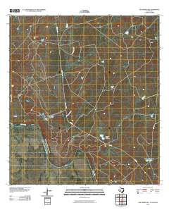
Layered GeoPDF 7.5 Minute Quadrangle Map. Layers of geospatial data include orthoimagery, roads, grids, geographic names, elevation contours, hydrography, and other selected map features.
Layered GeoPDF 7.5 Minute Quadrangle Map. Layers of geospatial data include orthoimagery, roads, grids, geographic names, elevation contours, hydrography, and other selected map features.
The Desert LCC identified the need for a Protected Areas spatial database that showed land ownership, management designations and conservation status for lands in the United States and Mexico. However, the existing Protected Areas database was found to be particularly prone to boundary and database errors that affected its potential use. This USGS project will develop a single, seamless, error-free Protected Areas dataset for the full geographic scope of the Desert LCC. This will involve acquiring numerous spatial layers from Federal, State, and NGO organizations which are responsible for administering and/or managing areas that have a designated protected status. Protected Area will be categorized as defined by...
Categories: Data,
Project;
Types: Map Service,
OGC WFS Layer,
OGC WMS Layer,
OGC WMS Service;
Tags: 2012,
AZ-01,
AZ-02,
AZ-03,
AZ-04,
There are few resources that provide managers cross-scale information for planning climate adaptation strategies for species and taxa at risk. Appropriate allocation of resources requires an understanding of mechanisms influencing a species’ risk to global change. Dr. Griffis-Kyle will produce a manuscript for peer-reviewed publication and create content for web pages that can be included on the Desert LCC website that provide modules on amphibian climate adaptation strategies. This work is associated with addressing Desert LCC Critical Management Question 4: Physiological Stress of Climate Change and follows a webinar that Dr. Griffis-Kyle presented for the Desert LCC’s CMQ 4 team, titled “Climate and Desert Amphibian...
Categories: Data,
Project;
Types: Map Service,
OGC WFS Layer,
OGC WMS Layer,
OGC WMS Service;
Tags: 2014,
AZ-01,
AZ-02,
AZ-03,
AZ-04,
The Desert Landscape Conservation Cooperative (Desert LCC) is designing a process that will: produce spatially explicit data and information about focal resources, chosen by the Desert LCC partners; seek to understand the effects of climate change and other landscape stressors on natural resources; integrate social and economic information to understand what these resources might look like in the future; and look at specific focal areas to develop collaborative adaptation responses that are useful and implementable by our partners.Where this work is being done: Dos Rios Eastern Mojave Desert Madrean Watersheds In the face of rapid climatic shifts, natural resource managers and conservation practitioners...
Categories: Data,
Project;
Types: Map Service,
OGC WFS Layer,
OGC WMS Layer,
OGC WMS Service;
Tags: 2014,
AZ-01,
AZ-02,
AZ-03,
AZ-04,
Article Abstract: Although riparian and aquatic ecosystems make up a small fraction of the area in arid and semi-arid lands, they are critical for the survival of desert life. There are, however, few compendia of efforts to define the quantity of water needed to maintain these ecosystems and understand the risks and stressors to them. Through our analysis we found that 62% of the rivers examined in the deserts of the U.S. and Mexico have had just one study over the past four decades and 67% of studies used qualitative methods. Furthermore, only one-third of the 312 species catalogued in our work have been studied more than once and only 5% have been considered five or more times. The most common risks or stressors...
Categories: Data,
Publication;
Types: Citation,
Map Service,
OGC WFS Layer,
OGC WMS Layer,
OGC WMS Service;
Tags: Aquascalientes,
Arizona,
Baja California,
California,
Chihuahua,
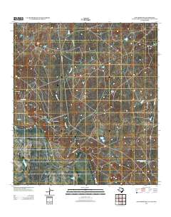
Layered GeoPDF 7.5 Minute Quadrangle Map. Layers of geospatial data include orthoimagery, roads, grids, geographic names, elevation contours, hydrography, and other selected map features.
The National Hydrography Dataset (NHD) is a feature-based database that interconnects and uniquely identifies the stream segments or reaches that make up the nation's surface water drainage system. NHD data was originally developed at 1:100,000-scale and exists at that scale for the whole country. This high-resolution NHD, generally developed at 1:24,000/1:12,000 scale, adds detail to the original 1:100,000-scale NHD. (Data for Alaska, Puerto Rico and the Virgin Islands was developed at high-resolution, not 1:100,000 scale.) Local resolution NHD is being developed where partners and data exist. The NHD contains reach codes for networked features, flow direction, names, and centerline representations for areal water...
This project will be focused on hosting 2-3 workshops in 2013 to train people to conduct the Springs Stewardship Institute’s spring assessment protocol and promote it as a standardized method. This will facilitate standardized data collection across the landscape that can contribute to a broad-scale inventory and assessment of springs, seeps, and aquatic resources throughout the Desert LCC.
Categories: Data,
Project;
Types: Downloadable,
Map Service,
OGC WFS Layer,
OGC WMS Layer,
OGC WMS Service,
Shapefile;
Tags: 2012,
AZ-01,
AZ-02,
AZ-03,
AZ-04,
In the desert southwest biodiversity is facing a changing landscape due to human population growth, expansion of energy development, and from the persistent effects of climate change among other threats. The 2012 Desert LCC science needs document recognized the importance of modeling and predicting habitat area, fragmentation and corridor network connectivity for a broad range of wildlife taxa. Tools and methods from conservation planning are available to address some of these issues, but tools to evaluate the expected benefits of corridors in mitigating climate change effects are only in their infancy. This USGS project will use quantitative spatial analysis and principles from landscape ecology to determine where...
Categories: Data,
Project;
Types: Downloadable,
Map Service,
OGC WFS Layer,
OGC WMS Layer,
OGC WMS Service,
Shapefile;
Tags: 2012,
AZ-01,
AZ-02,
AZ-03,
AZ-04,
|

|
