Filters: Tags: OGALLALA (X) > partyWithName: U.S. Geological Survey (X)
19 results (10ms)|
Filters
Date Range
Contacts
Categories Tag Types Tag Schemes |

These data were released prior to the October 1, 2016 effective date for the USGS’s policy dictating the review, approval, and release of scientific data as referenced in USGS Survey Manual Chapter 502.8 Fundamental Science Practices: Review and Approval of Scientific Data for Release. The U.S. Geological Survey and its partners have collaborated to complete airborne geophysical surveys for areas of the North and South Platte River valleys and Lodgepole Creek in western Nebraska. The objective of the surveys was to map the aquifers and bedrock topography of selected areas to help improve the understanding of groundwater-surface-water relationships to be used in water management decisions. Frequency-domain (2008...

These data were released prior to the October 1, 2016 effective date for the USGS’s policy dictating the review, approval, and release of scientific data as referenced in USGS Survey Manual Chapter 502.8 Fundamental Science Practices: Review and Approval of Scientific Data for Release. The U.S. Geological Survey and its partners have collaborated to complete airborne geophysical surveys for areas of the North and South Platte River valleys and Lodgepole Creek in western Nebraska. The objective of the surveys was to map the aquifers and bedrock topography of selected areas to help improve the understanding of groundwater-surface-water relationships to be used in water management decisions. Frequency-domain (2008...

These data were released prior to the October 1, 2016 effective date for the USGS’s policy dictating the review, approval, and release of scientific data as referenced in USGS Survey Manual Chapter 502.8 Fundamental Science Practices: Review and Approval of Scientific Data for Release. The U.S. Geological Survey and its partners have collaborated to complete airborne geophysical surveys for areas of the North and South Platte River valleys and Lodgepole Creek in western Nebraska. The objective of the surveys was to map the aquifers and bedrock topography of selected areas to help improve the understanding of groundwater-surface-water relationships to be used in water management decisions. Frequency-domain (2008...
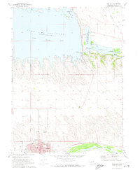
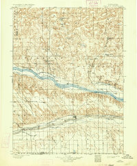
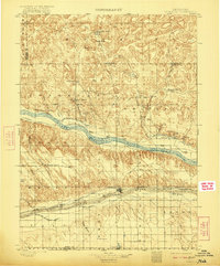
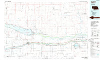
USGS Historical Quadrangle in GeoPDF.
USGS Historical Quadrangle in GeoPDF.

These data were released prior to the October 1, 2016 effective date for the USGS’s policy dictating the review, approval, and release of scientific data as referenced in USGS Survey Manual Chapter 502.8 Fundamental Science Practices: Review and Approval of Scientific Data for Release. The U.S. Geological Survey and its partners have collaborated to complete airborne geophysical surveys for areas of the North and South Platte River valleys and Lodgepole Creek in western Nebraska. The objective of the surveys was to map the aquifers and bedrock topography of selected areas to help improve the understanding of groundwater-surface-water relationships to be used in water management decisions. Frequency-domain (2008...
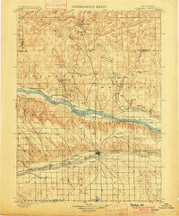
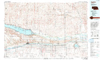
USGS Historical Quadrangle in GeoPDF.
USGS Historical Quadrangle in GeoPDF.

These data were released prior to the October 1, 2016 effective date for the USGS’s policy dictating the review, approval, and release of scientific data as referenced in USGS Survey Manual Chapter 502.8 Fundamental Science Practices: Review and Approval of Scientific Data for Release. The U.S. Geological Survey and its partners have collaborated to complete airborne geophysical surveys for areas of the North and South Platte River valleys and Lodgepole Creek in western Nebraska. The objective of the surveys was to map the aquifers and bedrock topography of selected areas to help improve the understanding of groundwater-surface-water relationships to be used in water management decisions. Frequency-domain (2008...

These data were released prior to the October 1, 2016 effective date for the USGS’s policy dictating the review, approval, and release of scientific data as referenced in USGS Survey Manual Chapter 502.8 Fundamental Science Practices: Review and Approval of Scientific Data for Release. The U.S. Geological Survey and its partners have collaborated to complete airborne geophysical surveys for areas of the North and South Platte River valleys and Lodgepole Creek in western Nebraska. The objective of the surveys was to map the aquifers and bedrock topography of selected areas to help improve the understanding of groundwater-surface-water relationships to be used in water management decisions. Frequency-domain (2008...
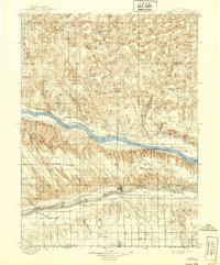
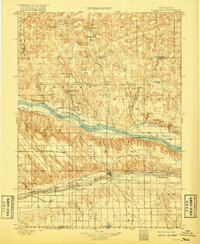
USGS Historical Quadrangle in GeoPDF.

These data were released prior to the October 1, 2016 effective date for the USGS’s policy dictating the review, approval, and release of scientific data as referenced in USGS Survey Manual Chapter 502.8 Fundamental Science Practices: Review and Approval of Scientific Data for Release. The U.S. Geological Survey and its partners have collaborated to complete airborne geophysical surveys for areas of the North and South Platte River valleys and Lodgepole Creek in western Nebraska. The objective of the surveys was to map the aquifers and bedrock topography of selected areas to help improve the understanding of groundwater-surface-water relationships to be used in water management decisions. Frequency-domain (2008...
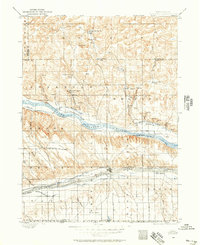
USGS Historical Quadrangle in GeoPDF.
USGS Historical Quadrangle in GeoPDF.
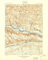
USGS Historical Quadrangle in GeoPDF.

These data were released prior to the October 1, 2016 effective date for the USGS’s policy dictating the review, approval, and release of scientific data as referenced in USGS Survey Manual Chapter 502.8 Fundamental Science Practices: Review and Approval of Scientific Data for Release. The U.S. Geological Survey and its partners have collaborated to complete airborne geophysical surveys for areas of the North and South Platte River valleys and Lodgepole Creek in western Nebraska. The objective of the surveys was to map the aquifers and bedrock topography of selected areas to help improve the understanding of groundwater-surface-water relationships to be used in water management decisions. Frequency-domain (2008...
USGS Historical Quadrangle in GeoPDF.
USGS Historical Quadrangle in GeoPDF.

These data were released prior to the October 1, 2016 effective date for the USGS’s policy dictating the review, approval, and release of scientific data as referenced in USGS Survey Manual Chapter 502.8 Fundamental Science Practices: Review and Approval of Scientific Data for Release. The U.S. Geological Survey and its partners have collaborated to complete airborne geophysical surveys for areas of the North and South Platte River valleys and Lodgepole Creek in western Nebraska. The objective of the surveys was to map the aquifers and bedrock topography of selected areas to help improve the understanding of groundwater- surface-water relationships to be used in water management decisions. Frequency-domain (2008...
|

|
