Filters: Tags: OH-BE-JOYFUL (X)
14 results (76ms)|
Filters
Date Range
Extensions Types
Contacts
Categories Tag Types Tag Schemes |
This data set contains imagery from the National Agriculture Imagery Program (NAIP). The NAIP program is administered by USDA FSA and has been established to support two main FSA strategic goals centered on agricultural production. These are, increase stewardship of America's natural resources while enhancing the environment, and to ensure commodities are procured and distributed effectively and efficiently to increase food security. The NAIP program supports these goals by acquiring and providing ortho imagery that has been collected during the agricultural growing season in the U.S. The NAIP ortho imagery is tailored to meet FSA requirements and is a fundamental tool used to support FSA farm and conservation programs....
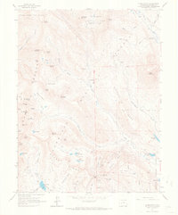
USGS Historical Quadrangle in GeoPDF.
This data set contains imagery from the National Agriculture Imagery Program (NAIP). The NAIP program is administered by USDA FSA and has been established to support two main FSA strategic goals centered on agricultural production. These are, increase stewardship of America's natural resources while enhancing the environment, and to ensure commodities are procured and distributed effectively and efficiently to increase food security. The NAIP program supports these goals by acquiring and providing ortho imagery that has been collected during the agricultural growing season in the U.S. The NAIP ortho imagery is tailored to meet FSA requirements and is a fundamental tool used to support FSA farm and conservation programs....
Surface electrical resistivity tomography, magnetic, and gravity surveys were conducted in July 2017 in the greater East River Watershed near Crested Butte Colorado with a focused effort in Redwell Basin as part of a broader study of the role of bedrock groundwater in the hydrogeology of mineralized mountain watersheds. Approximately ten kilometers of total field magnetics data were acquired on July 29, 2017 with a Geometrics G-858 cesium vapor magnetometer that detects changes in deep (tens of meters to kilometers) geologic structure based on variations in the magnetic properties of different formations. This data release includes the raw and processed magnetics data. They are provided as digital data, and data...
Categories: Data;
Types: Downloadable,
Map Service,
OGC WFS Layer,
OGC WMS Layer,
Shapefile;
Tags: Brush Creek,
Colorado,
Crested Butte,
East River,
GGGSC,
Surface electrical resistivity tomography (ERT), time-domain electromagnetics (TEM), nuclear magnetic resonance (NMR), magnetics, and gravity data were acquired in 2016, 2017 and 2018 in the greater East River Watershed near Crested Butte Colorado with a focused effort in Redwell Basin. Five ERT profiles were acquired within Redwell Basin and Brush Creek to map geologic structure at depths up to 40 meters, depending on the subsurface resistivity, using the Advanced Geosciences, Inc. SuperSting R8 resistivity meter. Approximately ten kilometers of total field magnetics data were acquired with a Geometrics G-858 cesium vapor magnetometer that detects changes in deep (tens of meters to kilometers) geologic structure...
Categories: Data;
Types: Downloadable,
Map Service,
OGC WFS Layer,
OGC WMS Layer,
Shapefile;
Tags: Brush Creek,
Colorado,
Crested Butte,
East River,
Environmental Health,
Surface electrical resistivity tomography, magnetic, and gravity surveys were conducted in July 2017 in the greater East River Watershed near Crested Butte Colorado with a focused effort in Redwell Basin as part of a broader study of the role of bedrock groundwater in the hydrogeology of mineralized mountain watersheds. Ten gravity stations were acquired with a LaCoste and Romberg G-model relative gravimeter to map density variations. This data release includes principal facts for the gravity stations provided as digital data. Data fields are defined in the data dictionary.
Categories: Data;
Types: Downloadable,
Map Service,
OGC WFS Layer,
OGC WMS Layer,
OGC WMS Service,
Shapefile;
Tags: Brush Creek,
Colorado,
Crested Butte,
East River,
GGGSC,

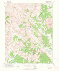
USGS Historical Quadrangle in GeoPDF.
This data set contains imagery from the National Agriculture Imagery Program (NAIP). The NAIP program is administered by USDA FSA and has been established to support two main FSA strategic goals centered on agricultural production. These are, increase stewardship of America's natural resources while enhancing the environment, and to ensure commodities are procured and distributed effectively and efficiently to increase food security. The NAIP program supports these goals by acquiring and providing ortho imagery that has been collected during the agricultural growing season in the U.S. The NAIP ortho imagery is tailored to meet FSA requirements and is a fundamental tool used to support FSA farm and conservation programs....
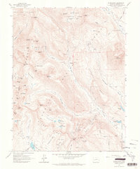
USGS Historical Quadrangle in GeoPDF.
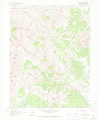
USGS Historical Quadrangle in GeoPDF.
USGS Historical Quadrangle in GeoPDF.
This data set contains imagery from the National Agriculture Imagery Program (NAIP). The NAIP program is administered by USDA FSA and has been established to support two main FSA strategic goals centered on agricultural production. These are, increase stewardship of America's natural resources while enhancing the environment, and to ensure commodities are procured and distributed effectively and efficiently to increase food security. The NAIP program supports these goals by acquiring and providing ortho imagery that has been collected during the agricultural growing season in the U.S. The NAIP ortho imagery is tailored to meet FSA requirements and is a fundamental tool used to support FSA farm and conservation programs....

USGS Historical Quadrangle in GeoPDF.
Surface geophysical surveys were conducted from 2016 to 2018 in the greater East River Watershed near Crested Butte Colorado with a focused effort in Redwell Basin as part of a broader study of the role of bedrock groundwater in the hydrogeology of mineralized mountain watersheds. Five electrical resistivity tomography (ERT) profiles were acquired within Redwell Basin and Brush Creek to map geologic structure at depths up to 40 meters, depending on the subsurface resistivity, using the Advanced Geosciences, Inc. SuperSting R8 resistivity meter. This data release includes the raw and processed resistivity data as well as inverted resistivity models. All are provided as digital data, and data fields for each file...
Categories: Data;
Types: Downloadable,
Map Service,
OGC WFS Layer,
OGC WMS Layer,
Shapefile;
Tags: Brush Creek,
Colorado,
Crested Butte,
East River,
GGGSC,
|

|
