Filters: Tags: Ouray County (X)
166 results (185ms)|
Filters
Date Range
Extensions Types Contacts
Categories Tag Types
|
Audiomagnetotelluric sounding data in the Silverton Caldera complex, Colorado, 2019; Station AMTMB09
This dataset includes audiomagnetotelluric (AMT) sounding data collected in July 2019 in the Silverton Caldera complex, Colorado, in the Southern Rocky Mountain Volcanic Field, by the U.S. Geological Survey (USGS). Along with geologic mapping, airborne magnetics, airborne electromagnetics, and magnetotellurics, the USGS collected AMT data at 26 sites along five profiles ranging from 2 to 5 kilometers in length: across Red Mountain of the Silverton caldera, within the caldera in Eureka Graben, across the south-eastern margin of the caldera along Arrastra Gulch, across the southern margin of the caldera along the western margin of Kendall Mountain, and across the south-western margin of the caldera along South Fork...
This dataset includes magnetotelluric (MT) sounding data collected in July 2019 in the Silverton Caldera complex, Colorado, in the Southern Rocky Mountain Volcanic Field, by the U.S. Geological Survey (USGS). Along with geologic mapping, airborne magnetics, airborne electromagnetics, and audiomagnetotellurics, the USGS collected MT data at 24 sites along five profiles ranging from 2 to 5 kilometers in length: across Red Mountain of the Silverton caldera, within the caldera in Eureka Graben, across the south-eastern margin of the caldera along Arrastra Gulch, across the southern margin of the caldera along the western margin of Kendall Mountain, and across the south-western margin of the caldera along South Fork...
This dataset includes magnetotelluric (MT) sounding data collected in July 2019 in the Silverton Caldera complex, Colorado, in the Southern Rocky Mountain Volcanic Field, by the U.S. Geological Survey (USGS). Along with geologic mapping, airborne magnetics, airborne electromagnetics, and audiomagnetotellurics, the USGS collected MT data at 24 sites along five profiles ranging from 2 to 5 kilometers in length: across Red Mountain of the Silverton caldera, within the caldera in Eureka Graben, across the south-eastern margin of the caldera along Arrastra Gulch, across the southern margin of the caldera along the western margin of Kendall Mountain, and across the south-western margin of the caldera along South Fork...
This data release includes magnetotelluric (MT) sounding data collected in July 2018 in the Silverton Caldera complex, Colorado, in the Southern Rocky Mountain Volcanic Field, by the U.S. Geological Survey (USGS). Along with geologic mapping, airborne magnetics, airborne electromagnetics, and audiomagnetotellurics, the USGS collected MT data at 22 sites along four profiles ranging from 3 to 6 kilometers in length across the north-western structural margin of the Silverton caldera in Mineral Basin (MB01-MB05), across the south-eastern margin of the caldera along Cunningham Creek (CC01-CC05), within the caldera in Eureka Graben (EG01-EG05), and within the caldera along upper Cement Creek near the Gold King mine (GK01-GK09).
This data release includes magnetotelluric (MT) sounding data collected in July 2018 in the Silverton Caldera complex, Colorado, in the Southern Rocky Mountain Volcanic Field, by the U.S. Geological Survey (USGS). Along with geologic mapping, airborne magnetics, airborne electromagnetics, and audiomagnetotellurics, the USGS collected MT data at 22 sites along four profiles ranging from 3 to 6 kilometers in length across the north-western structural margin of the Silverton caldera in Mineral Basin (MB01-MB05), across the south-eastern margin of the caldera along Cunningham Creek (CC01-CC05), within the caldera in Eureka Graben (EG01-EG05), and within the caldera along upper Cement Creek near the Gold King mine (GK01-GK09).
This data release includes magnetotelluric (MT) sounding data collected in July 2018 in the Silverton Caldera complex, Colorado, in the Southern Rocky Mountain Volcanic Field, by the U.S. Geological Survey (USGS). Along with geologic mapping, airborne magnetics, airborne electromagnetics, and audiomagnetotellurics, the USGS collected MT data at 22 sites along four profiles ranging from 3 to 6 kilometers in length across the north-western structural margin of the Silverton caldera in Mineral Basin (MB01-MB05), across the south-eastern margin of the caldera along Cunningham Creek (CC01-CC05), within the caldera in Eureka Graben (EG01-EG05), and within the caldera along upper Cement Creek near the Gold King mine (GK01-GK09).
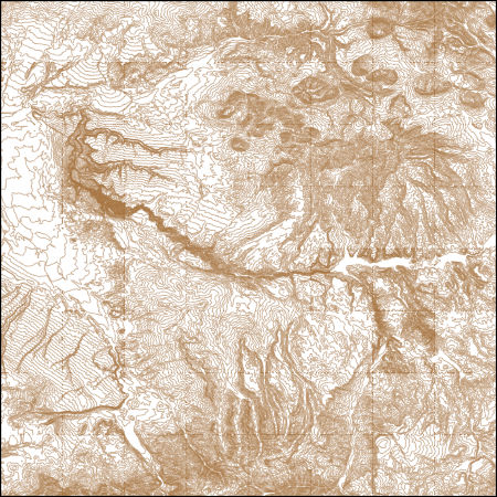
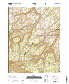
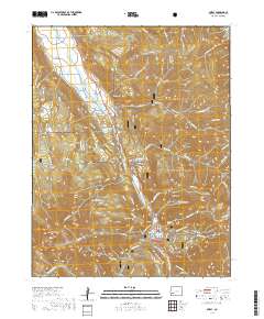
These vector contour lines are derived from the 3D Elevation Program using automated and semi-automated processes. They were created to support 1:24,000-scale CONUS and Hawaii, 1:25,000-scale Alaska, and 1:20,000-scale Puerto Rico / US Virgin Island topographic map products, but are also published in this GIS vector format. Contour intervals are assigned by 7.5-minute quadrangle, so this vector dataset is not visually seamless across quadrangle boundaries. The vector lines have elevation attributes (in feet above mean sea level on NAVD88), but this dataset does not carry line symbols or annotation.
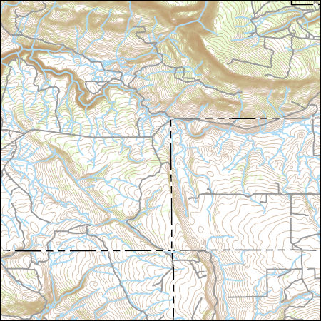
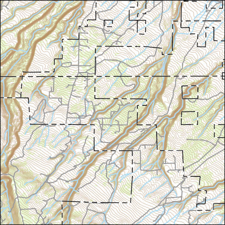
Layers of geospatial data include contours, boundaries, land cover, hydrography, roads, transportation, geographic names, structures, and other selected map features.
Layers of geospatial data include contours, boundaries, land cover, hydrography, roads, transportation, geographic names, structures, and other selected map features.
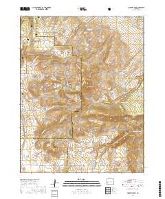
Layered geospatial PDF 7.5 Minute Quadrangle Map. Layers of geospatial data include orthoimagery, roads, grids, geographic names, elevation contours, hydrography, and other selected map features. This map is derived from GIS (geospatial information system) data. It represents a repackaging of GIS data in traditional map form, not creation of new information. The geospatial data in this map are from selected National Map data holdings and other government sources.
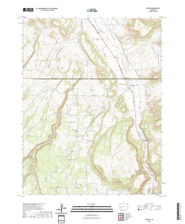
Layered geospatial PDF 7.5 Minute Quadrangle Map. Layers of geospatial data include orthoimagery, roads, grids, geographic names, elevation contours, hydrography, and other selected map features. This map is derived from GIS (geospatial information system) data. It represents a repackaging of GIS data in traditional map form, not creation of new information. The geospatial data in this map are from selected National Map data holdings and other government sources.
Layered geospatial PDF 7.5 Minute Quadrangle Map. Layers of geospatial data include orthoimagery, roads, grids, geographic names, elevation contours, hydrography, and other selected map features. This map is derived from GIS (geospatial information system) data. It represents a repackaging of GIS data in traditional map form, not creation of new information. The geospatial data in this map are from selected National Map data holdings and other government sources.
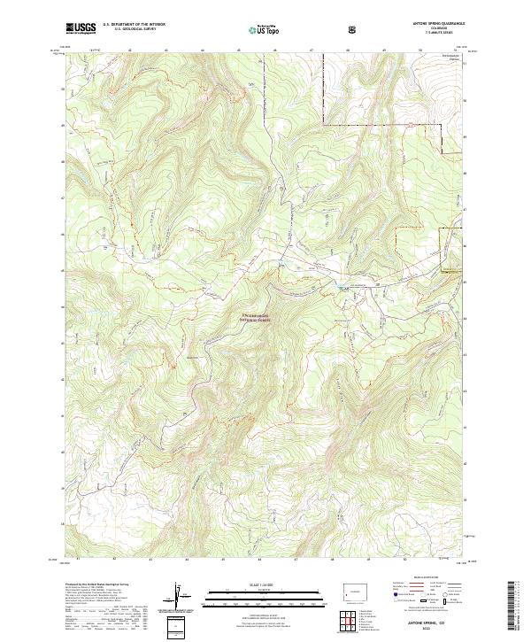
Layered geospatial PDF 7.5 Minute Quadrangle Map. Layers of geospatial data include orthoimagery, roads, grids, geographic names, elevation contours, hydrography, and other selected map features. This map is derived from GIS (geospatial information system) data. It represents a repackaging of GIS data in traditional map form, not creation of new information. The geospatial data in this map are from selected National Map data holdings and other government sources.
The U.S. Geological Survey developed a coupled groundwater and surface-water flow (GSFLOW) model to represent the aquifers of the Colorado Plateau and Upper Colorado River Basin. The study area covers approximately 142,000 square miles and includes parts of Arizona, Colorado, New Mexico, Utah, and Wyoming. To support this modeling effort, groundwater well withdrawal volume data were needed from January 01, 1980 to September 30, 2022. These data were retrieved from online state databases. In addition to withdrawal-volume data, well-construction data including depths and/or perforated casing intervals were recorded when available from the databases and/or scanned driller’s logs. Arizona groundwater-withdrawal volume...
Layered geospatial PDF 7.5 Minute Quadrangle Map. Layers of geospatial data include orthoimagery, roads, grids, geographic names, elevation contours, hydrography, and other selected map features. This map is derived from GIS (geospatial information system) data. It represents a repackaging of GIS data in traditional map form, not creation of new information. The geospatial data in this map are from selected National Map data holdings and other government sources.
The 'Blowout' file is part of the Grover Heinrichs mining collection. Grover was the Vice President of Heinrichs GEOEXploration, located in Tucson, Arizona. The collection contains over 1,400 folders including economic geology reports, maps, photos, correspondence, drill logs and other related materials. The focus of much of the information is on the western United States, particularly Arizona, but the collection also includes files on mining activity throughout the United States, foreign countries, and 82 mineral commodities.
UNCOMPAHGRE RIVER NEAR RIDGWAY, CO.
UNCOMPAHGRE RIVER NEAR RIDGWAY, CO.
This dataset includes magnetotelluric (MT) sounding data collected in July 2019 in the Silverton Caldera complex, Colorado, in the Southern Rocky Mountain Volcanic Field, by the U.S. Geological Survey (USGS). Along with geologic mapping, airborne magnetics, airborne electromagnetics, and audiomagnetotellurics, the USGS collected MT data at 24 sites along five profiles ranging from 2 to 5 kilometers in length: across Red Mountain of the Silverton caldera, within the caldera in Eureka Graben, across the south-eastern margin of the caldera along Arrastra Gulch, across the southern margin of the caldera along the western margin of Kendall Mountain, and across the south-western margin of the caldera along South Fork...
This data release includes magnetotelluric (MT) sounding data collected in July 2018 in the Silverton Caldera complex, Colorado, in the Southern Rocky Mountain Volcanic Field, by the U.S. Geological Survey (USGS). Along with geologic mapping, airborne magnetics, airborne electromagnetics, and audiomagnetotellurics, the USGS collected MT data at 22 sites along four profiles ranging from 3 to 6 kilometers in length across the north-western structural margin of the Silverton caldera in Mineral Basin (MB01-MB05), across the south-eastern margin of the caldera along Cunningham Creek (CC01-CC05), within the caldera in Eureka Graben (EG01-EG05), and within the caldera along upper Cement Creek near the Gold King mine (GK01-GK09).
|

|
