Filters: Tags: Ouray County (X)
166 results (4.5s)|
Filters
Date Range
Extensions Types Contacts
Categories Tag Types
|
UNCOMPAHGRE RIVER NEAR RIDGWAY, CO.
This dataset includes magnetotelluric (MT) sounding data collected in July 2019 in the Silverton Caldera complex, Colorado, in the Southern Rocky Mountain Volcanic Field, by the U.S. Geological Survey (USGS). Along with geologic mapping, airborne magnetics, airborne electromagnetics, and audiomagnetotellurics, the USGS collected MT data at 24 sites along five profiles ranging from 2 to 5 kilometers in length: across Red Mountain of the Silverton caldera, within the caldera in Eureka Graben, across the south-eastern margin of the caldera along Arrastra Gulch, across the southern margin of the caldera along the western margin of Kendall Mountain, and across the south-western margin of the caldera along South Fork...
Audiomagnetotelluric sounding data in the Silverton Caldera complex, Colorado, 2019; Station AMTEG06
This dataset includes audiomagnetotelluric (AMT) sounding data collected in July 2019 in the Silverton Caldera complex, Colorado, in the Southern Rocky Mountain Volcanic Field, by the U.S. Geological Survey (USGS). Along with geologic mapping, airborne magnetics, airborne electromagnetics, and magnetotellurics, the USGS collected AMT data at 26 sites along five profiles ranging from 2 to 5 kilometers in length: across Red Mountain of the Silverton caldera, within the caldera in Eureka Graben, across the south-eastern margin of the caldera along Arrastra Gulch, across the southern margin of the caldera along the western margin of Kendall Mountain, and across the south-western margin of the caldera along South Fork...
Audiomagnetotelluric sounding data in the Silverton Caldera complex, Colorado, 2019; Station AMTSF06
This dataset includes audiomagnetotelluric (AMT) sounding data collected in July 2019 in the Silverton Caldera complex, Colorado, in the Southern Rocky Mountain Volcanic Field, by the U.S. Geological Survey (USGS). Along with geologic mapping, airborne magnetics, airborne electromagnetics, and magnetotellurics, the USGS collected AMT data at 26 sites along five profiles ranging from 2 to 5 kilometers in length: across Red Mountain of the Silverton caldera, within the caldera in Eureka Graben, across the south-eastern margin of the caldera along Arrastra Gulch, across the southern margin of the caldera along the western margin of Kendall Mountain, and across the south-western margin of the caldera along South Fork...
This data release includes magnetotelluric (MT) sounding data collected in July 2018 in the Silverton Caldera complex, Colorado, in the Southern Rocky Mountain Volcanic Field, by the U.S. Geological Survey (USGS). Along with geologic mapping, airborne magnetics, airborne electromagnetics, and audiomagnetotellurics, the USGS collected MT data at 22 sites along four profiles ranging from 3 to 6 kilometers in length across the north-western structural margin of the Silverton caldera in Mineral Basin (MB01-MB05), across the south-eastern margin of the caldera along Cunningham Creek (CC01-CC05), within the caldera in Eureka Graben (EG01-EG05), and within the caldera along upper Cement Creek near the Gold King mine (GK01-GK09).
This data release includes magnetotelluric (MT) sounding data collected in July 2018 in the Silverton Caldera complex, Colorado, in the Southern Rocky Mountain Volcanic Field, by the U.S. Geological Survey (USGS). Along with geologic mapping, airborne magnetics, airborne electromagnetics, and audiomagnetotellurics, the USGS collected MT data at 22 sites along four profiles ranging from 3 to 6 kilometers in length across the north-western structural margin of the Silverton caldera in Mineral Basin (MB01-MB05), across the south-eastern margin of the caldera along Cunningham Creek (CC01-CC05), within the caldera in Eureka Graben (EG01-EG05), and within the caldera along upper Cement Creek near the Gold King mine (GK01-GK09).
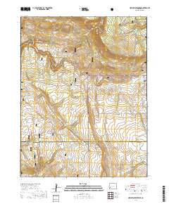
These vector contour lines are derived from the 3D Elevation Program using automated and semi-automated processes. They were created to support 1:24,000-scale CONUS and Hawaii, 1:25,000-scale Alaska, and 1:20,000-scale Puerto Rico / US Virgin Island topographic map products, but are also published in this GIS vector format. Contour intervals are assigned by 7.5-minute quadrangle, so this vector dataset is not visually seamless across quadrangle boundaries. The vector lines have elevation attributes (in feet above mean sea level on NAVD88), but this dataset does not carry line symbols or annotation.

Layers of geospatial data include contours, boundaries, land cover, hydrography, roads, transportation, geographic names, structures, and other selected map features.
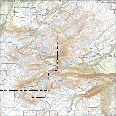
Layers of geospatial data include contours, boundaries, land cover, hydrography, roads, transportation, geographic names, structures, and other selected map features.
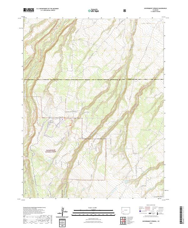
Layered geospatial PDF 7.5 Minute Quadrangle Map. Layers of geospatial data include orthoimagery, roads, grids, geographic names, elevation contours, hydrography, and other selected map features. This map is derived from GIS (geospatial information system) data. It represents a repackaging of GIS data in traditional map form, not creation of new information. The geospatial data in this map are from selected National Map data holdings and other government sources.
Layered geospatial PDF 7.5 Minute Quadrangle Map. Layers of geospatial data include orthoimagery, roads, grids, geographic names, elevation contours, hydrography, and other selected map features. This map is derived from GIS (geospatial information system) data. It represents a repackaging of GIS data in traditional map form, not creation of new information. The geospatial data in this map are from selected National Map data holdings and other government sources.
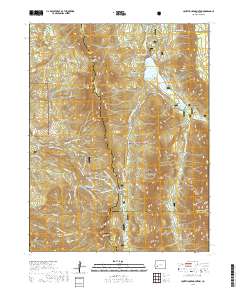
Layered geospatial PDF 7.5 Minute Quadrangle Map. Layers of geospatial data include orthoimagery, roads, grids, geographic names, elevation contours, hydrography, and other selected map features. This map is derived from GIS (geospatial information system) data. It represents a repackaging of GIS data in traditional map form, not creation of new information. The geospatial data in this map are from selected National Map data holdings and other government sources.
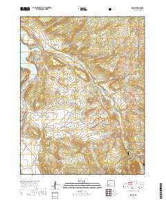
Layered geospatial PDF 7.5 Minute Quadrangle Map. Layers of geospatial data include orthoimagery, roads, grids, geographic names, elevation contours, hydrography, and other selected map features. This map is derived from GIS (geospatial information system) data. It represents a repackaging of GIS data in traditional map form, not creation of new information. The geospatial data in this map are from selected National Map data holdings and other government sources.
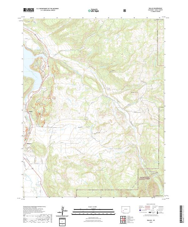
Layered geospatial PDF 7.5 Minute Quadrangle Map. Layers of geospatial data include orthoimagery, roads, grids, geographic names, elevation contours, hydrography, and other selected map features. This map is derived from GIS (geospatial information system) data. It represents a repackaging of GIS data in traditional map form, not creation of new information. The geospatial data in this map are from selected National Map data holdings and other government sources.
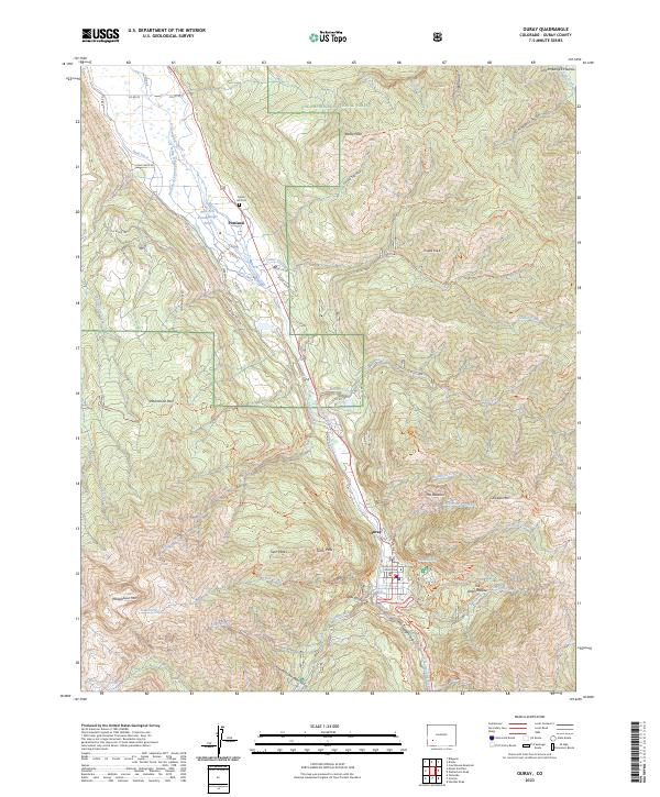
Layered geospatial PDF 7.5 Minute Quadrangle Map. Layers of geospatial data include orthoimagery, roads, grids, geographic names, elevation contours, hydrography, and other selected map features. This map is derived from GIS (geospatial information system) data. It represents a repackaging of GIS data in traditional map form, not creation of new information. The geospatial data in this map are from selected National Map data holdings and other government sources.
This dataset includes magnetotelluric (MT) sounding data collected in July 2019 in the Silverton Caldera complex, Colorado, in the Southern Rocky Mountain Volcanic Field, by the U.S. Geological Survey (USGS). Along with geologic mapping, airborne magnetics, airborne electromagnetics, and audiomagnetotellurics, the USGS collected MT data at 24 sites along five profiles ranging from 2 to 5 kilometers in length: across Red Mountain of the Silverton caldera, within the caldera in Eureka Graben, across the south-eastern margin of the caldera along Arrastra Gulch, across the southern margin of the caldera along the western margin of Kendall Mountain, and across the south-western margin of the caldera along South Fork...
This dataset includes magnetotelluric (MT) sounding data collected in July 2019 in the Silverton Caldera complex, Colorado, in the Southern Rocky Mountain Volcanic Field, by the U.S. Geological Survey (USGS). Along with geologic mapping, airborne magnetics, airborne electromagnetics, and audiomagnetotellurics, the USGS collected MT data at 24 sites along five profiles ranging from 2 to 5 kilometers in length: across Red Mountain of the Silverton caldera, within the caldera in Eureka Graben, across the south-eastern margin of the caldera along Arrastra Gulch, across the southern margin of the caldera along the western margin of Kendall Mountain, and across the south-western margin of the caldera along South Fork...
This dataset includes magnetotelluric (MT) sounding data collected in July 2019 in the Silverton Caldera complex, Colorado, in the Southern Rocky Mountain Volcanic Field, by the U.S. Geological Survey (USGS). Along with geologic mapping, airborne magnetics, airborne electromagnetics, and audiomagnetotellurics, the USGS collected MT data at 24 sites along five profiles ranging from 2 to 5 kilometers in length: across Red Mountain of the Silverton caldera, within the caldera in Eureka Graben, across the south-eastern margin of the caldera along Arrastra Gulch, across the southern margin of the caldera along the western margin of Kendall Mountain, and across the south-western margin of the caldera along South Fork...
This dataset includes magnetotelluric (MT) sounding data collected in July 2019 in the Silverton Caldera complex, Colorado, in the Southern Rocky Mountain Volcanic Field, by the U.S. Geological Survey (USGS). Along with geologic mapping, airborne magnetics, airborne electromagnetics, and audiomagnetotellurics, the USGS collected MT data at 24 sites along five profiles ranging from 2 to 5 kilometers in length: across Red Mountain of the Silverton caldera, within the caldera in Eureka Graben, across the south-eastern margin of the caldera along Arrastra Gulch, across the southern margin of the caldera along the western margin of Kendall Mountain, and across the south-western margin of the caldera along South Fork...
This dataset includes magnetotelluric (MT) sounding data collected in July 2019 in the Silverton Caldera complex, Colorado, in the Southern Rocky Mountain Volcanic Field, by the U.S. Geological Survey (USGS). Along with geologic mapping, airborne magnetics, airborne electromagnetics, and audiomagnetotellurics, the USGS collected MT data at 24 sites along five profiles ranging from 2 to 5 kilometers in length: across Red Mountain of the Silverton caldera, within the caldera in Eureka Graben, across the south-eastern margin of the caldera along Arrastra Gulch, across the southern margin of the caldera along the western margin of Kendall Mountain, and across the south-western margin of the caldera along South Fork...
|

|
