Filters: Tags: Oxnard (X)
12 results (16ms)|
Filters
Date Range
Types Contacts
Categories Tag Types Tag Schemes |
The U.S. Geological Survey (USGS), in cooperation with the California State Water Resources Control Board (SWRCB), compiled Fall 2017 fluid level elevation data from idle oil and gas wells in the Oxnard Oil Field to estimate vertical hydraulic head difference between oil production and overlying groundwater aquifer zones. Fluid elevations came from two sources, measurements in idle oil and gas wells and groundwater elevations in water wells in the overlying aquifer estimated at the points of idle well measurements using geographic information system (GIS) procedures. The fluid elevations from idle oil and gas wells were compiled by the California Geologic Energy Management Division (CalGEM) as part of their Idle...
Categories: Data;
Types: Map Service,
OGC WFS Layer,
OGC WMS Layer,
OGC WMS Service;
Tags: California,
Energy Resources,
Hydrology,
Oxnard,
USGS Science Data Catalog (SDC),
The U.S. Geological Survey (USGS) in cooperation with the California State Water Resources Control Board collected produced water and gas samples in the Oxnard Oil Field in Ventura County in August 2018 and the Placerita Oil Field in Los Angeles County in December 2018. Sampled sites included oil wells; injectate from tanks, pipelines, and injection wells where produced water from many wells, after removal of oil, is stored or transported prior to underground injection; and integrated produced water from many oil wells collected from pipelines before oil removal. This digital dataset contains the site information, analyzing laboratories and methods, and water and gas chemistry and quality-control results for these...
This data set contains imagery from the National Agriculture Imagery Program (NAIP). The NAIP program is administered by USDA FSA and has been established to support two main FSA strategic goals centered on agricultural production. These are, increase stewardship of America's natural resources while enhancing the environment, and to ensure commodities are procured and distributed effectively and efficiently to increase food security. The NAIP program supports these goals by acquiring and providing ortho imagery that has been collected during the agricultural growing season in the U.S. The NAIP ortho imagery is tailored to meet FSA requirements and is a fundamental tool used to support FSA farm and conservation programs....
This data set contains imagery from the National Agriculture Imagery Program (NAIP). The NAIP program is administered by USDA FSA and has been established to support two main FSA strategic goals centered on agricultural production. These are, increase stewardship of America's natural resources while enhancing the environment, and to ensure commodities are procured and distributed effectively and efficiently to increase food security. The NAIP program supports these goals by acquiring and providing ortho imagery that has been collected during the agricultural growing season in the U.S. The NAIP ortho imagery is tailored to meet FSA requirements and is a fundamental tool used to support FSA farm and conservation programs....
This data set contains imagery from the National Agriculture Imagery Program (NAIP). The NAIP program is administered by USDA FSA and has been established to support two main FSA strategic goals centered on agricultural production. These are, increase stewardship of America's natural resources while enhancing the environment, and to ensure commodities are procured and distributed effectively and efficiently to increase food security. The NAIP program supports these goals by acquiring and providing ortho imagery that has been collected during the agricultural growing season in the U.S. The NAIP ortho imagery is tailored to meet FSA requirements and is a fundamental tool used to support FSA farm and conservation programs....
This data set contains imagery from the National Agriculture Imagery Program (NAIP). The NAIP program is administered by USDA FSA and has been established to support two main FSA strategic goals centered on agricultural production. These are, increase stewardship of America's natural resources while enhancing the environment, and to ensure commodities are procured and distributed effectively and efficiently to increase food security. The NAIP program supports these goals by acquiring and providing ortho imagery that has been collected during the agricultural growing season in the U.S. The NAIP ortho imagery is tailored to meet FSA requirements and is a fundamental tool used to support FSA farm and conservation programs....
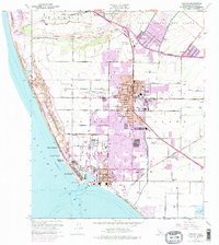
USGS Historical Quadrangle in GeoPDF.
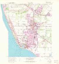
USGS Historical Quadrangle in GeoPDF.
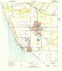
USGS Historical Quadrangle in GeoPDF.
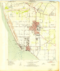
USGS Historical Quadrangle in GeoPDF.
The U.S. Geological Survey (USGS) in cooperation with the California State Water Resources Control Board (SWRCB) compiled and digitized mud logs from oil and gas wells in the Oxnard Oil Field area. Scanned copies of the mud logs were downloaded from the California Geologic Energy Management Division (CalGEM) online data and were digitized. Thirteen available mud logs associated with the Pliocene Tar Sand pool code (Vaca Tar Sand) were digitized. Mud-logging technology (mud logs) allows for identification and relative concentration measurement in parts per million by volume (ppmv) of light hydrocarbon gases (methane through pentane) occurring in drilling mud returned to the surface throughout the drilling process...
Categories: Data;
Types: Map Service,
OGC WFS Layer,
OGC WMS Layer,
OGC WMS Service;
Tags: California,
Energy Resources,
Geochemistry,
Geophysics,
Hydrology,
USGS Historical Quadrangle in GeoPDF.
|

|
