Filters: Tags: PEE DEE (X)
8 results (56ms)|
Filters
Date Range
Types Contacts
Tag Types Tag Schemes |
This data set contains imagery from the National Agriculture Imagery Program (NAIP). The NAIP program is administered by USDA FSA and has been established to support two main FSA strategic goals centered on agricultural production. These are, increase stewardship of America's natural resources while enhancing the environment, and to ensure commodities are procured and distributed effectively and efficiently to increase food security. The NAIP program supports these goals by acquiring and providing ortho imagery that has been collected during the agricultural growing season in the U.S. The NAIP ortho imagery is tailored to meet FSA requirements and is a fundamental tool used to support FSA farm and conservation programs....
The Cape Fear and Pee Dee River Basins in North Carolina and South Carolina were chosen as a focus area study (FAS) for the U.S. Geological Survey (USGS) National Water Census (NWC) in 2016. The objective of the NWC is to place technical information and tools in the hands of stake holders so that they can make decisions on water availability. The USGS South Atlantic Water Science Center, comprised of North Carolina, South Carolina, and Georgia, conducted a 3-year study of water use and availability to provide information related to the competing societal and ecological water needs in the Southeastern Atlantic Coastal Basins of the Carolinas. The Coastal Carolinas study area includes the Pee Dee and Cape Fear River...
As part of the Coastal Carolinas Focus Area Study of the U.S. Geological Survey National Water Census Program, the Soil and Water Assessment Tool (SWAT) was used to develop models for the Pee Dee River Basin, North Carolina and South Carolina, to simulate future streamflow and irrigation demand based on land use, climate, and water demand projections. SWAT is a basin-scale, process-based watershed model with the capability of simulating water-management scenarios. Model basins were divided into approximately two-square mile subbasins and subsequently divided into smaller, discrete hydrologic response units based on land use, slope, and soil type. The calibration period for the historic model was 2000 to 2014. The...
Types: Map Service,
OGC WFS Layer,
OGC WMS Layer,
OGC WMS Service;
Tags: Alexander,
Alleghany,
Anson,
Ashe,
Bladen,
This data set contains imagery from the National Agriculture Imagery Program (NAIP). The NAIP program is administered by USDA FSA and has been established to support two main FSA strategic goals centered on agricultural production. These are, increase stewardship of America's natural resources while enhancing the environment, and to ensure commodities are procured and distributed effectively and efficiently to increase food security. The NAIP program supports these goals by acquiring and providing ortho imagery that has been collected during the agricultural growing season in the U.S. The NAIP ortho imagery is tailored to meet FSA requirements and is a fundamental tool used to support FSA farm and conservation programs....
The American alligator (Alligator mississippiensis) is a species of ecological and economic importance in the southeastern United States. Within South Carolina, alligators are subject to private and public harvest programs, as well as nuisance removal. These management activities can have different impacts across alligator size classes that may not be apparent through widely-used monitoring techniques such as nightlight surveys. We synthesized multiple datasets within an integrated population model (IPM) to estimate size class-specific survival and abundance estimates, that would not be estimable through separate, non-integrated modeling frameworks. The IPM framework included a multistate mark-recapture-recovery...
This data set contains imagery from the National Agriculture Imagery Program (NAIP). The NAIP program is administered by USDA FSA and has been established to support two main FSA strategic goals centered on agricultural production. These are, increase stewardship of America's natural resources while enhancing the environment, and to ensure commodities are procured and distributed effectively and efficiently to increase food security. The NAIP program supports these goals by acquiring and providing ortho imagery that has been collected during the agricultural growing season in the U.S. The NAIP ortho imagery is tailored to meet FSA requirements and is a fundamental tool used to support FSA farm and conservation programs....
This data set contains imagery from the National Agriculture Imagery Program (NAIP). The NAIP program is administered by USDA FSA and has been established to support two main FSA strategic goals centered on agricultural production. These are, increase stewardship of America's natural resources while enhancing the environment, and to ensure commodities are procured and distributed effectively and efficiently to increase food security. The NAIP program supports these goals by acquiring and providing ortho imagery that has been collected during the agricultural growing season in the U.S. The NAIP ortho imagery is tailored to meet FSA requirements and is a fundamental tool used to support FSA farm and conservation programs....
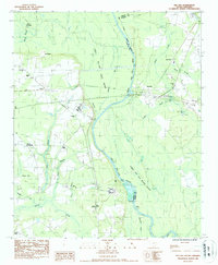
USGS Historical Quadrangle in GeoPDF.
|

|
