Filters: Tags: PINEWOOD (X)
9 results (49ms)|
Filters
Date Range
Types Contacts
Categories Tag Types Tag Schemes |
This data set contains imagery from the National Agriculture Imagery Program (NAIP). The NAIP program is administered by USDA FSA and has been established to support two main FSA strategic goals centered on agricultural production. These are, increase stewardship of America's natural resources while enhancing the environment, and to ensure commodities are procured and distributed effectively and efficiently to increase food security. The NAIP program supports these goals by acquiring and providing ortho imagery that has been collected during the agricultural growing season in the U.S. The NAIP ortho imagery is tailored to meet FSA requirements and is a fundamental tool used to support FSA farm and conservation programs....
In a crude-oil-contaminated sandy aquifer at the Bemidji site in northern Minnesota, biodegradation of petroleum hydrocarbons resulted in transient increases in magnetic susceptibility under high water table conditions. The magnetic susceptibility subsequently decreased again when the water table dropped. This data set was assembled to illustrate the cause of the magnetic susceptibility changes. These data show that alkalinity is high and dissolved oxygen is low in the area where the increased magnetic susceptibility is found. The decrease in the magnetic susceptibility can be attributed to the long term decline in sediment Fe(III) concentrations with time. The decrease is caused by iron reducing bacteria converting...
Categories: Data;
Tags: Bemidji,
Pinewood,
USGS Science Data Catalog (SDC),
dissolved metals,
groundwater quality,
Management of petroleum-impacted waters by monitored natural attenuation (MNA) requires an understanding of the toxicology of both the original compounds released as well as the transformation products formed during natural breakdown. Here, we report data from a groundwater plume consisting of a mixture of crude oil compounds and transformation products resulting from a crude-oil release in August, 1979 near Bemidji, MN, USA. Water samples were characterized for activation of 52 human nuclear receptor (NR) activities and 50 transcriptional pathways associated with toxic responses. Five replicate analyses were performed for each solution at strengths of 1, 3, and 10 times the sample concentration. Radar plots of...
Categories: Data;
Tags: Bemidji,
Pinewood,
USGS Science Data Catalog (SDC),
Water Quality,
groundwater quality,
This data set contains imagery from the National Agriculture Imagery Program (NAIP). The NAIP program is administered by USDA FSA and has been established to support two main FSA strategic goals centered on agricultural production. These are, increase stewardship of America's natural resources while enhancing the environment, and to ensure commodities are procured and distributed effectively and efficiently to increase food security. The NAIP program supports these goals by acquiring and providing ortho imagery that has been collected during the agricultural growing season in the U.S. The NAIP ortho imagery is tailored to meet FSA requirements and is a fundamental tool used to support FSA farm and conservation programs....
This data set contains imagery from the National Agriculture Imagery Program (NAIP). The NAIP program is administered by USDA FSA and has been established to support two main FSA strategic goals centered on agricultural production. These are, increase stewardship of America's natural resources while enhancing the environment, and to ensure commodities are procured and distributed effectively and efficiently to increase food security. The NAIP program supports these goals by acquiring and providing ortho imagery that has been collected during the agricultural growing season in the U.S. The NAIP ortho imagery is tailored to meet FSA requirements and is a fundamental tool used to support FSA farm and conservation programs....
Groundwater samples were collected in June 2018 from a background (reference) well located 200 m upgradient from the source and five wells along a flowline in the plume at 39, 68, 102, 125, and 254 m downgradient from the source. Before sampling, at least three times the water volume in the well casing was purged and field parameters (temperature, dissolved oxygen, specific conductance, and pH) were stable. Two samples from each well were collected into unpreserved 1 L amber bottles and shipped on ice overnight to a commercial lab. The two samples were extracted using dichloromethane (DCM; EPA Method 3510). One sample extract was treated with silica gel cleanup (SGC) column (USEPA method 3630C). Aliquots of the...
This data set contains imagery from the National Agriculture Imagery Program (NAIP). The NAIP program is administered by USDA FSA and has been established to support two main FSA strategic goals centered on agricultural production. These are, increase stewardship of America's natural resources while enhancing the environment, and to ensure commodities are procured and distributed effectively and efficiently to increase food security. The NAIP program supports these goals by acquiring and providing ortho imagery that has been collected during the agricultural growing season in the U.S. The NAIP ortho imagery is tailored to meet FSA requirements and is a fundamental tool used to support FSA farm and conservation programs....
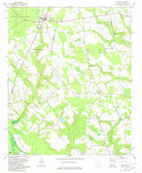
USGS Historical Quadrangle in GeoPDF.
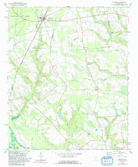
USGS Historical Quadrangle in GeoPDF.
|

|
