Filters: Tags: POCOMOKE CITY (X)
17 results (252ms)|
Filters
Date Range
Types Contacts
Categories Tag Types Tag Schemes |
This data set contains imagery from the National Agriculture Imagery Program (NAIP). The NAIP program is administered by USDA FSA and has been established to support two main FSA strategic goals centered on agricultural production. These are, increase stewardship of America's natural resources while enhancing the environment, and to ensure commodities are procured and distributed effectively and efficiently to increase food security. The NAIP program supports these goals by acquiring and providing ortho imagery that has been collected during the agricultural growing season in the U.S. The NAIP ortho imagery is tailored to meet FSA requirements and is a fundamental tool used to support FSA farm and conservation programs....
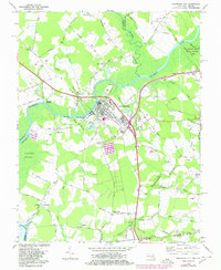
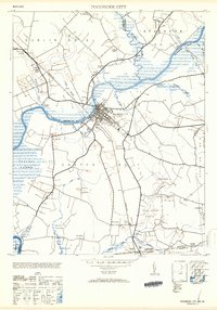
USGS Historical Quadrangle in GeoPDF.
This dataset documents the water quality in depth, salinity, and pH as well as the vegetation found in the freshwater swamps of Hickory Point State Forest near Pocomoke City, Maryland from 2013 to 2021.
Categories: Data;
Tags: Botany,
Chesapeake Bay,
Ecology,
Forested Wetland,
Hickory Point State Forest,
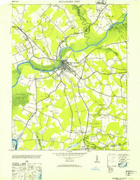
USGS Historical Quadrangle in GeoPDF.
This data set contains imagery from the National Agriculture Imagery Program (NAIP). The NAIP program is administered by USDA FSA and has been established to support two main FSA strategic goals centered on agricultural production. These are, increase stewardship of America's natural resources while enhancing the environment, and to ensure commodities are procured and distributed effectively and efficiently to increase food security. The NAIP program supports these goals by acquiring and providing ortho imagery that has been collected during the agricultural growing season in the U.S. The NAIP ortho imagery is tailored to meet FSA requirements and is a fundamental tool used to support FSA farm and conservation programs....
This data set contains imagery from the National Agriculture Imagery Program (NAIP). The NAIP program is administered by USDA FSA and has been established to support two main FSA strategic goals centered on agricultural production. These are, increase stewardship of America's natural resources while enhancing the environment, and to ensure commodities are procured and distributed effectively and efficiently to increase food security. The NAIP program supports these goals by acquiring and providing ortho imagery that has been collected during the agricultural growing season in the U.S. The NAIP ortho imagery is tailored to meet FSA requirements and is a fundamental tool used to support FSA farm and conservation programs....
This data set contains imagery from the National Agriculture Imagery Program (NAIP). The NAIP program is administered by USDA FSA and has been established to support two main FSA strategic goals centered on agricultural production. These are, increase stewardship of America's natural resources while enhancing the environment, and to ensure commodities are procured and distributed effectively and efficiently to increase food security. The NAIP program supports these goals by acquiring and providing ortho imagery that has been collected during the agricultural growing season in the U.S. The NAIP ortho imagery is tailored to meet FSA requirements and is a fundamental tool used to support FSA farm and conservation programs....
This data set contains imagery from the National Agriculture Imagery Program (NAIP). The NAIP program is administered by USDA FSA and has been established to support two main FSA strategic goals centered on agricultural production. These are, increase stewardship of America's natural resources while enhancing the environment, and to ensure commodities are procured and distributed effectively and efficiently to increase food security. The NAIP program supports these goals by acquiring and providing ortho imagery that has been collected during the agricultural growing season in the U.S. The NAIP ortho imagery is tailored to meet FSA requirements and is a fundamental tool used to support FSA farm and conservation programs....
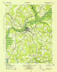
USGS Historical Quadrangle in GeoPDF.
On November 11, 2021, the height, density, and species richness of trees were recorded in five plots along a 175 m transect at Hickory Point State Forest near Pocomoke City, Maryland. This data was divided into categories depending on if the tree was alive, dead, or a sapling. Emergent species' height, density, and richness was also recorded.
Categories: Data;
Tags: Botany,
Chesapeake Bay,
Ecology,
Forested Wetland,
Hickory Point State Forest,
This work captures a multi-year progression from 2013 to 2021 of change in the height of the topographic surface and freshwater status of the rooting zone that may indicate impending vegetation transition. Two Surface Elevation Tables (SETs) in a tidal Taxodium distichum swamp at Hickory Point State Forest near Pocomoke City, Maryland were used to collect data on the height of the topographic surface established with respect to a local vertical datum. Annual root production over time was measured by collecting data on ingrowth into mesh root bags. Root bags were collected at 5 set locations within the study area and analyzed to determine the weight in grams of new root production per meter cubed each year. This...
Types: Collection;
Tags: Chesapeake Bay,
Forested Wetland,
Hickory Point State Forest,
Maryland,
Pocomoke City,
Annual root production over time was measured by collecting data on ingrowth into mesh root bags. The study was conducted on tidal freshwater swamp environments subjected to salinity intrusion at Hickory Point State Forest near Pocomoke City, Maryland. Root bags were collected at 5 set locations within the study area from 2013 to 2021 and analyzed to determine the weight in grams of new root production per meter cubed each year.
Categories: Data;
Tags: Botany,
Chesapeake Bay,
Ecology,
Forested Wetland,
Hickory Point State Forest,
This dataset represents data collected from 2018 to 2021 by a submersible datalogger known as a CTD Diver located in a well 48 cm below soil level at Hickory Point State Forest near Pocomoke City, Maryland.
Categories: Data;
Tags: Chesapeake Bay,
Ecology,
Forested Wetland,
Hickory Point State Forest,
Maryland,
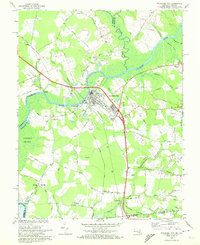
USGS Historical Quadrangle in GeoPDF.
In 2013 five Taxodium distichum trees along a 125 m long transect of Hickory Point State Forest outside Pocomoke City, Maryland were outfitted with dendrobands. Each year the growth of the T. distichum trees was measured in terms of the ratio of that year's circumference to the previous year's circumference. Tree growth was measured until the year the tree died or the conclusion of the study in 2021.
Categories: Data;
Tags: Botany,
Chesapeake Bay,
Ecology,
Forested Wetland,
Hickory Point State Forest,
USGS Historical Quadrangle in GeoPDF.
This study was conducted using surface elevation tables (SETs) to determine the change in soil height over time. The study took place at Hickory Point State Forest near Pocomoke City, Maryland from 2015 to 2021. Instead of using the SETs to measure elevation, this dataset uses the concept of the height of the topographic surface established with respect to a local vertical datum, which can be more accurately measured.
|

|
