Filters: Tags: PORT ISABEL (X)
15 results (53ms)|
Filters
Date Range
Types Contacts
Categories Tag Types Tag Schemes |
This data set contains imagery from the National Agriculture Imagery Program (NAIP). The NAIP program is administered by USDA FSA and has been established to support two main FSA strategic goals centered on agricultural production. These are increase stewardship of America's natural resources while enhancing the environment, and to ensure commodities are procured and distributed effectively and efficiently to increase food security. The NAIP program supports these goals by acquiring and providing ortho imagery that has been collected during the agricultural growing season in the U.S. The NAIP ortho imagery is tailored to meet FSA requirements and is a fundamental tool used to support FSA farm and conservation programs....
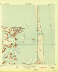
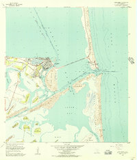
USGS Historical Quadrangle in GeoPDF.
Beaches and water recreation are important to the South Padre Island, Texas area and across the United States. The movement of sediment in channels along beaches and the nearshore environment is important for coastal stakeholders and resource managers. Sediment removed by maintenance dredging is often placed back into the littoral system for potential beach replenishment. The movement of sediment from offshore berms to onshore beaches is not well known. Sediment transport is highly dependent on local current conditions and seasonal conditions. The U.S. Geological Survey, in cooperation with the City of South Padre Island, completed an oceanographic field study from August 2018 to February 2019 to investigate the...
Categories: Data,
Data Release - Revised;
Tags: Cameron,
Currents,
Oceanographic observations,
Port Isabel,
Pressure,
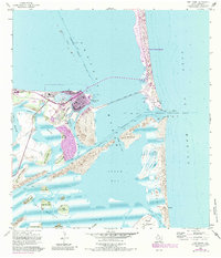
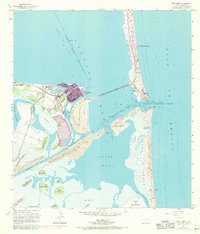
USGS Historical Quadrangle in GeoPDF.
Beaches and water recreation are important to the South Padre Island, Texas area and across the United States. The movement of sediment in channels along beaches and the nearshore environment is important for coastal stakeholders and resource managers. Sediment removed by maintenance dredging is often placed back into the littoral system for potential beach replenishment. The movement of sediment from offshore berms to onshore beaches is not well known. Sediment transport is highly dependent on local current conditions and seasonal conditions. The U.S. Geological Survey, in cooperation with the City of South Padre Island, completed an oceanographic field study from August 2018 to February 2019 to investigate the...
This data set contains imagery from the National Agriculture Imagery Program (NAIP). The NAIP program is administered by USDA FSA and has been established to support two main FSA strategic goals centered on agricultural production. These are increase stewardship of America's natural resources while enhancing the environment, and to ensure commodities are procured and distributed effectively and efficiently to increase food security. The NAIP program supports these goals by acquiring and providing ortho imagery that has been collected during the agricultural growing season in the U.S. The NAIP ortho imagery is tailored to meet FSA requirements and is a fundamental tool used to support FSA farm and conservation programs....
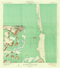
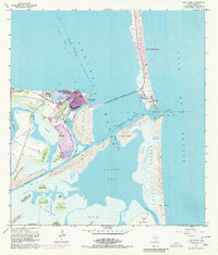
USGS Historical Quadrangle in GeoPDF.
This data set contains imagery from the National Agriculture Imagery Program (NAIP). The NAIP program is administered by USDA FSA and has been established to support two main FSA strategic goals centered on agricultural production. These are increase stewardship of America's natural resources while enhancing the environment, and to ensure commodities are procured and distributed effectively and efficiently to increase food security. The NAIP program supports these goals by acquiring and providing ortho imagery that has been collected during the agricultural growing season in the U.S. The NAIP ortho imagery is tailored to meet FSA requirements and is a fundamental tool used to support FSA farm and conservation programs....
This data set contains imagery from the National Agriculture Imagery Program (NAIP). The NAIP program is administered by USDA FSA and has been established to support two main FSA strategic goals centered on agricultural production. These are increase stewardship of America's natural resources while enhancing the environment, and to ensure commodities are procured and distributed effectively and efficiently to increase food security. The NAIP program supports these goals by acquiring and providing ortho imagery that has been collected during the agricultural growing season in the U.S. The NAIP ortho imagery is tailored to meet FSA requirements and is a fundamental tool used to support FSA farm and conservation programs....
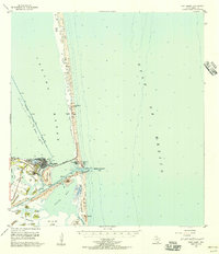
USGS Historical Quadrangle in GeoPDF.
USGS Historical Quadrangle in GeoPDF.
USGS Historical Quadrangle in GeoPDF.

USGS Historical Quadrangle in GeoPDF.
Beaches and water recreation are important to the South Padre Island, Texas area and across the United States. The movement of sediment in channels along beaches and the nearshore environment is important for coastal stakeholders and resource managers. Sediment removed by maintenance dredging is often placed back into the littoral system for potential beach replenishment. The movement of sediment from offshore berms to onshore beaches is not well known. Sediment transport is highly dependent on local current conditions and seasonal conditions. The U.S. Geological Survey, in cooperation with the City of South Padre Island, completed an oceanographic field study from August 2018 to February 2019 to investigate the...
USGS Historical Quadrangle in GeoPDF.
|

|
