Filters
Date Types (for Date Range)
Extensions
Types
Contacts
Categories
Tag Types
Tag Schemes
|
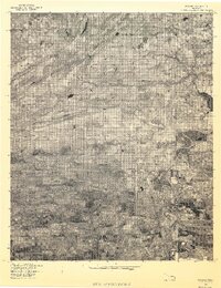
USGS Historical Quadrangle in GeoPDF.
Tags: 7.5 x 7.5 minute,
Advance,
Downloadable Data,
GeoPDF,
GeoTIFF, All tags...
Historical Topographic Maps,
Historical Topographic Maps 7.5 x 7.5 Minute Map Series,
Map,
Oklahoma,
Panama,
imageryBaseMapsEarthCover, Fewer tags

This composite shaded relief image dataset depicts generalized bathymetry and topography of the Caribbean region.
Categories: Data,
pre-SM502.8;
Tags: AG,
AI,
AN,
AW,
Anguilla, All tags...
Antigua and Barbuda,
Aruba,
Aves Ridge (6109),
BB,
BS,
BZ,
Bahama Platform (6119),
Bahamas,
Barbados,
Barbados Accretionary Complex (6127),
Barinas-Apure Basin (6097),
Bathymetry,
Beata Ridge (6111),
Belize,
Bonaire Basin (6101),
British Virgin Islands,
CO,
CR,
CU,
Cariaco Basin (6102),
Caribbean,
Caribbean region,
Cayman Islands,
Cayman Ridge (6121),
Cayman Trough (6120),
Cesar Basin (6094),
Chiapas Massif-Nuclear Central America (6122),
Choco Pacific Basin (6087),
Colombia,
Colombian Basin (6112),
Costa Rica,
Cuba,
DM,
DO,
Dominica,
Dominican Republic,
Earth Science,
East Venezuela Basin (6098),
El Salvador,
Falcon Basin (6100),
Florida Peninsula (5050),
GD,
GP,
GT,
GY,
Geology,
Greater Antilles Deformed Belt (6117),
Grenada,
Grenada Back-Arc Basin (6126),
Guadeloupe,
Guajira Basin (6095),
Guatemala,
Gulf Cenozoic OCS (5097),
Gulf Cenozoic OCS (5098),
Guyana,
Guyana Shield (6002),
Guyana-Suriname Basin (6021),
HN,
HT,
Haiti,
Honduras,
Image,
JM,
Jamaica,
KN,
KY,
LC,
Lesser Antilles Deformed Belt (6107),
Llanos Basin (6096),
Lower Magdelena (6091),
MQ,
MS,
MX,
Macuspana Basin (5306),
Maracaibo Basin (6099),
Martinique,
Maya Mountains (6125),
Mexico,
Middle America Province (6113),
Middle Magdelena (6090),
Monserrat,
NI,
Neogene Volcanic Belt (6108),
Netherlands Antilles,
Nicaragua,
North Caribbean Deformed Belt (6116),
North Nicaraguan Rise (6114),
Ocean (0),
Ocean (1),
PA,
PR,
Pacific Offshore Basin (6088),
Panama,
Perjira-Venezuela-Coastal Ranges (6093),
Puerto Rico,
Puerto Rico Trench (6118),
SV,
Saline-Comalcalco Basin (5304),
Shaded Relief,
Sierra Madre de Chiapas-Peten Foldbelt (5310),
Sierra Nevada de Santa Marta (6105),
South Caribbean Accretionary Prism (6104),
South Nicaraguan Rise (6115),
St. Kitts and Nevis,
St. Lucia,
St. Vincent and the Grenadines,
Surface,
TC,
TT,
Tobago Trough (6103),
Topography,
Trinidad and Tobago,
Turks and Caicos Islands,
U.S. Geological Survey,
US,
USGS,
USGS Science Data Catalog (SDC),
United States,
VC,
VE,
VI,
VQ,
Venezuela,
Venezuelan Basin (6110),
Villahermosa Uplift (5305),
Virgin Islands,
West-Central Cordillera (6106),
Yucatan Basin (6123),
Yucatan Platform (5308),
caribbean,
elevation,
environment,
geoscientificInformation,
imageryBaseMapsEarthCover,
oilgas,
wep,
worldgeologicmaps, Fewer tags
The Caribbean region is part of World Energy Assessment region 6 (Central and South America). A fundamental task in the assessment is to map the locations and type of production for existing oil and gas fields. The Petroconsultants database is the only available database that has coverage for the Caribbean region. Oil and gas field symbols represent field center-points and are published with permission from Petroconsultants International Data Corporation, 2002 database.
Categories: Data,
pre-SM502.8;
Types: Downloadable,
Map Service,
OGC WFS Layer,
OGC WMS Layer,
Shapefile;
Tags: AG,
AI,
AN,
AW,
Anguilla, All tags...
Antigua and Barbuda,
Aruba,
Assessment,
BB,
BS,
BZ,
Bahamas,
Barbados,
Belize,
British Virgin Islands,
CO,
CR,
CU,
Caribbean,
Cayman Islands,
Colombia,
Costa Rica,
Cuba,
DM,
DO,
Dominica,
Dominican Republic,
Earth Science,
Economic geology,
El Salvador,
GD,
GP,
GT,
GY,
Gas,
Geology,
Geology,
Greneda,
Guadeloupe,
Guatemala,
Guyana,
HN,
HT,
Haiti,
Honduras,
JM,
Jamaica,
KN,
KY,
LC,
MQ,
MS,
MX,
Martinique,
Mexico,
Monserrat,
NI,
Natural Gas,
Natural Resourses,
Natural gas resources,
Netherlands Antilles,
Nicaragua,
Oil,
Oil and Gas Fields,
Oil resources,
PA,
PR,
Panama,
Petroleum,
Petroleum,
Puerto Rico,
Resource Assessment,
SV,
St. Kitts and Nevis,
St. Lucia,
St. Vincent and the Grenadines,
TC,
TT,
Trinidad and Tobago,
Turks and Caicas Islands,
U.S. Geological Survey,
US,
USGS,
USGS Science Data Catalog (SDC),
United States,
VC,
VE,
VI,
VQ,
Venezuela,
Virgin Islands,
World Energy Project,
World Energy Resources,
caribbean,
economy,
environment,
geoscientificInformation,
imageryBaseMapsEarthCover,
oilgas,
wep,
worldgeologicmaps, Fewer tags

This dataset describes mercury (Hg) stable isotope values in fish dorsal muscle from different freshwater environments across the globe. Fish were collected at numerous field sites in North America, South and Central America, Africa, and Asia from 2006-2020. Sub-samples were provided by cooperators to the U.S. Geological Survey Mercury Research Laboratory and the University of Wisconsin for mercury stable isotope analysis. Samples were analyzed for mercury stable isotopes from 2017-2021. These specimens represent multiple trophic levels and body sizes from different food webs and when adequate mass was available, multiple species from the same food web were examined. Cooperators include, but are not limited to:...
Categories: Data;
Tags: Aquatic Biology,
Botswana,
Congo,
Environmental Health,
Gabon, All tags...
Geochemistry,
Ghana,
Guatemala,
Honduras,
Kenya,
Mongolia,
Panama,
Suriname,
Tanzania,
Thailand,
USGS Science Data Catalog (SDC),
United States,
Venezuela,
food web,
isotopic analysis,
mercury contamination, Fewer tags

This dataset includes a modified subset of polygon features that describe U.S. Geological Survey's defined geologic provinces of the World. Each province has a set of geologic characteristics that distinguish it from surrounding provinces. These characteristics may include dominant lithologies, the age of the strata, and/or structural type. Each province is assigned a unique numeric code and may fall within two or more countries or assessment regions.
Categories: Data,
pre-SM502.8;
Types: Downloadable,
Map Service,
OGC WFS Layer,
OGC WMS Layer,
Shapefile;
Tags: AG,
AI,
AN,
AW,
Anguilla, All tags...
Antigua and Barbuda,
Aruba,
Aves Ridge (6109),
BB,
BS,
BZ,
Bahama Platform (6119),
Bahamas,
Barbados,
Barbados Accretionary Complex (6127),
Barinas-Apure Basin (6097),
Beata Ridge (6111),
Belize,
Bonaire Basin (6101),
British Virgin Islands,
CO,
CR,
CU,
Cariaco Basin (6102),
Caribbean,
Cayman Islands,
Cayman Ridge (6121),
Cayman Trough (6120),
Cesar Basin (6094),
Chiapas Massif-Nuclear Central America (6122),
Choco Pacific Basin (6087),
Colombia,
Colombian Basin (6112),
Costa Rica,
Cuba,
DM,
DO,
Dominica,
Dominican Republic,
Earth Science,
East Venezuela Basin (6098),
Economic geology,
El Salvador,
Falcon Basin (6100),
Florida Peninsula (5050),
GD,
GP,
GT,
GY,
Gas province,
Gas resource assessment,
Geologic province,
Geology,
Greater Antilles Deformed Belt (6117),
Grenada,
Grenada Back-Arc Basin (6126),
Guadeloupe,
Guajira Basin (6095),
Guatemala,
Gulf Cenozoic OCS (5097),
Gulf Cenozoic OCS (5098),
Guyana,
Guyana Shield (6002),
Guyana-Suriname Basin (6021),
HN,
HT,
Haiti,
Honduras,
JM,
Jamaica,
KN,
KY,
LC,
Lesser Antilles Deformed Belt (6107),
Llanos Basin (6096),
Lower Magdelena (6091),
MQ,
MS,
MX,
Macuspana Basin (5306),
Maracaibo Basin (6099),
Martinique,
Maya Mountains (6125),
Mexico,
Middle America Province (6113),
Middle Magdelena (6090),
Monserrat,
NI,
Natural Gas,
Natural gas liquids resource assessment,
Natural gas resources,
Neogene Volcanic Belt (6108),
Netherlands Antilles,
Nicaragua,
North Caribbean Deformed Belt (6116),
North Nicaraguan Rise (6114),
Ocean (0),
Ocean (1),
Oil and gas province,
Oil and gas resource assessment,
Oil province,
Oil resource assessment,
Oil resources,
PA,
PR,
Pacific Offshore Basin (6088),
Panama,
Perjira-Venezuela-Coastal Ranges (6093),
Petroleum,
Puerto Rico,
Puerto Rico Trench (6118),
Resource Assessment,
SV,
Saline-Comalcalco Basin (5304),
Sierra Madre de Chiapas-Peten Foldbelt (5310),
Sierra Nevada de Santa Marta (6105),
South Caribbean Accretionary Prism (6104),
South Nicaraguan Rise (6115),
St. Kitts and Nevis,
St. Lucia,
St. Vincent and the Grenadines,
TC,
TT,
Tobago Trough (6103),
Trinidad and Tobago,
Turks and Caicas Islands,
U.S. Geological Survey,
US,
USGS,
USGS Science Data Catalog (SDC),
United States,
VC,
VE,
VI,
VQ,
Venezuela,
Venezuelan Basin (6110),
Villahermosa Uplift (5305),
Virgin Islands,
West-Central Cordillera (6106),
Yucatan Basin (6123),
Yucatan Platform (5308),
caribbean,
economy,
environment,
geoscientificInformation,
oilgas,
wep,
worldgeologicmaps, Fewer tags

Album Caption: Darien Expedition. Pinogana, Tuyra River. 1871. NARA # 77-H-8913S-25. During 1870-1875, Navy Commander Thomas O. Selfridge led several exploring and surveying expeditions to the Isthmus of Darien (now known as Panama) to ascertain the practicability of a ship canal between the Atlantic and Pacific Oceans. Photographer Timothy O'Sullivan accompanied the first Darien Expedition in 1870, and photographer John Moran (older brother of Painter Thomas Moran) traveled wit the second Darien Expedition in 1871. Reports from later expeditions did not mention whether a photographer accompanied the surveyors. Apparently O'Sullivan traveled only to the eastern-most area on the Atlantic side of the Isthmus, and...
This dataset describes faults and structural features of the Caribbean region (Anguilla, Antigua and Barbuda, Aruba, Bahamas, Barbados, Belize, British Virgin Islands, Cayman Islands, Colombia, Costa Rica, Cuba, Dominica, Dominican Republic, El Salvador, Grenada, Guadeloupe, Guatemala, Guyana, Haiti, Honduras, Jamaica, Martinique, Mexico, Montserrat, Netherlands Antilles, Nicaragua, Panama, Puerto Rico, St. Kitts and Nevis, St. Lucia, St. Vincent and the Grenadines, Trinidad and Tobago, Turks and Caicos Islands, United States, Venezuela, and the Virgin Islands (named countries may not be completely shown on map)).
Categories: Data,
pre-SM502.8;
Types: Downloadable,
Map Service,
OGC WFS Layer,
OGC WMS Layer,
Shapefile;
Tags: AG,
AI,
AN,
AW,
Age, All tags...
Anguilla,
Antigua and Barbuda,
Aruba,
Aves Ridge (6109),
BB,
BS,
BZ,
Bahama Platform (6119),
Bahamas,
Barbados,
Barbados Accretionary Complex (6127),
Barinas-Apure Basin (6097),
Beata Ridge (6111),
Belize,
Bonaire Basin (6101),
British Virgin Islands,
CO,
CR,
CU,
Cariaco Basin (6102),
Caribbean,
Cayman Islands,
Cayman Ridge (6121),
Cayman Trough (6120),
Cesar Basin (6094),
Chiapas Massif-Nuclear Central America (6122),
Choco Pacific Basin (6087),
Coal,
Coal resources,
Coalbed Methane,
Coalbed methane resources,
Colombia,
Colombian Basin (6112),
Costa Rica,
Cuba,
DM,
DO,
Dominica,
Dominican Republic,
Earth Science,
East Venezuela Basin (6098),
Economic geology,
El Salvador,
Falcon Basin (6100),
Faults,
Florida Peninsula (5050),
GD,
GP,
GT,
GY,
Gas,
Geologic Age,
Geologic Map,
Geologic Province,
Geology,
Geology,
Greater Antilles Deformed Belt (6117),
Grenada,
Grenada Back-Arc Basin (6126),
Guadeloupe,
Guajira Basin (6095),
Guatemala,
Gulf Cenozoic OCS (5097),
Gulf Cenozoic OCS (5098),
Guyana,
Guyana Shield (6002),
Guyana-Suriname Basin (6021),
HN,
HT,
Haiti,
Honduras,
JM,
Jamaica,
KN,
KY,
LC,
Lesser Antilles Deformed Belt (6107),
Llanos Basin (6096),
Lower Magdelena (6091),
MQ,
MS,
MX,
Macuspana Basin (5306),
Maracaibo Basin (6099),
Martinique,
Maya Mountains (6125),
Mexico,
Middle America Province (6113),
Middle Magdelena (6090),
Monserrat,
NI,
Natural Gas,
Natural gas resources,
Neogene Volcanic Belt (6108),
Netherlands Antilles,
Nicaragua,
North Caribbean Deformed Belt (6116),
North Nicaraguan Rise (6114),
Ocean (0),
Ocean (1),
Oil,
Oil resources,
PA,
PR,
Pacific Offshore Basin (6088),
Panama,
Perjira-Venezuela-Coastal Ranges (6093),
Petroleum,
Puerto Rico,
Puerto Rico Trench (6118),
Resource Assessment,
SV,
Saline-Comalcalco Basin (5304),
Sierra Madre de Chiapas-Peten Foldbelt (5310),
Sierra Nevada de Santa Marta (6105),
South Caribbean Accretionary Prism (6104),
South Nicaraguan Rise (6115),
St. Kitts and Nevis,
St. Lucia,
St. Vincent and the Grenadines,
Structural Features,
Structure,
Surface Geology,
TC,
TT,
Tectonics,
Tobago Trough (6103),
Trinidad and Tobago,
Turks and Caicos Islands,
U.S. Geological Survey,
US,
USGS,
USGS Science Data Catalog (SDC),
United States,
VC,
VE,
VI,
VQ,
Venezuela,
Venezuelan Basin (6110),
Villahermosa Uplift (5305),
Virgin Islands,
West-Central Cordillera (6106),
World Energy Project,
World Energy Resources,
Yucatan Basin (6123),
Yucatan Platform (5308),
caribbean,
economy,
environment,
geoscientificInformation,
imageryBaseMapsEarthCover,
oilgas,
structure,
wep,
worldgeologicmaps, Fewer tags
This dataset includes polygons that describe the geologic age of surface outcrops of bedrock of the Caribbean region (Anguilla, Antigua and Barbuda, Aruba, Bahamas, Barbados, Belize, British Virgin Islands, Cayman Islands, Colombia, Costa Rica, Cuba, Dominica, Dominican Republic, El Salvador, Grenada, Guadeloupe, Guatemala, Guyana, Haiti, Honduras, Jamaica, Martinique, Mexico, Montserrat, Netherlands Antilles, Nicaragua, Panama, Puerto Rico, St. Kitts and Nevis, St. Lucia, St. Vincent and the Grenadines, Trinidad and Tobago, Turks and Caicos Islands, United States, Venezuela, and the Virgin Islands (named countries may not be completely shown on map)).
Categories: Data,
pre-SM502.8;
Types: Downloadable,
Map Service,
OGC WFS Layer,
OGC WMS Layer,
Shapefile;
Tags: AG,
AI,
AN,
AW,
Age, All tags...
Anguilla,
Antigua and Barbuda,
Aruba,
Aves Ridge (6109),
BB,
BS,
BZ,
Bahama Platform (6119),
Bahamas,
Barbados,
Barbados Accretionary Complex (6127),
Barinas-Apure Basin (6097),
Beata Ridge (6111),
Belize,
Bonaire Basin (6101),
British Virgin Islands,
CO,
CR,
CU,
Cariaco Basin (6102),
Caribbean,
Cayman Islands,
Cayman Ridge (6121),
Cayman Trough (6120),
Cesar Basin (6094),
Chiapas Massif-Nuclear Central America (6122),
Choco Pacific Basin (6087),
Coal,
Coal resources,
Coalbed Methane,
Coalbed methane resources,
Colombia,
Colombian Basin (6112),
Costa Rica,
Cuba,
DM,
DO,
Dominica,
Dominican Republic,
Earth Science,
East Venezuela Basin (6098),
Economic geology,
El Salvador,
Falcon Basin (6100),
Florida Peninsula (5050),
GD,
GP,
GT,
GY,
Gas,
Geologic Age,
Geologic Map,
Geologic Province,
Geology,
Geology,
Greater Antilles Deformed Belt (6117),
Grenada,
Grenada Back-Arc Basin (6126),
Guadeloupe,
Guajira Basin (6095),
Guatemala,
Gulf Cenozoic OCS (5097),
Gulf Cenozoic OCS (5098),
Guyana,
Guyana Shield (6002),
Guyana-Suriname Basin (6021),
HN,
HT,
Haiti,
Honduras,
JM,
Jamaica,
KN,
KY,
LC,
Lesser Antilles Deformed Belt (6107),
Llanos Basin (6096),
Lower Magdelena (6091),
MQ,
MS,
MX,
Macuspana Basin (5306),
Maracaibo Basin (6099),
Martinique,
Maya Mountains (6125),
Mexico,
Middle America Province (6113),
Middle Magdelena (6090),
Monserrat,
NI,
Natural Gas,
Natural gas resources,
Neogene Volcanic Belt (6108),
Netherlands Antilles,
Nicaragua,
North Caribbean Deformed Belt (6116),
North Nicaraguan Rise (6114),
Ocean (0),
Ocean (1),
Oil,
Oil resources,
PA,
PR,
Pacific Offshore Basin (6088),
Panama,
Perjira-Venezuela-Coastal Ranges (6093),
Petroleum,
Puerto Rico,
Puerto Rico Trench (6118),
Resource Assessment,
SV,
Saline-Comalcalco Basin (5304),
Sierra Madre de Chiapas-Peten Foldbelt (5310),
Sierra Nevada de Santa Marta (6105),
South Caribbean Accretionary Prism (6104),
South Nicaraguan Rise (6115),
St. Kitts and Nevis,
St. Lucia,
St. Vincent and the Grenadines,
Surface Geology,
TC,
TT,
Tobago Trough (6103),
Trinidad and Tobago,
Turks and Caicos Islands,
U.S. Geological Survey,
US,
USGS,
USGS Science Data Catalog (SDC),
United States,
VC,
VE,
VI,
VQ,
Venezuela,
Venezuelan Basin (6110),
Villahermosa Uplift (5305),
Virgin Islands,
West-Central Cordillera (6106),
World Energy Project,
World Energy Resources,
Yucatan Basin (6123),
Yucatan Platform (5308),
caribbean,
economy,
environment,
geoscientificInformation,
imageryBaseMapsEarthCover,
oilgas,
wep,
worldgeologicmaps, Fewer tags

Lepidocyclina (Nephrolepidina) chaperi: Eocene and Oligocene and larger foraminifera from the Panama Canal Zone and Vicinity, Panama. Published in U.S.Geological Survey Professional paper 244, Plate 12. 1952.
|
|

