Filters: Tags: Paonia Reservoir (X)
15 results (12ms)|
Filters
Date Range
Types Contacts
Categories Tag Types Tag Schemes |

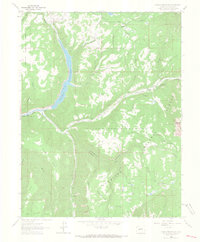
USGS Historical Quadrangle in GeoPDF.
This data set contains cross-section geometry and sediment-size distribution data collected in the fall of 2015 from Muddy Creek and North Fork Gunnison River below Paonia Reservoir, Colorado. Six cross-sections were surveyed using Real-Time Kinematic Global Navigation Satellite System (RTK-GNSS) methods to document channel geometry below the reservoir. One cross-section was surveyed on Muddy Creek below Paonia Reservoir, and five cross-sections were surveyed from North Fork Gunnison River below Paonia Reservoir. All six cross-sections are incorporated in this data release within one shapefile. Pebble-counts were performed at each of the six cross-sections to document sediment-size distributions downstream from...
Types: Citation;
Tags: Geomorphology,
Paonia Reservoir,
USGS Science Data Catalog (SDC),
Water Resources,
geomorphology,
This data set contains imagery from the National Agriculture Imagery Program (NAIP). The NAIP program is administered by USDA FSA and has been established to support two main FSA strategic goals centered on agricultural production. These are, increase stewardship of America's natural resources while enhancing the environment, and to ensure commodities are procured and distributed effectively and efficiently to increase food security. The NAIP program supports these goals by acquiring and providing ortho imagery that has been collected during the agricultural growing season in the U.S. The NAIP ortho imagery is tailored to meet FSA requirements and is a fundamental tool used to support FSA farm and conservation programs....

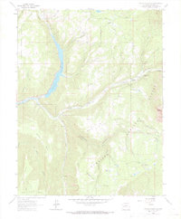
USGS Historical Quadrangle in GeoPDF.
Dataset includes the analysis results of 49 inorganic chemical elements bound to suspended-sediment particles below Paonia Reservoir during a sediment release in September 2017. Suspended-sediment samples were collected at U.S. Geological Survey (USGS) station number 385626107212000 by following data collection procedures and protocols in Edwards and Glysson (1999). The samples were freeze-dried after collection and then decomposed using a mixture of nitric, hydrofluoric, and perchloric acids. The dried residue after acid digestion was analyzed by atomic absorption spectrometry and inductively coupled plasma-mass spectrometry following procedures and protocols in Taggart (2002). Reference samples of flue gas desulfurization...
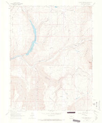
USGS Historical Quadrangle in GeoPDF.
This dataset contains cross-section geometry and sediment-size data collected in the fall of 2019 from Muddy Creek and North Fork Gunnison River below Paonia Reservoir, western Colorado. Six cross sections were surveyed using Real-Time Kinematic Global Navigation Satellite System (RTK-GNSS) methods to document channel geometry below Paonia Reservoir. One cross section was surveyed on Muddy Creek below Paonia Reservoir, and five cross sections were surveyed from North Fork Gunnison River below Paonia Reservoir. All six cross sections are incorporated in this data release within one shapefile. Pebble counts were performed at each of the six cross sections to document sediment-size distributions downstream from the...
This data set contains imagery from the National Agriculture Imagery Program (NAIP). The NAIP program is administered by USDA FSA and has been established to support two main FSA strategic goals centered on agricultural production. These are, increase stewardship of America's natural resources while enhancing the environment, and to ensure commodities are procured and distributed effectively and efficiently to increase food security. The NAIP program supports these goals by acquiring and providing ortho imagery that has been collected during the agricultural growing season in the U.S. The NAIP ortho imagery is tailored to meet FSA requirements and is a fundamental tool used to support FSA farm and conservation programs....
This data set contains imagery from the National Agriculture Imagery Program (NAIP). The NAIP program is administered by USDA FSA and has been established to support two main FSA strategic goals centered on agricultural production. These are, increase stewardship of America's natural resources while enhancing the environment, and to ensure commodities are procured and distributed effectively and efficiently to increase food security. The NAIP program supports these goals by acquiring and providing ortho imagery that has been collected during the agricultural growing season in the U.S. The NAIP ortho imagery is tailored to meet FSA requirements and is a fundamental tool used to support FSA farm and conservation programs....
This data set contains cross-section geometry and sediment-size distribution data collected in the fall of 2016 from Muddy Creek and North Fork Gunnison River below Paonia Reservoir, Colorado. Six cross-sections were surveyed using Real-Time Kinematic Global Navigation Satellite System (RTK-GNSS) methods to document channel geometry below the reservoir in 2015. Those same cross-sections were re-surveyed using the same methods in 2016 to document any changes. One cross-section was surveyed on Muddy Creek below Paonia Reservoir, and five cross-sections were surveyed from North Fork Gunnison River below Paonia Reservoir. All six cross-sections are incorporated in this data release within one shapefile. Pebble-counts...
USGS Historical Quadrangle in GeoPDF.
This data set contains imagery from the National Agriculture Imagery Program (NAIP). The NAIP program is administered by USDA FSA and has been established to support two main FSA strategic goals centered on agricultural production. These are, increase stewardship of America's natural resources while enhancing the environment, and to ensure commodities are procured and distributed effectively and efficiently to increase food security. The NAIP program supports these goals by acquiring and providing ortho imagery that has been collected during the agricultural growing season in the U.S. The NAIP ortho imagery is tailored to meet FSA requirements and is a fundamental tool used to support FSA farm and conservation programs....
This data set contains cross-section geometry and sediment-size distribution data collected in the fall of 2017 from Muddy Creek and North Fork Gunnison River below Paonia Reservoir, western Colorado. Six cross-sections were surveyed using Real-Time Kinematic Global Navigation Satellite System (RTK-GNSS) methods to document channel geometry below the reservoir in 2015. Those same cross-sections were re-surveyed using the same methods in 2016 and 2017 to document any changes. One cross-section was surveyed on Muddy Creek below Paonia Reservoir, and five cross-sections were surveyed from North Fork Gunnison River below Paonia Reservoir. All six cross-sections are incorporated in this data release within one shapefile....
USGS Historical Quadrangle in GeoPDF.
This dataset contains cross-section geometry and sediment-size distribution data collected in the fall of 2018 from Muddy Creek and North Fork Gunnison River below Paonia Reservoir, western Colorado. Six cross-sections were surveyed using Real-Time Kinematic Global Navigation Satellite System (RTK-GNSS) methods to document channel geometry below the reservoir in 2015. Those same cross-sections were re-surveyed using the same methods in 2018 to document any changes. One cross-section was surveyed on Muddy Creek below Paonia Reservoir, and five cross-sections were surveyed from North Fork Gunnison River below Paonia Reservoir. All six cross-sections are incorporated in this data release within one shapefile. Pebble...
|

|
