Filters
Date Range
Types
Contacts
Categories
Tag Types
Tag Schemes
|
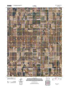
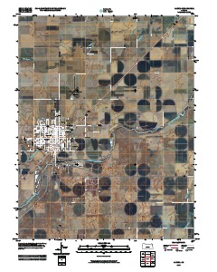
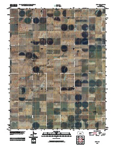
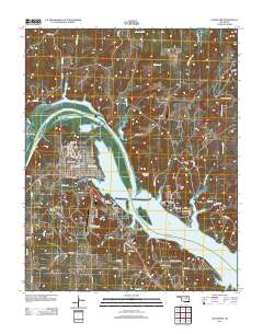
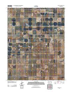
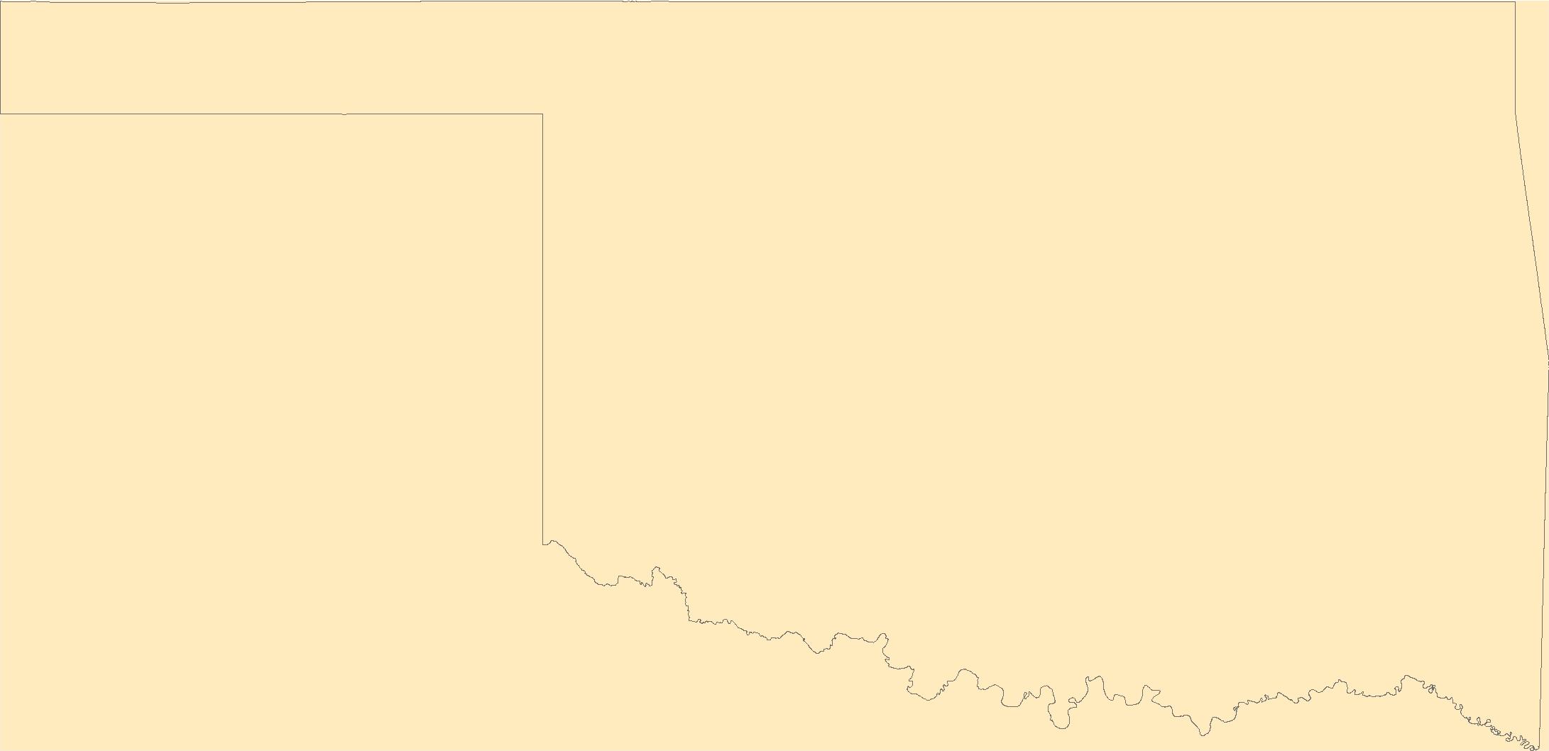
This data set contains imagery from the National Agriculture Imagery Program (NAIP). The NAIP program is administered by USDA FSA and has been established to support two main FSA strategic goals centered on agricultural production. These are, increase stewardship of America's natural resources while enhancing the environment, and to ensure commodities are procured and distributed effectively and efficiently to increase food security. The NAIP program supports these goals by acquiring and providing ortho imagery that has been collected during the agricultural growing season in the U.S. The NAIP ortho imagery is tailored to meet FSA requirements and is a fundamental tool used to support FSA farm and conservation programs....
Types: Citation;
Tags: 17167,
3.75 x 3.75 minute,
3908928,
Aerial Compliance,
Compliance, All tags...
Digital Ortho rectified Image,
Downloadable Data,
IL,
IL167,
JPEG2000,
NAIP,
Ortho Rectification,
Orthoimagery,
PAWNEE,
PAWNEE, NE,
Quarter Quadrangle,
SANGAMON CO IL FSA,
Sangamon,
USDA National Agriculture Imagery Program (NAIP),
farming, Fewer tags
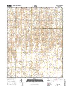
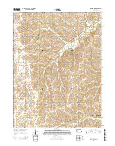
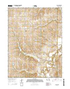
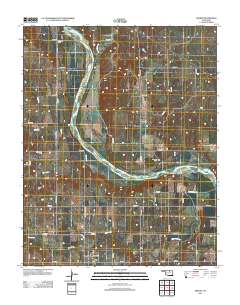
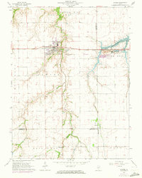
Layered GeoPDF 7.5 Minute Quadrangle Map. Layers of geospatial data include orthoimagery, roads, grids, geographic names, elevation contours, hydrography, and other selected map features.
Tags: 7.5 x 7.5 minute,
Downloadable Data,
EarthCover,
Edwards,
GeoPDF, All tags...
Imagery and Base Maps,
Kansas,
Map,
Pawnee,
Public Land Survey System,
Rozel SW, KS,
U.S. National Grid,
US,
US Topo,
US Topo Historical,
United States,
boundary,
contour,
geographic names,
hydrography,
imageryBaseMapsEarthCover,
orthoimage,
structures,
topographic,
transportation,
woodland, Fewer tags
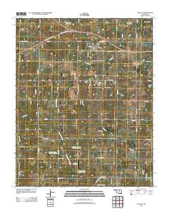
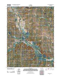
Layered GeoPDF 7.5 Minute Quadrangle Map. Layers of geospatial data include orthoimagery, roads, grids, geographic names, elevation contours, hydrography, and other selected map features.
Tags: 7.5 x 7.5 minute,
Downloadable Data,
EarthCover,
Edwards,
GeoPDF, All tags...
Hanston SE, KS,
Hodgeman,
Imagery and Base Maps,
Kansas,
Map,
Pawnee,
Public Land Survey System,
U.S. National Grid,
US,
US Topo,
US Topo Historical,
United States,
boundary,
contour,
geographic names,
hydrography,
imageryBaseMapsEarthCover,
orthoimage,
structures,
topographic,
transportation,
woodland, Fewer tags
Layered GeoPFD 7.5 Minute Quadrangle Map. Layers of geospatial data include orthoimagery, roads, grids, geographic names, elevation contours, hydrography, and other selected map features.
Tags: 7.5 x 7.5 minute,
Downloadable Data,
EarthCover,
GeoPDF,
Imagery and Base Maps, All tags...
Kansas,
Larned, KS,
Map,
Pawnee,
U.S. National Grid,
US,
US Topo,
US Topo Historical,
United States,
contour,
geographic names,
hydrography,
orthoimage,
topographic,
transportation, Fewer tags
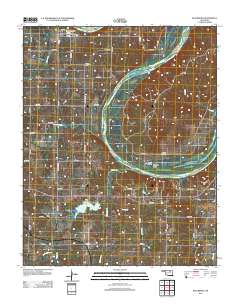
Layered GeoPDF 7.5 Minute Quadrangle Map. Layers of geospatial data include orthoimagery, roads, grids, geographic names, elevation contours, hydrography, and other selected map features.
Tags: 7.5 x 7.5 minute,
Crab Orchard, NE,
Downloadable Data,
EarthCover,
Gage, All tags...
GeoPDF,
Imagery and Base Maps,
Johnson,
Map,
Nebraska,
Pawnee,
Public Land Survey System,
U.S. National Grid,
US,
US Topo,
US Topo Historical,
United States,
boundary,
contour,
geographic names,
hydrography,
imageryBaseMapsEarthCover,
orthoimage,
structures,
topographic,
transportation,
woodland, Fewer tags
Layered GeoPDF 7.5 Minute Quadrangle Map. Layers of geospatial data include orthoimagery, roads, grids, geographic names, elevation contours, hydrography, and other selected map features.
Tags: 7.5 x 7.5 minute,
Downloadable Data,
Du Bois, NE-KS,
EarthCover,
GeoPDF, All tags...
Imagery and Base Maps,
Kansas,
Map,
Nebraska,
Nemaha,
Pawnee,
Public Land Survey System,
Richardson,
U.S. National Grid,
US,
US Topo,
US Topo Historical,
United States,
boundary,
contour,
geographic names,
hydrography,
imageryBaseMapsEarthCover,
orthoimage,
structures,
topographic,
transportation,
woodland, Fewer tags
Layered GeoPFD 7.5 Minute Quadrangle Map. Layers of geospatial data include orthoimagery, roads, grids, geographic names, elevation contours, hydrography, and other selected map features.
Tags: 7.5 x 7.5 minute,
Downloadable Data,
EarthCover,
Edwards,
GeoPDF, All tags...
Imagery and Base Maps,
Kansas,
Map,
Pawnee,
U.S. National Grid,
US,
US Topo,
US Topo Historical,
United States,
Zook, KS,
contour,
geographic names,
hydrography,
orthoimage,
topographic,
transportation, Fewer tags
Layered GeoPDF 7.5 Minute Quadrangle Map. Layers of geospatial data include orthoimagery, roads, grids, geographic names, elevation contours, hydrography, and other selected map features.
Tags: 7.5 x 7.5 minute,
Downloadable Data,
EarthCover,
GeoPDF,
Glencoe, OK, All tags...
Imagery and Base Maps,
Map,
Noble,
Oklahoma,
Pawnee,
Payne,
Public Land Survey System,
U.S. National Grid,
US,
US Topo,
US Topo Historical,
United States,
boundary,
contour,
geographic names,
hydrography,
imageryBaseMapsEarthCover,
orthoimage,
structures,
topographic,
transportation,
woodland, Fewer tags
Layered GeoPDF 7.5 Minute Quadrangle Map. Layers of geospatial data include orthoimagery, roads, grids, geographic names, elevation contours, hydrography, and other selected map features.
Tags: 7.5 x 7.5 minute,
Blackburn, OK,
Downloadable Data,
EarthCover,
GeoPDF, All tags...
Imagery and Base Maps,
Map,
Oklahoma,
Osage,
Pawnee,
Public Land Survey System,
U.S. National Grid,
US,
US Topo,
US Topo Historical,
United States,
boundary,
contour,
geographic names,
hydrography,
imageryBaseMapsEarthCover,
orthoimage,
structures,
topographic,
transportation,
woodland, Fewer tags
Layered GeoPDF 7.5 Minute Quadrangle Map. Layers of geospatial data include orthoimagery, roads, grids, geographic names, elevation contours, hydrography, and other selected map features.
Tags: 7.5 x 7.5 minute,
Cleveland, OK,
Downloadable Data,
EarthCover,
GeoPDF, All tags...
Imagery and Base Maps,
Map,
Oklahoma,
Osage,
Pawnee,
Public Land Survey System,
U.S. National Grid,
US,
US Topo,
US Topo Historical,
United States,
boundary,
contour,
geographic names,
hydrography,
imageryBaseMapsEarthCover,
orthoimage,
structures,
topographic,
transportation,
woodland, Fewer tags
Layered GeoPDF 7.5 Minute Quadrangle Map. Layers of geospatial data include orthoimagery, roads, grids, geographic names, elevation contours, hydrography, and other selected map features.
Tags: 7.5 x 7.5 minute,
Downloadable Data,
EarthCover,
GeoPDF,
Imagery and Base Maps, All tags...
Map,
Oklahoma,
Osage,
Pawnee,
Public Land Survey System,
Skedee, OK,
U.S. National Grid,
US,
US Topo,
US Topo Historical,
United States,
boundary,
contour,
geographic names,
hydrography,
imageryBaseMapsEarthCover,
orthoimage,
structures,
topographic,
transportation,
woodland, Fewer tags
Layered GeoPDF 7.5 Minute Quadrangle Map. Layers of geospatial data include orthoimagery, roads, grids, geographic names, elevation contours, hydrography, and other selected map features.
Tags: 7.5 x 7.5 minute,
Downloadable Data,
EarthCover,
GeoPDF,
Imagery and Base Maps, All tags...
Map,
Nebraska,
Pawnee,
Richardson,
Table Rock, NE,
U.S. National Grid,
US,
US Topo,
US Topo Historical,
United States,
contour,
geographic names,
hydrography,
imageryBaseMapsEarthCover,
orthoimage,
structures,
topographic,
transportation, Fewer tags
Layered GeoPDF 7.5 Minute Quadrangle Map. Layers of geospatial data include orthoimagery, roads, grids, geographic names, elevation contours, hydrography, and other selected map features.
Tags: 7.5 x 7.5 minute,
Downloadable Data,
EarthCover,
GeoPDF,
Imagery and Base Maps, All tags...
Map,
Morrison, OK,
Noble,
Oklahoma,
Pawnee,
Public Land Survey System,
U.S. National Grid,
US,
US Topo,
US Topo Historical,
United States,
boundary,
contour,
geographic names,
hydrography,
imageryBaseMapsEarthCover,
orthoimage,
structures,
topographic,
transportation,
woodland, Fewer tags
Layered GeoPDF 7.5 Minute Quadrangle Map. Layers of geospatial data include orthoimagery, roads, grids, geographic names, elevation contours, hydrography, and other selected map features.
Tags: 7.5 x 7.5 minute,
Burdett, KS,
Downloadable Data,
EarthCover,
GeoPDF, All tags...
Hodgeman,
Imagery and Base Maps,
Kansas,
Map,
Pawnee,
Public Land Survey System,
U.S. National Grid,
US,
US Topo,
US Topo Historical,
United States,
boundary,
contour,
geographic names,
hydrography,
imageryBaseMapsEarthCover,
orthoimage,
structures,
topographic,
transportation,
woodland, Fewer tags
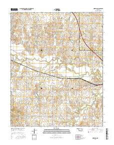
USGS Historical Quadrangle in GeoPDF.
Tags: 7.5 x 7.5 minute,
Downloadable Data,
GeoPDF,
GeoTIFF,
Historical Topographic Maps, All tags...
Historical Topographic Maps 7.5 x 7.5 Minute Map Series,
IL,
Map,
Pawnee,
imageryBaseMapsEarthCover, Fewer tags

The Geographic Names Information System (GNIS) is the Federal standard for geographic nomenclature. The U.S. Geological Survey developed the GNIS for the U.S. Board on Geographic Names, a Federal inter-agency body chartered by public law to maintain uniform feature name usage throughout the Government and to promulgate standard names to the public. The GNIS is the official repository of domestic geographic names data; the official vehicle for geographic names use by all departments of the Federal Government; and the source for applying geographic names to Federal electronic and printed products of all types.
Tags: Adams,
Antarctica,
Antarctica,
Antelope,
Arthur, All tags...
BGN,
Banner,
Blaine,
Board on Geographic Names,
Boone,
Borough,
Box Butte,
Boyd,
Brown,
Buffalo,
Burt,
Butler,
Cass,
Cedar,
Census Area,
Chase,
Cherry,
Cheyenne,
Clay,
Colfax,
Commonwealth,
County,
Cuming,
Custer,
Dakota,
Dawes,
Dawson,
Deuel,
District,
Dixon,
Dodge,
Douglas,
Downloadable Data,
Dundy,
Feature class,
Feature coordinates,
Feature county,
Feature description,
Feature designation,
Feature history,
Feature indentification,
Feature name,
Feature state,
Fillmore,
Franklin,
Frontier,
Furnas,
GNIS,
Gage,
Garden,
Garfield,
GeoPackage,
Geographic Names,
Geographic Names Full Model,
Geographic Names Information System,
Geographic feature,
Geographic name,
Geographical feature,
Geographical name,
Gosper,
Grant,
Greeley,
Hall,
Hamilton,
Harlan,
Hayes,
Hitchcock,
Holt,
Hooker,
Howard,
Jefferson,
Johnson,
Kearney,
Keith,
Keya Paha,
Kimball,
Knox,
Lancaster,
Lincoln,
Logan,
Loup,
Madison,
McPherson,
Merrick,
Morrill,
Municipio,
NE,
Nance,
National Geographic Names Information System (GNIS),
National Geographic Names Information System (GNIS),
Nebraska,
Nemaha,
Nuckolls,
Official feature name,
Open Geospatial Consortium GeoPackage 1.2,
Otoe,
Outlying Area,
Parish,
Pawnee,
Perkins,
Phelps,
Pierce,
Place name,
Platte,
Polk,
Populated Place,
Red Willow,
Richardson,
Rock,
Saline,
Sarpy,
Saunders,
Scotts Bluff,
Seward,
Sheridan,
Sherman,
Sioux,
Stanton,
State,
Territories,
Territory,
Thayer,
Thomas,
Thurston,
Topographic Map,
U.S. Board on Geographic Names,
U.S. Geological Survey,
US,
USA,
USBGN,
USGS,
United States,
United States,
United States,
Valley,
Variant name,
Washington,
Wayne,
Webster,
Wheeler,
York,
antarctic,
database,
economy,
environment,
feature,
gazetteer,
geographic,
geographic names,
geographical,
geography,
geospatial,
imageryBaseMapsEarthCover,
inlandWaters,
location,
map,
name,
place,
placename,
society,
structure,
topographic map,
toponymy, Fewer tags
The Geographic Names Information System (GNIS) is the Federal standard for geographic nomenclature. The U.S. Geological Survey developed the GNIS for the U.S. Board on Geographic Names, a Federal inter-agency body chartered by public law to maintain uniform feature name usage throughout the Government and to promulgate standard names to the public. The GNIS is the official repository of domestic geographic names data; the official vehicle for geographic names use by all departments of the Federal Government; and the source for applying geographic names to Federal electronic and printed products of all types.
Tags: Adams,
Antarctica,
Antarctica,
Antelope,
Arthur, All tags...
BGN,
Banner,
Blaine,
Board on Geographic Names,
Boone,
Borough,
Box Butte,
Boyd,
Brown,
Buffalo,
Burt,
Butler,
Cass,
Cedar,
Census Area,
Chase,
Cherry,
Cheyenne,
Clay,
Colfax,
Commonwealth,
County,
Cuming,
Custer,
Dakota,
Dawes,
Dawson,
Deuel,
District,
Dixon,
Dodge,
Douglas,
Downloadable Data,
Dundy,
Feature class,
Feature coordinates,
Feature county,
Feature description,
Feature designation,
Feature history,
Feature indentification,
Feature name,
Feature state,
Fillmore,
Franklin,
Frontier,
Furnas,
GNIS,
Gage,
Garden,
Garfield,
Geographic Names,
Geographic Names Domestic Names,
Geographic Names Information System,
Geographic feature,
Geographic name,
Geographical feature,
Geographical name,
Gosper,
Grant,
Greeley,
Hall,
Hamilton,
Harlan,
Hayes,
Hitchcock,
Holt,
Hooker,
Howard,
Jefferson,
Johnson,
Kearney,
Keith,
Keya Paha,
Kimball,
Knox,
Lancaster,
Lincoln,
Logan,
Loup,
Madison,
McPherson,
Merrick,
Morrill,
Municipio,
NE,
Nance,
National Geographic Names Information System (GNIS),
National Geographic Names Information System (GNIS),
Nebraska,
Nemaha,
Nuckolls,
Official feature name,
Otoe,
Outlying Area,
Parish,
Pawnee,
Perkins,
Phelps,
Pierce,
Place name,
Platte,
Polk,
Populated Place,
Red Willow,
Richardson,
Rock,
Saline,
Sarpy,
Saunders,
Scotts Bluff,
Seward,
Sheridan,
Sherman,
Sioux,
Stanton,
State,
TXT (pipes),
Territories,
Territory,
Thayer,
Thomas,
Thurston,
Topographic Map,
U.S. Board on Geographic Names,
U.S. Geological Survey,
US,
USA,
USBGN,
USGS,
UTF-8 Pipe Delimited Text File nan,
United States,
United States,
United States,
Valley,
Variant name,
Washington,
Wayne,
Webster,
Wheeler,
York,
antarctic,
database,
economy,
environment,
feature,
gazetteer,
geographic,
geographic names,
geographical,
geography,
geospatial,
imageryBaseMapsEarthCover,
inlandWaters,
location,
map,
name,
place,
placename,
society,
structure,
topographic map,
toponymy, Fewer tags
The Geographic Names Information System (GNIS) is the Federal standard for geographic nomenclature. The U.S. Geological Survey developed the GNIS for the U.S. Board on Geographic Names, a Federal inter-agency body chartered by public law to maintain uniform feature name usage throughout the Government and to promulgate standard names to the public. The GNIS is the official repository of domestic geographic names data; the official vehicle for geographic names use by all departments of the Federal Government; and the source for applying geographic names to Federal electronic and printed products of all types.
Tags: Allen,
Anderson,
Antarctica,
Antarctica,
Atchison, All tags...
BGN,
Barber,
Barton,
Board on Geographic Names,
Borough,
Bourbon,
Brown,
Butler,
Census Area,
Chase,
Chautauqua,
Cherokee,
Cheyenne,
Clark,
Clay,
Cloud,
Coffey,
Comanche,
Commonwealth,
County,
Cowley,
Crawford,
Decatur,
Dickinson,
District,
Doniphan,
Douglas,
Downloadable Data,
Edwards,
Elk,
Ellis,
Ellsworth,
Feature class,
Feature coordinates,
Feature county,
Feature description,
Feature designation,
Feature history,
Feature indentification,
Feature name,
Feature state,
Finney,
Ford,
Franklin,
GNIS,
Geary,
Geographic Names,
Geographic Names Federal Codes,
Geographic Names Information System,
Geographic feature,
Geographic name,
Geographical feature,
Geographical name,
Gove,
Graham,
Grant,
Gray,
Greeley,
Greenwood,
Hamilton,
Harper,
Harvey,
Haskell,
Hodgeman,
Jackson,
Jefferson,
Jewell,
Johnson,
KS,
Kansas,
Kearny,
Kingman,
Kiowa,
Labette,
Lane,
Leavenworth,
Lincoln,
Linn,
Logan,
Lyon,
Marion,
Marshall,
McPherson,
Meade,
Miami,
Mitchell,
Montgomery,
Morris,
Morton,
Municipio,
National Geographic Names Information System (GNIS),
National Geographic Names Information System (GNIS),
Nemaha,
Neosho,
Ness,
Norton,
Official feature name,
Osage,
Osborne,
Ottawa,
Outlying Area,
Parish,
Pawnee,
Phillips,
Place name,
Populated Place,
Pottawatomie,
Pratt,
Rawlins,
Reno,
Republic,
Rice,
Riley,
Rooks,
Rush,
Russell,
Saline,
Scott,
Sedgwick,
Seward,
Shawnee,
Sheridan,
Sherman,
Smith,
Stafford,
Stanton,
State,
Stevens,
Sumner,
TXT (pipes),
Territories,
Territory,
Thomas,
Topographic Map,
Trego,
U.S. Board on Geographic Names,
U.S. Geological Survey,
US,
USA,
USBGN,
USGS,
UTF-8 Pipe Delimited Text File nan,
United States,
United States,
United States,
Variant name,
Wabaunsee,
Wallace,
Washington,
Wichita,
Wilson,
Woodson,
Wyandotte,
antarctic,
database,
economy,
environment,
feature,
gazetteer,
geographic,
geographic names,
geographical,
geography,
geospatial,
imageryBaseMapsEarthCover,
inlandWaters,
location,
map,
name,
place,
placename,
society,
structure,
topographic map,
toponymy, Fewer tags
The Geographic Names Information System (GNIS) is the Federal standard for geographic nomenclature. The U.S. Geological Survey developed the GNIS for the U.S. Board on Geographic Names, a Federal inter-agency body chartered by public law to maintain uniform feature name usage throughout the Government and to promulgate standard names to the public. The GNIS is the official repository of domestic geographic names data; the official vehicle for geographic names use by all departments of the Federal Government; and the source for applying geographic names to Federal electronic and printed products of all types.
Tags: Adair,
Alfalfa,
Antarctica,
Antarctica,
Atoka, All tags...
BGN,
Beaver,
Beckham,
Blaine,
Board on Geographic Names,
Borough,
Bryan,
Caddo,
Canadian,
Carter,
Census Area,
Cherokee,
Choctaw,
Cimarron,
Cleveland,
Coal,
Comanche,
Commonwealth,
Cotton,
County,
Craig,
Creek,
Custer,
Delaware,
Dewey,
District,
Downloadable Data,
Ellis,
Feature class,
Feature coordinates,
Feature county,
Feature description,
Feature designation,
Feature history,
Feature indentification,
Feature name,
Feature state,
GNIS,
Garfield,
Garvin,
Geographic Names,
Geographic Names Federal Codes,
Geographic Names Information System,
Geographic feature,
Geographic name,
Geographical feature,
Geographical name,
Grady,
Grant,
Greer,
Harmon,
Harper,
Haskell,
Hughes,
Jackson,
Jefferson,
Johnston,
Kay,
Kingfisher,
Kiowa,
Latimer,
Le Flore,
Lincoln,
Logan,
Love,
Major,
Marshall,
Mayes,
McClain,
McCurtain,
McIntosh,
Municipio,
Murray,
Muskogee,
National Geographic Names Information System (GNIS),
National Geographic Names Information System (GNIS),
Noble,
Nowata,
OK,
Official feature name,
Okfuskee,
Oklahoma,
Oklahoma,
Okmulgee,
Osage,
Ottawa,
Outlying Area,
Parish,
Pawnee,
Payne,
Pittsburg,
Place name,
Pontotoc,
Populated Place,
Pottawatomie,
Pushmataha,
Roger Mills,
Rogers,
Seminole,
Sequoyah,
State,
Stephens,
TXT (pipes),
Territories,
Territory,
Texas,
Tillman,
Topographic Map,
Tulsa,
U.S. Board on Geographic Names,
U.S. Geological Survey,
US,
USA,
USBGN,
USGS,
UTF-8 Pipe Delimited Text File nan,
United States,
United States,
United States,
Variant name,
Wagoner,
Washington,
Washita,
Woods,
Woodward,
antarctic,
database,
economy,
environment,
feature,
gazetteer,
geographic,
geographic names,
geographical,
geography,
geospatial,
imageryBaseMapsEarthCover,
inlandWaters,
location,
map,
name,
place,
placename,
society,
structure,
topographic map,
toponymy, Fewer tags
The Watershed Boundary Dataset (WBD) is a comprehensive aggregated collection of hydrologic unit data consistent with the national criteria for delineation and resolution. It defines the areal extent of surface water drainage to a point except in coastal or lake front areas where there could be multiple outlets as stated by the "Federal Standards and Procedures for the National Watershed Boundary Dataset (WBD)" "Standard" (https://pubs.usgs.gov/tm/11/a3/). Watershed boundaries are determined solely upon science-based hydrologic principles, not favoring any administrative boundaries or special projects, nor particular program or agency. This dataset represents the hydrologic unit boundaries to the 12-digit (6th level)...
Tags: 10-digit,
12-digit,
14-digit,
16-digit,
2-digit, All tags...
4-digit,
6-digit,
8-digit,
AR,
Adair,
Alamosa,
Alfalfa,
Allen,
Anderson,
Archer,
Arkansas,
Armstrong,
Atoka,
Baca,
Barber,
Barry,
Barton,
Basin,
Baxter,
Baylor,
Beaver,
Beckham,
Bent,
Benton,
Bienville,
Blaine,
Boone,
Bossier,
Bourbon,
Bowie,
Briscoe,
Bryan,
Butler,
CO,
Caddo,
Camp,
Canadian,
Carroll,
Carson,
Carter,
Cass,
Castro,
Chaffee,
Chase,
Chautauqua,
Cherokee,
Cheyenne,
Childress,
Choctaw,
Christian,
Cimarron,
Claiborne,
Clark,
Clay,
Cleburne,
Cleveland,
Coal,
Coffey,
Colfax,
Collingsworth,
Colorado,
Columbia,
Comanche,
Conway,
Cooke,
Costilla,
Cottle,
Cotton,
Cowley,
Craig,
Crawford,
Creek,
Crosby,
Crowley,
Curry,
Custer,
Dade,
Dallam,
De Soto,
Deaf Smith,
Delaware,
Delta,
Dent,
Dewey,
Dickens,
Donley,
Douglas,
Downloadable Data,
Eagle,
Edwards,
El Paso,
Elbert,
Elk,
Ellis,
Ellsworth,
Esri Shapefile nan,
Fannin,
Faulkner,
Finney,
Floyd,
Foard,
Ford,
Franklin,
Fremont,
Fulton,
Garfield,
Garland,
Garvin,
Grady,
Grant,
Gray,
Grayson,
Greeley,
Greene,
Greenwood,
Greer,
Gregg,
Guadalupe,
Gunnison,
HU-2,
HU-2 Region,
HU2_11,
HUC,
Hale,
Hall,
Hamilton,
Hansford,
Hardeman,
Harding,
Harmon,
Harper,
Harrison,
Hartley,
Harvey,
Haskell,
Hemphill,
Hempstead,
Hodgeman,
Hopkins,
Howard,
Howell,
Huerfano,
Hughes,
Hunt,
Hutchinson,
Hydrography,
Hydrologic Unit Code,
Hydrologic Units,
Independence,
Iron,
Izard,
Jackson,
Jasper,
Jefferson,
Johnson,
Johnston,
KS,
Kansas,
Kay,
Kearny,
King,
Kingfisher,
Kingman,
Kiowa,
Kit Carson,
Knox,
LA,
Labette,
Lafayette,
Lake,
Lamar,
Lane,
Las Animas,
Latimer,
Lawrence,
Le Flore,
Lincoln,
Lipscomb,
Little River,
Logan,
Lonoke,
Louisiana,
Love,
Lyon,
MO,
Madison,
Major,
Marion,
Marshall,
Mayes,
McClain,
McCurtain,
McDonald,
McIntosh,
McPherson,
Meade,
Miller,
Missouri,
Montague,
Montgomery,
Moore,
Mora,
Morris,
Morton,
Motley,
Murray,
Muskogee,
NM,
Natchitoches,
National Watershed Boundary Dataset (WBD),
National Watershed Boundary Dataset (WBD),
Neosho,
Ness,
Nevada,
New Mexico,
Newton,
Noble,
Nowata,
OK,
Ochiltree,
Okfuskee,
Oklahoma,
Oklahoma,
Okmulgee,
Oldham,
Oregon,
Osage,
Otero,
Ottawa,
Ozark,
Panola,
Park,
Parmer,
Pawnee,
Payne,
Perry,
Pike,
Pitkin,
Pittsburg,
Polk,
Pontotoc,
Pope,
Pottawatomie,
Potter,
Pratt,
Prowers,
Pueblo,
Pulaski,
Pushmataha,
Quay,
Randall,
Randolph,
Rapides,
Red River,
Region,
Reno,
Reynolds,
Rice,
Rio Arriba,
Ripley,
Roberts,
Roger Mills,
Rogers,
Rush,
Sabine,
Saguache,
Saline,
San Miguel,
Scott,
Searcy,
Sebastian,
Sedgwick,
Seminole,
Sequoyah,
Sevier,
Seward,
Shannon,
Shapefile,
Sharp,
Sherman,
Stafford,
Stanton,
Stephens,
Stevens,
Stone,
Sub-basin,
Sub-region,
Subwatershed,
Summit,
Sumner,
Swisher,
TX,
Taney,
Taos,
Teller,
Texas,
Texas,
Tillman,
Titus,
Tulsa,
US,
Union,
United States,
Upshur,
Van Buren,
Vernon,
WBD,
Wabaunsee,
Wagoner,
Washington,
Washita,
Watershed,
Watershed Boundary Dataset,
Wayne,
Webster,
Wheeler,
White,
Wichita,
Wilbarger,
Wilson,
Winn,
Wood,
Woodruff,
Woods,
Woodson,
Woodward,
Wright,
Yell,
Young,
inlandWaters, Fewer tags
|
|

