Filters: Tags: Peach Springs (X)
22 results (39ms)|
Filters
Date Range
Extensions Types
Contacts
Categories Tag Types Tag Schemes |
This data set contains imagery from the National Agriculture Imagery Program (NAIP). The NAIP program is administered by USDA FSA and has been established to support two main FSA strategic goals centered on agricultural production. These are, increase stewardship of America's natural resources while enhancing the environment, and to ensure commodities are procured and distributed effectively and efficiently to increase food security. The NAIP program supports these goals by acquiring and providing ortho imagery that has been collected during the agricultural growing season in the U.S. The NAIP ortho imagery is tailored to meet FSA requirements and is a fundamental tool used to support FSA farm and conservation programs....
In May 2021, the Grand Canyon Monitoring and Research Center (GCMRC) of the U.S. Geological Survey’s (USGS), Southwest Biological Science Center (SBSC) acquired airborne multispectral high resolution data for the Colorado River in Grand Canyon in Arizona, USA. The imagery data consist of four bands (Band 1 – red, Band 2 – green, Band 3 – blue, and Band 4 – near infrared) with a ground resolution of 20 centimeters (cm). These image data are available to the public as 16-bit GeoTIFF files, which can be read and used by most geographic information system (GIS) and image-processing software. The spatial reference of the image data are in the State Plane (SP) map projection using the central Arizona zone (FIPS 0202)...
Airborne electromagnetic (AEM) and magnetic survey data were collected during March 2018 along 1,637 line kilometers over the western Hualapai Indian Reservation and surrounding areas. The survey was conducted as part of a study of the groundwater resources of the Truxton basin and Hualapai Plateau. The survey was designed to improve the understanding of the geometry of major hydrostratigraphic contacts of the study area. Deterministic laterally constrained inversion of the processed AEM data was conducted using the AarhusINV code (Auken and others, 2014) implemented in Aarhus Workbench software (Aarhus Geosoftware, Aarhus, Denmark). Inversion parameters were selected by running a series of test models with varying...
Categories: Data;
Types: Map Service,
OGC WFS Layer,
OGC WMS Layer,
OGC WMS Service;
Tags: AZWSC,
Arizona,
Arizona Water Science Center,
GGGSC,
Geology, Geophysics, and Geochemistry Science Center,
In May 2021, the Grand Canyon Monitoring and Research Center (GCMRC) of the U.S. Geological Survey’s (USGS), Southwest Biological Science Center (SBSC) acquired airborne multispectral high resolution data for the Colorado River in Grand Canyon in Arizona, USA. The imagery data consist of four bands (Band 1 – red, Band 2 – green, Band 3 – blue, and Band 4 – near infrared) with a ground resolution of 20 centimeters (cm). These image data are available to the public as 16-bit GeoTIFF files, which can be read and used by most geographic information system (GIS) and image-processing software. The spatial reference of the image data are in the State Plane (SP) map projection using the central Arizona zone (FIPS 0202)...
Airborne electromagnetic (AEM) and magnetic survey data were collected during March 2018 along 1,637 line line-kilometers over the western Hualapai Indian Reservation and surrounding areas. The survey was conducted as part of a study of the groundwater resources of the Truxton basin and Hualapai Plateau. The survey was designed to improve the understanding of the geometry of the major hydrostratigraphic contacts of the study area. Data were acquired by SkyTEM ApS with the SkyTEM 312 time-domain helicopter-borne electromagnetic system together with a Geometrics G822A cesium vapor magnetometer. The survey was flown at a nominal flight height of 30 meters (m) above terrain along block-style lines with a nominal spacing...
Categories: Data;
Types: Map Service,
OGC WFS Layer,
OGC WMS Layer,
OGC WMS Service;
Tags: AZWSC,
Arizona,
Arizona Water Science Center,
GGGSC,
Geology, Geophysics, and Geochemistry Science Center,
This data set contains imagery from the National Agriculture Imagery Program (NAIP). The NAIP program is administered by USDA FSA and has been established to support two main FSA strategic goals centered on agricultural production. These are, increase stewardship of America's natural resources while enhancing the environment, and to ensure commodities are procured and distributed effectively and efficiently to increase food security. The NAIP program supports these goals by acquiring and providing ortho imagery that has been collected during the agricultural growing season in the U.S. The NAIP ortho imagery is tailored to meet FSA requirements and is a fundamental tool used to support FSA farm and conservation programs....
Airborne electromagnetic (AEM) and magnetic survey data were collected during March 2018 along 1,637 line line-kilometers over the western Hualapai Indian Reservation and surrounding areas. The survey was conducted as part of a study of the groundwater resources of the Truxton basin and Hualapai Plateau. The survey was designed to improve the understanding of the geometry of the major hydrostratigraphic contacts of the study area. Data were acquired by SkyTEM ApS with the SkyTEM 312 time-domain helicopter-borne electromagnetic system together with a Geometrics G822A cesium vapor magnetometer. The survey was flown at a nominal flight height of 30 meters (m) above terrain along block-style lines with a nominal spacing...
Two unique datasets on the abundance and morphology of the angel lichen moth (Cisthene angelus) in Grand Canyon, Arizona, USA were compiled to describe the phenology and life history of this common, but poorly known, species. The abundance data were collected from 2012 to 2013 through a collaboration with river runners in Grand Canyon National Park. These citizen scientists deployed light traps from their campsites for one hour each night of their expedition. Insects were preserved in ethanol on site, and returned to the Southwest Biological Science Center in Flagstaff, Arizona for analysis in the laboratory. A total of 2,437 light trap samples were sorted through, 903 of which contained C. angelus. In total, 73,841...
These data are classified maps of water in the Colorado River at a discharge of approximately 227 meters squared/second in Grand Canyon from Glen Canyon Dam to Pearce Ferry in Arizona. The data are derived from interpretation of multispectral high resolution airborne imagery that was acquired in May 2013. The water classification data have the same 0.2-meter ground resolution as the imagery. These data have not undergone a statistical accuracy assessment, but they are based on methods that included image interpretation to exhaustively identify water which have been shown to produce very high classification accuracies and excellent correlation between maps of total vegetation produced by independent analysts and...
This data set contains imagery from the National Agriculture Imagery Program (NAIP). The NAIP program is administered by USDA FSA and has been established to support two main FSA strategic goals centered on agricultural production. These are, increase stewardship of America's natural resources while enhancing the environment, and to ensure commodities are procured and distributed effectively and efficiently to increase food security. The NAIP program supports these goals by acquiring and providing ortho imagery that has been collected during the agricultural growing season in the U.S. The NAIP ortho imagery is tailored to meet FSA requirements and is a fundamental tool used to support FSA farm and conservation programs....
In May 2013, the Grand Canyon Monitoring and Research Center (GCMRC) of the U.S. Geological Survey’s (USGS) Southwest Biological Science Center (SBSC) acquired airborne multispectral high resolution data for the Colorado River in Grand Canyon in Arizona, USA. The imagery data consist of four bands (blue, green, red and near infrared) with a ground resolution of 20 centimeters (cm). These data are available to the public as 16-bit geotiff files. They are projected in the State Plane (SP) map projection using the central Arizona zone (202) and the North American Datum of 1983 (NAD83). The assessed accuracy for these data is based on 91 Ground Control Points (GCPs), and is reported at 95% confidence as 0.64 meters...
This dataset represents the network-adjusted results of relative- and absolute-gravity surveys. Data are provided in tabular (csv) and vector (shapefile) formats with one row per station.Relative-gravity surveys were carried out using a ZLS Coporation Burris relative-gravity meter. The effect of solid Earth tides and ocean loading were removed from the data. Instrument drift was removed by evaluating gravity change during repeated measurements at one or more base stations, or between absolute-gravity stations. Absolute-gravity surveys were carried out using a Micro-g LaCoste, Inc. A-10 absolute-gravity meter. The vertical gravity gradient was assumed to be -3 microGal/cm at each absolute-gravity site. Relative-gravity...
Categories: Data;
Types: Downloadable,
Map Service,
OGC WFS Layer,
OGC WMS Layer,
Shapefile;
Tags: Arizona Water Science Center,
Geophysics,
Hualapai Indian Reservation,
Mohave Country,
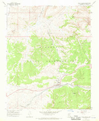
Peach Springs,
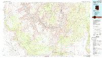
USGS Historical Quadrangle in GeoPDF.
Airborne electromagnetic (AEM) and magnetic survey data were collected during March 2018 along 1,637 line kilometers over the western Hualapai Reservation and surrounding areas. The survey was conducted as part of a study of the groundwater resources of the Truxton basin and Hualapai Plateau. The survey was designed to improve our understanding of the geometry the major hydrostratigraphic contacts and regional-scale geologic structures of the study area. Minimally processed binary AEM data received from the contractor were imported into the Aarhus Workbench software (Aarhus Geosoftware, Aarhus, Denmark) and processed. Filters were applied to inclinometer and spatial positioning data to smooth raw data and remove...
Categories: Data;
Types: Map Service,
OGC WFS Layer,
OGC WMS Layer,
OGC WMS Service;
Tags: AZWSC,
Arizona,
Arizona Water Science Center,
GGGSC,
Geology, Geophysics, and Geochemistry Science Center,
In May 2021, the Grand Canyon Monitoring and Research Center (GCMRC) of the U.S. Geological Survey’s (USGS), Southwest Biological Science Center (SBSC) acquired airborne multispectral high resolution data for the Colorado River in Grand Canyon in Arizona, USA. The imagery data consist of four bands (Band 1 – red, Band 2 – green, Band 3 – blue, and Band 4 – near infrared) with a ground resolution of 20 centimeters (cm). These image data are available to the public as 16-bit GeoTIFF files, which can be read and used by most geographic information system (GIS) and image-processing software. The spatial reference of the image data are in the State Plane (SP) map projection using the central Arizona zone (FIPS 0202)...
Categories: Data;
Types: Downloadable,
Map Service,
OGC WFS Layer,
OGC WMS Layer,
Shapefile;
Tags: Arizona,
Bright Angel Creek,
Colorado River,
Diamond Creek,
ESRI shapefile,
USGS Historical Quadrangle in GeoPDF.
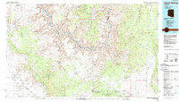
USGS Historical Quadrangle in GeoPDF.
These data were compiled to examine patterns of humpback chub (Gila cypha) in western Grand Canyon from just below Havasu Creek at river kilometer (rkm) 253 (Lees Ferry is rkm 0) downriver to Pearce Ferry at rkm 451. These data represent mean daily water temperatures in degrees Celsius from two USGS gaging locations (2005-2016), catches of individual humpback chub in hoop nets (2005-2016), total lengths of individual humpback chub captured in hoop nets during 2014, 2015 and 2016, and the effort (number of seine hauls) and catch of humpback chub in seines (2000-2016) in the Colorado River. These data were collected by research staff from the Grand Canyon, Monitoring & Research Center, Southwest Biological Science...
These data are classification maps of total riparian vegetation along the Colorado River in Grand Canyon from Glen Canyon Dam to Pearce Ferry in Arizona. The data are derived from interpretation of multispectral high resolution airborne imagery that was acquired in May 2013. The total vegetation data have the same 0.2-meter ground resolution as the imagery. These data have not undergone a statistical accuracy assessment, but they are based on methods that included image interpretation to exhaustively identify total vegetation which have been shown to produce very high classification accuracies and excellent correlation between maps of total vegetation produced by independent analysts and ground truth. The data represent...
In May 2021, the Grand Canyon Monitoring and Research Center (GCMRC) of the U.S. Geological Survey’s (USGS), Southwest Biological Science Center (SBSC) acquired airborne multispectral high resolution data for the Colorado River in Grand Canyon in Arizona, USA. The imagery data consist of four bands (Band 1 – red, Band 2 – green, Band 3 – blue, and Band 4 – near infrared) with a ground resolution of 20 centimeters (cm). These image data are available to the public as 16-bit GeoTIFF files, which can be read and used by most geographic information system (GIS) and image-processing software. The spatial reference of the image data are in the State Plane (SP) map projection using the central Arizona zone (FIPS 0202)...
|

|
