Filters: Tags: Peru (X)
129 results (81ms)|
Filters
Date Range
Extensions Types Contacts
Categories Tag Types
|
This data set contains imagery from the National Agriculture Imagery Program (NAIP). The NAIP program is administered by USDA FSA and has been established to support two main FSA strategic goals centered on agricultural production. These are increase stewardship of America's natural resources while enhancing the environment, and to ensure commodities are procured and distributed effectively and efficiently to increase food security. The NAIP program supports these goals by acquiring and providing ortho imagery that has been collected during the agricultural growing season in the U.S. The NAIP ortho imagery is tailored to meet FSA requirements and is a fundamental tool used to support FSA farm and conservation programs....
A seismic hazard model for South America, based on a smoothed (gridded) seismicity model, a subduction model, a crustal fault model, and a ground motion model, has been produced by the U.S. Geological Survey. These models are combined to account for ground shaking from earthquakes on known faults as well as earthquakes on un-modeled faults. This data set represents the results of calculations of hazard curves for a grid of points with a spacing of 0.1 degrees in latitude and longitude. This particular data set is for Modified Mercalli Intensity with a 2 percent probability of exceedance in 50 years. The maps and data were derived from PGA ground-motion conversions of Worden et al. (2012), and include soil amplification...
Categories: Data;
Types: Citation,
Downloadable,
GeoTIFF,
Map Service,
OGC WFS Layer,
OGC WMS Layer,
Raster,
Shapefile;
Tags: Argentina,
Bolivia,
Brazil,
Chile,
Colombia,
A seismic hazard model for South America, based on a smoothed (gridded) seismicity model, a subduction model, a crustal fault model, and a ground motion model, has been produced by the U.S. Geological Survey. These models are combined to account for ground shaking from earthquakes on known faults as well as earthquakes on un-modeled faults. This data set represents the results of calculations of hazard curves for a grid of points with a spacing of 0.1 degrees in latitude and longitude. This particular data set is for horizontal spectral response acceleration for 0.2-second period with a 10 percent probability of exceedance in 50 years.
Categories: Data;
Types: Citation,
Downloadable,
Map Service,
OGC WFS Layer,
OGC WMS Layer,
Shapefile;
Tags: Argentina,
Bolivia,
Brazil,
Chile,
Colombia,
This data set contains imagery from the National Agriculture Imagery Program (NAIP). The NAIP program is administered by USDA FSA and has been established to support two main FSA strategic goals centered on agricultural production. These are, increase stewardship of America's natural resources while enhancing the environment, and to ensure commodities are procured and distributed effectively and efficiently to increase food security. The NAIP program supports these goals by acquiring and providing ortho imagery that has been collected during the agricultural growing season in the U.S. The NAIP ortho imagery is tailored to meet FSA requirements and is a fundamental tool used to support FSA farm and conservation programs....
This data set contains imagery from the National Agriculture Imagery Program (NAIP). The NAIP program is administered by USDA FSA and has been established to support two main FSA strategic goals centered on agricultural production. These are increase stewardship of America's natural resources while enhancing the environment, and to ensure commodities are procured and distributed effectively and efficiently to increase food security. The NAIP program supports these goals by acquiring and providing ortho imagery that has been collected during the agricultural growing season in the U.S. The NAIP ortho imagery is tailored to meet FSA requirements and is a fundamental tool used to support FSA farm and conservation programs....
The combustion of perennial grass biomass to generate electricity may be a promising renewable energy option. Switchgrass (Panicum virgatum) grown as a biofuel has the potential to provide a cash crop for farmers and quality nesting cover for grassland birds. In southwestern Wisconsin (near lat. 42 degrees 52', long. 90 degrees 08'), we investigated the impact of an August harvest of switchgrass for bioenergy on community composition and abundance of Wisconsin grassland bird species of management concern. Harvesting the switchgrass in August resulted in changes in vegetation structure and bird species composition the following nesting season. In harvested transects, residual vegetation was shorter and the litter...
A seismic hazard model for South America, based on a smoothed (gridded) seismicity model, a subduction model, a crustal fault model, and a ground motion model, has been produced by the U.S. Geological Survey. These models are combined to account for ground shaking from earthquakes on known faults as well as earthquakes on un-modeled faults. This data set represents the hazard curves for a grid of points with a spacing of 0.1 degrees in latitude and longitude. It represents the annual rate of exceedance versus peak ground acceleration.

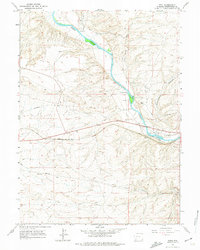
USGS Historical Quadrangle in GeoPDF.
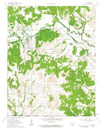
USGS Historical Quadrangle in GeoPDF.
Peru Earthquake May 31, 1970. Lower part of the Huascaran debris avalanche: Yungay, Ranrahirea, Matacoto, Cemetery Hill in Yungay, overtopped ridge between the Rio Shacsha and Yungay. The combined Yungay and Ranrahirea debris lobes cover an area of about 8 kilometers and probably contain close to 50 million meters of material. June 1970.
Categories: Image;
Tags: Earthquakes,
Peru,
Peru Earthquake May 31, 1970,
Photographers,
Plafker, G. Collection,
Photo shows the Aguas Calientes, Peru landslide taken in April, 2004. Photo also on Wikipedia Commons, http://commons.wikimedia.org/wiki/File:Aguas_calientes_landslide_april_2004.jpg
Categories: Image;
Types: Map Service,
OGC WFS Layer,
OGC WMS Layer,
OGC WMS Service;
Tags: Aguas Calientes landslide,
Highland, Lynn M. Digital Collection,
Landslides,
Peru,
Photographers,
Peru Earthquake October 3, 1974. Example of the extensive damage in La Molina District. This classroom and a laboratory building at the Agrarian University partially collapsed. 1974. Pages 6-7, Earthquake Information Bulletin, v.7, no.2.
Categories: Image;
Types: Map Service,
OGC WFS Layer,
OGC WMS Layer,
OGC WMS Service;
Tags: Earthquakes,
Peru,
Peru Earthquake October 3, 1974,
photo print
This data set contains imagery from the National Agriculture Imagery Program (NAIP). The NAIP program is administered by USDA FSA and has been established to support two main FSA strategic goals centered on agricultural production. These are, increase stewardship of America's natural resources while enhancing the environment, and to ensure commodities are procured and distributed effectively and efficiently to increase food security. The NAIP program supports these goals by acquiring and providing ortho imagery that has been collected during the agricultural growing season in the U.S. The NAIP ortho imagery is tailored to meet FSA requirements and is a fundamental tool used to support FSA farm and conservation programs....
This data set contains imagery from the National Agriculture Imagery Program (NAIP). The NAIP program is administered by USDA FSA and has been established to support two main FSA strategic goals centered on agricultural production. These are increase stewardship of America's natural resources while enhancing the environment, and to ensure commodities are procured and distributed effectively and efficiently to increase food security. The NAIP program supports these goals by acquiring and providing ortho imagery that has been collected during the agricultural growing season in the U.S. The NAIP ortho imagery is tailored to meet FSA requirements and is a fundamental tool used to support FSA farm and conservation programs....
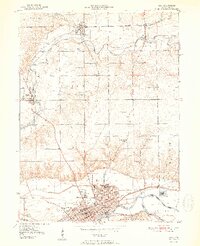
USGS Historical Quadrangle in GeoPDF.
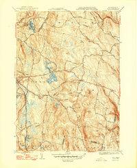
USGS Historical Quadrangle in GeoPDF.
USGS Historical Quadrangle in GeoPDF.
These worksheets contain data from geochemical analyses of solid mill tailings and other ore processing materials from worldwide localities, and leachates from those samples.
A lobe of the Huascaran debris avalanche that now covers the former city of Yungay; the avalanche flowed over a 100-200 meter high ridge (arrow) between Yungay and Llanganuco Valley. Peru. 1970. Published as figure 4 in U. S. Geological Survey. Circular 639. 1970.
Categories: Image;
Tags: Earthquakes,
Peru,
Peru Earthquake May 31, 1970,
Photographers,
photo print
Peru Earthquake May 31, 1970. Bus and truck were completely intermeshed by the Huascaran debris avalanche. Photo by G.E. Ericksen, 1970. Pages 68-69 (upper photo), Earthquake Information Bulletin, v.12, no.2.
Categories: Image;
Tags: Earthquakes,
Ericksen, G.E. Collection,
Peru,
Peru Earthquake May 31, 1970,
Photographers,
|

|
