Filters: Tags: Phoenix (X)
66 results (32ms)|
Filters
Date Range
Extensions Types Contacts
Categories Tag Types
|
This data set contains imagery from the National Agriculture Imagery Program (NAIP). The NAIP program is administered by USDA FSA and has been established to support two main FSA strategic goals centered on agricultural production. These are increase stewardship of America's natural resources while enhancing the environment, and to ensure commodities are procured and distributed effectively and efficiently to increase food security. The NAIP program supports these goals by acquiring and providing ortho imagery that has been collected during the agricultural growing season in the U.S. The NAIP ortho imagery is tailored to meet FSA requirements and is a fundamental tool used to support FSA farm and conservation programs....
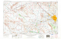
USGS Historical Quadrangle in GeoPDF.
These data sets are is a compilation of bird and environmental samples obtained from 6 sites in Maricopa County, Arizona on the dates shown. Sites were only visited and sampled if they had Rosy-cheeked lovebirds coming to bird feeders at the location and with the permission of the property owner. Two swab samples were obtained from each captured bird and 3 swab samples were collected from the environment at each site. Each sample was tested by PCR for Chlamydia psittaci, Psittacine Circovirus genotype 1 [PCV-1]), and Psittacine Circovirus genotype 2 (PCV-2) and, for appropriate samples (love birds and environmental samples) and where enough sample material remained for PBFD virus Pathotype 2.
Categories: Data;
Types: Map Service,
OGC WFS Layer,
OGC WMS Layer,
OGC WMS Service;
Tags: Arizona,
Chlamydia psittaci,
Maricopa,
Mesa,
Phoenix,
This location is part of the Arizona Mineral Industry Location System (AzMILS), an inventory of mineral occurences, prospects and mine locations in Arizona. LaPaz712 is located in T10N R15W Sec 32 -- in the Swansea - 15 Min quad. This collection consists of various reports, maps, records and related materials acquired by the Arizona Department of Mines and Mineral Resources regarding mining properties in Arizona. Information was obtained by various means, including the property owners, exploration companies, consultants, verbal interviews, field visits, newspapers and publications. Some sections may be redacted for copyright. Please see the access statement.
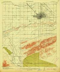
USGS Historical Quadrangle in GeoPDF.
These data were compiled for the creation of a continuous, transboundary land cover map of Bird Conservation Region 33, Sonoran and Mojave Deserts (BCR 33). Objective(s) of our study were to, 1) develop a machine learning (ML) algorithm trained to classify vegetation land cover using remote sensing spectral data and phenology metrics from 2013-2020, over a large subregion of the Sonoran and Mojave Deserts BCR, 2) Calibrate, validate, and refine the final ML-derived vegetation map using a collection of openly sourced remote sensing and ground-based ancillary data, images, and limited fieldwork, and 3) Harmonize a new transboundary classification system by expanding existing land cover mapping resources from the United...
Categories: Data;
Types: Downloadable,
GeoTIFF,
Map Service,
Raster;
Tags: Arizona,
Baja California,
Botany,
California,
Ecology,
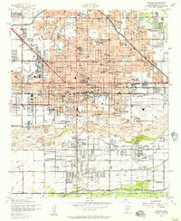
USGS Historical Quadrangle in GeoPDF.
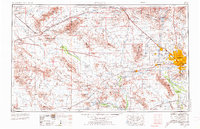
USGS Historical Quadrangle in GeoPDF.
The Rainbow Valley mule deer (Odocoileus hemionus) reside in the expansive Sonoran Desert flat between the Sierra Estrella Mountains and the North Maricopa Mountains. The herd, which numbered 1,500 in 2017, is managed for hunting within Game Management Units (GMU) 39 and 40. The movements depicted in this report represent annual range for 3 mule deer which are part of a much larger research project along the Interstate 11 (I-11) Proposed Corridor Alternative. The research is being conducted by the Arizona Game and Fish Department (AZGFD), with funding from the U.S. Department of the Interior through Secretarial Order 3362. Although the Rainbow Valley mule deer are not migratory in the traditional sense, their annual...
Categories: Data;
Types: Downloadable,
Map Service,
OGC WFS Layer,
OGC WMS Layer,
Shapefile;
Tags: Arizona,
Phoenix,
United States,
animal behavior,
economy,
This location is part of the Arizona Mineral Industry Location System (AzMILS), an inventory of mineral occurences, prospects and mine locations in Arizona. Yavapai200A is located in T7N R2W Sec 18 N2 in the Red Picacho - 7.5 Min quad. This collection consists of various reports, maps, records and related materials acquired by the Arizona Department of Mines and Mineral Resources regarding mining properties in Arizona. Information was obtained by various means, including the property owners, exploration companies, consultants, verbal interviews, field visits, newspapers and publications. Some sections may be redacted for copyright. Please see the access statement.
This data set contains imagery from the National Agriculture Imagery Program (NAIP). The NAIP program is administered by USDA FSA and has been established to support two main FSA strategic goals centered on agricultural production. These are, increase stewardship of America's natural resources while enhancing the environment, and to ensure commodities are procured and distributed effectively and efficiently to increase food security. The NAIP program supports these goals by acquiring and providing ortho imagery that has been collected during the agricultural growing season in the U.S. The NAIP ortho imagery is tailored to meet FSA requirements and is a fundamental tool used to support FSA farm and conservation programs....
This data set contains imagery from the National Agriculture Imagery Program (NAIP). The NAIP program is administered by USDA FSA and has been established to support two main FSA strategic goals centered on agricultural production. These are increase stewardship of America's natural resources while enhancing the environment, and to ensure commodities are procured and distributed effectively and efficiently to increase food security. The NAIP program supports these goals by acquiring and providing ortho imagery that has been collected during the agricultural growing season in the U.S. The NAIP ortho imagery is tailored to meet FSA requirements and is a fundamental tool used to support FSA farm and conservation programs....
Heirarchiacal Bayesian Scaling of Soil Properties Across Urban, Agricultural, and Desert Ecoysystems
Ecologists increasingly use plot-scale data to inform research and policy related to regional and global environmental change. For soil chemistry research, scaling from the plot to the region is especially difficult due to high spatial variability at all scales. We used a hierarchical Bayesian model of plot-scale soil nutrient pools to predict storage of soil organic carbon (oC), inorganic carbon (iC), total nitrogen (N), and available phosphorus (avP) in a 7962-km2 area including the Phoenix, Arizona, USA, metropolitan area and its desert and agricultural surroundings. The Bayesian approach was compared to a traditional approach that multiplied mean values for urban mesic residential, urban xeric residential, nonresidential...
Categories: Publication;
Types: Citation,
Journal Citation;
Tags: Arizona,
CAP LTER,
Ecological Applications,
Ecological Society of America,
Phoenix,
USGS Historical Quadrangle in GeoPDF.
USGS Historical Quadrangle in GeoPDF.
USGS Historical Quadrangle in GeoPDF.
This data set contains imagery from the National Agriculture Imagery Program (NAIP). The NAIP program is administered by USDA FSA and has been established to support two main FSA strategic goals centered on agricultural production. These are, increase stewardship of America's natural resources while enhancing the environment, and to ensure commodities are procured and distributed effectively and efficiently to increase food security. The NAIP program supports these goals by acquiring and providing ortho imagery that has been collected during the agricultural growing season in the U.S. The NAIP ortho imagery is tailored to meet FSA requirements and is a fundamental tool used to support FSA farm and conservation programs....
USGS Historical Quadrangle in GeoPDF.

USGS Historical Quadrangle in GeoPDF.

USGS Historical Quadrangle in GeoPDF.
|

|
