Filters: Tags: Pigeon Point (X)
26 results (6.2s)|
Filters
Date Range
Extensions Types Contacts
Categories Tag Types Tag Schemes |
This data set contains imagery from the National Agriculture Imagery Program (NAIP). The NAIP program is administered by USDA FSA and has been established to support two main FSA strategic goals centered on agricultural production. These are, increase stewardship of America's natural resources while enhancing the environment, and to ensure commodities are procured and distributed effectively and efficiently to increase food security. The NAIP program supports these goals by acquiring and providing ortho imagery that has been collected during the agricultural growing season in the U.S. The NAIP ortho imagery is tailored to meet FSA requirements and is a fundamental tool used to support FSA farm and conservation programs....
This part of DS 781 presents data for the faults for the geologic and geomorphic map of the Offshore Pigeon Point map area, California. The vector data file is included in "Faults_OffshorePigeonPoint.zip," which is accessible from https://doi.org/10.5066/F7513W80. These data accompany the pamphlet and map sheets of Cochrane, G.R., Watt, J.T., Dartnell, P., Greene, H.G., Erdey, M.D., Dieter, B.E., Golden, N.E., Johnson, S.Y., Endris, C.A., Hartwell, S.R., Kvitek, R.G., Davenport, C.W., Krigsman, L.M., Ritchie, A.C., Sliter, R.W., Finlayson, D.P., and Maier, K.L. (G.R. Cochrane and S.A. Cochran, eds.), 2015, California State Waters Map Series—Offshore of Pigeon Point, California: U.S. Geological Survey Open-File Report...
Categories: Data;
Types: Downloadable,
Map Service,
OGC WFS Layer,
OGC WMS Layer,
Shapefile;
Tags: Bathymetry,
CMHRP,
Coastal and Marine Hazards and Resources Program,
Continental/Island Shelf,
Marine Nearshore Subtidal,
This part of DS 781 presents data for the folds for the geologic and geomorphic map of the Offshore Pigeon Point map area, California. The vector data file is included in "Folds_OffshorePigeonPoint.zip," which is accessible from https://doi.org/10.5066/F7513W80. These data accompany the pamphlet and map sheets of Cochrane, G.R., Watt, J.T., Dartnell, P., Greene, H.G., Erdey, M.D., Dieter, B.E., Golden, N.E., Johnson, S.Y., Endris, C.A., Hartwell, S.R., Kvitek, R.G., Davenport, C.W., Krigsman, L.M., Ritchie, A.C., Sliter, R.W., Finlayson, D.P., and Maier, K.L. (G.R. Cochrane and S.A. Cochran, eds.), 2015, California State Waters Map Series—Offshore of Pigeon Point, California: U.S. Geological Survey Open-File Report...
Categories: Data;
Types: Downloadable,
Map Service,
OGC WFS Layer,
OGC WMS Layer,
Shapefile;
Tags: Bathymetry,
CMHRP,
Coastal and Marine Hazards and Resources Program,
Continental/Island Shelf,
Marine Nearshore Subtidal,
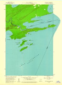
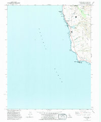
USGS Historical Quadrangle in GeoPDF.
USGS Historical Quadrangle in GeoPDF.
This part of DS 781 presents data for the acoustic-backscatter map of Offshore of Pigeon Point map area, California. Backscatter data are provided as three separate grids depending on mapping system. This metadata file refers to the data included in "BackscatterB_7125_OffshorePigeonPoint.zip," which is accessible from https://doi.org/10.5066/F7513W80. These data accompany the pamphlet and map sheets of Cochrane, G.R., Watt, J.T., Dartnell, P., Greene, H.G., Erdey, M.D., Dieter, B.E., Golden, N.E., Johnson, S.Y., Endris, C.A., Hartwell, S.R., Kvitek, R.G., Davenport, C.W., Krigsman, L.M., Ritchie, A.C., Sliter, R.W., Finlayson, D.P., and Maier, K.L. (G.R. Cochrane and S.A. Cochran, eds.), 2015, California State Waters...
Categories: Data;
Types: Downloadable,
GeoTIFF,
Map Service,
Raster;
Tags: Acoustic Reflectivity,
Ano Nuevo,
Backscatter,
CMHRP,
Coastal and Marine Hazards and Resources Program,
This part of DS 781 presents data for the bathymetric contours for several seafloor maps of the Offshore Pigeon Point map area, California. The vector data file is included in "Contours_OffshorePigeonPoint.zip", which is accessible from https://doi.org/10.5066/F7513W80. These data accompany the pamphlet and map sheets of Cochrane, G.R., Watt, J.T., Dartnell, P., Greene, H.G., Erdey, M.D., Dieter, B.E., Golden, N.E., Johnson, S.Y., Endris, C.A., Hartwell, S.R., Kvitek, R.G., Davenport, C.W., Krigsman, L.M., Ritchie, A.C., Sliter, R.W., Finlayson, D.P., and Maier, K.L. (G.R. Cochrane and S.A. Cochran, eds.), 2015, California State Waters Map Series—Offshore of Pigeon Point, California: U.S. Geological Survey Open-File...
Categories: Data;
Types: Downloadable,
Map Service,
OGC WFS Layer,
OGC WMS Layer,
Shapefile;
Tags: Ano Nuevo,
Bathymetry,
CMHRP,
Coastal and Marine Hazards and Resources Program,
Continental/Island Shelf,
This data set contains imagery from the National Agriculture Imagery Program (NAIP). The NAIP program is administered by USDA FSA and has been established to support two main FSA strategic goals centered on agricultural production. These are, increase stewardship of America's natural resources while enhancing the environment, and to ensure commodities are procured and distributed effectively and efficiently to increase food security. The NAIP program supports these goals by acquiring and providing ortho imagery that has been collected during the agricultural growing season in the U.S. The NAIP ortho imagery is tailored to meet FSA requirements and is a fundamental tool used to support FSA farm and conservation programs....
This part of DS 781 presents the seafloor-character map Offshore of Pigeon Point, California. The raster data file is included in "SeafloorCharacter_OffshorePigeonPoint.zip," which is accessible from https://doi.org/10.5066/F7513W80. These data accompany the pamphlet and map sheets of Cochrane, G.R., Watt, J.T., Dartnell, P., Greene, H.G., Erdey, M.D., Dieter, B.E., Golden, N.E., Johnson, S.Y., Endris, C.A., Hartwell, S.R., Kvitek, R.G., Davenport, C.W., Krigsman, L.M., Ritchie, A.C., Sliter, R.W., Finlayson, D.P., and Maier, K.L. (G.R. Cochrane and S.A. Cochran, eds.), 2015, California State Waters Map Series—Offshore of Pigeon Point, California: U.S. Geological Survey Open-File Report 2015–1232, pamphlet 40 p.,...
Categories: Data;
Types: Downloadable,
GeoTIFF,
Map Service,
OGC WFS Layer,
OGC WMS Layer,
OGC WMS Service,
Raster;
Tags: Acoustic Reflectivity,
Ano Nuevo State Park,
Bathymetry,
CMHRP,
Coastal and Marine Hazards and Resources Program,
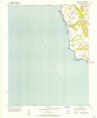
USGS Historical Quadrangle in GeoPDF.
USGS Historical Quadrangle in GeoPDF.
USGS Historical Quadrangle in GeoPDF.
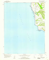
USGS Historical Quadrangle in GeoPDF.

USGS Historical Quadrangle in GeoPDF.
This part of DS 781 presents data for the acoustic-backscatter map of Offshore of Pigeon Point map area, California. Backscatter data are provided as three separate grids depending on mapping system. This metadata file refers to the data included in "BackscatterA_8101_OffshorePigeonPoint.zip," which is accessible from https://doi.org/10.5066/F7513W80. These data accompany the pamphlet and map sheets of Cochrane, G.R., Watt, J.T., Dartnell, P., Greene, H.G., Erdey, M.D., Dieter, B.E., Golden, N.E., Johnson, S.Y., Endris, C.A., Hartwell, S.R., Kvitek, R.G., Davenport, C.W., Krigsman, L.M., Ritchie, A.C., Sliter, R.W., Finlayson, D.P., and Maier, K.L. (G.R. Cochrane and S.A. Cochran, eds.), 2015, California State Waters...
Categories: Data;
Types: Downloadable,
GeoTIFF,
Map Service,
Raster;
Tags: Acoustic Reflectivity,
Ano Nuevo,
Backscatter,
CMHRP,
Coastal and Marine Hazards and Resources Program,
This part of DS 781 presents data for the shaded-relief bathymetry map of Offshore Pigeon Point, California. The raster data file is included in "BathymetryHS_OffshorePigeonPoint.zip", which is accessible from https://doi.org/10.5066/F7513W80. These data accompany the pamphlet and map sheets of Cochrane, G.R., Watt, J.T., Dartnell, P., Greene, H.G., Erdey, M.D., Dieter, B.E., Golden, N.E., Johnson, S.Y., Endris, C.A., Hartwell, S.R., Kvitek, R.G., Davenport, C.W., Krigsman, L.M., Ritchie, A.C., Sliter, R.W., Finlayson, D.P., and Maier, K.L. (G.R. Cochrane and S.A. Cochran, eds.), 2015, California State Waters Map Series—Offshore of Pigeon Point, California: U.S. Geological Survey Open-File Report 2015–1232, pamphlet...
Categories: Data;
Types: Downloadable,
GeoTIFF,
Map Service,
Raster;
Tags: Ano Nuevo,
Bathymetry,
CMHRP,
Coastal and Marine Hazards and Resources Program,
Continental/Island Shelf,
This part of DS 781 presents data for the geologic and geomorphic map of the Offshore Pigeon Point map area, California. The vector data file is included in "Geology_OffshorePigeonPoint.zip," which is accessible from https://doi.org/10.5066/F7513W80. Marine geology and geomorphology were mapped in the Offshore Pigeon Point map area, California, from approximate Mean High Water (MHW) to the 3-nautical-mile limit of California's State Waters. Offshore geologic units were delineated on the basis of integrated analyses of adjacent onshore geology with multibeam bathymetry and backscatter imagery, seafloor-sediment and rock samples, digital camera and video imagery, and high-resolution seismic-reflection profiles....
Categories: Data;
Types: Downloadable,
Map Service,
OGC WFS Layer,
OGC WMS Layer,
Shapefile;
Tags: Bathymetry,
CMHRP,
Coastal and Marine Hazards and Resources Program,
Continental/Island Shelf,
Marine Nearshore Subtidal,
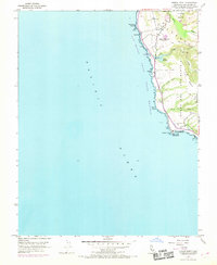
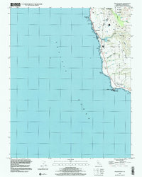
USGS Historical Quadrangle in GeoPDF.

USGS Historical Quadrangle in GeoPDF.
This data set contains imagery from the National Agriculture Imagery Program (NAIP). The NAIP program is administered by USDA FSA and has been established to support two main FSA strategic goals centered on agricultural production. These are, increase stewardship of America's natural resources while enhancing the environment, and to ensure commodities are procured and distributed effectively and efficiently to increase food security. The NAIP program supports these goals by acquiring and providing ortho imagery that has been collected during the agricultural growing season in the U.S. The NAIP ortho imagery is tailored to meet FSA requirements and is a fundamental tool used to support FSA farm and conservation programs....
|

|
