Filters: Tags: Point Sal (X)
22 results (20ms)|
Filters
Date Range
Extensions Types Contacts
Categories Tag Types Tag Schemes |
This data set contains imagery from the National Agriculture Imagery Program (NAIP). The NAIP program is administered by USDA FSA and has been established to support two main FSA strategic goals centered on agricultural production. These are, increase stewardship of America's natural resources while enhancing the environment, and to ensure commodities are procured and distributed effectively and efficiently to increase food security. The NAIP program supports these goals by acquiring and providing ortho imagery that has been collected during the agricultural growing season in the U.S. The NAIP ortho imagery is tailored to meet FSA requirements and is a fundamental tool used to support FSA farm and conservation programs....
This data release includes approximately 1,032 km of marine single-channel seismic-reflection data collected by the U.S. Geological Survey on a research cruise (USGS survey 2014-632-FA) in July and August, 2014, between Point Sal and Refugio State Beach. The dataset includes 168 profiles, most of which were collected on tracklines roughly perpendicular to the coast at 1 km line spacing; additional profiles were collected on coast-parallel tie lines. These data were acquired to support the California Seafloor Mapping Program and USGS Geologic Hazards projects. Seismic-reflection data were collected using a minisparker system that creates an acoustic signal by discharging an electrical pulse between electrodes and...

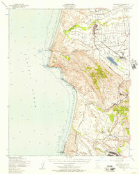
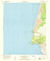
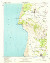
USGS Historical Quadrangle in GeoPDF.

USGS Historical Quadrangle in GeoPDF.

USGS Historical Quadrangle in GeoPDF.

This part of DS 781 presents data for the isopachs of the Point Sur to Point Arguello, California, region. The vector data file is included in the “Isopachs_PointSurToPointArguello.zip,” which is accessible from https://doi.org/10.5066/P97CZ0T7. As part of the USGS's California State Waters Mapping Project, a 50-m grid of sediment thickness for the seafloor within the 3-nautical mile limit between Point Sur and Point Arguello was generated from seismic-reflection data collected between 2008 and 2014, and supplemented with geologic structure (fault and fold) information following the methodology of Wong (2012). Reference Cited: Wong, F. L., Phillips, E.L., Johnson, S.Y., and Sliter, R.W., 2012, Modeling of depth...
Categories: Data;
Types: Downloadable,
Map Service,
OGC WFS Layer,
OGC WMS Layer,
Shapefile;
Tags: Avila Beach,
CMHRP,
Cambria,
Coastal and Marine Hazards and Resources Program,
Distributions,
USGS Historical Quadrangle in GeoPDF.

This part of DS 781 presents data for the transgressive contours of the Point Sur to Point Arguello, California, region. The vector data file is included in the “TransgressiveContours_PointSurToPointArguello.zip,” which is accessible from https://doi.org/10.5066/P97CZ0T7. As part of the USGS's California State Waters Mapping Project, a 50-m grid of sediment thickness for the seafloor within the 3-nautical mile limit between Point Sur and Point Arguello was generated from seismic-reflection data collected between 2008 and 2014, and supplemented with geologic structure (fault and fold) information following the methodology of Wong (2012). Water depths determined from bathymetry data were added to the sediment thickness...
Categories: Data;
Types: Downloadable,
Map Service,
OGC WFS Layer,
OGC WMS Layer,
Shapefile;
Tags: Avila Beach,
CMHRP,
Cambria,
Coastal and Marine Hazards and Resources Program,
Distributions,

This part of DS 781 presents data for the faults of the Point Sur to Point Arguello, California, region. The vector data file is included in the “Faults_PointSurToPointArguello.zip,” which is accessible from https://doi.org/10.5066/P97CZ0T7. Faults in the Point Sur to Point Arguello region are identified on seismic-reflection data based on abrupt truncation or warping of reflections and (or) juxtaposition of reflection panels with different seismic parameters such as reflection presence, amplitude, frequency, geometry, continuity, and vertical sequence. Faults were primarily mapped by interpretation of seismic reflection profile data collected by the U.S. Geological Survey between 2008 and 2014.
Categories: Data;
Types: Downloadable,
Map Service,
OGC WFS Layer,
OGC WMS Layer,
Shapefile;
Tags: Avila Beach,
CMHRP,
Cambria,
Coastal and Marine Hazards and Resources Program,
Distributions,
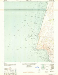
USGS Historical Quadrangle in GeoPDF.
USGS Historical Quadrangle in GeoPDF.

USGS Historical Quadrangle in GeoPDF.
This dataset includes navigation data for marine geophysical data, collected by the U.S. Geological Survey (USGS) in 2014, between Point Sal and Refugio State Beach in southern California.
Categories: Data;
Types: Downloadable,
Map Service,
OGC WFS Layer,
OGC WMS Layer,
Shapefile;
Tags: Bathymetry,
CMHRP,
Coastal and Marine Hazards and Resources Program,
Cojo Ranch,
Continental Margins,
This dataset includes swell-filtered, high-resolution seismic-reflection data, collected by the U.S. Geological Survey (USGS) in 2014, between Point Sal and Refugio State Beach in southern California.
This dataset includes raw, high-resolution seismic-reflection data, collected by the U.S. Geological Survey (USGS) in 2014, between Point Sal and Refugio State Beach in southern California.
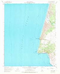
USGS Historical Quadrangle in GeoPDF.
USGS Historical Quadrangle in GeoPDF.

USGS Historical Quadrangle in GeoPDF.

This part of DS 781 presents data for the folds of the Point Sur to Point Arguello, California, region. The vector data file is included in the “Folds_PointSurToPointArguello.zip,” which is accessible from https://doi.org/10.5066/P97CZ0T7. Folds in the Point Sur to Point Arguello region are identified on seismic-reflection data based on warping and tilting of reflections. Folds were primarily mapped by interpretation of seismic reflection profile data collected by the U.S. Geological Survey between 2008 and 2014 and interpretation of high-resolution bathymetry data.
Categories: Data;
Types: Downloadable,
Map Service,
OGC WFS Layer,
OGC WMS Layer,
Shapefile;
Tags: Avila Beach,
CMHRP,
Cambria,
Coastal and Marine Hazards and Resources Program,
Distributions,

This part of DS 781 presents data for the depth-to-transition map of the Point Sur to Point Arguello, California, region. The raster data file is included in the “DepthToTransition_PointSurToPointArguello.zip,” which is accessible from https://doi.org/10.5066/P97CZ0T7. As part of the USGS's California State Waters Mapping Project, a 50-m grid of sediment thickness for the seafloor within the 3-nautical mile limit between Point Sur and Point Arguello was generated from seismic-reflection data collected between 2008 and 2014, and supplemented with geologic structure (fault and fold) information following the methodology of Wong (2012). Water depths determined from bathymetry data were added to the sediment thickness...
Categories: Data;
Types: Downloadable,
GeoTIFF,
Map Service,
Raster;
Tags: Avila Beach,
CMHRP,
Cambria,
Coastal and Marine Hazards and Resources Program,
Distributions,
|

|
