Filters: Tags: Poland (X)
35 results (12ms)|
Filters
Contacts
(Less)
|
The data document the results of several microbe bioassays performed by the USGS on Phragmites australis plants, including those performed on mature leaves, seedlings, and dead leaf tissues exploration of the literature to find accounts of microbes associated with Phragmites worldwide. For the bioassays, we prepared 162 pure cultures isolated from Phragmites plants in North America along the east coast, Florida, the Gulf of Mexico, and the Great Lakes area, 125 of which were from a previous study, and 38 represent new collections. The DNA sequences used to identify the 37 new collections are included. Microbes were isolated from plants collected from 2015-2018. We performed assays using both North American plant...
The Critical Minerals in Archived Mine Samples Database (CMDB) contains chemistry and geologic information for historic ore and ore-related rock samples from mineral deposits in the United States. In addition, the database contains samples from archetypal deposits from 27 other countries in North America, South America, Asia, Africa and Europe. Samples were obtained from archived ore collections under the U.S. Geological Survey's project titled "Quick Assessment of Rare and Critical Metals in Ore Deposits: A National Assessment" (2008 to 2013) in an effort to begin an assessment of the Nations' previously mined ore deposits for critical minerals. Mineralized and altered rock samples were provided by the Colorado...
Categories: Data;
Types: ArcGIS REST Map Service,
ArcGIS Service Definition,
Downloadable,
Map Service,
OGC WFS Layer,
OGC WMS Layer,
Shapefile;
Tags: Alaska,
Argentina,
Arizona,
Arkansas,
Australia,
This coverage includes arcs, polygons and polygon labels that describe U.S. Geological Survey defined geologic provinces of Europe including Turkey. (Albania, Andorra, Austria, Belgium, Bosnia and Herzegovina, Bulgaria, Croatia, Cyprus, Czech Republic, Denmark, Finland, France, Germany, Greece, Hungary, Iceland, Ireland, Italy, Liechtenstein, Luxembourg, The Former Yugoslav Republic of Macedonia, Malta, Monaco, Netherlands, Norway, Poland, Portugal, Romania, San Marino, Serbia and Montenegro, Slovakia, Slovenia, Spain, Sweden, Switzerland, Turkey, United Kingdom and Vatican City.) Each province has a set of geologic characteristics distinguishing it from surrounding provinces. These characteristics may include the...
Categories: Data,
pre-SM502.8;
Types: Downloadable,
Map Service,
OGC WFS Layer,
OGC WMS Layer,
Shapefile;
Tags: AL,
AN,
AU,
Adana/Sivas, Province 2079,
Adriatic Basin, Province 4058,
At recent technical conferences, many coal geoscientists in academia and government institutions as well as in industry organizations have expressed concern about the dwindling number of students and young staff members interested in careers in coal geoscience. To better understand what is driving these trends and to identify potential ways that the community can increase interest and participation in coal geoscience, two different surveys were sent to 94 coal geoscientists who were current or past members of The Society of Organic Petrology (TSOP) in February 2020. As the trends and perceptions in industry and government organizations may be different than in universities, one distinct survey was sent to members...
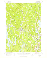
USGS Historical Quadrangle in GeoPDF.

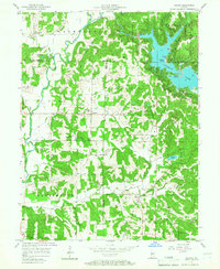
USGS Historical Quadrangle in GeoPDF.
This data set contains imagery from the National Agriculture Imagery Program (NAIP). The NAIP program is administered by USDA FSA and has been established to support two main FSA strategic goals centered on agricultural production. These are, increase stewardship of America's natural resources while enhancing the environment, and to ensure commodities are procured and distributed effectively and efficiently to increase food security. The NAIP program supports these goals by acquiring and providing ortho imagery that has been collected during the agricultural growing season in the U.S. The NAIP ortho imagery is tailored to meet FSA requirements and is a fundamental tool used to support FSA farm and conservation programs....
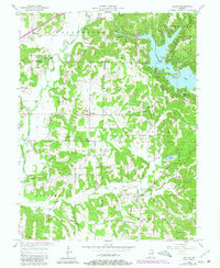
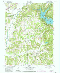
USGS Historical Quadrangle in GeoPDF.
USGS Historical Quadrangle in GeoPDF.
USGS Historical Quadrangle in GeoPDF.
USGS Historical Quadrangle in GeoPDF.
USGS Historical Quadrangle in GeoPDF.
USGS Historical Quadrangle in GeoPDF.

USGS Historical Quadrangle in GeoPDF.
USGS Historical Quadrangle in GeoPDF.
Environmental monitoring has been an ongoing activity on the U.S. Department of Energy's Hanford Site in southeastern Washington for almost 50 years. Objectives are to detect and assess potential impacts of Site operations on air, surface and ground waters, foodstuffs, fish, wildlife, soil and vegetation. Data from monitoring effects are used to calculate the overall radiological dose to humans working onsite or residing in nearby communities. In 1989, measured Hanford Site perimeter concentrations of airborne radionuclides were below applicable guidelines. Concentrations of radionuclides and nonradiological water quality in the Columbia River were in compliance with applicable standards. Foodstuffs irrigated with...
USGS Historical Quadrangle in GeoPDF.
USGS Historical Quadrangle in GeoPDF.
|

|
