Filters: Tags: Port Angeles (X)
31 results (1.7s)|
Filters
Date Range
Extensions Types
Contacts
Categories Tag Types Tag Schemes |
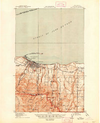
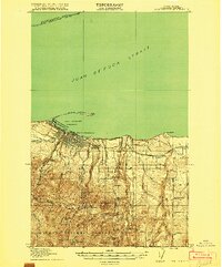
USGS Historical Quadrangle in GeoPDF.
Removal of two large dams from the Elwha River, Washington USA, in 2011-2014 released ~20.5 metric tons (Mt) of impounded sediment, ~5.4 Mt of which was deposited in the river delta and estuary. This dataset presents measurements of geomorphic surfaces, vegetation colonization, and plant community development in the Elwha River delta and estuary after dam removal. Geomorphic surfaces and vegetation colonization were estimated from aerial imagery of the delta and estuary in 2016 and 2018. Plant community development was quantified from field plot surveys of pioneer plant communities on new surfaces in 2014 and 2018 and of established delta and estuarine plant communities on older surfaces in 2007, 2014, and 2018....
This data set contains imagery from the National Agriculture Imagery Program (NAIP). The NAIP program is administered by USDA FSA and has been established to support two main FSA strategic goals centered on agricultural production. These are, increase stewardship of America's natural resources while enhancing the environment, and to ensure commodities are procured and distributed effectively and efficiently to increase food security. The NAIP program supports these goals by acquiring and providing ortho imagery that has been collected during the agricultural growing season in the U.S. The NAIP ortho imagery is tailored to meet FSA requirements and is a fundamental tool used to support FSA farm and conservation programs....
Estuary vegetation cover delineated from 28 August 2014 0.15-meter-resolution NPS Elwha PlaneCam aerial imagery at a scale of 1:1500.
Categories: Data;
Types: Citation,
Downloadable,
Map Service,
OGC WFS Layer,
OGC WMS Layer,
Shapefile;
Tags: Clallam County,
Elwha River,
Olympic Peninsula,
Port Angeles,
United States of America,
This data set contains imagery from the National Agriculture Imagery Program (NAIP). The NAIP program is administered by USDA FSA and has been established to support two main FSA strategic goals centered on agricultural production. These are, increase stewardship of America's natural resources while enhancing the environment, and to ensure commodities are procured and distributed effectively and efficiently to increase food security. The NAIP program supports these goals by acquiring and providing ortho imagery that has been collected during the agricultural growing season in the U.S. The NAIP ortho imagery is tailored to meet FSA requirements and is a fundamental tool used to support FSA farm and conservation programs....
This portion of the data release presents riparian plant species abundance (percent cover) data from plots sampled in the Elwha River estuary, Washington, in 2007 and 2014. In August 2007, we established 21 vegetation plots within the study area in a stratified random fashion, with three to five plots in five of the vegetation cover types denoted in the habitat classification maps: mixed riparian forest, willow-alder forest, riparian shrub, emergent marsh/marsh-shrub transition, and dunegrass. Each plot was 100 square meter, usually 10 m x 10 m, but in areas where the vegetation patch was narrow, plots were either 4 m x 25 m or 5 m x 20 m. We visually estimated percent cover by species of all vascular plants within...
Categories: Data;
Types: Citation;
Tags: Clallam County,
Elwha River,
Olympic Peninsula,
Port Angeles,
State of Washington,
Estuary vegetation cover delineated from 11 September 2009 1-meter-resolution NAIP aerial imagery at a scale of 1:1500.
Categories: Data;
Types: Citation,
Downloadable,
Map Service,
OGC WFS Layer,
OGC WMS Layer,
Shapefile;
Tags: Clallam County,
Elwha River,
Olympic Peninsula,
Port Angeles,
United States of America,
Estuary vegetation cover delineated from 26 August 2013 0.15-meter-resolution NPS Elwha PlaneCam aerial imagery at a scale of 1:1500.
Categories: Data;
Types: Citation,
Downloadable,
Map Service,
OGC WFS Layer,
OGC WMS Layer,
Shapefile;
Tags: Clallam County,
Elwha River,
Olympic Peninsula,
Port Angeles,
United States of America,
Estuary geomorphic units delineated at a scale of 1:1500 using a combination of (a) 28 August 2014 0.15 meter resolution NPS Elwha PlaneCam aerial imagery; and (b) elevation-colored and hillshaded digital elevation models from USGS backpack/jetski topobathy surveys (5-8 September 2014) for areas < MHHW and aerial lidar surveys (7 November 2014) supplemented with NPS Elwha PlaneCam SfM photogrammetry data (30 September 2014) for elevations > MHHW.
Categories: Data;
Types: Citation,
Downloadable,
Map Service,
OGC WFS Layer,
OGC WMS Layer,
Shapefile;
Tags: Clallam County,
Elwha River,
Olympic Peninsula,
Port Angeles,
United States of America,
Estuary geomorphic units delineated at a scale of 1:1500 using a combination of (a) 11 September 2009 1 meter resolution NAIP aerial imagery; and (b) elevation-colored and hillshaded digital elevation models from USGS backpack/jetski topobathy surveys (17 September 2009) for areas < MHHW and aerial lidar surveys (4-6 April 2009) for elevations > MHHW.
Categories: Data;
Types: Citation,
Downloadable,
Map Service,
OGC WFS Layer,
OGC WMS Layer,
Shapefile;
Tags: Clallam County,
Elwha River,
Olympic Peninsula,
Port Angeles,
United States of America,
Estuary geomorphic units delineated at a scale of 1:1500 using a combination of (a) 26 August 2013 0.15 meter resolution NPS Elwha PlaneCam aerial imagery; and (b) elevation-colored and hillshaded digital elevation models from USGS backpack/jetski topobathy surveys (16 September 2013) for areas < MHHW and aerial lidar surveys (17 October 2012) supplemented with NPS Elwha PlaneCam SfM photogrammetry data (19 September 2013) for elevations > MHHW.
Categories: Data;
Types: Citation,
Downloadable,
Map Service,
OGC WFS Layer,
OGC WMS Layer,
Shapefile;
Tags: Clallam County,
Elwha River,
Olympic Peninsula,
Port Angeles,
United States of America,
This portion of the data release presents riparian plant species richness (number of unique taxa) data from plots sampled in the Elwha River estuary, Washington, in 2007 and 2014. In August 2007, we established 21 vegetation plots within the study area in a stratified random fashion, with three to five plots in five of the vegetation cover types denoted in the habitat classification maps: mixed riparian forest, willow-alder forest, riparian shrub, emergent marsh/marsh-shrub transition, and dunegrass. Each plot was 100 square meters, usually 10 m x 10 m, but in areas where the vegetation patch was narrow, plots were either 4 m x 25 m or 5 m x 20 m. We visually estimated percent cover by species of all vascular plants...
Categories: Data;
Types: Citation;
Tags: Clallam County,
Elwha River,
Olympic Peninsula,
Port Angeles,
State of Washington,
This data set contains imagery from the National Agriculture Imagery Program (NAIP). The NAIP program is administered by USDA FSA and has been established to support two main FSA strategic goals centered on agricultural production. These are, increase stewardship of America's natural resources while enhancing the environment, and to ensure commodities are procured and distributed effectively and efficiently to increase food security. The NAIP program supports these goals by acquiring and providing ortho imagery that has been collected during the agricultural growing season in the U.S. The NAIP ortho imagery is tailored to meet FSA requirements and is a fundamental tool used to support FSA farm and conservation programs....

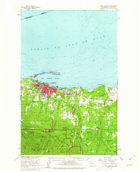
USGS Historical Quadrangle in GeoPDF.
Estuary vegetation cover delineated from 30 August 2012 0.15-meter-resolution NPS Elwha PlaneCam aerial imagery at a scale of 1:1500.
Categories: Data;
Types: Citation,
Downloadable,
Map Service,
OGC WFS Layer,
OGC WMS Layer,
Shapefile;
Tags: Clallam County,
Elwha River,
Olympic Peninsula,
Port Angeles,
United States of America,
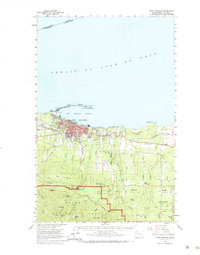
USGS Historical Quadrangle in GeoPDF.
Estuary vegetation cover delineated from 3 September 2011* 0.3-meter-resolution aerial imagery (Microsoft/Digital Globe) at a scale of 1:1500. *Image date of 3-Sep corrected in metadata. During product generation the imagery date was believed to be 8-25-2011, as reported by DigitalGlobe reseller.
Categories: Data;
Types: Citation,
Downloadable,
Map Service,
OGC WFS Layer,
OGC WMS Layer,
Shapefile;
Tags: Clallam County,
Elwha River,
Olympic Peninsula,
Port Angeles,
United States of America,
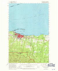
USGS Historical Quadrangle in GeoPDF.
USGS Historical Quadrangle in GeoPDF.
USGS Historical Quadrangle in GeoPDF.
|

|
