Filters
Date Range
Contacts
Tag Types
Tag Schemes
|
USGS Historical Quadrangle in GeoPDF.
Tags: 1 x 2 degree,
Downloadable Data,
GeoPDF,
GeoTIFF,
Historical Topographic Maps, All tags...
Historical Topographic Maps 1 x 2 Degree Map Series,
Map,
Port Arthur,
TX,
imageryBaseMapsEarthCover, Fewer tags
USGS Historical Quadrangle in GeoPDF.
Tags: 1 x 2 degree,
Downloadable Data,
GeoPDF,
GeoTIFF,
Historical Topographic Maps, All tags...
Historical Topographic Maps 1 x 2 Degree Map Series,
Map,
Port Arthur,
TX,
imageryBaseMapsEarthCover, Fewer tags
USGS Historical Quadrangle in GeoPDF.
Tags: 30 x 60 minute,
Downloadable Data,
GeoPDF,
GeoTIFF,
Historical Topographic Maps, All tags...
Historical Topographic Maps 30 x 60 Minute Map Series,
Map,
Port Arthur,
TX,
imageryBaseMapsEarthCover, Fewer tags
USGS Historical Quadrangle in GeoPDF.
Tags: 1 x 2 degree,
Downloadable Data,
GeoPDF,
GeoTIFF,
Historical Topographic Maps, All tags...
Historical Topographic Maps 1 x 2 Degree Map Series,
Map,
Planimetric,
Port Arthur,
TX,
imageryBaseMapsEarthCover, Fewer tags
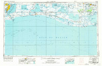
USGS Historical Quadrangle in GeoPDF.
Tags: 1 x 2 degree,
Downloadable Data,
GeoPDF,
GeoTIFF,
Historical Topographic Maps, All tags...
Historical Topographic Maps 1 x 2 Degree Map Series,
Map,
Port Arthur,
TX,
imageryBaseMapsEarthCover, Fewer tags
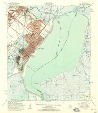
USGS Historical Quadrangle in GeoPDF.
Tags: 15 x 15 minute,
Downloadable Data,
GeoPDF,
GeoTIFF,
Historical Topographic Maps, All tags...
Historical Topographic Maps 15 x 15 Minute Map Series,
Map,
Port Arthur,
TX,
imageryBaseMapsEarthCover, Fewer tags
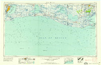
USGS Historical Quadrangle in GeoPDF.
Tags: 1 x 2 degree,
Downloadable Data,
GeoPDF,
GeoTIFF,
Historical Topographic Maps, All tags...
Historical Topographic Maps 1 x 2 Degree Map Series,
Map,
Planimetric,
Port Arthur,
TX,
imageryBaseMapsEarthCover, Fewer tags

The U.S. Geological Survey (USGS) 3D Elevation Program (3DEP) has initiated the development of a second pilot 3D National Topography Model (3DNTM) to generate 3-dimensional surface elevation models that integrate topographic bare-earth elevation surfaces with river channel bed and coastal bathymetry and topobathymetry. Detailed knowledge of integrated river system topography, bathymetry, and topobathymetry is essential for fisheries habitat restoration, hydrologic modeling, and other key science applications such as flood mapping and identification of fluvial geomorphic features. An integrated 1-meter topobathymetric digital elevation model (TBDEM) for Hardin, Orange, and Jefferson counties in Southeast Texas has...
Tags: 3D Elevation Program (3DEP),
3D National Topography Model (3D NTM),
Beaumont,
East Pass,
Geography, All tags...
Geomorphology,
Gulf of Mexico,
Hardin County,
Jefferson County,
Keith Lake-Salt Bayou System,
National Geospatial Program (NGP),
Neches River,
Orange County,
Port Arthur,
Port Neches,
Remote Sensing,
Sabine Lake,
Sabine River,
Sabine-Neches Waterway,
Southeast, Texas,
Southeast, Texas,
U.S.,
U.S. Geological Survey,
USA,
USGS Science Data Catalog (SDC),
United States,
United States,
Water Resources,
elevation,
geoscientificInformation,
inlandWaters,
oceans, Fewer tags
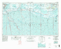
USGS Historical Quadrangle in GeoPDF.
Tags: 1 x 2 degree,
Downloadable Data,
GeoPDF,
GeoTIFF,
Historical Topographic Maps, All tags...
Historical Topographic Maps 1 x 2 Degree Map Series,
Map,
Port Arthur,
TX,
imageryBaseMapsEarthCover, Fewer tags
USGS Historical Quadrangle in GeoPDF.
Tags: 1 x 2 degree,
Downloadable Data,
GeoPDF,
GeoTIFF,
Historical Topographic Maps, All tags...
Historical Topographic Maps 1 x 2 Degree Map Series,
Map,
Port Arthur,
TX,
imageryBaseMapsEarthCover, Fewer tags
USGS Historical Quadrangle in GeoPDF.
Tags: 15 x 15 minute,
Downloadable Data,
GeoPDF,
GeoTIFF,
Historical Topographic Maps, All tags...
Historical Topographic Maps 15 x 15 Minute Map Series,
Map,
Port Arthur,
TX,
imageryBaseMapsEarthCover, Fewer tags
|
|
